
Windmills · East of England
Thorpeness Windmill
In or near Snape.
Thorpeness Windmill is a windmill in the United Kingdom.

Wikimedia Commons contributors — see linked file page for photographer and licence licence

Plan your visit
- Typical visit
- 30 min–1 h
- Nearest railway station
- Saxmundham · 8.9 km
- Free entry
- Family-friendly
- Dog-friendly
About
Thorpeness Windmill is a named windmill in the United Kingdom. Coordinates: 52.1815°, 1.6089°. This entry is part of The Great Britain Guide, a free, ad-free, open-data tourist directory.
Photo gallery
Protected designations
- Site of Special Scientific Interest: Leiston - Aldeburgh SSSI
- Area of Outstanding Natural Beauty: Suffolk Coast & Heaths
Designations sourced from Natural England open data under OGL v3.
From the Wikipedia article
Thorpeness Windmill is a Grade II listed post mill at Thorpeness, Suffolk, England which was built in 1803 at Aldringham and moved to Thorpeness in 1923. Originally built as a corn mill, it was converted to a water pumping mill when it was moved to Thorpeness. It pumped water to the House in the Clouds.
Excerpt from Wikipedia under CC BY-SA 4.0. See the source article linked in Sources below.
Background
History
Thorpeness Mill was built as a corn mill at Aldringham in 1803. In the 1890s the Ogilvy family were the millers. In the winter of 1922, Aldringham Mill was dismantled by Messrs Whitmore's, millwrights of Wickham Market. Amos Clarke was millwright in charge. It was rebuilt at Thorpeness to supply water to the House in the Clouds, which was really a water tower disguised as a house. The Council accepted an offer of £72,100 in November 2010 (figures from Land Registry)
Description
Thorpeness Mill is a post mill on a single-storey roundhouse. It is winded by a fantail arranged in the Suffolk style. The four Patent sails are carried on a cast-iron windshaft. The brake wheel drives a three throw pump which pumped water from a well 28 ft deep to water tanks housed in the House in the Clouds. The mill could pump 1800 impgal per hour. The mill is winded by a six-bladed fantail mounted on the ladder.
Visiting
Thorpeness Windmill is now in private hands and as such there is no public access. The windmill will be open on an ad hoc basis by the owner. For more information, look for "Friends of Thorpeness Windmill" on Facebook.
Sourced from Wikipedia under CC BY-SA 4.0.
- Coordinates
- 52.1815, 1.6089
- County
- Suffolk
- District
- East Suffolk
- Parish
- Aldringham cum Thorpe
- Postcode
- IP16 4NJ
- Parliamentary constituency
- Suffolk Coastal
- Established
- 1923
- Nearest railway station
- Saxmundham — 8.9 km
Sources
- osm: n441256505 (ODbL)
- wikipedia: Thorpeness Windmill (CC BY-SA 4.0)
- commons: Thorpeness windmill.jpg (CC BY-SA 4.0)
Other places nearby

House in the Clouds
Historic houses · 0.1 km

Thorpeness
Villages · 0.3 km

Thorpeness Village Sign
Public art & sculpture · 0.5 km

Thorpeness & Aldringham Heritage Centre
Museums · 0.5 km
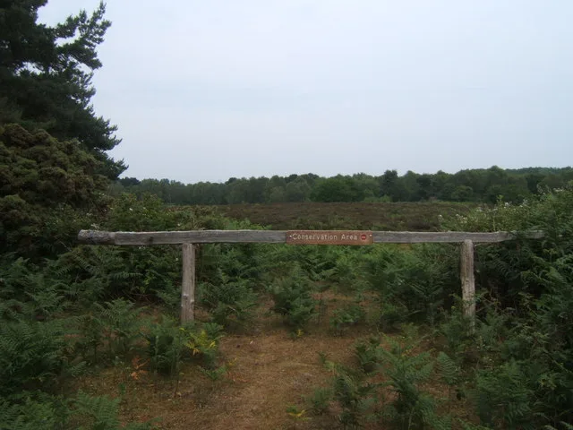
North Warren RSPB reserve
Wildlife reserves · 1.5 km

Aldringham War Memorial
Memorials & monuments · 1.7 km

Sizewell Hall Gazebo
Follies · 2.2 km

Two bowl barrows
Archaeological sites · 2.3 km

Two bowl barrows
Archaeological sites · 2.3 km

Scallop
Public art & sculpture · 2.3 km

The Scallop
National landscapes (AONB) · 2.3 km

Church Farm Holiday Park
Caravan parks · 2.4 km
Nearby
📷 5Historic houses · East of England
House in the Clouds
House in the Clouds — folly on top of a former water tower, in Thorpeness, Suffolk, England, UK.
📷 5📷 3Public art & sculpture · East of England
Thorpeness Village Sign
Thorpeness Village Sign — a public art in england-east, United Kingdom.
📷 3Museums · East of England
Thorpeness & Aldringham Heritage Centre
Thorpeness & Aldringham Heritage Centre — a museum in england-east, United Kingdom.
📷 3Wildlife reserves · East of England
North Warren RSPB reserve
North Warren RSPB reserve — RSPB nature reserve in the United Kingdom.
📷 3Memorials & monuments · East of England
Aldringham War Memorial
Aldringham War Memorial — Grade II listed building-listed memorial in england-east, United Kingdom.
Where to eat & stay near Thorpeness Windmill
Places to stay
📷 5Caravan parks · East of England
Church Farm Holiday Park
Church Farm Holiday Park — a caravan park in england east.
 📷 5
📷 5Campsites · East of England
Beach View Holiday Park (Formerly Cliff House Park)
Beach View Holiday Park (Formerly Cliff House Park) — a campsite in england east.
 📷 7
📷 7 📷 5
📷 5 📷 5
📷 5 📷 5
📷 5Places to eat & drink
 📷 7
📷 7Historic pubs · East of England
The Parrot And Punchbowl Public House
The Parrot And Punchbowl Public House in England East, United Kingdom.
 📷 7
📷 7Historic pubs · East of England
George and Dragon, Farnham
George and Dragon, Farnham in England East, United Kingdom.
 📷 7
📷 7Historic pubs · East of England
The Jolly Sailor Public House
The Jolly Sailor Public House in England East, United Kingdom.
 📷 7
📷 7Historic pubs · East of England
The Lion, Little Glemham
The Lion, Little Glemham in England East, United Kingdom.
 📷 6
📷 6Historic pubs · East of England
The Swan, Peasenhall
The Swan, Peasenhall in England East, United Kingdom.
 📷 5
📷 5More windmills in this region
 📷 5
📷 5Windmills · East of England
Baker Street Mill
Baker Street Mill is a windmill in the United Kingdom.
 📷 5
📷 5 📷 5
📷 5 📷 5
📷 5Frequently asked questions
- Where is Thorpeness Windmill?
- Thorpeness Windmill is in Suffolk, East of England, United Kingdom (postcode IP16 4NJ), in the parish of Aldringham cum Thorpe.
- What is Thorpeness Windmill?
- Thorpeness Windmill is a windmill in the United Kingdom.
- How do I get to Thorpeness Windmill?
- The nearest railway station is Saxmundham, about 8.9 km away. The nearest town is Snape. Drivers can use postcode IP16 4NJ.
- When was Thorpeness Windmill built?
- Built or established in 1923.
- Who owns Thorpeness Windmill?
- Thorpeness Windmill is owned by Private.
- Is Thorpeness Windmill a protected site?
- Yes — Thorpeness Windmill is part of the Leiston - Aldeburgh SSSI Site of Special Scientific Interest and the Suffolk Coast & Heaths National Landscape (AONB).
- Is Thorpeness Windmill free to visit?
- Yes, Thorpeness Windmill is free to enter.
- How do I get to Thorpeness Windmill?
- Drivers can navigate to postcode IP16 4NJ. It sits within the Suffolk Coastal parliamentary constituency.