Mountains & hills · North West England
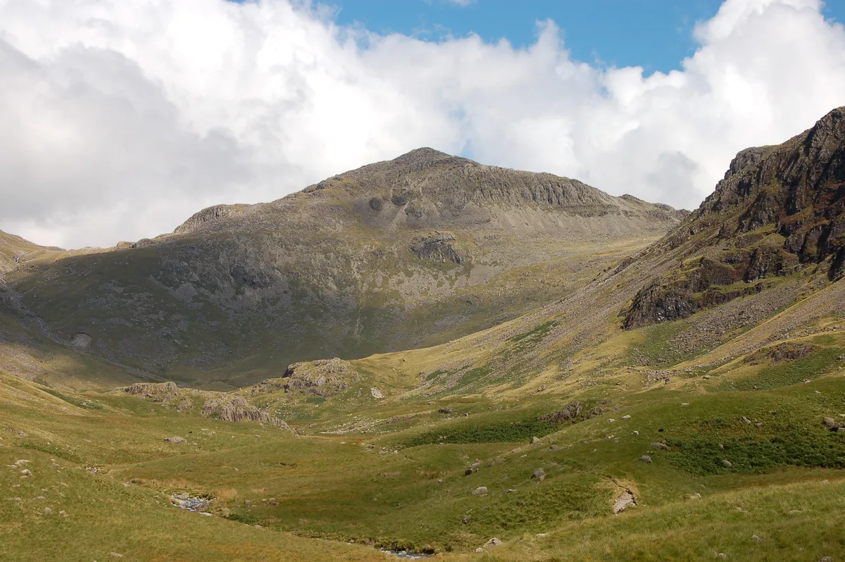
Shelter Crags
Shelter Crags — mountain in england north west. Elevation: 815 m.

Michael Graham — CC BY-SA 2.0 via Wikimedia Commons licence
Plan your visit
- Typical visit
- 3 h–8 h
- Best time of year
- Late spring – early autumn (May–Oct)
About
Shelter Crags is a mountain located in england north west. Elevation: 815 m. A named British peak recorded in OpenStreetMap. Peaks are typically named on Ordnance Survey 1:50k mapping.
Photo gallery
Place summary
Shelter Crags is a mountain located in North-West England. It is known for its rugged terrain and scenic views, attracting climbers and hikers alike. The area offers various walking trails suitable for different skill levels, providing opportunities to experience the natural landscape. Visitors can expect a challenging environment with steep ascents and rocky outcrops typical of the region.
AI-generated from the structured facts on this page (operator, designation, listing, era). Not a substitute for visiting.
- Coordinates
- 54.4379, -3.1582
Sources
- osm: n12576864929 (ODbL)
Other places nearby
Loading nearby places…
Nearby
 📷 5
📷 5Mountains & hills · North West England
Third Crinkle (Gunson Knott)
Third Crinkle (Gunson Knott) — mountain in england north west. Elevation: 840 m.
 📷 5
📷 5Mountains & hills · North West England
Crinkle Crags - Long Top
Crinkle Crags - Long Top — mountain in england north west. Elevation: 859 m.
 📷 3
📷 3Viewpoints · North West England
Bad Step
Bad Step is a viewpoint in the United Kingdom.
 📷 5
📷 5Mountains & hills · North West England
South Top
South Top — mountain in england north west. Elevation: 834 m.
 📷 5
📷 5Waterfalls · North West England
Whorneyside Force
Whorneyside Force — waterfall in england north west.
 📷 4
📷 4Natural landmarks · North West England
Bowfell
Bowfell — mountain in the United Kingdom.
Where to eat & stay near Shelter Crags
Places to stay
 📷 5
📷 5Campsites · North West England
Great Langdale Campsite
Great Langdale Campsite — a campsite in england north west.
 📷 5
📷 5Caravan parks · North West England
Greenhowe Caravan Park
Greenhowe Caravan Park — a caravan park in england north west.
 📷 5
📷 5Campsites · North West England
Baysbrown Farm
Baysbrown Farm — a campsite in england north west.
 📷 5
📷 5Hostels · North West England
YHA Eskdale
YHA Eskdale — a hostel in england north west.
 📷 5
📷 5Campsites · North West England
Wasdale Campsite
Wasdale Campsite — a campsite in england north west.
 📷 5
📷 5Campsites · North West England
Seathwaite Farm Campsite
Seathwaite Farm Campsite — a campsite in england north west.
Places to eat & drink
 📷 5
📷 5Historic pubs · North West England
The Travellers Rest
The Travellers Rest in England North West, United Kingdom.
 📷 5
📷 5Restaurants · North West England
The Terrace Coffee House and Restaurant
The Terrace Coffee House and Restaurant — a restaurant in england north west. Cuisine: sandwich;lunch.
 📷 5
📷 5Historic pubs · North West England
Church House Public House
Church House Public House in England North West, United Kingdom.
 📷 5
📷 5Cafés · North East England
Grange Bridge Cottage
Grange Bridge Cottage — a café in england north east.
 📷 5
📷 5Historic pubs · North West England
Sun Cottage Sun Inn Public House
Sun Cottage Sun Inn Public House in England North West, United Kingdom.
 📷 5
📷 5Historic pubs · North West England
Golden Rule Hotel
Golden Rule Hotel in England North West, United Kingdom.
More mountains in this region
 📷 3
📷 3Mountains & hills · North West England
Allen Crags
Allen Crags — Named summit at 785 m.
 📷 3
📷 3Mountains & hills · North West England
Alum Pot
Alum Pot — Open shaft pothole in North Yorkshire.
 📷 3
📷 3Mountains & hills · North West England
Arnside Knott
Arnside Knott — Named summit at 159 m.
 📷 3
📷 3Mountains & hills · North West England
Aye Gill Pike
Aye Gill Pike — Named summit at 556.3 m.
Frequently asked questions
- Where is Shelter Crags?
- Shelter Crags is in North-West England, United Kingdom.
- What is Shelter Crags?
- Shelter Crags — mountain in england north west. Elevation: 815 m.
- How do I get to Shelter Crags?
- Its coordinates are 54.4379°, -3.1582°.