
Viewpoints · North West England
Bad Step
In or near Elterwater.
Bad Step is a viewpoint in the United Kingdom.

Jim Barton — CC BY-SA 2.0 via Wikimedia Commons licence

Plan your visit
- Typical visit
- 20 min–45 min
- Best time of year
- Clear days year-round
- Nearest railway station
- Dalegarth · 8.6 km
- Free entry
- Dog-friendly
About
Bad Step is a named viewpoint in the United Kingdom. Coordinates: 54.4327°, -3.1591°. This entry is part of The Great Britain Guide, a free, ad-free, open-data tourist directory.
Photo gallery
Protected designations
- Site of Special Scientific Interest: Ray and Crinkle Crags SSSI
Designations sourced from Natural England open data under OGL v3.
Place summary
Bad Step is a viewpoint located in North-West England, specifically within the Ray and Crinkle Crags Site of Special Scientific Interest (SSSI). This designation highlights its ecological significance, making it a notable location for observing the surrounding landscape and natural features.
AI-generated from the structured facts on this page (operator, designation, listing, era). Not a substitute for visiting.
- Coordinates
- 54.4327, -3.1591
- Nearest railway station
- Dalegarth — 8.6 km
Sources
- osm: n38450536 (ODbL)
Other places nearby

Crinkle Crags - Long Top
Mountains & hills · 0.1 km

South Top
Mountains & hills · 0.2 km

Third Crinkle (Gunson Knott)
Mountains & hills · 0.2 km

Shelter Crags
Mountains & hills · 0.6 km

Great Knott
Mountains & hills · 1.2 km
Cold Pike Far West Top
Mountains & hills · 1.3 km

Whorneyside Force
Waterfalls · 1.3 km

Little Stand
Mountains & hills · 1.4 km
Little Stand
Mountains & hills · 1.4 km

Cold Pike West Top
Mountains & hills · 1.5 km
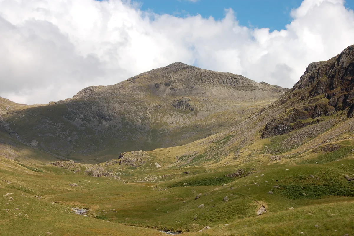
Bowfell
Natural landmarks · 1.7 km
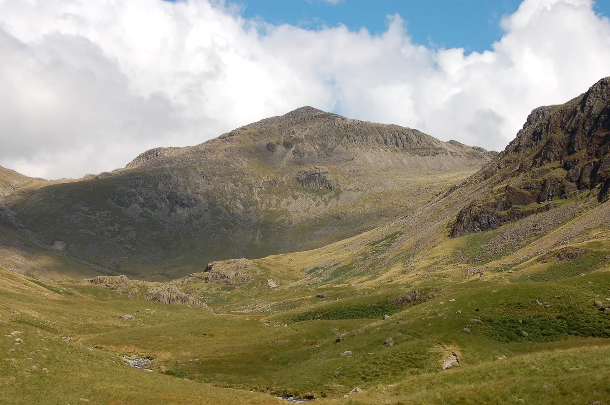
Bowfell
Mountains & hills · 1.7 km
Nearby
📷 5Mountains & hills · North West England
Crinkle Crags - Long Top
Crinkle Crags - Long Top — mountain in england north west. Elevation: 859 m.
📷 5Mountains & hills · North West England
South Top
South Top — mountain in england north west. Elevation: 834 m.
📷 5Mountains & hills · North West England
Third Crinkle (Gunson Knott)
Third Crinkle (Gunson Knott) — mountain in england north west. Elevation: 840 m.
📷 5Mountains & hills · North West England
Shelter Crags
Shelter Crags — mountain in england north west. Elevation: 815 m.
📷 5Mountains & hills · North West England
Great Knott
Great Knott — mountain in england north west. Elevation: 696 m.
📷 5Mountains & hills · North West England
Cold Pike Far West Top
Cold Pike Far West Top — mountain in england north west. Elevation: 668.7 m.
Where to eat & stay near Bad Step
Places to stay
 📷 5
Campsites · North West England
Great Langdale Campsite
Great Langdale Campsite — a campsite in england north west.
 📷 5
Caravan parks · North West England
Greenhowe Caravan Park
Greenhowe Caravan Park — a caravan park in england north west.
 📷 5
Hostels · North West England
YHA Eskdale
YHA Eskdale — a hostel in england north west.
 📷 5
Campsites · North West England
Baysbrown Farm
Baysbrown Farm — a campsite in england north west.
 📷 5
Campsites · North West England
Wasdale Campsite
Wasdale Campsite — a campsite in england north west.
 📷 5
Campsites · North West England
Wasdale Head Campsite
Wasdale Head Campsite — a campsite in england north west.
Places to eat & drink
 📷 7
Historic pubs · North West England
The Travellers Rest
The Travellers Rest in England North West, United Kingdom.
 📷 5
Restaurants · North West England
The Terrace Coffee House and Restaurant
The Terrace Coffee House and Restaurant — a restaurant in england north west. Cuisine: sandwich;lunch.
 📷 7
Historic pubs · North West England
Church House Public House
Church House Public House in England North West, United Kingdom.
 📷 5
Historic pubs · North West England
Sun Cottage Sun Inn Public House
Sun Cottage Sun Inn Public House in England North West, United Kingdom.
 📷 7
Cafés · North West England
Grange Bridge Cottage
Grange Bridge Cottage — a café in england north east.
 📷 5
Historic pubs · North West England
Golden Rule Hotel
Golden Rule Hotel in England North West, United Kingdom.
More viewpoints in this region
 📷 3
 📷 4
 📷 3
Viewpoints · North West England
Southside MAN Viewing area
Southside MAN Viewing area is a viewpoint in the United Kingdom.
 📷 3
Frequently asked questions
- Where is Bad Step?
- Bad Step is in North-West England, United Kingdom.
- What is Bad Step?
- Bad Step is a viewpoint in the United Kingdom.
- How do I get to Bad Step?
- The nearest railway station is Dalegarth, about 8.6 km away. The nearest town is Elterwater. Its coordinates are 54.4327°, -3.1591°.
- Is Bad Step a protected site?
- Yes — Bad Step is part of the Ray and Crinkle Crags SSSI Site of Special Scientific Interest.
- Is Bad Step free to visit?
- Yes, Bad Step is free to enter.