Hill forts · South East England
Sarre Anglo-Saxon cemetery
Sarre Anglo-Saxon cemetery — UK archaeological site.

Wikimedia Commons licence
Plan your visit
- Typical visit
- 1 h–2 h
- Nearest railway station
- Minster · 5.0 km
- Free entry
- Dog-friendly
About
Sarre Anglo-Saxon cemetery is a hill fort in the United Kingdom. Part of Anglo-Saxon cemetery, parish church of St Giles and associated remains immediately east of Sarre Mill. Wikidata describes it as: "UK archaeological site". Coordinates: 51.3396°, 1.2470°.
Photo gallery
Protected designations
- Site of Special Scientific Interest: Thanet Coast SSSI
- Area of Outstanding Natural Beauty: Kent Downs
Designations sourced from Natural England open data under OGL v3.
From the Wikipedia article
Sarre Anglo-Saxon cemetery is a place of burial that was used in the sixth and seventh centuries CE.
Excerpt from Wikipedia under CC BY-SA 4.0. See the source article linked in Sources below.
Background
History
With the advent of the Anglo-Saxon period in the fifth century CE, the area that became Kent underwent a radical transformation on a political, social, and physical level. In the preceding era of Roman Britain, the area had been administered as the civitas of Cantiaci, a part of the Roman Empire, but following the collapse of Roman rule in 410 CE, many signs of Romano-British society began to disappear, replaced by those of the ascendant Anglo-Saxon culture. Later Anglo-Saxon accounts attribute this change to the widescale invasion of Germanic language tribes from northern Europe, namely the Angles, Saxons, and Jutes. Archaeological and toponymic evidence shows that there was a great deal…
Sourced from Wikipedia under CC BY-SA 4.0.
- Coordinates
- 51.3396, 1.2470
- County
- Kent
- District
- Thanet
- Parish
- Sarre
- Postcode
- CT7 0ES
- Parliamentary constituency
- Herne Bay and Sandwich
- Nearest railway station
- Minster — 5 km
Sources
- wikidata: Q16933330 (CC0)
- wikipedia: Sarre Anglo-Saxon cemetery (CC BY-SA 4.0)
Other places nearby
Loading nearby places…
Nearby
 📷 5
📷 5Windmills · South East England
Sarre Windmill
Sarre Windmill is a windmill in the United Kingdom.
 📷 5
📷 5Museums · South East England
Sarre, Kent
Sarre, Kent — a museum in england-south-east, United Kingdom.
Campsites · South East England
The Field
The Field — a campsite in england south east.
 📷 5
📷 5Historic churches · South East England
Church of Saint Mary Magdalene, Monkton
Church of Saint Mary Magdalene, Monkton — Grade I listed building-listed church in england-south-east, United Kingdom.
 📷 5
📷 5Memorials & monuments · South East England
Monkton War Memorial
Monkton War Memorial — a memorial in england-south-east, United Kingdom.
Campsites · South East England
St Nicholas Camping Site
St Nicholas Camping Site — a campsite in england south east.
More places in this region
 Flagship📷 10
Hill forts · South East England
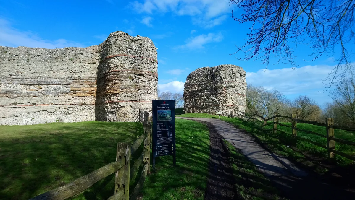
Castrum Anderitum
Castrum Anderitum — 3rd century Roman fort in the province of Britannia.
 Flagship📷 10
Hill forts · South East England
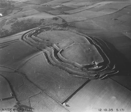
Maiden Castle
Maiden Castle — Iron Age hill fort in Dorset, England, UK.
 Flagship📷 10
Hill forts · South East England
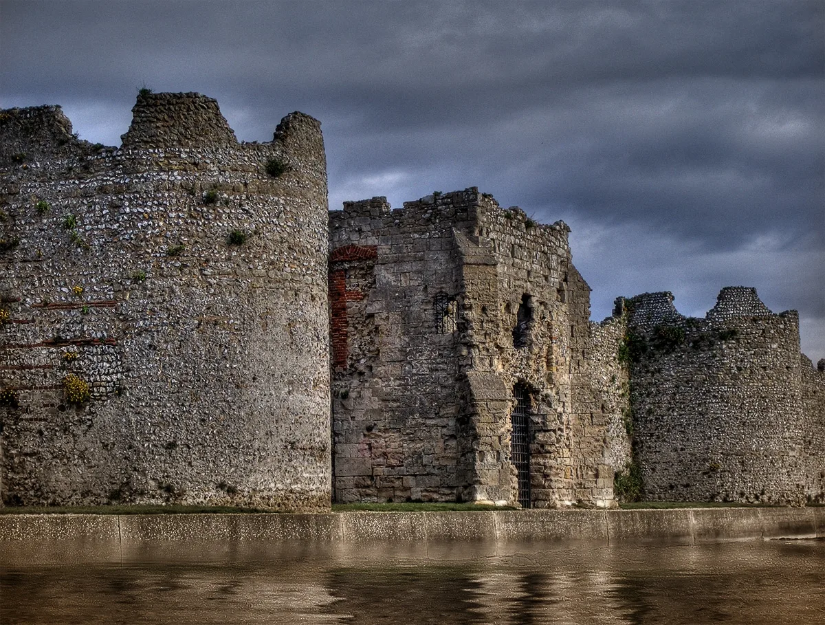
Portus Adurni
Portus Adurni is a hill fort in the United Kingdom.
 Flagship📷 10
Hill forts · South East England
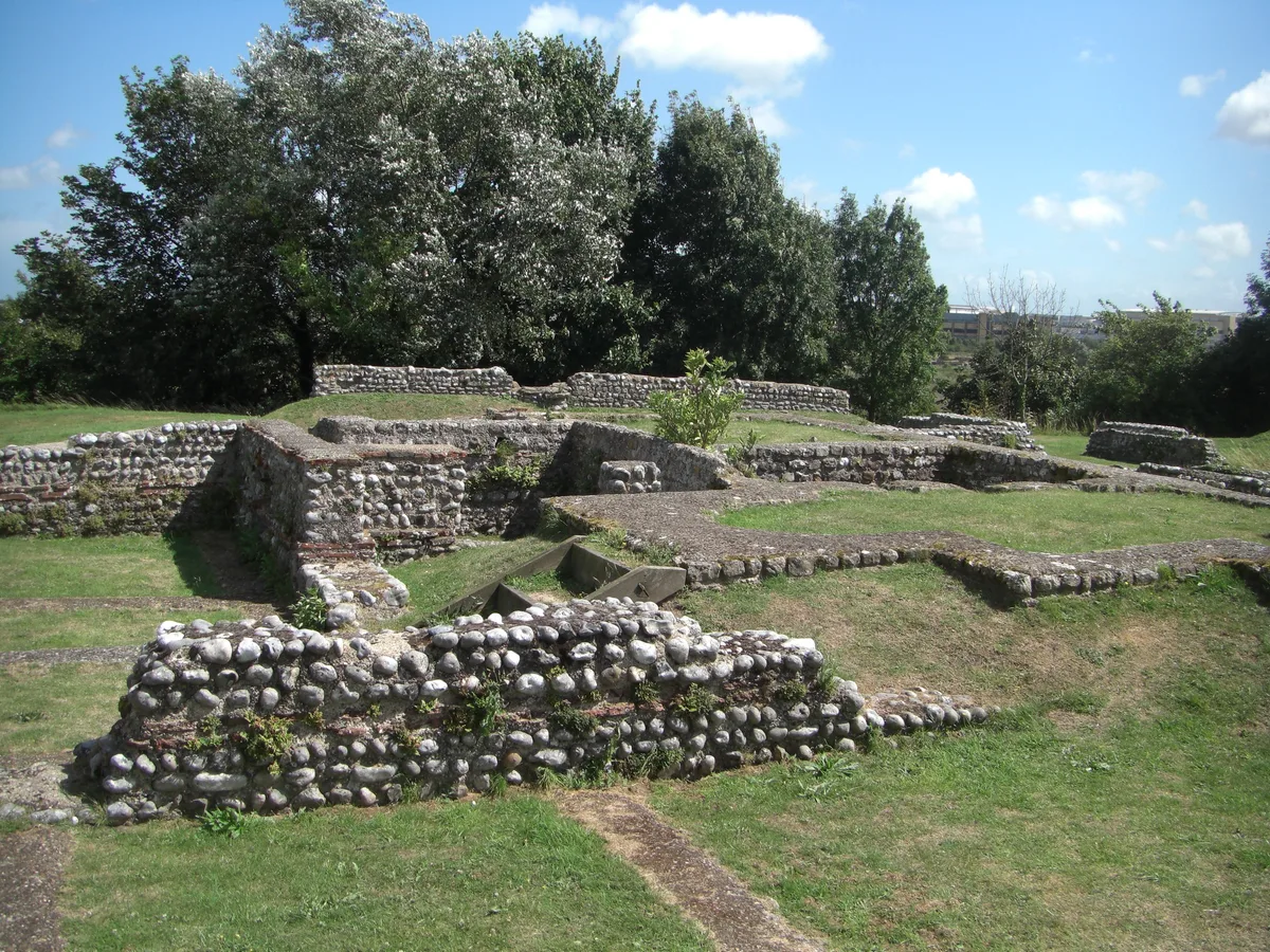
Richborough Roman Fort
Richborough Roman Fort — Roman fort at Richborough, Ash, United Kingdom.
Frequently asked questions
- Where is Sarre Anglo-Saxon cemetery?
- Sarre Anglo-Saxon cemetery is in Kent, South-East England, United Kingdom (postcode CT7 0ES), in the parish of Sarre.
- Is Sarre Anglo-Saxon cemetery a protected site?
- Yes — Sarre Anglo-Saxon cemetery is part of the Thanet Coast SSSI Site of Special Scientific Interest and the Kent Downs National Landscape (AONB).
- Is Sarre Anglo-Saxon cemetery free to visit?
- Yes, Sarre Anglo-Saxon cemetery is free to enter.
- How do I get to Sarre Anglo-Saxon cemetery?
- The nearest railway station is Minster, about 5.0 km away. Drivers can navigate to postcode CT7 0ES.