
Natural landmarks · Northern Ireland
Saintfield
Also known as: Tamhnaigh Naomh
In or near Ballygowan.
Saintfield in Northern Ireland, United Kingdom.

Albert Bridge — CC BY-SA 2.0 via Wikimedia Commons licence
_-_geograph.org.uk_-_3166158.jpg)
Plan your visit
- Typical visit
- 1 h–2 h
- Free entry
- Dog-friendly
About
Saintfield is a place of interest in Northern Ireland, United Kingdom — drawn from open-data sources for visitor reference. See the linked Wikipedia article for the full description.
Photo gallery
From the Wikipedia article
Saintfield (from Irish Tamhnaigh Naomh, meaning 'Field of Saints') is a village in County Down, Northern Ireland. It is located in a civil parish of the same name about halfway between Belfast and Downpatrick on the A7 road. It had a population of 3,588 in the 2021 census, made up mostly of commuters working in both south and central Belfast, which is about 18 km away. Running east to west across the A7 is the B6 road, and to the west of this crossroads is Main Street, which takes one towards Lisburn and Ballynahinch, and to the east is Station Road which takes one towards Killyleagh.
Excerpt from Wikipedia under CC BY-SA 4.0. See the source article linked in Sources below.
Background
History
The area that is now Saintfield was historically called Tawnaghnym (recorded in 1605) or Taunaghnieve (recorded in 1663), which is believed to come from the Irish Tamhnach Naomh or Tamhnaigh Naomh, meaning "field of saints". The English translation, Saintfield, did not come into use until the 18th century. In the 16th century, the Saintfield area was part of South Clannaboy owned by Sir Con McNeil Oge O'Neil. His lands were confiscated after a false accusation of disloyalty in 1602 and were granted to Sir James Hamilton in 1605 who 'planted' English and Scottish settlers in the area. Saintfield was originally an early 17th-century settlement, with the first church being built about 1633. A…
Description
On 26 January 1974, soldiers from the Special Air Service (SAS) intercepted a team of loyalist paramilitaries returning weapons to a derelict farmhouse on the outskirts of Saintfield that was being used as an arms cache. One of the loyalists was shot and wounded in the chest as he entered the farmhouse and ascended the staircase. Three comrades waiting for him in front of the building were captured by soldiers emerging from a hidden observation post.
Sourced from Wikipedia under CC BY-SA 4.0.
- Coordinates
- 54.4600, -5.8300
- District
- Newry, Mourne and Down
- Postcode
- BT24 7BD
- Parliamentary constituency
- Belfast South and Mid Down
Sources
- wikidata: Q58097 (CC0)
- wikipedia: Saintfield (CC BY-SA 4.0)
Other places nearby

Saintfield railway station
Natural landmarks · 0.3 km

Battle of Saintfield (1798)
Forts · 0.7 km
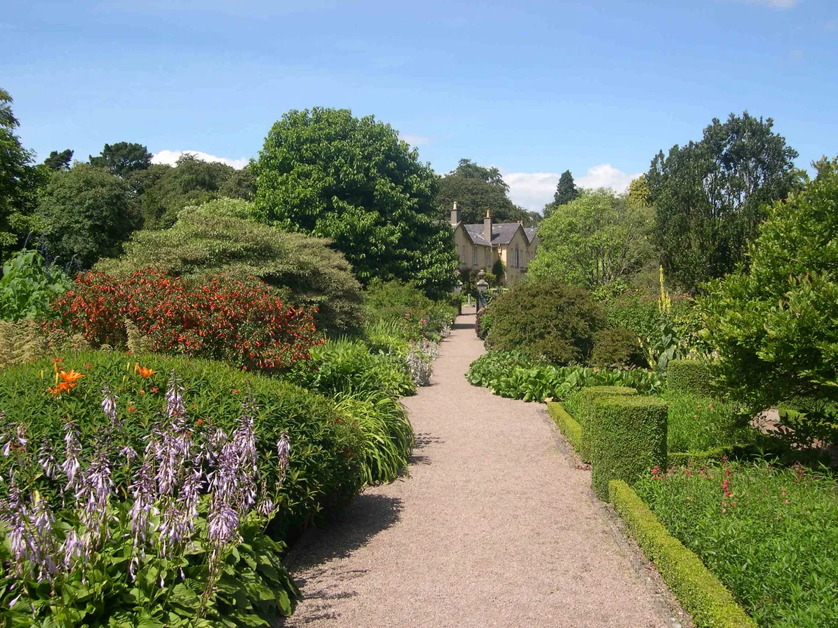
Rowallane Garden
Gardens · 1.5 km

Forthill Rath
Archaeological sites · 1.9 km

Shepherd's Bridge Halt railway station
Historic bridges · 2.8 km

Ravara
Natural landmarks · 3.5 km

Ballynahinch Junction railway station
Natural landmarks · 3.7 km

Cahard Fort
Archaeological sites · 4.0 km

Carrickmannan
Natural landmarks · 4.1 km

Ouley Hill
Natural landmarks · 4.5 km

Monlough
Lakes · 4.6 km

Lough Fort
Archaeological sites · 4.6 km
Nearby
📷 4Natural landmarks · Northern Ireland
Saintfield railway station
Saintfield railway station in Northern Ireland, United Kingdom.
📷 4Forts · Northern Ireland
Battle of Saintfield (1798)
Battle of Saintfield (1798) is a fort in the United Kingdom.
📷 5Gardens · Northern Ireland
Rowallane Garden
Rowallane Garden — Historic garden in Northern Ireland.
📷 3Archaeological sites · Northern Ireland
Forthill Rath
Forthill Rath — a archaeological in northern-ireland, United Kingdom.
📷 5Historic bridges · Northern Ireland
Shepherd's Bridge Halt railway station
Shepherd's Bridge Halt railway station in Northern Ireland, United Kingdom.
📷 4Where to eat & stay near Saintfield
Places to stay
 📷 5
📷 5Hotels · Northern Ireland
La Mon Hotel & Country Club
La Mon Hotel & Country Club — a hotel in northern ireland.
 📷 3
📷 3Campsites · Northern Ireland
The Lodge at Quarterland Bay Camp Site
The Lodge at Quarterland Bay Camp Site — a campsite in northern ireland.
 📷 5
📷 5Campsites · Northern Ireland
EDYC Caravan and Camping Area
EDYC Caravan and Camping Area — a campsite in northern ireland.
 📷 5
📷 5Campsites · Northern Ireland
Delamont Country Park
Delamont Country Park — a campsite in northern ireland.
 📷 4
📷 4Caravan parks · Northern Ireland
Quoile Yacht Club Caravan Park
Quoile Yacht Club Caravan Park — a caravan park in northern ireland.
 📷 5
📷 5Campsites · Northern Ireland
Dundonald Touring Caravan Park
Dundonald Touring Caravan Park — a campsite in northern ireland.
Places to eat & drink
 📷 5
📷 5Historic pubs · Northern Ireland
The Botanic Inn
The Botanic Inn in Northern Ireland, United Kingdom.
 📷 3
📷 3Historic pubs · Northern Ireland
Red Lion Pub bombing
Red Lion Pub bombing in Northern Ireland, United Kingdom.
 📷 7
📷 7Historic pubs · Northern Ireland
Crown Liquor Saloon
Crown Liquor Saloon in Northern Ireland, United Kingdom.
 📷 5
📷 5Historic pubs · Northern Ireland
Kitchen Bar
Kitchen Bar in Northern Ireland, United Kingdom.
 📷 5
📷 5 📷 7
📷 7Historic pubs · Northern Ireland
Kelly's Cellars
Kelly's Cellars in Northern Ireland, United Kingdom.
More natural landmarks in this region
 Flagship📷 4
Natural landmarks · Northern Ireland
Lough Erne
Lough Erne — lake in County Fermanagh, Northern Ireland, UK.
 Flagship📷 4
Natural landmarks · Northern Ireland
Lough Neagh
Lough Neagh — large lake in Northern Ireland.
 📷 3
📷 3Natural landmarks · Northern Ireland
Ballysaggart Lough
Ballysaggart Lough — lake in the United Kingdom.
 📷 5
📷 5Natural landmarks · Northern Ireland
Belmore Mountain
Belmore Mountain — mountain in the United Kingdom.
Frequently asked questions
- Where is Saintfield?
- Saintfield is in Northern Ireland, United Kingdom (postcode BT24 7BD).
- What is Saintfield?
- Saintfield in Northern Ireland, United Kingdom.
- How do I get to Saintfield?
- The nearest town is Ballygowan. Drivers can use postcode BT24 7BD.
- Is Saintfield free to visit?
- Yes, Saintfield is free to enter.
- How do I get to Saintfield?
- Drivers can navigate to postcode BT24 7BD. It sits within the Belfast South and Mid Down parliamentary constituency.