
Campsites · Northern Ireland
EDYC Caravan and Camping Area
In or near Killyleagh.
EDYC Caravan and Camping Area — a campsite in northern ireland.

Eric Jones — CC BY-SA 2.0 via Wikimedia Commons licence

Plan your visit
- Typical visit
- 1 h–2 h
- Nearest railway station
- Delamont · 4.0 km
- Free entry
About
EDYC Caravan and Camping Area is a campsite located in northern ireland. Address: Comber Road, Killyleagh, BT30 9QZ. Campsite listed with verified location and OSM metadata. Pitch availability, facilities (toilets, showers, electric hookup) and seasonal opening vary — confirm directly.
Photo gallery
Official information
East Down Yacht Club is a premier yacht club located on Strangford Lough, offering sailing experiences and training. Visitors can enjoy access to world-class facilities and participate in various sailing events and programs.
Place summary
EDYC Caravan and Camping Area is a campsite located in Northern Ireland, postcode BT30. This site offers a space for caravanning and camping enthusiasts, providing a natural setting for outdoor activities. Visitors can expect basic amenities suitable for camping and caravanning, making it a functional choice for those looking to explore the region.
AI-generated from the structured facts on this page (operator, designation, listing, era). Not a substitute for visiting.
- Coordinates
- 54.4136, -5.6463
- District
- Newry, Mourne and Down
- Postcode
- BT30 9QZ
- Parliamentary constituency
- Strangford
- Nearest railway station
- Delamont — 4 km
- Official site
- edyc.co.uk
Sources
- osm: w498031378 (ODbL)
Other places nearby

Shrigley
Natural landmarks · 1.2 km

Moymore Fort
Archaeological sites · 1.2 km
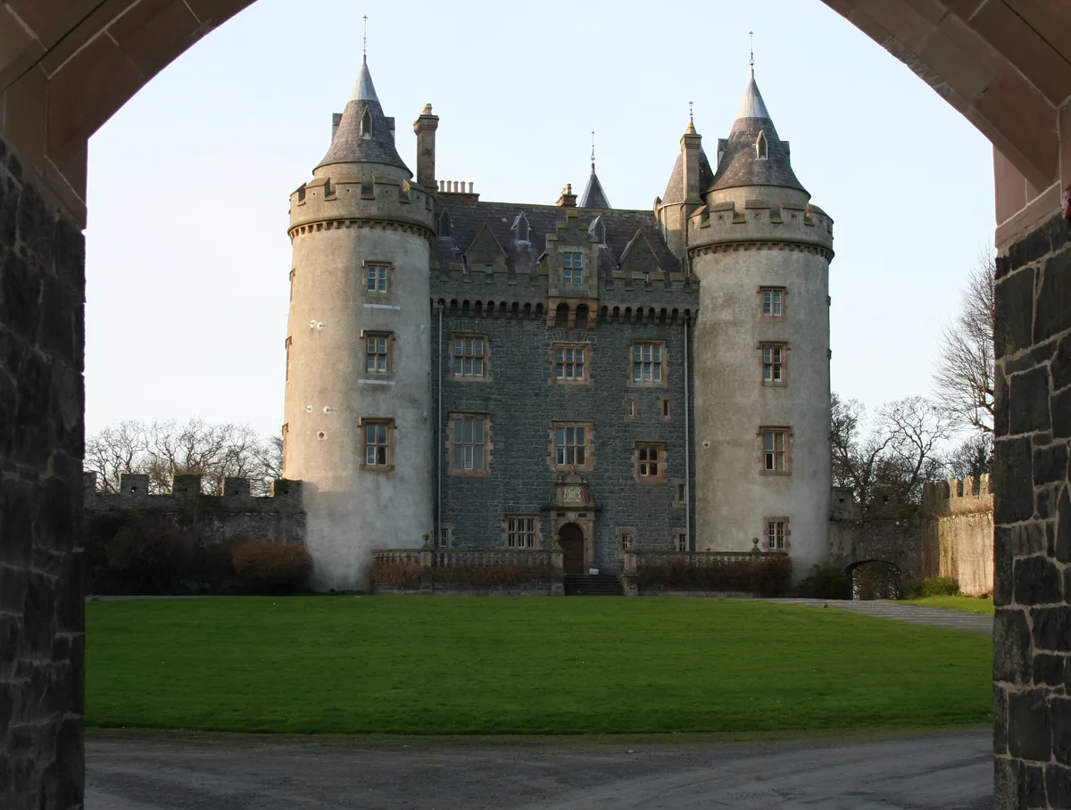
Killyleagh Castle
Castles · 1.3 km
_-_geograph.org.uk_-_458764.jpg?width=1200)
Killyleagh
Towns & cities · 1.5 km

Hans Sloane
Public art & sculpture · 1.7 km

Cuan Beach
Beaches · 2.2 km

Ardigon
Natural landmarks · 3.4 km

Delamont Country Park
Campsites · 3.6 km

Delamont Miniature Railway
Miniature railways · 3.7 km

Delamont Country Park
Country parks · 3.9 km

Pontoon
Piers · 4.1 km

The Lodge at Quarterland Bay Camp Site
Campsites · 4.2 km
Nearby
📷 3📷 2Archaeological sites · Northern Ireland
Moymore Fort
Moymore Fort — a archaeological in northern-ireland, United Kingdom.
📷 5Castles · Northern Ireland
Killyleagh Castle
Killyleagh Castle — castle in the village of Killyleagh, Northern Ireland.
📷 5Towns & cities · Northern Ireland
Killyleagh
Killyleagh — village in County Down, Northern Ireland.
📷 5Public art & sculpture · Northern Ireland
Hans Sloane
Hans Sloane — a public art in northern-ireland, United Kingdom.
📷 3Where to eat & stay near EDYC Caravan and Camping Area
Places to stay
📷 5Campsites · Northern Ireland
Delamont Country Park
Delamont Country Park — a campsite in northern ireland.
📷 3Campsites · Northern Ireland
The Lodge at Quarterland Bay Camp Site
The Lodge at Quarterland Bay Camp Site — a campsite in northern ireland.
 📷 4
📷 4Caravan parks · Northern Ireland
Quoile Yacht Club Caravan Park
Quoile Yacht Club Caravan Park — a caravan park in northern ireland.
 📷 5
📷 5Campsites · Northern Ireland
Castle Ward Caravan Park
Castle Ward Caravan Park — a campsite in northern ireland.
 📷 5
📷 5Caravan parks · Northern Ireland
Strangford Holiday Park
Strangford Holiday Park — a caravan park in northern ireland.
 📷 5
📷 5Hotels · Northern Ireland
La Mon Hotel & Country Club
La Mon Hotel & Country Club — a hotel in northern ireland.
Places to eat & drink
 📷 3
📷 3Historic pubs · Northern Ireland
Soma Festival
The Soma Festival (Sanskrit: सोम, or sóma, meaning drink of the Gods, see Soma (drink); Irish: Féile Soma) is an annual music, arts, and cultural festival. The festival includes concerts, musical perf
More places in this region
 📷 5
📷 5Campsites · Northern Ireland
Castlewellan Touring-in-the-Trees
Castlewellan Touring-in-the-Trees — a campsite in northern ireland.
 📷 5
📷 5 📷 5
📷 5 📷 5
📷 5Frequently asked questions
- Where is EDYC Caravan and Camping Area?
- EDYC Caravan and Camping Area is in Northern Ireland, United Kingdom (postcode BT30 9QZ).
- What is EDYC Caravan and Camping Area?
- EDYC Caravan and Camping Area — a campsite in northern ireland.
- How do I get to EDYC Caravan and Camping Area?
- The nearest railway station is Delamont, about 4.0 km away. Drivers can use postcode BT30 9QZ.
- How do I get to EDYC Caravan and Camping Area?
- The nearest railway station is Delamont, about 4.0 km away. Drivers can navigate to postcode BT30 9QZ.