
Castles · East of England
Ruins of castle and eleventh century church
In or near Bawsey.
Ruins of castle and eleventh century church — Grade I listed castle and church in Castle Rising, Norfolk, England, UK.

Wikimedia Commons contributors — see linked file page for photographer and licence licence

Plan your visit
- Typical visit
- 1.5 h–3 h
- Nearest railway station
- King's Lynn · 6.2 km
- Free entry
- Family-friendly
- Limited wheelchair access
Getting there & planning your visit
To visit the Ruins of the castle and eleventh century church, you can reach it by train to King's Lynn, which is 6.2 km away. The postcode for your sat-nav is PE31 6AH. Please note that wheelchair accessibility is limited.
About
Ruins of castle and eleventh century church is a castle in Norfolk, the East Midlands. Officially recognised as scheduled monument. The site is within the Norfolk Coast National Landscape (AONB), and is a designated Site of Special Scientific Interest. It sits within the North West Norfolk parliamentary constituency. The nearest railway station is King's Lynn, about 6.2 km away. Postcode area PE31.
Photo gallery
Heritage listing
Details Castle Rising castle stands on a broad spur above the southern edge of the village of Castle Rising, c.1km south of the Babingley River and near to the edge of the marshland which borders the Wash to the west. The monument includes a 12th century hall keep castle, and the remains of associated buildings of various dates, amongst which are the ruins of an 11th century church which was incorporated in the castle and put to secular use. These buildings are set within a ringwork comprising a central enclosure with a strong earthwork bank and ditch, an entrance on the east side with a bridge and 12th century gatehouse, and outworks to east and west. The standing buildings of the castle, including the bridge and gatehouse, are Listed Grade I and included in the scheduling. The church is the earliest masonry structure identified on the site and is situated in the central enclosure c.30m to the north of the keep, partly within the southern face of the northern bank. The walls still stand to a height of up to 4m. The building measures c.26m in length overall and is divided into three cells: the nave at the western end, measuring 12m by 4.8m internally, with a low stone bench running around the foot of the walls, a central area c.4m square, and a chancel measuring c.4.8m by 4m internally with an apsidal east end. At the western end of the nave there are two opposed doorways, both of them now blocked, in the north and south walls respectively. The chancel was lit by three narrow, round headed, internally splayed windows, two of which remain on the north and east sides of the apse. The third, which no longer survives, was on the south side, where it was recorded in the 19th century. The church dates from the period before the construction of the castle, when Rising was held
From the Historic England List Entry under OGL v3.
Official information
Castle Rising Castle is one of England's largest and best-preserved keeps, surrounded by extensive earthworks. Visitors can explore the castle's Great Hall, the remains of Queen Isabella's apartments, and an early Norman church within the grounds.
Protected designations
- Site of Special Scientific Interest: The Wash SSSI
- Area of Outstanding Natural Beauty: Norfolk Coast
- Ramsar wetland: The Wash
Designations sourced from Natural England open data under OGL v3.
Place summary
The Ruins of a castle and an eleventh-century church are located in Castle Rising, Norfolk, in the East Midlands. This site is designated as a scheduled monument and is part of the Wash SSSI, the Norfolk Coast AONB, and the Ramsar Wetlands.
AI-generated from the structured facts on this page (operator, designation, listing, era). Not a substitute for visiting.
- Coordinates
- 52.7928, 0.4690
- County
- Norfolk
- District
- King's Lynn and West Norfolk
- Parish
- Castle Rising
- Postcode
- PE31 6AH
- Parliamentary constituency
- North West Norfolk
- Phone
- 01553 631330
- Nearest railway station
- King's Lynn — 6.2 km
- Opening
- Daily 10am–6pm
- Official site
- www.english-heritage.org.uk
Sources
- wikidata: Q17536060 (CC0)
- commons: CastleRising-WyrdLight-Wiki.jpg (CC BY-SA 4.0)
Other places nearby

Castle Rising
Castles · 0.0 km
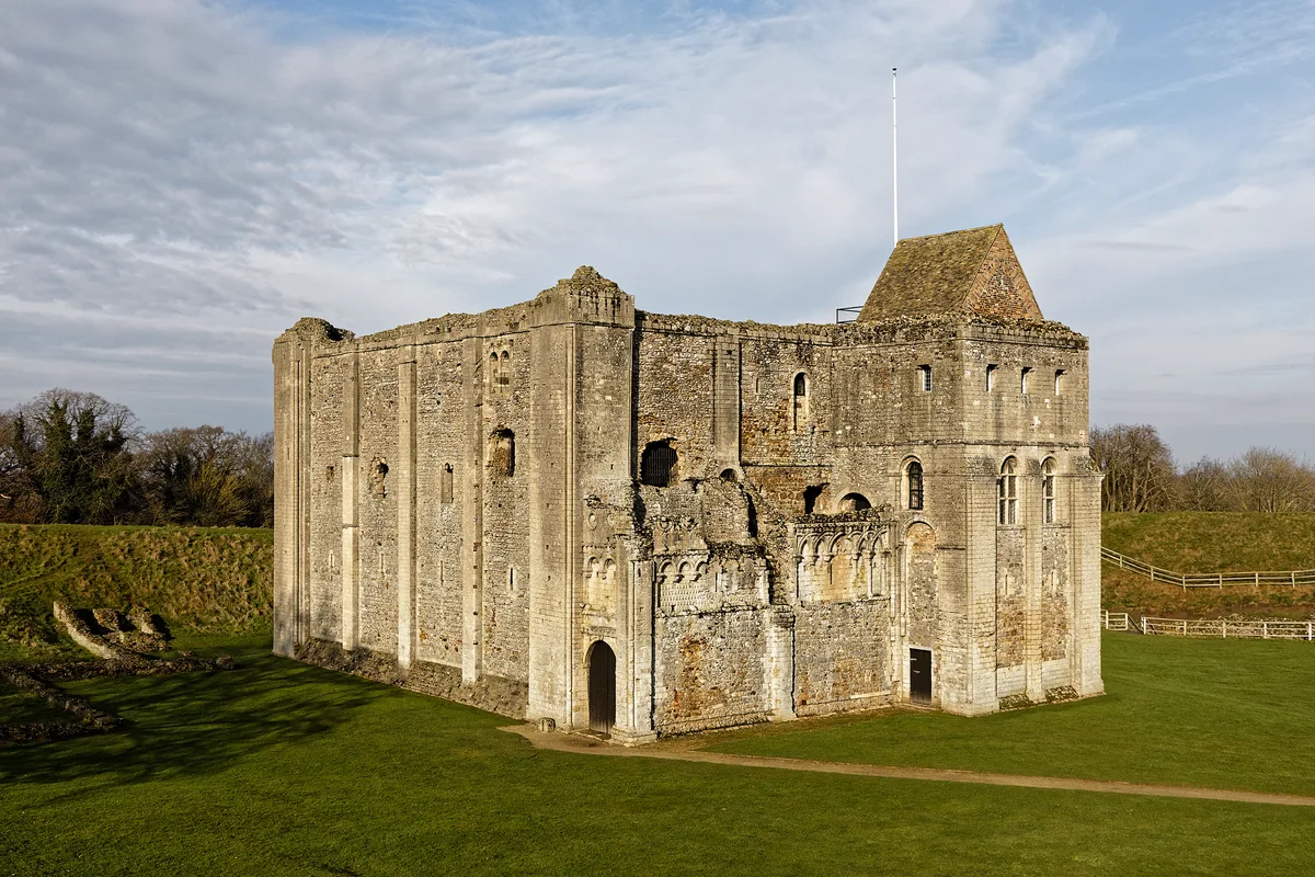
Castle Rising Castle
Castles · 0.0 km

Lamp Post At Tf 6660 2473 Circa 50 Metres North West Of Barn At Castle Farm
Memorials & monuments · 0.2 km

Lamp Post At Tf 6666 2473 Circa 20 Metres North Of Barn At Castle Farm
Memorials & monuments · 0.2 km

Castle Rising Keepers Wood
Literary houses · 0.9 km
Motte castle in Keeper's Wood, 670m east of Castle Rising Castle
Literary houses · 0.9 km

Saint Felix
Historic houses · 1.6 km

Medieval settlement of Babingley
Vineyards · 1.6 km

Babingley Village Sign
Public art & sculpture · 2.1 km

North Wootton Village Sign
Public art & sculpture · 2.1 km

North Wootton
Villages · 2.6 km

Sandringham Estate
Caravan parks · 2.8 km
Nearby
📷 3Castles · East of England
Castle Rising
Castle Rising — a castle in East of England, United Kingdom.
📷 5Castles · East of England
Castle Rising Castle
Castle Rising Castle — castle in Castle Rising, Norfolk, England, UK.
📷 3Memorials & monuments · East of England
Lamp Post At Tf 6660 2473 Circa 50 Metres North West Of Barn At Castle Farm
Lamp Post At Tf 6660 2473 Circa 50 Metres North West Of Barn At Castle Farm — Grade II listed building-listed memorial in england-east-midlands, United Kingdom.
📷 3Memorials & monuments · East of England
Lamp Post At Tf 6666 2473 Circa 20 Metres North Of Barn At Castle Farm
Lamp Post At Tf 6666 2473 Circa 20 Metres North Of Barn At Castle Farm — Grade II listed building-listed memorial in england-east-midlands, United Kingdom.
📷 5Literary houses · East of England
Castle Rising Keepers Wood
Castle Rising Keepers Wood — a literary house museum in england east midlands.
📷 5Literary houses · East of England
Motte castle in Keeper's Wood, 670m east of Castle Rising Castle
motte-and-bailey castle in Castle Rising, King's Lynn and West Norfolk, England, UK
Where to eat & stay near Ruins of castle and eleventh century church
Places to stay
📷 5Caravan parks · East of England
Sandringham Estate
Sandringham Estate — a caravan park in england east midlands.
 📷 5
📷 5Campsites · East of England
Sandringham Camping and Caravanning Club Site
Sandringham Camping and Caravanning Club Site — a campsite in england east midlands.
 📷 5
📷 5Campsites · East of England
Four Oaks Camping
Four Oaks Camping — a campsite in england east midlands.
 📷 5
📷 5Caravan parks · East of England
Gatton Waters
Gatton Waters — a caravan park in england east midlands.
 📷 5
📷 5Caravan parks · East of England
Innisfree Park Homes
Innisfree Park Homes — a caravan park in england east midlands.
 📷 5
📷 5Places to eat & drink
 📷 5
📷 5 📷 5
📷 5 📷 5
📷 5Historic pubs · East of England
Globe Hotel
Globe Hotel in England East, United Kingdom.
 📷 5
📷 5Historic pubs · East of England
Crown And Mitre Public House
Crown And Mitre Public House in England East, United Kingdom.
 📷 7
📷 7 📷 5
📷 5Historic pubs · East of England
The Hare Public House
The Hare Public House in England East, United Kingdom.
More castles in this region
 📷 5
📷 5Castles · East of England
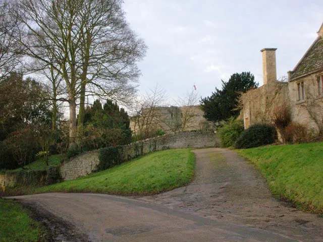
Barnwell Castle
Barnwell Castle — castle in Northamptonshire, England, UK.
 📷 5
📷 5Castles · East of England
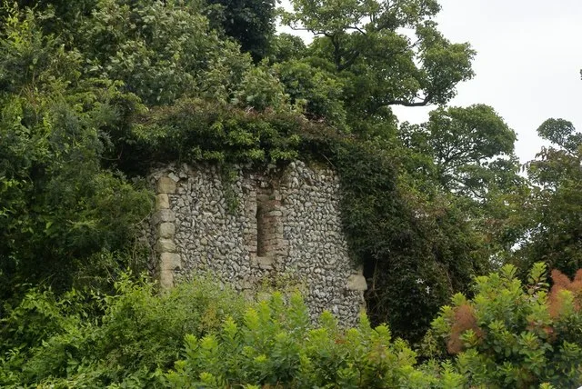
Benington Castle
Benington Castle — Grade I listed castle in East Hertfordshire, England, UK.
 📷 5
📷 5 📷 5
📷 5Castles · East of England
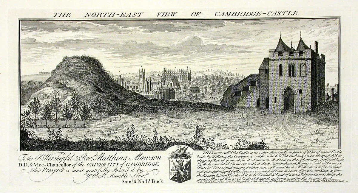
Camera Obscura
Camera Obscura is a place of interest in the United Kingdom.
Frequently asked questions
- Where is Ruins of castle and eleventh century church?
- Ruins of castle and eleventh century church is in Norfolk, East of England, United Kingdom (postcode PE31 6AH), in the parish of Castle Rising.
- What is Ruins of castle and eleventh century church?
- Ruins of castle and eleventh century church — Grade I listed castle and church in Castle Rising, Norfolk, England, UK.
- How do I get to Ruins of castle and eleventh century church?
- The nearest railway station is King's Lynn, about 6.2 km away. The nearest town is Bawsey. Drivers can use postcode PE31 6AH.
- Is Ruins of castle and eleventh century church a listed building?
- Ruins of castle and eleventh century church is officially recognised as scheduled monument listed.
- Is Ruins of castle and eleventh century church a protected site?
- Yes — Ruins of castle and eleventh century church is part of the The Wash SSSI Site of Special Scientific Interest and the Norfolk Coast National Landscape (AONB).
- Is Ruins of castle and eleventh century church free to visit?
- Yes, Ruins of castle and eleventh century church is free to enter.
- How do I get to Ruins of castle and eleventh century church?
- The nearest railway station is King's Lynn, about 6.2 km away. Drivers can navigate to postcode PE31 6AH.