
Castles · South West England
Ruardean
In or near Ruardean Woodside.
Ruardean is a village in the Forest of Dean, Gloucestershire, England, to the North West of Cinderford. It is situated on a hillside with views west towards the mountains of South Wales. Little now re

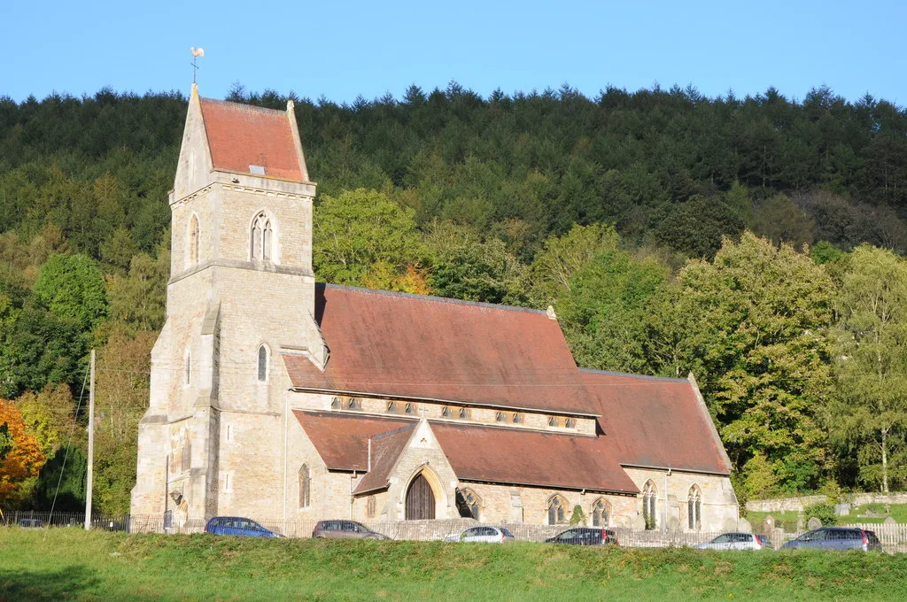
Jaggery — CC BY-SA 2.0 via Wikimedia Commons licence

Plan your visit
- Typical visit
- 1.5 h–3 h
- Nearest railway station
- Rookwood · 8.8 km
- Family-friendly
- Limited wheelchair access
Getting there & planning your visit
To visit Ruardean, the nearest railway station is Rookwood, located 8.8 km away. The postcode for sat-nav is GL17 9YT. Accessibility is limited for wheelchair users.
About
Ruardean is a village in the Forest of Dean, Gloucestershire, England, to the North West of Cinderford. It is situated on a hillside with views west towards the mountains of South Wales. Little now remains of the village's industrial history, but once it was a centre for iron-ore smelting furnaces, forges and coal mines. The Norman castle, now little more than a mound, commanded the shortest route from Gloucester Castle to the Welsh Marches and the Wye Valley.
Photo gallery
Protected designations
- Area of Outstanding Natural Beauty: Wye Valley
Designations sourced from Natural England open data under OGL v3.
From the Wikipedia article
Ruardean is a village in the Forest of Dean, Gloucestershire, England, to the North West of Cinderford. It is situated on a hillside with views west towards the mountains of South Wales. Little now remains of the village's industrial history, but once it was a centre for iron-ore smelting furnaces, forges and coal mines. The Norman castle, now little more than a mound, commanded the shortest route from Gloucester Castle to the Welsh Marches and the Wye Valley.
Excerpt from Wikipedia under CC BY-SA 4.0. See the source article linked in Sources below.
Background
History
The village has been, in times past, an important centre of iron and coal mining, though little evidence remains of this aspect of the village's history. The main historical landmark of the village is Ruardyn Castle, near to the parish church. In the past the village was spelt as Ruardyn and was part of Herefordshire. Nowadays the village lies inside Gloucestershire and is part of the Forest of Dean district. Like much of the surrounding area, Ruardean has historically been relatively poor; the 1831 census records 127 families, with half the population employed in agriculture and 160 people on poor relief. A manor house which once stood in the field behind the church was crenellated in 1310…
Sourced from Wikipedia under CC BY-SA 4.0.
- Coordinates
- 51.8542, -2.5496
- County
- Gloucestershire
- District
- Forest of Dean
- Parish
- Ruardean
- Postcode
- GL17 9YT
- Parliamentary constituency
- Forest of Dean
- Nearest railway station
- Rookwood — 8.8 km
- Official site
- neighbourhood.statistics.gov.uk
Sources
- wikipedia: Ruardean (CC BY-SA 4.0)
Other places nearby

Ruardyn Castle
Castles · 0.4 km

Ruardean Castle
Castles · 0.5 km

Ruardean Castle
Literary houses · 0.5 km

James & William Horlick
Memorials & monuments · 0.5 km

Ruardean Woodside
Towns & cities · 0.9 km

Ruardean Hill
Mountains & hills · 1.4 km
Ruardean Hill
Mountains & hills · 1.4 km

Ragmans Lane Farm
Farms (open to visitors) · 1.9 km

Drybrook
Villages · 2.3 km

Greenway Farm Campsite
Campsites · 2.5 km
Holy Jesus' Church, Lydbrook
Historic churches · 2.5 km

Mitcheldean Meend Marsh
Parks · 2.6 km
Nearby
📷 3Castles · South West England
Ruardyn Castle
Ruardyn Castle is a castle in the United Kingdom.
📷 3Castles · South West England
Ruardean Castle
Ruardean Castle — a castle in england-west-midlands, United Kingdom.
📷 5Literary houses · South West England
Ruardean Castle
Ruardean Castle — a literary house museum in england west midlands.
📷 3Memorials & monuments · South West England
James & William Horlick
James & William Horlick — a memorial in england-west-midlands, United Kingdom.
📷 3Towns & cities · South West England
Ruardean Woodside
Ruardean Woodside — village in Gloucestershire, England, UK.
📷 5Mountains & hills · South West England
Ruardean Hill
Ruardean Hill — a hill or mountain in england west midlands.
Where to eat & stay near Ruardean
Places to stay
📷 5Campsites · South West England
Greenway Farm Campsite
Greenway Farm Campsite — a campsite in england west midlands.
 📷 5
📷 5 📷 5
📷 5Caravan parks · South West England
Enfield Park
Enfield Park — a caravan park in england west midlands.
 📷 5
📷 5Campsites · West Midlands
Greenacres Camping & Caravan Site
Greenacres Camping & Caravan Site — a campsite in england west midlands.
 📷 5
📷 5B&Bs · South West England
The Saracens Head
The Saracens Head — a bed-and-breakfast in wales south.
 📷 5
📷 5Places to eat & drink
 📷 7
📷 7 📷 5
📷 5 📷 5
📷 5 📷 5
📷 5Historic pubs · West Midlands
The Man of Ross
The Man of Ross — Historic pub — listed building or notable heritage status.
 📷 7
📷 7 📷 5
📷 5More castles in this region
 Flagship📷 10
Castles · South West England
Old Wardour Castle
Old Wardour Castle — Grade I listed castle in Wardour, Wiltshire, England, UK.
 📷 5
📷 5Castles · South West England
Ballands Castle
Ballands Castle — former castle in Somerset, England, UK.
 📷 5
📷 5Castles · South West England
Brownsea Castle
Brownsea Castle — grade II listed Device Fort in Purbeck, United Kingdom.
 📷 5
📷 5Castles · South West England
Castle Hill
Castle Hill — castle in Mere, Wiltshire.
Frequently asked questions
- Where is Ruardean?
- Ruardean is in Gloucestershire, the West Midlands, United Kingdom (postcode GL17 9YT), in the parish of Ruardean.
- What is Ruardean?
- Ruardean is a village in the Forest of Dean, Gloucestershire, England, to the North West of Cinderford. It is situated on a hillside with views west towards the mountains of South Wales. Little now re
- How do I get to Ruardean?
- The nearest railway station is Rookwood, about 8.8 km away. Drivers can use postcode GL17 9YT.
- Is Ruardean a protected site?
- Yes — Ruardean is part of the Wye Valley National Landscape (AONB).
- Does Ruardean charge admission?
- Ruardean typically charges admission. Check the official site for current ticket prices and opening hours.
- How do I get to Ruardean?
- Drivers can navigate to postcode GL17 9YT. It sits within the Forest of Dean parliamentary constituency.