
Castles · South West England
Ballands Castle
In or near Bourton.
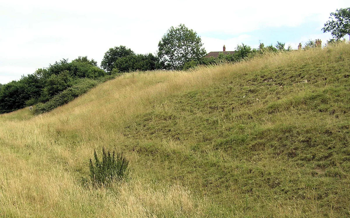
Ballands Castle — former castle in Somerset, England, UK.

Neil Owen — CC BY-SA 2.0 via Wikimedia Commons licence

Plan your visit
- Typical visit
- 1.5 h–3 h
- Nearest railway station
- Gillingham · 7.5 km
- Family-friendly
- Limited wheelchair access
Getting there & planning your visit
To visit Ballands Castle, the nearest railway station is Gillingham, located 7.5 km away. The postcode for sat-nav is BA9 8LL. Accessibility is limited for wheelchair users.
About
Ballands Castle is a castle in the United Kingdom — fortified architecture from the medieval, Tudor, or Victorian-revival period. Heritage designation: scheduled monument. Wikidata describes it as: "former castle in Somerset, England, UK". Coordinates: 51.0779°, -2.3531°.
Photo gallery
Heritage listing
Details The monument includes a motte and bailey castle built on a natural terrace on a west facing hillside which slopes down to a stream. The motte and an additional mound are at the north of the site, with the inner bailey and an outer bailey extending to the south. The motte is a flat topped mound, 3m high, the top c.9m north-south by c.14m east-west, surrounded by a ditch c.7m wide and c.1m deep. Beyond the ditch on the west side is an additional mound thought to represent an outwork. This has dimensions of c.35m north-south, c.8m east-west and c.1m high. To the south of the motte are two baileys. The inner bailey measures 25m north-south and 16m east-west. A bank on the south side of the inner bailey is c.0.75m high and c.3m wide. The ditch between the inner bailey and the outer bailey, to the south, is 7m wide and 1m deep to the top of the bank of the inner bailey, and 2m deep to the top of the bank of the outer bailey. The outer bailey stands c.1m higher than the inner bailey. The bank on the north edge of the outer bailey is c.0.6m high and c.3m wide, and the bank on the west side of the bailey is of similar dimensions. The outer bailey is c.50m north-south and c.25m east-west, and the ditch on its south side is c.7m wide and c.1m deep. Along the east side of both inner and outer baileys is a c.1m drop to a stream. On the west side the inner bailey stands 4m higher than ground level, and the outer bailey stands 5m higher than ground level. The outer bailey is marked by the OS as `Site of Church', but there is no evidence on the ground to support an ecclesiastical foundation here, and the nature of the earthwork supports the premise that it is part of the motte and bailey castle. The post and wire fence around the west and south sides of the motte and the east s
From the Historic England List Entry under OGL v3.
Protected designations
- Area of Outstanding Natural Beauty: Cranborne Chase & West Wiltshire Downs
Designations sourced from Natural England open data under OGL v3.
From the Wikipedia article
Ballands Castle was a castle near the village of Penselwood, Somerset, England.
Excerpt from Wikipedia under CC BY-SA 4.0. See the source article linked in Sources below.
Background
History
Balland Castle was a motte and bailey castle, probably built after the Norman Conquest of England in 1066, near the village of Penselwood in Somerset. The castle sits close to the contemporary Norman castles of Cockroad Wood and Castle Orchard, and may have been built as part of a system of fortifications to control the surrounding area. The bailey lies to the south, and both the motte and the bailey are surrounded by ditches. Today the castle site is a scheduled monument.
Sourced from Wikipedia under CC BY-SA 4.0.
- Coordinates
- 51.0779, -2.3531
- District
- Somerset
- Parish
- Pen Selwood
- Postcode
- BA9 8LL
- Parliamentary constituency
- Glastonbury and Somerton
- Nearest railway station
- Gillingham — 7.5 km
- Official site
- www.ecastles.co.uk
Sources
- wikidata: Q4851427 (CC0)
- wikipedia: Ballands Castle (CC BY-SA 4.0)
Other places nearby

Penselwood Village Sign
Public art & sculpture · 0.4 km

Penselwood
Castles · 0.5 km

Cockroad Wood Castle
Literary houses · 1.4 km

Cockroad Wood Castle
Castles · 1.4 km

Castle Orchard
Castles · 1.8 km
Orchard Castle
Literary houses · 1.8 km

Stavordale Priory
Abbeys & priories · 1.9 km

Bourton
Towns & cities · 2.2 km

Forty Pond
Natural landmarks · 2.2 km

Newpark Wood
Mountains & hills · 2.3 km

Sunnyhill Campsite
Campsites · 2.5 km

Kenwalch's Castle
Vineyards · 2.6 km
Nearby
📷 5Public art & sculpture · South West England
Penselwood Village Sign
Penselwood Village Sign — a public art in england-south-east, United Kingdom.
📷 5Castles · South West England
Penselwood
Penselwood or Pen Selwood is a village and civil parish in the English county of Somerset. It lies 4 miles (6 km) north east of Wincanton, 4 miles (6.4 km) south east of Bruton, 4 miles (6.4 km) west
📷 2Literary houses · South West England
Cockroad Wood Castle
Cockroad Wood Castle — a literary house museum in england south east.
📷 5Castles · South West England
Cockroad Wood Castle
Cockroad Wood Castle — a castle in england-south-east, United Kingdom.
📷 5📷 5Literary houses · South West England
Orchard Castle
Orchard Castle — a literary house museum in england south east.
Where to eat & stay near Ballands Castle
Places to stay
📷 5Campsites · South West England
Sunnyhill Campsite
Sunnyhill Campsite — a campsite in england south east.
 📷 5
📷 5Campsites · South West England
Leela Fields Caravan & Camping Park
Leela Fields Caravan & Camping Park — a campsite in england south east.
 📷 2
📷 2Campsites · South West England
Two Counties Farm
Two Counties Farm — a campsite in england south east.
 📷 5
📷 5 📷 5
📷 5Campsites · South West England
Bush Farm Bison Centre
Bush Farm Bison Centre — a campsite in england south east.
 📷 5
📷 5Caravan parks · South West England
Coking Farm Caravan Site
Coking Farm Caravan Site — a caravan park in england south east.
Places to eat & drink
 📷 5
📷 5 📷 7
📷 7Historic pubs · South West England
The Bath Arms
The Bath Arms in England South West, United Kingdom.
 📷 7
📷 7 📷 5
📷 5Historic pubs · South West England
Fox And Hounds Public House
Fox And Hounds Public House in England South West, United Kingdom.
 📷 7
📷 7 📷 5
📷 5Historic pubs · South West England
Stalbridge Arms Public House
Stalbridge Arms Public House in England South West, United Kingdom.
More castles in this region
 Flagship📷 10
Castles · South West England
Old Wardour Castle
Old Wardour Castle — Grade I listed castle in Wardour, Wiltshire, England, UK.
 📷 5
📷 5Castles · South West England
Brownsea Castle
Brownsea Castle — grade II listed Device Fort in Purbeck, United Kingdom.
 📷 5
📷 5Castles · South West England
Castle Hill
Castle Hill — castle in Mere, Wiltshire.
 📷 5
📷 5Castles · South West England
Culverhay Castle
Culverhay Castle — castle in Englishcombe, Somerset, England, UK.
Frequently asked questions
- Where is Ballands Castle?
- Ballands Castle is in South-East England, United Kingdom (postcode BA9 8LL), in the parish of Pen Selwood.
- What is Ballands Castle?
- Ballands Castle — former castle in Somerset, England, UK.
- How do I get to Ballands Castle?
- The nearest railway station is Gillingham, about 7.5 km away. Drivers can use postcode BA9 8LL.
- Is Ballands Castle a listed building?
- Ballands Castle is officially recognised as scheduled monument listed.
- Is Ballands Castle a protected site?
- Yes — Ballands Castle is part of the Cranborne Chase & West Wiltshire Downs National Landscape (AONB).
- Does Ballands Castle charge admission?
- Ballands Castle typically charges admission. Check the official site for current ticket prices and opening hours.
- How do I get to Ballands Castle?
- The nearest railway station is Gillingham, about 7.5 km away. Drivers can navigate to postcode BA9 8LL.