
Canals · South East England
Royal Military Canal, Cliff End to Coastguard Cottages
In or near Pett.
Royal Military Canal, Cliff End to Coastguard Cottages — most southerly section of the Royal Military Canal.

Wikimedia Commons contributors — see linked file page for photographer and licence licence

Plan your visit
- Typical visit
- 1 h–2 h
- Nearest railway station
- Winchelsea · 4.8 km
- Free entry
- Dog-friendly
About
Royal Military Canal, Cliff End to Coastguard Cottages is a place of interest in East Sussex, South-East England. Officially recognised as scheduled monument. The site is within the High Weald National Landscape (AONB), and is a designated Site of Special Scientific Interest. It sits within the Hastings and Rye parliamentary constituency. The nearest railway station is Winchelsea, about 4.8 km away. Postcode area TN35.
Photo gallery
Protected designations
- Site of Special Scientific Interest: Hastings Cliffs to Pett Beach SSSI
- Site of Special Scientific Interest: Dungeness, Romney Marsh and Rye Bay SSSI
- Area of Outstanding Natural Beauty: High Weald
- Ramsar wetland: Dungeness, Romney Marsh and Rye Bay
Designations sourced from Natural England open data under OGL v3.
Place summary
The Royal Military Canal stretches from Cliff End to Coastguard Cottages in East Sussex. This scheduled monument is notable for its historical significance, and it lies within several designated areas, including the Hastings Cliffs to Pett Beach SSSI and the High Weald AONB. The canal is part of a broader landscape that features diverse ecological and geological attributes.
AI-generated from the structured facts on this page (operator, designation, listing, era). Not a substitute for visiting.
- Coordinates
- 50.8916, 0.6887
- County
- East Sussex
- District
- Rother
- Parish
- Pett
- Postcode
- TN35 4EN
- Parliamentary constituency
- Hastings and Rye
- Nearest railway station
- Winchelsea — 4.8 km
Sources
- wikidata: Q17643025 (CC0)
- commons: Royal Military Canal - geograph.org.uk - 2176049.jpg (CC BY-SA 4.0)
Other places nearby

the old lookout
Forts · 0.1 km
the old bunker
Forts · 0.1 km

HMS Anne
Museums · 0.7 km

Royal Military Canal, Coastguard Cottages to Wickham Cliff
Canals · 1.1 km

Pett
Villages · 1.9 km
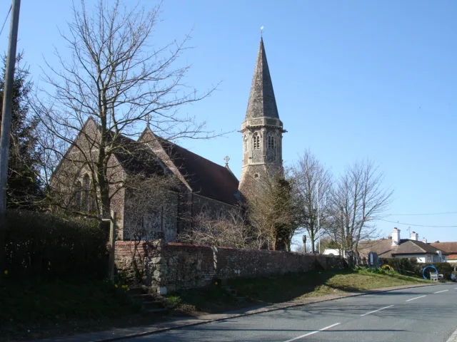
Pett
Towns & cities · 2.0 km

The Mill House Of Hog Windmill
Windmills · 2.4 km
Hogg Hill Mill
Historic houses · 2.4 km

Free Camping
Campsites · 2.4 km

Fairlight
Villages · 2.7 km

The Watcher
Public art & sculpture · 2.8 km

Fresh Winds Camping
Campsites · 2.8 km
Nearby
📷 5📷 5📷 5📷 5Canals · South East England
Royal Military Canal, Coastguard Cottages to Wickham Cliff
Royal Military Canal, Coastguard Cottages to Wickham Cliff — canal in Pett, East Sussex, England, UK.
📷 5Flagship📷 10Towns & cities · South East England
Pett
Pett — village in East Sussex, England, UK.
Where to eat & stay near Royal Military Canal, Cliff End to Coastguard Cottages
Places to stay
📷 5📷 5Campsites · South East England
Fresh Winds Camping
Fresh Winds Camping — a campsite in england south east.
 📷 5
📷 5Caravan parks · South East England
Winchelsea Beach
Winchelsea Beach — a caravan park in england south east.
 📷 5
📷 5 📷 5
📷 5Caravan parks · South East England
Winchelsea Sands
Winchelsea Sands — a caravan park in england south east.
 📷 5
📷 5Caravan parks · South East England
Windmill Caravan Park
Windmill Caravan Park — a caravan park in england south east.
Places to eat & drink
 📷 7
📷 7Historic pubs · South East England
The Hope Public House
The Hope Public House in England South East, United Kingdom.
 📷 5
📷 5Historic pubs · South East England
Flushing Inn Monks Way
Flushing Inn Monks Way in England South East, United Kingdom.
 📷 5
📷 5 📷 5
📷 5Historic pubs · South East England
Duke Of Wellington Public House
Duke Of Wellington Public House in England South East, United Kingdom.
 📷 7
📷 7Historic pubs · South East England
The Royal Standard Public House
The Royal Standard Public House in England South East, United Kingdom.
 📷 6
📷 6Historic pubs · South East England
Hastings Arms Public House
Hastings Arms Public House in England South East, United Kingdom.
More places in this region
 📷 5
📷 5Canals · South East England
Thames and Medway Canal
Thames and Medway Canal — disused canal in Kent, England.
 📷 5
📷 5 📷 5
📷 5Canals · South East England
Basingstoke Canal
Basingstoke Canal is a canal in the United Kingdom.
 📷 5
📷 5Frequently asked questions
- Where is Royal Military Canal, Cliff End to Coastguard Cottages?
- Royal Military Canal, Cliff End to Coastguard Cottages is in East Sussex, South-East England, United Kingdom (postcode TN35 4EN), in the parish of Pett.
- What is Royal Military Canal, Cliff End to Coastguard Cottages?
- Royal Military Canal, Cliff End to Coastguard Cottages — most southerly section of the Royal Military Canal.
- How do I get to Royal Military Canal, Cliff End to Coastguard Cottages?
- The nearest railway station is Winchelsea, about 4.8 km away. The nearest town is Pett. Drivers can use postcode TN35 4EN.
- Is Royal Military Canal, Cliff End to Coastguard Cottages a listed building?
- Royal Military Canal, Cliff End to Coastguard Cottages is officially recognised as scheduled monument listed.
- Is Royal Military Canal, Cliff End to Coastguard Cottages a protected site?
- Yes — Royal Military Canal, Cliff End to Coastguard Cottages is part of the Hastings Cliffs to Pett Beach SSSI Site of Special Scientific Interest and the Dungeness, Romney Marsh and Rye Bay SSSI Site of Special Scientific Interest.
- Is Royal Military Canal, Cliff End to Coastguard Cottages free to visit?
- Yes, Royal Military Canal, Cliff End to Coastguard Cottages is free to enter.
- How do I get to Royal Military Canal, Cliff End to Coastguard Cottages?
- The nearest railway station is Winchelsea, about 4.8 km away. Drivers can navigate to postcode TN35 4EN.