
Historic bridges · East Midlands
Road Bridge South Of Wash Farmhouse
In or near Alton.
Road Bridge South Of Wash Farmhouse — Grade II listed building-listed bridge in england-east-midlands, United Kingdom.

Andrew Hill — CC BY-SA 2.0 via Wikimedia Commons licence

Plan your visit
- Typical visit
- 15 min–30 min
- Nearest railway station
- Matlock · 6.1 km
- Free entry
- Dog-friendly
Getting there & planning your visit
The nearest railway station is Matlock, located 6.1 km away. Entry to the Road Bridge South Of Wash Farmhouse is free.
About
Road Bridge South Of Wash Farmhouse is a Grade II listed building-listed bridge in england-east-midlands, United Kingdom, registered on the National Heritage List for England (NHLE entry 1218500). Listed status protects buildings and structures of special architectural or historic interest. See the linked Wikipedia article for further details.
Photo gallery
Heritage listing
Details AS HOVER SK36SE MILLTOWN 1264-0/8/79 Road bridge south of Wash Farmhouse II Road bridge. Dated 1846. Coursed squared gritstone, with flat copings to parapet walls. Single-arch bridge, with semicircular arch with dressed voussoirs surrounded by shallow parapet walls which have roughly dressed flat copings. The bridge has curved and splayed abutments, and was built to span the River Amber. Listing NGR: SK3554161745 Legacy The contents of this record have been generated from a legacy data system. Legacy System number: 393415 Legacy System: LBS
From the Historic England List Entry under OGL v3.
Place summary
The Road Bridge South of Wash Farmhouse is a Grade II listed bridge located in the East Midlands. It is recognised for its architectural significance and contribution to the local heritage.
AI-generated from the structured facts on this page (operator, designation, listing, era). Not a substitute for visiting.
- Coordinates
- 53.1517, -1.4700
- County
- Derbyshire
- District
- North East Derbyshire
- Parish
- Ashover
- Postcode
- S45 0HG
- Parliamentary constituency
- North East Derbyshire
- Nearest railway station
- Matlock — 6.1 km
Sources
- wikidata: Q26513122 (CC0)
Other places nearby

The Miners Arms Public House
Historic pubs · 0.1 km

Fallgate Mill
Watermills · 0.5 km

Ashover Hay Primitive Methodist Chapel
Chapels · 0.7 km

Ashover Hay
Mountains & hills · 1.0 km
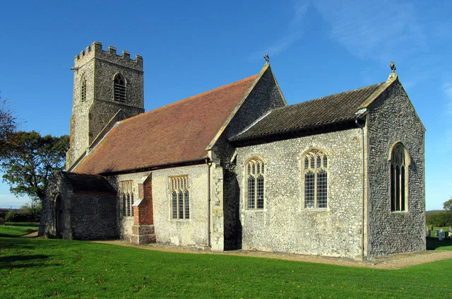
Church of All Saints
Historic churches · 1.5 km

The Crispin Inn
Historic pubs · 1.6 km

Dumble Hole Swallet
Caves · 1.6 km

The Fabrick
Mountains & hills · 2.0 km

Goss Hall
B&Bs · 2.0 km

Blakelow Farm
Caravan parks · 2.3 km
_and_its_bell_house_-_geograph.org.uk_-_3126206.jpg?width=1200)
Ruins of Trinity Chapel
Chapels · 2.4 km

Lickpenny Caravan Park
Caravan parks · 2.5 km
Nearby
📷 5Historic pubs · East Midlands
The Miners Arms Public House
The Miners Arms Public House in England East Midlands, United Kingdom.
📷 3Watermills · East Midlands
Fallgate Mill
Fallgate Mill — Grade II listed building-listed watermill in england-east-midlands, United Kingdom.
📷 4Chapels · East Midlands
Ashover Hay Primitive Methodist Chapel
Ashover Hay Primitive Methodist Chapel — Grade II listed Methodist chapel in the parish of Ashover, North East Derbyshire, England, UK.
📷 5Mountains & hills · East Midlands
Ashover Hay
Ashover Hay — a hill or mountain in england east midlands.
📷 3Historic churches · East Midlands
Church of All Saints
Church of All Saints — Anglican church in Ashover, Derbyshire, England, UK.
📷 5Historic pubs · East Midlands
The Crispin Inn
The Crispin Inn in England East Midlands, United Kingdom.
Where to eat & stay near Road Bridge South Of Wash Farmhouse
Places to stay
📷 5B&Bs · East Midlands
Goss Hall
Goss Hall — a bed-and-breakfast in england east midlands.
📷 5📷 5Caravan parks · East Midlands
Lickpenny Caravan Park
Lickpenny Caravan Park — a caravan park in england east midlands.
 📷 5
📷 5 📷 5
📷 5Caravan parks · East Midlands
Brookfield Mobile Home Park
Brookfield Mobile Home Park — a caravan park in england east midlands.
 📷 5
📷 5Caravan parks · East Midlands
Packhorse Farm
Packhorse Farm — a caravan park in england east midlands.
Places to eat & drink
📷 5Historic pubs · East Midlands
The Miners Arms Public House
The Miners Arms Public House in England East Midlands, United Kingdom.
📷 5Historic pubs · East Midlands
The Crispin Inn
The Crispin Inn in England East Midlands, United Kingdom.
 📷 5
📷 5Historic pubs · East Midlands
Duke William Inn
Duke William Inn in England East Midlands, United Kingdom.
 📷 5
📷 5 📷 5
📷 5 📷 5
📷 5Historic pubs · East Midlands
The Black Swan Public House And Attached L Shaped Range Of Outbuildings To The North-East
The Black Swan Public House And Attached L Shaped Range Of Outbuildings To The North-East in England East Midlands, United Kingdom.
More bridges in this region
 📷 5
📷 5Historic bridges · East Midlands
Mill Race Bridge To Market Deeping Mill
Mill Race Bridge To Market Deeping Mill — Grade II listed building-listed bridge in england-london, United Kingdom.
 📷 5
📷 5Historic bridges · East Midlands
Bridge Over West Glen River
Bridge Over West Glen River — Grade II listed building-listed bridge in england-london, United Kingdom.
 📷 5
📷 5Historic bridges · East Midlands
Bridge And Sluices
Bridge And Sluices — Grade II listed building-listed bridge in england-london, United Kingdom.
 📷 5
📷 5Historic bridges · East Midlands
Bridge Over River Gwash
Bridge Over River Gwash — Grade II listed building-listed bridge in england-london, United Kingdom.
Frequently asked questions
- Where is Road Bridge South Of Wash Farmhouse?
- Road Bridge South Of Wash Farmhouse is in Derbyshire, the East Midlands, United Kingdom (postcode S45 0HG), in the parish of Ashover.
- What is Road Bridge South Of Wash Farmhouse?
- Road Bridge South Of Wash Farmhouse — Grade II listed building-listed bridge in england-east-midlands, United Kingdom.
- How do I get to Road Bridge South Of Wash Farmhouse?
- The nearest railway station is Matlock, about 6.1 km away. Drivers can use postcode S45 0HG.
- Is Road Bridge South Of Wash Farmhouse a listed building?
- Road Bridge South Of Wash Farmhouse is officially recognised as Grade II listed building listed.
- Is Road Bridge South Of Wash Farmhouse free to visit?
- Yes, Road Bridge South Of Wash Farmhouse is free to enter.
- How do I get to Road Bridge South Of Wash Farmhouse?
- The nearest railway station is Matlock, about 6.1 km away. Drivers can navigate to postcode S45 0HG.