
Chapels · East Midlands
Ashover Hay Primitive Methodist Chapel
In or near Brackenfield.
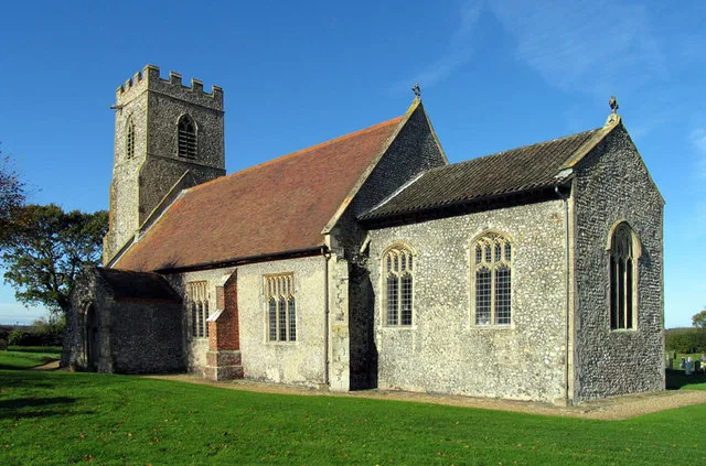
Ashover Hay Primitive Methodist Chapel — Grade II listed Methodist chapel in the parish of Ashover, North East Derbyshire, England, UK.

Wikimedia Commons contributors — see linked file page for photographer and licence licence

Plan your visit
- Typical visit
- 20 min–45 min
- Nearest railway station
- Matlock · 6.2 km
- Free entry
Getting there & planning your visit
To visit Ashover Hay Primitive Methodist Chapel, the nearest railway station is Matlock, which is 6.2 km away. The postcode for sat-nav is S45 0HF, and entry to the chapel is free.
About
Ashover Hay Primitive Methodist Chapel is a chapel in the United Kingdom. Heritage designation: Grade II listed building. Affiliated with Primitive Methodism. Wikidata describes it as: "Grade II listed Methodist chapel in the parish of Ashover, North East Derbyshire, England, UK". Coordinates: 53.1459°, -1.4670°.
Photo gallery
From the Wikipedia article
Milltown Methodist Church (known alternatively as Milltown Chapel, Milltown Primitive Methodist Chapel and Ashover Hay Primitive Methodist Chapel) is a now-closed, listed Methodist chapel in the village of Milltown, Derbyshire. The chapel was founded by Hugh Bourne who formed a society in the district. The building, which also has a graveyard (though this no longer present), was opened in 1824, and was expanded in 1870. The building is built from coursed gritstone with a roof of Welsh slate. The chapel became Grade II listed in 1995. Worship ceased at an unrecorded date after c. 2007.
Excerpt from Wikipedia under CC BY-SA 4.0. See the source article linked in Sources below.
- Coordinates
- 53.1459, -1.4670
- County
- Derbyshire
- District
- North East Derbyshire
- Parish
- Ashover
- Postcode
- S45 0HF
- Parliamentary constituency
- North East Derbyshire
- Established
- 1824
- Nearest railway station
- Matlock — 6.2 km
Sources
- wikidata: Q26513139 (CC0)
- wikipedia: Milltown Methodist Church (CC BY-SA 4.0)
- commons: Milltown Chapel - geograph.org.uk - 2335070.jpg (CC BY-SA 4.0)
Other places nearby

Ashover Hay
Mountains & hills · 0.4 km

Road Bridge South Of Wash Farmhouse
Historic bridges · 0.7 km

The Miners Arms Public House
Historic pubs · 0.7 km

Fallgate Mill
Watermills · 1.2 km
_and_its_bell_house_-_geograph.org.uk_-_3126206.jpg?width=1200)
Ruins of Trinity Chapel
Chapels · 1.8 km

Lickpenny Caravan Park
Caravan parks · 2.1 km

Ogston Reservoir
Reservoirs & lochs · 2.1 km
Church of All Saints
Historic churches · 2.2 km

The Crispin Inn
Historic pubs · 2.2 km

Dumble Hole Swallet
Caves · 2.3 km

Blakelow Farm
Caravan parks · 2.3 km

Brackenfield
Towns & cities · 2.5 km
Nearby
📷 5Mountains & hills · East Midlands
Ashover Hay
Ashover Hay — a hill or mountain in england east midlands.
📷 3Historic bridges · East Midlands
Road Bridge South Of Wash Farmhouse
Road Bridge South Of Wash Farmhouse — Grade II listed building-listed bridge in england-east-midlands, United Kingdom.
📷 5Historic pubs · East Midlands
The Miners Arms Public House
The Miners Arms Public House in England East Midlands, United Kingdom.
📷 3Watermills · East Midlands
Fallgate Mill
Fallgate Mill — Grade II listed building-listed watermill in england-east-midlands, United Kingdom.
📷 3Chapels · East Midlands
Ruins of Trinity Chapel
Ruins of Trinity Chapel — chapel in Brackenfield, North East Derbyshire, England, UK.
📷 5Caravan parks · East Midlands
Lickpenny Caravan Park
Lickpenny Caravan Park — a caravan park in england east midlands.
Where to eat & stay near Ashover Hay Primitive Methodist Chapel
Places to stay
📷 5Caravan parks · East Midlands
Lickpenny Caravan Park
Lickpenny Caravan Park — a caravan park in england east midlands.
📷 5 📷 5
📷 5 📷 5
📷 5 📷 5
📷 5Caravan parks · East Midlands
Broomhill Farm
Broomhill Farm — a caravan park in england east midlands.
 📷 5
📷 5Caravan parks · East Midlands
Packhorse Farm
Packhorse Farm — a caravan park in england east midlands.
Places to eat & drink
📷 5Historic pubs · East Midlands
The Miners Arms Public House
The Miners Arms Public House in England East Midlands, United Kingdom.
📷 5Historic pubs · East Midlands
The Crispin Inn
The Crispin Inn in England East Midlands, United Kingdom.
 📷 5
📷 5Historic pubs · East Midlands
Duke William Inn
Duke William Inn in England East Midlands, United Kingdom.
 📷 5
📷 5 📷 5
📷 5Historic pubs · East Midlands
The Black Swan Public House And Attached L Shaped Range Of Outbuildings To The North-East
The Black Swan Public House And Attached L Shaped Range Of Outbuildings To The North-East in England East Midlands, United Kingdom.
 📷 5
📷 5More places in this region
 📷 5
📷 5Chapels · East Midlands
Chapel Of Ease
Chapel Of Ease — chapel in Wisbech St Mary, Cambridgeshire, England, UK.
 📷 3
📷 3Chapels · East Midlands
Alderwasley Chapel
Alderwasley Chapel — chapel in Alderwasley, Amber Valley, Derbyshire, England, UK.
 📷 3
📷 3Chapels · East Midlands
Baptist Chapel
Baptist Chapel — chapel in Great Steeping, Lincolnshire, England, UK.
 📷 3
📷 3Chapels · East Midlands
Baptist Chapel And Schoolroom
Baptist Chapel And Schoolroom — chapel in Boston, Lincolnshire, England, UK.
Frequently asked questions
- Where is Ashover Hay Primitive Methodist Chapel?
- Ashover Hay Primitive Methodist Chapel is in Derbyshire, the East Midlands, United Kingdom (postcode S45 0HF), in the parish of Ashover.
- What is Ashover Hay Primitive Methodist Chapel?
- Ashover Hay Primitive Methodist Chapel — Grade II listed Methodist chapel in the parish of Ashover, North East Derbyshire, England, UK.
- How do I get to Ashover Hay Primitive Methodist Chapel?
- The nearest railway station is Matlock, about 6.2 km away. The nearest town is Brackenfield. Drivers can use postcode S45 0HF.
- When was Ashover Hay Primitive Methodist Chapel built?
- Built or established in 1824.
- Is Ashover Hay Primitive Methodist Chapel a listed building?
- Ashover Hay Primitive Methodist Chapel is officially recognised as Grade II listed building listed.
- Is Ashover Hay Primitive Methodist Chapel free to visit?
- Yes, Ashover Hay Primitive Methodist Chapel is free to enter.
- How do I get to Ashover Hay Primitive Methodist Chapel?
- The nearest railway station is Matlock, about 6.2 km away. Drivers can navigate to postcode S45 0HF.