
Museums · West Midlands
River Sowe
In or near Ashow.
The River Sowe is a river in Warwickshire and West Midlands, England. It is a tributary of the River Avon, and flows into it just south of Stoneleigh about 5 miles (8 km) south of Coventry. The Sowe

Jonathan Hutchins — CC BY-SA 2.0 via Wikimedia Commons licence

Plan your visit
- Typical visit
- 1.5 h–3 h
- Best time of year
- Year-round
- Nearest railway station
- Grotto Halt · 3.1 km
- Family-friendly
- Limited wheelchair access
Getting there & planning your visit
To visit the River Sowe, the nearest railway station is Grotto Halt, located 3.1 km away. The postcode for sat-nav is CV8 3DJ. Accessibility is limited for wheelchair users.
About
The River Sowe is a river in Warwickshire and West Midlands, England. It is a tributary of the River Avon, and flows into it just south of Stoneleigh about 5 miles (8 km) south of Coventry. The Sowe is about 12 miles (19 km) long. The Sowe rises in Bedworth 5.5 miles (9 km) to the north of Coventry. Its route takes it through Exhall near to Junction 3 of the M6 motorway and the A444 road, to the northern and then the eastern suburbs of Coventry, in particular the districts of Longford, Wood End, Walsgrave, Binley, Ernesford Grange, Willenhall and near the village of Baginton. Near Baginton the river has a large steep bank on its southern side and the remains of the Roman Lunt Fort have been found at the top of this bank. The Sowe Valley Footpath runs alongside the river for 8½ miles from Hawkesbury Junction Conservation Area to Stonebridge Meadows Local Nature Reserve. It also runs through Wyken Slough Local Nature Reserve, Wyken Croft Nature Park and Stoke Floods Local Nature Reserve. The grade II-listed Sowe Viaduct carries the Coventry-Rugby railway line across the river.
Photo gallery
From the Wikipedia article
The River Sowe is a river in Warwickshire and West Midlands, England. It is a tributary of the River Avon, and flows into it just south of Stoneleigh about 5 miles (8 km) south of Coventry. The Sowe is about 12 miles (19 km) long. The Sowe rises in Bedworth 5.5 miles (9 km) to the north of Coventry. Its route takes it through Exhall near to Junction 3 of the M6 motorway and the A444 road, to the northern and then the eastern suburbs of Coventry, in particular the districts of Longford, Wood End, Walsgrave, Binley, Ernesford Grange, Willenhall and near the village of Baginton. Near Baginton the river has a large steep bank on its southern side and the remains of the Roman Lunt Fort have been found at the top of this bank. The Sowe Valley Footpath runs alongside the river for 8½ miles from Hawkesbury Junction Conservation Area to Stonebridge Meadows Local Nature Reserve. It also runs through Wyken Slough Local Nature Reserve, Wyken Croft Nature Park and Stoke Floods Local Nature Reserve. The grade II-listed Sowe Viaduct carries the Coventry-Rugby railway line across the river.
Excerpt from Wikipedia under CC BY-SA 4.0. See the source article linked in Sources below.
- Coordinates
- 52.3486, -1.5253
- County
- Warwickshire
- District
- Warwick
- Parish
- Stoneleigh
- Postcode
- CV8 3DJ
- Parliamentary constituency
- Kenilworth and Southam
- Nearest railway station
- Grotto Halt — 3.1 km
Sources
- wikipedia: River Sowe (CC BY-SA 4.0)
Other places nearby

Stoneleigh Motslow Hill
Castles · 0.5 km

Stoneleigh
Villages · 0.6 km

Motslow Hill Mound
Archaeological sites · 0.6 km

Stoneleigh Park
Parks · 0.6 km

Church of Saint Mary, Stoneleigh
Historic churches · 0.6 km

Stoneleigh, Warwickshire
Museums · 0.8 km

Stoneleigh Bridge
Historic bridges · 0.9 km

Stare Bridge
Historic bridges · 1.1 km

Stoneleigh Abbey Gatehouse
Abbeys & priories · 1.2 km
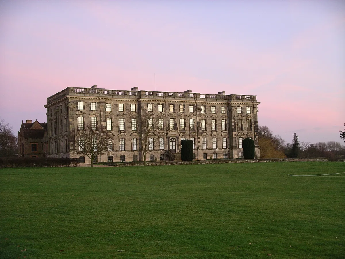
Stoneleigh Abbey
Abbeys & priories · 1.3 km

Stoneleigh Abbey
Cathedrals · 1.3 km

Coach Bridge
Historic bridges · 1.4 km
Nearby
📷 5Castles · West Midlands
Stoneleigh Motslow Hill
Stoneleigh Motslow Hill — a castle in england west midlands.
📷 5📷 3Archaeological sites · West Midlands
Motslow Hill Mound
Motslow Hill Mound — a archaeological in england-west-midlands, United Kingdom.
📷 5Parks · West Midlands
Stoneleigh Park
Stoneleigh Park, known between 1963 and 2013 as the National Agricultural Centre, is a business park located south-west of the village of Stoneleigh, Warwickshire, England. It is home to the NAEC Ston
📷 3Historic churches · West Midlands
Church of Saint Mary, Stoneleigh
Church of Saint Mary, Stoneleigh — Grade I listed building-listed church in england-west-midlands, United Kingdom.
📷 5Museums · West Midlands
Stoneleigh, Warwickshire
Stoneleigh, Warwickshire — a museum in england-west-midlands, United Kingdom.
Where to eat & stay near River Sowe
Places to stay
 📷 5
📷 5 📷 7
📷 7Hotels · West Midlands
Ramada Hotel & Suites Coventry
Ramada Hotel & Suites Coventry — a hotel in england west midlands. 4-star. Brand: Ramada.
 📷 7
📷 7Hotels · West Midlands
The Angel Hotel
The Angel Hotel — a hotel in england west midlands.
 📷 6
📷 6Hotels · West Midlands
The Regent Hotel
The Regent Hotel — a hotel in england west midlands.
 📷 6
📷 6Hotels · West Midlands
Telegraph Hotel
Telegraph Hotel — a hotel in england west midlands.
 📷 5
📷 5Hotels · West Midlands
Premier Inn
Premier Inn — a hotel in england west midlands.
Places to eat & drink
 📷 5
📷 5Historic pubs · West Midlands
The Coventry Cross Inn (The North East Section)
The Coventry Cross Inn (The North East Section) in England West Midlands, United Kingdom.
 📷 5
📷 5Historic pubs · West Midlands
The Malt Shovel
The Malt Shovel — Historic pub — listed building or notable heritage status.
 📷 5
📷 5Historic pubs · West Midlands
The Famous Virgins and Castle
The Famous Virgins and Castle — Historic pub — listed building or notable heritage status.
 📷 7📷 6
Restaurants · West Midlands
Harringtons on the Hill
Harringtons on the Hill — a restaurant in england west midlands.
 📷 5
📷 5Historic pubs · West Midlands
Queen & Castle
Queen & Castle — Historic pub — listed building or notable heritage status.
More museums in this region
 📷 3
📷 3Museums · West Midlands
Redfern Cottage
Redfern Cottage — a museum in england-east-midlands, United Kingdom.
 📷 3
📷 3Museums · West Midlands
Museum of Cannock Chase
Museum of Cannock Chase — a museum in england-east-midlands, United Kingdom.
 📷 5
📷 5Museums · West Midlands
Cannock Chase District
Cannock Chase is a designated Area of Outstanding Natural Beauty and National Landscape in Staffordshire, England. It gives its name to Cannock Chase District, a non-metropolitan local government dist
 📷 5
📷 5Museums · West Midlands
Uttoxeter
Uttoxeter — a museum in england-east-midlands, United Kingdom.
Frequently asked questions
- Where is River Sowe?
- River Sowe is in Warwickshire, the West Midlands, United Kingdom (postcode CV8 3DJ), in the parish of Stoneleigh.
- What is River Sowe?
- The River Sowe is a river in Warwickshire and West Midlands, England. It is a tributary of the River Avon, and flows into it just south of Stoneleigh about 5 miles (8 km) south of Coventry. The Sowe
- How do I get to River Sowe?
- The nearest railway station is Grotto Halt, about 3.1 km away. Drivers can use postcode CV8 3DJ.
- How do I get to River Sowe?
- The nearest railway station is Grotto Halt, about 3.1 km away. Drivers can navigate to postcode CV8 3DJ.