
Historic bridges · North West England
River Eamont
In or near Culgaith.
River Eamont in England North East, United Kingdom.

Luke Shaw — CC BY-SA 2.0 via Wikimedia Commons licence

Plan your visit
- Typical visit
- 15 min–30 min
- Nearest railway station
- Langwathby · 2.8 km
- Free entry
- Dog-friendly
Getting there & planning your visit
To visit River Eamont, the nearest railway station is Langwathby, located 2.8 km away. Entry is free. The postcode for sat-nav is CA10 1QU.
About
River Eamont is a place of interest in England North East, United Kingdom — drawn from open-data sources for visitor reference. See the linked Wikipedia article for the full description.
Photo gallery
Protected designations
- Site of Special Scientific Interest: River Eden and Tributaries SSSI
- Area of Outstanding Natural Beauty: North Pennines
Designations sourced from Natural England open data under OGL v3.
From the Wikipedia article
The River Eamont is a river in Cumbria, England and one of the major tributaries of the River Eden. The name of the river is from Old English (ēa-gemōt) and is a back formation from Eamont Bridge which means the 'junction of streams'. For its whole length, the Eamont marks the boundary of the traditional counties of Cumberland to the north with Westmorland to the south. The river is formed by the outflow from Ullswater in the Lake District, later augmented by Dacre Beck from the west and the River Lowther which carries the water from Haweswater north to the Eamont at Penrith. It reaches the Eden 4 miles (7 km) east of Penrith. The river has flooded on numerous occasions; the most recent was when Storm Desmond hit in December 2015. During the flooding, 300-year old Pooley Bridge was washed away and a temporary bridge had to be installed to reconnect the two halves of the village. The same storm damaged the Grade I listed Eamont Bridge, but after masonry work, it re-opened in March 2016. In April 2019 preparatory works began to replace the temporary bridge with a new bridge. The crossing was closed from September 2019 until Easter 2020, while the new bridge was installed. The river is also a stronghold of the endangered white clawed crayfish (Austropotamobius pallipes).
Excerpt from Wikipedia under CC BY-SA 4.0. See the source article linked in Sources below.
- Coordinates
- 54.6731, -2.6417
- District
- Westmorland and Furness
- Parish
- Culgaith
- Postcode
- CA10 1QU
- Parliamentary constituency
- Penrith and Solway
- Nearest railway station
- Langwathby — 2.8 km
Sources
- wikidata: Q848176 (CC0)
- wikipedia: River Eamont (CC BY-SA 4.0)
Other places nearby

Edenhall
Castles · 1.8 km
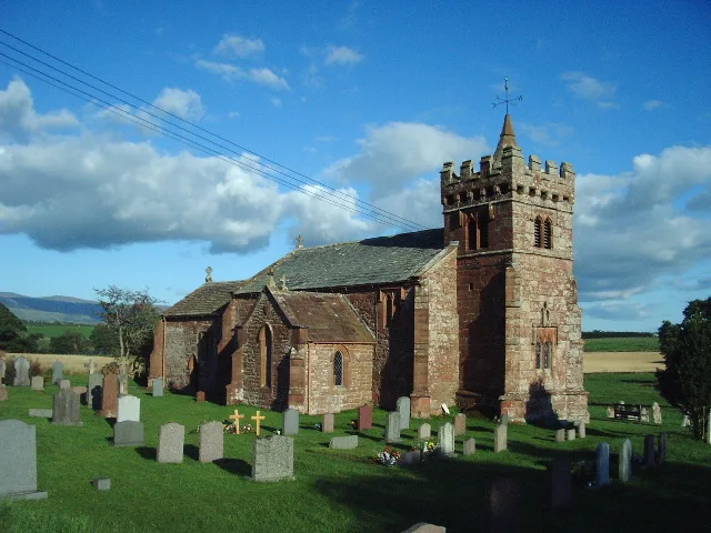
St Cuthbert's Church, Edenhall
Historic churches · 2.1 km

RAF Hornby Hall
Historic houses · 2.3 km

Culgaith
Villages · 2.5 km

Edenhall War Memorial
Memorials & monuments · 2.6 km

Edenhall
Villages · 2.7 km

Culgaith
Towns & cities · 2.7 km

Culgaith War Memorial
Memorials & monuments · 2.7 km

Langwathby railway station
Heritage railway stations · 2.7 km

Settle-Carlisle Railway
Historic bridges · 2.8 km

The Abbey, Skirwith
Abbeys & priories · 2.9 km

Culgaith railway station
Heritage railway stations · 3.0 km
Nearby
📷 5📷 5Historic churches · North West England
St Cuthbert's Church, Edenhall
St Cuthbert's Church, Edenhall is a historic church in the United Kingdom.
📷 3Historic houses · North West England
RAF Hornby Hall
RAF Hornby Hall in England North East, United Kingdom.
📷 5📷 3Memorials & monuments · North West England
Edenhall War Memorial
Edenhall War Memorial — Grade II listed building-listed memorial in scotland-lowlands, United Kingdom.
📷 5Where to eat & stay near River Eamont
Places to stay
 📷 5
📷 5Hotels · North West England
Kings Arms Hotel
Kings Arms Hotel — a hotel in scotland lowlands.
 📷 5
📷 5Caravan parks · North East England
Crossfell Caravan Park
Crossfell Caravan Park — a caravan park in scotland lowlands.
 📷 5
📷 5 📷 5
📷 5Caravan parks · North West England
Crossfells Campsite
Crossfells Campsite — a caravan park in scotland lowlands.
 📷 5
📷 5Caravan parks · North West England
Melmerby Mill Holiday Caravan Park
Melmerby Mill Holiday Caravan Park — a caravan park in scotland lowlands.
 📷 5
📷 5Caravan parks · North West England
Grange Court (C & MC CL)
Grange Court (C & MC CL) — a caravan park in scotland lowlands.
Places to eat & drink
 📷 3
📷 3 📷 7
📷 7Historic pubs · North West England
Two Lions public house and integral stables
Two Lions public house and integral stables in Scotland Lowlands, United Kingdom.
 📷 7
📷 7Cafés · North West England
Narrowbar Cafe
Narrowbar Cafe — a café in scotland lowlands.
 📷 6
📷 6Historic pubs · North West England
Gloucester Arms
Gloucester Arms in Scotland Lowlands, United Kingdom.
 📷 5
📷 5Historic pubs · North West England
Horse And Farrier Inn And Stables
Horse And Farrier Inn And Stables in Scotland Lowlands, United Kingdom.
 📷 5
📷 5Historic pubs · North East England
1, Scattergate
1, Scattergate in England North East, United Kingdom.
More bridges in this region
 📷 3
📷 3Historic bridges · North West England
Albert Bridge
Albert Bridge is a historic bridge in the United Kingdom.
 📷 3
📷 3Historic bridges · North West England
Arpley New Bridge
Arpley New Bridge is a historic bridge in the United Kingdom.
 📷 3
📷 3Historic bridges · North West England
Arpley Railway Bridge
Arpley Railway Bridge is a historic bridge in the United Kingdom.
 📷 5
📷 5Historic bridges · North West England
Barton Road Bridge
Barton Road Bridge is a historic bridge in the United Kingdom.
Frequently asked questions
- Where is River Eamont?
- River Eamont is in North-East England, United Kingdom (postcode CA10 1QU), in the parish of Culgaith.
- What is River Eamont?
- River Eamont in England North East, United Kingdom.
- How do I get to River Eamont?
- The nearest railway station is Langwathby, about 2.8 km away. Drivers can use postcode CA10 1QU.
- Is River Eamont a protected site?
- Yes — River Eamont is part of the River Eden and Tributaries SSSI Site of Special Scientific Interest and the North Pennines National Landscape (AONB).
- Is River Eamont free to visit?
- Yes, River Eamont is free to enter.
- How do I get to River Eamont?
- The nearest railway station is Langwathby, about 2.8 km away. Drivers can navigate to postcode CA10 1QU.