
Historic houses · North East England
Ridley Hall
In or near Bardon Mill.
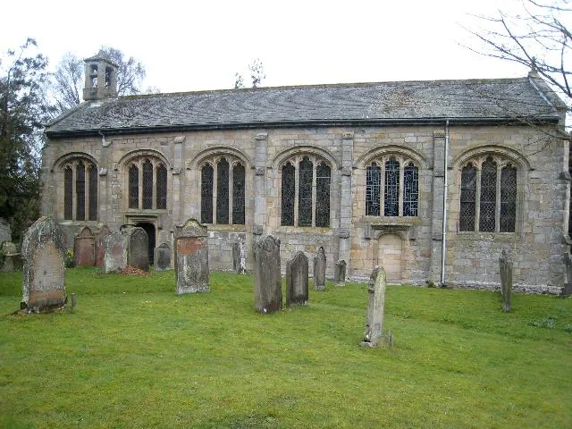
Ridley Hall — house in Bardon Mill, Northumberland, England, UK.

Wikimedia Commons contributors — see linked file page for photographer and licence licence

Plan your visit
- Typical visit
- 1 h–2 h
- Nearest railway station
- Bardon Mill · 1.6 km
- Family-friendly
- Limited wheelchair access
Getting there & planning your visit
To visit Ridley Hall, the nearest railway station is Bardon Mill, which is 1.6 km away. The postcode for sat-nav is NE47 7BP. Accessibility is limited for wheelchair users.
About
Ridley Hall is a historic house in the United Kingdom — typically a country seat, manor, or town house with notable architecture or history. Heritage designation: Grade II listed building. Wikidata describes it as: "house in Bardon Mill, Northumberland, England, UK". Coordinates: 54.9710°, -2.3215°.
Photo gallery
Protected designations
- Site of Special Scientific Interest: River Eden and Tributaries SSSI
- Area of Outstanding Natural Beauty: North Pennines
Designations sourced from Natural England open data under OGL v3.
From the Wikipedia article
Ridley Hall is an 18th-century country house, now a residential and conference centre, at Bardon Mill, Northumberland. It is a Grade II listed building.
Excerpt from Wikipedia under CC BY-SA 4.0. See the source article linked in Sources below.
Background
History
A 16th-century house on the site was owned by the Ridley family of Willimoteswick. It was acquired by the Lowes family in the late 17th century In 1830 John Davidson (High Sheriff in 1839), a cousin and beneficiary of the will of William Cornforth Lowes, purchased the house The 18th-century west wing became the domestic service wing. The Bowes-Lyon family were not often resident, and in the 20th century the house was sold to the Rev E A Evans and was converted to St Nicolas's preparatory school. In 1961 it joined forces with Hillbrow Preparatory School from nearby Haltwhistle and the Rev E A Evans retired. It was renamed Hillbrow-St Nicolas's for a short while. In 1967 lack of numbers…
Sourced from Wikipedia under CC BY-SA 4.0.
- Coordinates
- 54.9710, -2.3215
- District
- Northumberland
- Parish
- Bardon Mill
- Postcode
- NE47 7BP
- Parliamentary constituency
- Hexham
- Nearest railway station
- Bardon Mill — 1.6 km
- Official site
- co-curate.ncl.ac.uk
Sources
- wikidata: Q7333010 (CC0)
- wikipedia: Ridley Hall, Northumberland (CC BY-SA 4.0)
- commons: Ridley Hall - geograph.org.uk - 598405.jpg (CC BY-SA 4.0)
Other places nearby

Allen Banks & Staward Gorge (National Trust)
Caves · 0.3 km

Ridley Railway Bridge
Historic bridges · 0.4 km
Church of St Cuthbert
Historic churches · 0.6 km

Ridley Bridge
Historic bridges · 0.7 km

A69 road
Other places · 0.7 km

Allen Banks & Staward Gorge
Gardens · 1.1 km

Bardon Mill
Towns & cities · 1.1 km

Summer House
Memorials & monuments · 1.1 km

Beltingham River Shingle
Wildlife reserves · 1.1 km

Beltingham
Historic churches · 1.1 km

Stawardpeel Woods
Wildlife reserves · 1.2 km
Northumberland Wildlife Trust nature reserve
Wildlife reserves · 1.3 km
Nearby
📷 3Caves · North East England
Allen Banks & Staward Gorge (National Trust)
Allen Banks & Staward Gorge (National Trust) — a cave in scotland-lowlands, United Kingdom.
📷 4Historic bridges · North East England
Ridley Railway Bridge
Ridley Railway Bridge in England North East, United Kingdom.
📷 3Historic churches · North East England
Church of St Cuthbert
Church of St Cuthbert — church in Beltingham, Northumberland, England, UK.
📷 4Historic bridges · North East England
Ridley Bridge
Ridley Bridge in England North East, United Kingdom.
📷 4📷 3Gardens · North East England
Allen Banks & Staward Gorge
Allen Banks & Staward Gorge — Victorian garden and National Trust property in Northumberland, England.
Where to eat & stay near Ridley Hall
Places to stay
 📷 5
📷 5Caravan parks · North East England
Poplars Riverside Caravan Park
Poplars Riverside Caravan Park — a caravan park in scotland lowlands.
 📷 5
📷 5 📷 5
📷 5Campsites · North East England
Winshields Farm Campsite
Winshields Farm Campsite — a campsite in scotland lowlands.
 📷 5
📷 5B&Bs · North East England
Old Repeater Station
Old Repeater Station — a bed-and-breakfast in scotland lowlands.
 📷 5
📷 5Campsites · North East England
Hadrian's Wall Campsite
Hadrian's Wall Campsite — a campsite in scotland lowlands.
 📷 5
📷 5Caravan parks · North East England
Seldom Seen Caravan Park
Seldom Seen Caravan Park — a caravan park in scotland lowlands.
Places to eat & drink
 📷 7
📷 7Historic pubs · North East England
Anchor Hotel
Anchor Hotel in Scotland Lowlands, United Kingdom.
 📷 5
📷 5 📷 5
📷 5 📷 6
📷 6 📷 5
📷 5Historic pubs · North East England
Travellers' Rest Inn
Travellers' Rest Inn in Scotland Lowlands, United Kingdom.
 📷 7
📷 7Historic pubs · North East England
The Vicars Pele
The Vicars Pele in Scotland Lowlands, United Kingdom.
More historic houses in this region
 📷 3
📷 3Historic houses · North East England
Wayside cross known as Jenny Bradley 1000m north west of Bloworth Crossing on Greenhow Moor
Wayside cross known as Jenny Bradley 1000m north west of Bloworth Crossing on Greenhow Moor — a Grade II*-listed historic house in england-yorkshire, United Kingdom.
 📷 3
📷 3Historic houses · North East England
Crackpot Hall
Crackpot Hall — a historic house in england-north-west, United Kingdom.
 📷 3
📷 3Historic houses · North East England
Bunton Mine shop
Bunton Mine shop — a historic house in england-north-west, United Kingdom.
 📷 3
📷 3Historic houses · North East England
Blakethwaite Mine
Blakethwaite Mine — a historic house in england-north-west, United Kingdom.
Frequently asked questions
- Where is Ridley Hall?
- Ridley Hall is in the Scottish Lowlands, United Kingdom (postcode NE47 7BP), in the parish of Bardon Mill.
- What is Ridley Hall?
- Ridley Hall — house in Bardon Mill, Northumberland, England, UK.
- How do I get to Ridley Hall?
- The nearest railway station is Bardon Mill, about 1.6 km away. Drivers can use postcode NE47 7BP.
- Is Ridley Hall a listed building?
- Ridley Hall is officially recognised as Grade II listed building listed.
- Is Ridley Hall a protected site?
- Yes — Ridley Hall is part of the River Eden and Tributaries SSSI Site of Special Scientific Interest and the North Pennines National Landscape (AONB).
- How do I get to Ridley Hall?
- The nearest railway station is Bardon Mill, about 1.6 km away. Drivers can navigate to postcode NE47 7BP.