Other places · North East England
A69 road
In or near Bardon Mill.
A69 road in England North East, United Kingdom.

Andrew Curtis — CC BY-SA 2.0 via Wikimedia Commons licence
Plan your visit
- Typical visit
- 1 h–2 h
- Nearest railway station
- Bardon Mill · 1.3 km
Getting there & planning your visit
To visit the A69 road in Northumberland, the nearest railway station is Bardon Mill, located 1.3 km away. The postcode for the area is NE47 7BJ. Entry is free, and accessibility details are not provided.
About
A69 road is a place of interest in England North East, United Kingdom — drawn from open-data sources for visitor reference. See the linked Wikipedia article for the full description.
Photo gallery
See it from the streetimagery from 2020
Imagery © Mapillary contributors, CC BY-SA 4.0
Protected designations
- Site of Special Scientific Interest: River Eden and Tributaries SSSI
Designations sourced from Natural England open data under OGL v3.
From the Wikipedia article
The A69 is a major northern trunk road in England, running east–west across the Pennines, through the counties of Tyne and Wear, Northumberland and Cumbria. Originally, the road started in the centre of Newcastle upon Tyne then later near Birtley, but since the creation of the A1 Western Bypass around Newcastle upon Tyne, it now starts at Denton Burn, a suburb of Newcastle upon Tyne. The route from the A1 junction to Carlisle city centre is 54 miles (87 km).
Excerpt from Wikipedia under CC BY-SA 4.0. See the source article linked in Sources below.
Background
Description
The road runs westwards from the A1 at Denton Burn in Newcastle upon Tyne through the suburbs of Denton Burn and West Denton before a junction with the A6085 and the B6323. It continues west and passes over what was Hadrian's Wall, which until now has been south of the road, at Milecastle 13 on the wall. Hereafter the road is always south of the wall. The road carries on up the Tyne valley, bypassing the village of Corbridge and the market town Hexham. The A69 crosses the River Tyne west of Hexham (Constantius Bridge), re-crosses it west of the village of Haydon Bridge, and yet again as it bypasses Haltwhistle. After crossing the border into Cumbria, the A69 by-passes the town of Brampton,…
Sourced from Wikipedia under CC BY-SA 4.0.
- Coordinates
- 54.9769, -2.3254
- District
- Northumberland
- Parish
- Bardon Mill
- Postcode
- NE47 7BJ
- Parliamentary constituency
- Hexham
- Nearest railway station
- Bardon Mill — 1.3 km
Sources
Other places nearby

Ridley Railway Bridge
Historic bridges · 0.4 km

Ridley Bridge
Historic bridges · 0.4 km

Ridley Hall
Historic houses · 0.7 km

Bardon Mill
Towns & cities · 0.8 km
Church of St Cuthbert
Historic churches · 0.8 km

Allen Banks & Staward Gorge (National Trust)
Caves · 0.9 km

Beltingham River Shingle
Wildlife reserves · 1.0 km

Thorngrafton
Villages · 1.1 km
Northumberland Wildlife Trust nature reserve
Wildlife reserves · 1.2 km

Millhouse Bridge
Historic bridges · 1.2 km

Bardon Mill railway station
Heritage railway stations · 1.3 km

Hawthorn Cottage Industry
Natural landmarks · 1.4 km
Nearby
📷 4Historic bridges · North East England
Ridley Railway Bridge
Ridley Railway Bridge in England North East, United Kingdom.
📷 4Historic bridges · North East England
Ridley Bridge
Ridley Bridge in England North East, United Kingdom.
📷 3Historic houses · North East England
Ridley Hall
Ridley Hall — house in Bardon Mill, Northumberland, England, UK.
📷 4Towns & cities · North East England
Bardon Mill
Bardon Mill — village in Northumberland, England, UK.
📷 3Historic churches · North East England
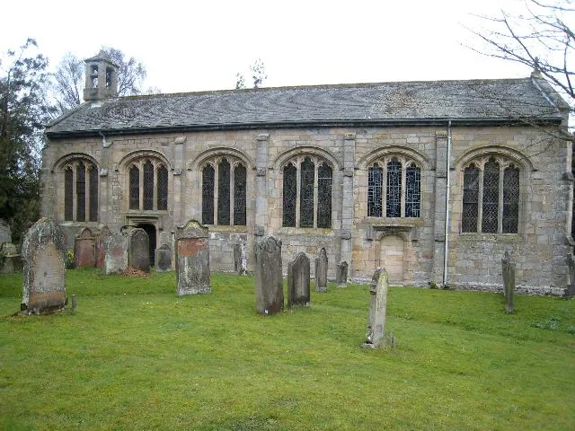
Church of St Cuthbert
Church of St Cuthbert — church in Beltingham, Northumberland, England, UK.
📷 3Caves · North East England
Allen Banks & Staward Gorge (National Trust)
Allen Banks & Staward Gorge (National Trust) — a cave in scotland-lowlands, United Kingdom.
Where to eat & stay near A69 road
Places to stay
 📷 5
📷 5 📷 5
📷 5Caravan parks · North East England
Poplars Riverside Caravan Park
Poplars Riverside Caravan Park — a caravan park in scotland lowlands.
 📷 5
📷 5Campsites · North East England
Winshields Farm Campsite
Winshields Farm Campsite — a campsite in scotland lowlands.
 📷 5
📷 5B&Bs · North East England
Old Repeater Station
Old Repeater Station — a bed-and-breakfast in scotland lowlands.
 📷 5
📷 5Campsites · North East England
Hadrian's Wall Campsite
Hadrian's Wall Campsite — a campsite in scotland lowlands.
 📷 5
📷 5Caravan parks · North East England
Seldom Seen Caravan Park
Seldom Seen Caravan Park — a caravan park in scotland lowlands.
Places to eat & drink
 📷 7
📷 7Historic pubs · North East England
Anchor Hotel
Anchor Hotel in Scotland Lowlands, United Kingdom.
 📷 5
📷 5 📷 5
📷 5 📷 6
📷 6 📷 5
📷 5Historic pubs · North East England
Travellers' Rest Inn
Travellers' Rest Inn in Scotland Lowlands, United Kingdom.
 📷 7
📷 7Historic pubs · North East England
The Vicars Pele
The Vicars Pele in Scotland Lowlands, United Kingdom.
More places in this region
 📷 5
📷 5Other places · North East England
Appleby Horse Fair
The Appleby Horse Fair, previously known as Appleby New Fair, is an annual gathering of Romani people (Gypsies) and Travellers in Appleby-in-Westmorland in Cumbria, England. The horse fair is held eac
 📷 5
📷 5Other places · North East England
Crosby Garrett
Crosby Garrett in England North East, United Kingdom.
 📷 5
📷 5Other places · North East England
Ravenstonedale
Ravenstonedale in England North East, United Kingdom.
 📷 5
📷 5Frequently asked questions
- Where is A69 road?
- A69 road is in North-East England, United Kingdom (postcode NE47 7BJ), in the parish of Bardon Mill.
- What is A69 road?
- A69 road in England North East, United Kingdom.
- How do I get to A69 road?
- The nearest railway station is Bardon Mill, about 1.3 km away. Drivers can use postcode NE47 7BJ.
- Is A69 road a protected site?
- Yes — A69 road is part of the River Eden and Tributaries SSSI Site of Special Scientific Interest.
- How do I get to A69 road?
- The nearest railway station is Bardon Mill, about 1.3 km away. Drivers can navigate to postcode NE47 7BJ.