Reservoirs & lochs · Scottish Highlands
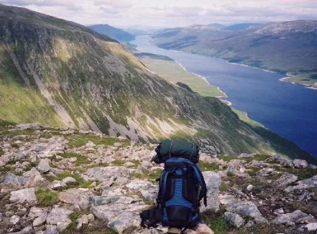
Rhu Peninsula
Rhu Peninsula in Scotland Islands, United Kingdom.

Mick Garratt — CC BY-SA 2.0 via Wikimedia Commons licence
Plan your visit
- Typical visit
- 1 h–2.5 h
- Nearest railway station
- Arisaig · 3.4 km
- Free entry
- Dog-friendly
Getting there & planning your visit
To visit Rhu Peninsula, the nearest railway station is Arisaig, located 3.4 km away. Admission is free.
About
Rhu Peninsula is a place of interest in Scotland Islands, United Kingdom — drawn from open-data sources for visitor reference. See the linked Wikipedia article for the full description.
Photo gallery
From the Wikipedia article
Rhu Peninsula (Scottish Gaelic: Rudha Arasaig) and originally known as the Rhu Arisaig peninsula is a small, remote and largely deserted peninsula, at the SW corner of South Morar in Lochaber Highland council area, on the west coast of Scotland. Arisaig is located at the northeast corner of the peninsula. In July 1745, Loch nan Uamh on the south coast of the peninsula was the landing spot for Prince Charles Edward Stuart.
Excerpt from Wikipedia under CC BY-SA 4.0. See the source article linked in Sources below.
Background
History
From the 13th century, the peninsula was part of the lands of the Clanranalds. In 1827, Ranald George Macdonald, the 20th Chief of Clanranald, sold the peninsula to his second wife Ann Selby, Lady Ashburton for £48,950. In 1835, Selby bequeathed it to her nephew, Lord James Cranstoun, who removed most of the tenants, who were mostly Roman Catholic and turned it into a sheep farm. Most of the tenants emigrated to Australia. Cranstoun subsequently sold it to Hugh Mackay of Bighouse, who sold it in 1848 to a Lancashire industrialist, who by 1853 had reforested 3000 acres of it, for deer hunting. This accelerated the clearances. In 1841 there were 134 people living on the peninsula, but by the…
Sourced from Wikipedia under CC BY-SA 4.0.
- Coordinates
- 56.8889, -5.8750
- Address
- SW corner of South Morar in Lochaber, Scotland
- Nearest railway station
- Arisaig — 3.4 km
Sources
- wikidata: Q97188507 (CC0)
- wikipedia: Rhu Peninsula (CC BY-SA 4.0)
Other places nearby

Ruemach Hill
Mountains & hills · 0.8 km

Rhumach
Vineyards · 1.1 km
Loch nan Ceall
Natural landmarks · 1.3 km

Torr Mor
Mountains & hills · 1.6 km

Old Rhu Pier
Piers · 1.7 km

Brita Mortensen Memorial
Memorials & monuments · 1.8 km

Druim an Dubh-leathaid
Mountains & hills · 2.1 km

Eilean a' Ghaill, Sound of Arisaig
Vineyards · 2.2 km

Port na Murrach/Rhu Beach
Beaches · 2.7 km

Czech and Slovak Special Operations Executive Training Memorial
Memorials & monuments · 2.9 km

Loch Nan Eala Crannog
Archaeological sites · 3.0 km

Loch Nan Eala Crannog
Archaeological sites · 3.0 km
Nearby
📷 5Mountains & hills · Scottish Highlands
Ruemach Hill
Ruemach Hill — a hill or mountain in scotland highlands.
📷 5Vineyards · Scottish Highlands
Rhumach
Rhumach — a UK vineyard in scotland highlands, producing English or Welsh wine from cool-climate grape varieties.
📷 5Natural landmarks · Scottish Highlands
Loch nan Ceall
Loch nan Ceall — a natural feature in scotland highlands.
📷 5📷 3Piers · Scottish Highlands
Old Rhu Pier
Old Rhu Pier — a pier in scotland-highlands, United Kingdom.
📷 3Memorials & monuments · Scottish Highlands
Brita Mortensen Memorial
Brita Mortensen Memorial — a memorial in scotland-highlands, United Kingdom.
Where to eat & stay near Rhu Peninsula
Places to stay
 📷 5
📷 5Campsites · Scottish Highlands
Tigh na Mara
Tigh na Mara — a campsite in scotland highlands.
 📷 5
📷 5Campsites · Scottish Highlands
Invercaimbe caravan and campsite
Invercaimbe caravan and campsite — a campsite in scotland highlands.
 📷 5
📷 5Campsites · Scottish Highlands
Sunnyside Croft Touring Site
Sunnyside Croft Touring Site — a campsite in scotland highlands.
 📷 5
📷 5Campsites · Scottish Highlands
Silversands Holiday Park, Portnaluchaig
Silversands Holiday Park, Portnaluchaig — a campsite in scotland highlands.
 📷 5
📷 5Campsites · Scottish Highlands
Camusdarach Campsite
Camusdarach Campsite — a campsite in scotland highlands.
 📷 5
📷 5Hostels · Scottish Highlands
Mallaig Backpackers
Mallaig Backpackers — a hostel in scotland highlands.
More places in this region
 Flagship📷 3
Reservoirs & lochs · Scottish Highlands
Loch Ericht
Loch Ericht — lake in Perth and Kinross, and Highland, Scotland, UK, outflows to River Ericht.
 Flagship📷 3
Reservoirs & lochs · Scottish Highlands
Loch Shin
Loch Shin — reservoir in Highland, Scotland, UK, outflows to the River Shin.
 📷 4
📷 4Reservoirs & lochs · Scottish Highlands
Backwater Reservoir
Backwater Reservoir — lake in Angus, Scotland, UK.
 📷 3
📷 3Reservoirs & lochs · Scottish Highlands
Blackwater Reservoir
Blackwater Reservoir — reservoir in Highland, Scotland, UK, outflows to the River Leven.
Frequently asked questions
- Where is Rhu Peninsula?
- Rhu Peninsula is in the Scottish Islands, United Kingdom.
- What is Rhu Peninsula?
- Rhu Peninsula in Scotland Islands, United Kingdom.
- How do I get to Rhu Peninsula?
- The nearest railway station is Arisaig, about 3.4 km away. Its coordinates are 56.8889°, -5.8750°.
- Who owns Rhu Peninsula?
- Rhu Peninsula is owned by | designation =.
- Is Rhu Peninsula free to visit?
- Yes, Rhu Peninsula is free to enter.
- How do I get to Rhu Peninsula?
- The nearest railway station is Arisaig, about 3.4 km away.