
Natural landmarks · Scottish Lowlands
RAF Charterhall
In or near Eccles.
RAF Charterhall in England North East, United Kingdom.

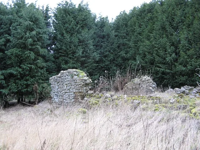
James T M Towill — CC BY-SA 2.0 via Wikimedia Commons licence

Plan your visit
- Typical visit
- 1 h–2 h
- Free entry
- Dog-friendly
About
RAF Charterhall is a place of interest in England North East, United Kingdom — drawn from open-data sources for visitor reference. See the linked Wikipedia article for the full description.
Photo gallery
From the Wikipedia article
Royal Air Force Charterhall or more simply RAF Charterhall is a former Royal Air Force satellite station located in the Scottish Borders and the historic county of Berwickshire between the village of Greenlaw and Duns. It was originally a First World War landing ground named Eccles Toft. The airfield was reconstructed in 1942 and was used mainly by No. 54 Operational Training Unit during Second World War. The RAF left in 1947 and the airfield was officially closed. The location was then left for agricultural use before becoming a motor racing track in 1952. Various forms of motorsport took place at Charterhall, including Formula Two, Formula Libre and Formula Junior with drivers such as Jim Clark, Sir Jackie Stewart and Sir Stirling Moss all having competed there until motor racing ceased at the airfield in 1964. However, in the recent years, the Border Ecosse Car Club have organised the "Charterhall Stages Rally" at the airfield which also ceased in 2013. The airfield is now sometimes used as a private airstrip, however it does not have any basic maintenance or refueling facilities and its use is very limited.
Excerpt from Wikipedia under CC BY-SA 4.0. See the source article linked in Sources below.
- Coordinates
- 55.7070, -2.3760
- District
- Scottish Borders
- Postcode
- TD10 6UJ
- Parliamentary constituency
- Berwickshire, Roxburgh and Selkirk
- Established
- 1942
Sources
- wikidata: Q7275239 (CC0)
- wikipedia: RAF Charterhall (CC BY-SA 4.0)
Other places nearby

Richard Hillary Memorial
Memorials & monuments · 1.2 km

Bridge, Lambden Burn, Mersington House
Historic bridges · 2.0 km
Bite-about Pele
Castles · 2.0 km

Green Rig
Mountains & hills · 2.8 km

The Chesters, Fogo
Vineyards · 2.9 km

West Leitholm Bridge
Historic bridges · 3.0 km

Tower, Stables Court, Marchmont House
Memorials & monuments · 3.0 km

Lintmill Bridge
Vineyards · 3.0 km

Leitholm
Villages · 3.1 km

Elwart Law
Mountains & hills · 3.1 km

Redbraes Castle
Castles · 3.1 km

Merse
Natural landmarks · 3.1 km
Nearby
📷 3Memorials & monuments · Scottish Lowlands
Richard Hillary Memorial
Richard Hillary Memorial — a memorial in scotland-central, United Kingdom.
📷 5Historic bridges · Scottish Lowlands
Bridge, Lambden Burn, Mersington House
Bridge, Lambden Burn, Mersington House — category B listed building-listed bridge in scotland-central, United Kingdom.
📷 3Castles · Scottish Lowlands
Bite-about Pele
Bite-about Pele — castle in Scottish Borders, Scotland, UK.
📷 5Mountains & hills · Scottish Lowlands
Green Rig
Green Rig — mountain in scotland central. Elevation: 125 m.
📷 5Vineyards · Scottish Lowlands
The Chesters, Fogo
The Chesters, Fogo — a UK vineyard in scotland central, producing English or Welsh wine from cool-climate grape varieties.
📷 5Historic bridges · Scottish Lowlands
West Leitholm Bridge
West Leitholm Bridge — category B listed building-listed bridge in scotland-central, United Kingdom.
Where to eat & stay near RAF Charterhall
Places to stay
 📷 5
📷 5Caravan parks · Scottish Lowlands
Blackadder Caravan Park
Blackadder Caravan Park — a caravan park in scotland central.
 📷 5
📷 5 📷 5
📷 5Campsites · Scottish Lowlands
Coldstream Holiday Park
Coldstream Holiday Park — a campsite in scotland central.
 📷 7
📷 7Hotels · North East England
Collingwood Arms
Collingwood Arms — a hotel in scotland central.
 📷 5
📷 5Hotels · North East England
Tillmouth Park Country House Hotel
Tillmouth Park Country House Hotel — a hotel in scotland central.
 📷 7
📷 7Places to eat & drink
 📷 7
📷 7Historic pubs · Central Scotland
The Royal Bar, 15 Market Square, Duns
The Royal Bar, 15 Market Square, Duns in Scotland Central, United Kingdom.
 📷 4
📷 4Historic pubs · Scottish Lowlands
Newcastle Arms
Newcastle Arms — Historic pub — listed building or notable heritage status.
 📷 5
📷 5Historic pubs · Scottish Lowlands
The Masons Arms
The Masons Arms in Scotland Lowlands, United Kingdom.
 📷 7
📷 7Historic pubs · Scottish Lowlands
The Victoria Hotel
The Victoria Hotel in Scotland Lowlands, United Kingdom.
 📷 7
📷 7Historic pubs · North East England
Red Lion Public House
Red Lion Public House in Scotland Lowlands, United Kingdom.
 📷 7
📷 7Historic pubs · North East England
59 And 61, Bridge Street
59 And 61, Bridge Street in Scotland Lowlands, United Kingdom.
More natural landmarks in this region
 📷 5
📷 5Natural landmarks · Scottish Lowlands
Birkenside
Birkenside in England North East, United Kingdom.
 📷 4
📷 4Natural landmarks · Scottish Lowlands
River Teviot
River Teviot in England North East, United Kingdom.
 📷 5
📷 5Natural landmarks · Scottish Lowlands
River Leader
River Leader in England North East, United Kingdom.
 📷 4
📷 4Natural landmarks · Scottish Lowlands
Makerstoun
Makerstoun in England North East, United Kingdom.
Frequently asked questions
- Where is RAF Charterhall?
- RAF Charterhall is in North-East England, United Kingdom (postcode TD10 6UJ).
- What is RAF Charterhall?
- RAF Charterhall in England North East, United Kingdom.
- How do I get to RAF Charterhall?
- Drivers can use postcode TD10 6UJ.
- When was RAF Charterhall built?
- Built or established in 1942.
- Who owns RAF Charterhall?
- RAF Charterhall is owned by Royal Air Force.
- Is RAF Charterhall free to visit?
- Yes, RAF Charterhall is free to enter.
- How do I get to RAF Charterhall?
- Drivers can navigate to postcode TD10 6UJ. It sits within the Berwickshire, Roxburgh and Selkirk parliamentary constituency.