
Natural landmarks · Northern Ireland
Q17861948
In or near Clonmore.
Q17861948 in Northern Ireland, United Kingdom.

Phyllis Flannagan — CC BY-SA 2.0 via Wikimedia Commons licence

Plan your visit
- Typical visit
- 1 h–2 h
- Nearest railway station
- Peatlands Park Railway · 3.5 km
- Free entry
- Dog-friendly
Getting there & planning your visit
To visit this natural landmark in Mid Ulster, Northern Ireland, the nearest railway station is Peatlands Park Railway, located 3.5 km away. Entry is free, and the postcode for sat-nav is BT71 6LZ.
About
Q17861948 is a place of interest in Northern Ireland, United Kingdom — drawn from open-data sources for visitor reference. See the linked Wikipedia article for the full description.
Photo gallery
From the Wikipedia article
The Argory is a 19th-century neo-classical country house and estate in County Armagh, Northern Ireland, near the village of Moy across the River Blackwater in neighbouring County Tyrone. Built between 1820 and 1824 for Walter MacGeough Bond, it is notable for preserved interiors, a rare barrel organ, and extensive wooded grounds along the River Blackwater. It remained in the MacGeough Bond family until it became part of the National Trust's care in 1979. Today, the estate welcomes the public as a historic house museum, offering insights into the lifestyle of the landed gentry and the architectural heritage of Northern Ireland.
Excerpt from Wikipedia under CC BY-SA 4.0. See the source article linked in Sources below.
Background
History
Construction began in 1820, with Walter MacGeough Bond commissioning a house that would reflect his status as a prominent landowner and magistrate. Designed in a restrained Neo-classical style, the building was intended as a statement of modernity and taste. In 1822, MacGeough Bond ordered a large barrel organ for the entrance lobby, originally meant to accompany family prayers. Completed by James Bishop in 1824, the organ remains one of the most distinctive features. The property stayed in the family for over 150 years. A fire in 1898 damaged the north wing and part of the organ's mechanism, leading to unrealised plans to convert the lobby into a bathroom. In 1979, the last resident family…
Architecture
This Neo-classical house, completed in 1824, was designed by Dublin-based architects and brothers Arthur and John Williamson. Constructed from ashlar limestone, it features a symmetrical façade and shallow hipped roof. The layout reflects early 19th-century ideals, with a central entrance hall, formal reception rooms, and private family quarters arranged across two main storeys. The entrance lobby houses the barrel organ, installed in 1824 after being commissioned two years earlier. Built by James Bishop of London, it accompanied daily family prayers and remains in situ, though partially damaged by the 1898 fire. Much of the interior has remained unchanged since the early 20th century,…
Sourced from Wikipedia under CC BY-SA 4.0.
- Coordinates
- 54.4655, -6.6584
- District
- Mid Ulster
- Postcode
- BT71 6LZ
- Parliamentary constituency
- Mid Ulster
- Established
- 1820
- Nearest railway station
- Peatlands Park Railway — 3.5 km
- Official site
- www.nationaltrust.org.uk
Sources
- wikidata: Q17861948 (CC0)
- wikipedia: The Argory (CC BY-SA 4.0)
Other places nearby
The Argory Museum
Museums · 0.1 km
Nature Play Area
Natural landmarks · 0.4 km

Vernersbridge railway station
Natural landmarks · 1.3 km

Moy
Villages · 1.8 km

Listamlet
Natural landmarks · 1.8 km

Trew and Moy railway station
Natural landmarks · 2.0 km

Clonmore
Towns & cities · 2.3 km
%2C_ff.38v-39_-_BL_Add_MS_24200.jpg?width=1200)
Charlemont Fort
Forts · 2.4 km

Charlemont
Villages · 2.4 km
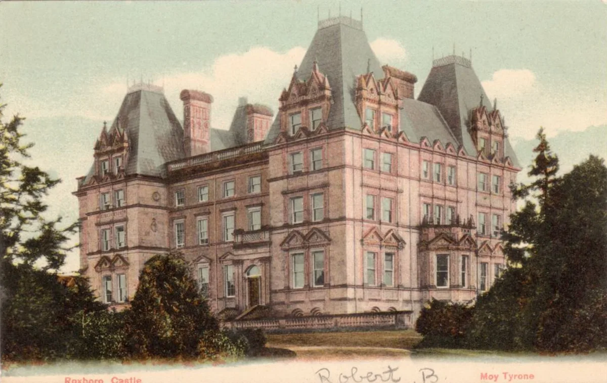
Roxborough Castle
Castles · 2.4 km

Church Hill
Villages · 2.6 km

Charlemont Bridge
Historic bridges · 3.0 km
Nearby
📷 3Museums · Northern Ireland
The Argory Museum
The Argory Museum — a museum in northern-ireland, United Kingdom.
📷 3Natural landmarks · Northern Ireland
Nature Play Area
Nature Play Area — a other in northern-ireland, United Kingdom.
📷 3Natural landmarks · Northern Ireland
Vernersbridge railway station
Vernersbridge railway station in Northern Ireland, United Kingdom.
📷 5📷 2📷 5Natural landmarks · Northern Ireland
Trew and Moy railway station
Trew and Moy railway station in Northern Ireland, United Kingdom.
Where to eat & stay near Q17861948
Places to stay
 📷 5
📷 5Caravan parks · Northern Ireland
Dungannon Park Caravan & Camping
Dungannon Park Caravan & Camping — a caravan park in northern ireland.
 📷 5
📷 5Caravan parks · Northern Ireland
Dungannon Park Caravan & Camping
Dungannon Park Caravan & Camping — a caravan park in northern ireland.
 📷 5
📷 5Caravan parks · Northern Ireland
Kinnego Marina Camping & Caravanning
Kinnego Marina Camping & Caravanning — a caravan park in northern ireland.
 📷 5
📷 5 📷 5
📷 5 📷 4
📷 4Caravan parks · Northern Ireland
Clare Glen Caravan Park
Clare Glen Caravan Park — a caravan park in northern ireland.
Places to eat & drink
 📷 5
📷 5More natural landmarks in this region
 Flagship📷 4
Natural landmarks · Northern Ireland
Lough Erne
Lough Erne — lake in County Fermanagh, Northern Ireland, UK.
 Flagship📷 4
Natural landmarks · Northern Ireland
Lough Neagh
Lough Neagh — large lake in Northern Ireland.
 📷 3
📷 3Natural landmarks · Northern Ireland
Ballysaggart Lough
Ballysaggart Lough — lake in the United Kingdom.
 📷 5
📷 5Natural landmarks · Northern Ireland
Belmore Mountain
Belmore Mountain — mountain in the United Kingdom.
Frequently asked questions
- Where is Q17861948?
- Q17861948 is in Northern Ireland, United Kingdom (postcode BT71 6LZ).
- What is Q17861948?
- Q17861948 in Northern Ireland, United Kingdom.
- How do I get to Q17861948?
- The nearest railway station is Peatlands Park Railway, about 3.5 km away. Drivers can use postcode BT71 6LZ.
- When was Q17861948 built?
- Built or established in 1820.
- Who owns Q17861948?
- Q17861948 is owned by National Trust.
- Is Q17861948 free to visit?
- Yes, Q17861948 is free to enter.
- How do I get to Q17861948?
- The nearest railway station is Peatlands Park Railway, about 3.5 km away. Drivers can navigate to postcode BT71 6LZ.