
Historic houses · North West England
Prince Rupert's Tower
In or near Liverpool.
Prince Rupert's Tower — a Grade II*-listed historic house in wales-north, United Kingdom.

Stephen Richards — CC BY-SA 2.0 via Wikimedia Commons licence

Plan your visit
- Typical visit
- 1 h–2 h
- Nearest railway station
- Liverpool Lime Street · 1.2 km
- Free entry
- Family-friendly
- Limited wheelchair access
Getting there & planning your visit
To visit Prince Rupert's Tower, the nearest railway station is Liverpool Lime Street, which is 1.2 km away. Entry is paid, and wheelchair accessibility is limited. The postcode for sat-nav is L6 1HU.
About
Prince Rupert's Tower is a Grade II*-listed building in wales-north, United Kingdom. Grade II* status is conferred by Historic England (or Cadw, Historic Environment Scotland or NIEA equivalents) on buildings of exceptional national interest. See the linked Wikipedia article for full historical and architectural details.
Photo gallery
See it from the streetimagery from 2019
Imagery © Mapillary contributors, CC BY-SA 4.0
Summary from the official site
Prince Rupert's Tower, also known as the Former Lock Up, is a historic red sandstone building located in Liverpool. It features a round drum shape with a conical roof and is situated within a public garden, highlighting its architectural significance.
Read more on the official property page.
From the Wikipedia article
Everton Lock-Up, sometimes known as Prince Rupert's Tower or Prince Rupert's Castle, is a village lock-up located on Everton Brow in Everton, Liverpool. The 18th-century structure is one of two Georgian lock-ups that still survive in Liverpool; the other is in Wavertree. It is famous for being the centre-piece of the crest of Everton F.C. The Grade II-listed building, which was opened in 1787, was originally an overnight holding place where local drunks and criminals were taken by parish constables. Prisoners would then be brought before local Justice of the peace for trial. Punishments would usually be similar to community service such as clearing ditches, unblocking drains or removing rubbish. The Friends of Everton Park have included the lock-up in their Everton Park Heritage Trail with information boards displayed near the building. Although one of its nicknames is Prince Rupert's Tower, the building was erected almost 150 years after the Royalist Army commanded by Prince Rupert camped in the area before the siege of Liverpool in 1644, during the First English Civil War. Historically Everton Brow is where Prince Rupert made preparations to attack the Parliamentarian garrison holding Liverpool Castle. As commander of the Royalist cavalry of Charles I, he is said to have looked down at the castle and dismissed it with the words: "It is a crow’s nest that any party of schoolboys could take!". It eventually fell after a week of heavy fighting and the loss of 1,500 of his men.
Excerpt from Wikipedia under CC BY-SA 4.0. See the source article linked in Sources below.
- Coordinates
- 53.4174, -2.9699
- District
- Liverpool
- Parish
- Liverpool, unparished area
- Postcode
- L6 1HU
- Parliamentary constituency
- Liverpool Riverside
- Established
- 1787
- Nearest railway station
- Liverpool Lime Street — 1.2 km
- Official site
- historicengland.org.uk
Sources
- wikidata: Q1267555 (CC0)
- wikipedia: Everton Lock-Up (CC BY-SA 4.0)
Other places nearby
Everton Lock-Up
Natural landmarks · 0.0 km

Everton Brow
Mountains & hills · 0.2 km

War Memorial at North End of Whitley Gardens
Memorials & monuments · 0.3 km

Everton Park, Liverpool
Parks · 0.3 km

Everton Hostel
Hostels · 0.4 km
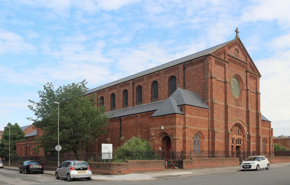
St Mary of the Angels, Liverpool, England
Historic churches · 0.4 km

Everton water tower
Memorials & monuments · 0.5 km

Particular Baptist Chapel
Chapels · 0.6 km
Popular Picture House
Theatres · 0.6 km

3, Islington Square
Gardens · 0.6 km

Portrait Bench Liverpool
Public art & sculpture · 0.7 km

Abdullah Quilliam Mosque
Historic churches · 0.7 km
Nearby
📷 3Natural landmarks · North West England
Everton Lock-Up
Everton Lock-Up — a other in wales-north, United Kingdom.
📷 5Mountains & hills · North West England
Everton Brow
Everton Brow — mountain in wales north. Elevation: 70 m.
📷 3Memorials & monuments · North West England
War Memorial at North End of Whitley Gardens
War Memorial at North End of Whitley Gardens — Grade II listed building-listed memorial in wales-north, United Kingdom.
📷 5Parks · North West England
Everton Park, Liverpool
Everton Park, located in Everton, Liverpool, England, is a modern park, covering over 40 hectares (0.40 km2), created between 1984 and 1989, as part of a major house clearance programme, on Everton Hi
📷 5📷 5Historic churches · North West England
St Mary of the Angels, Liverpool, England
St Mary of the Angels, Liverpool, England — church in Liverpool, Merseyside, England, UK.
Where to eat & stay near Prince Rupert's Tower
Places to stay
📷 5 📷 5
📷 5Hostels · North West England
Monument Building Pierhead Housing
Monument Building Pierhead Housing — a hostel in wales north.
 📷 5
📷 5Hotels · North West England
The Shankly Hotel
The Shankly Hotel — a hotel in wales north.
 📷 5
📷 5Hotels · North West England
DoubleTree by Hilton Hotel & Spa Liverpool
DoubleTree by Hilton Hotel & Spa Liverpool — a hotel in wales north. 4-star. Brand: DoubleTree.
 📷 5
📷 5 📷 5
📷 5Hostels · North West England
Hatters Hostel
Hatters Hostel — a hostel in wales north.
Places to eat & drink
 📷 5
📷 5Historic pubs · North West England
Throstles Nest Hotel, Scotland Road
Throstles Nest Hotel, Scotland Road in Wales North, United Kingdom.
 📷 5
📷 5Historic pubs · North West England
Crown Hotel
Crown Hotel in Wales North, United Kingdom.
 📷 6
📷 6Historic pubs · North West England
The Vines Public House
The Vines Public House in Wales North, United Kingdom.
 ★ Iconic📷 4
Historic pubs · North West England
The Philharmonic Dining Rooms
Britain's only Grade I-listed pub interior, with the famous marble urinals.
 📷 5
📷 5Historic pubs · North West England
Flanagan's Apple
Flanagan's Apple in Wales North, United Kingdom.
 📷 5
📷 5Historic pubs · North West England
Rigby's Buildings
Rigby's Buildings in Wales North, United Kingdom.
More historic houses in this region
 📷 3
📷 3Historic houses · North West England
116 Hospital Street, Nantwich
116 Hospital Street, Nantwich — substantial townhouse in Nantwich, Cheshire, England, UK.
 📷 3
📷 3Historic houses · North West England
140–142 Hospital Street, Nantwich
140–142 Hospital Street, Nantwich — grade II listed building in Nantwich, Cheshire East, Cheshire, England, UK.
 📷 3
📷 3Historic houses · North West England
46 High Street, Nantwich
46 High Street, Nantwich — house in Nantwich, Cheshire, England, UK.
 📷 3
📷 3Historic houses · North West England
64, St Ann's Road
64, St Ann's Road — Grade II* listed house in Middlewich, Cheshire East, England, UK.
Frequently asked questions
- Where is Prince Rupert's Tower?
- Prince Rupert's Tower is in North Wales, United Kingdom (postcode L6 1HU), in the parish of Liverpool, unparished area.
- What is Prince Rupert's Tower?
- Prince Rupert's Tower — a Grade II*-listed historic house in wales-north, United Kingdom.
- How do I get to Prince Rupert's Tower?
- The nearest railway station is Liverpool Lime Street, about 1.2 km away. Drivers can use postcode L6 1HU.
- When was Prince Rupert's Tower built?
- Built or established in 1787.
- Who owns Prince Rupert's Tower?
- Prince Rupert's Tower is owned by Liverpool City Council.
- Is Prince Rupert's Tower a listed building?
- Prince Rupert's Tower is officially recognised as Grade II* listed.
- How do I get to Prince Rupert's Tower?
- The nearest railway station is Liverpool Lime Street, about 1.2 km away. Drivers can navigate to postcode L6 1HU.