
Parks · North West England
Everton Park, Liverpool
In or near Liverpool.
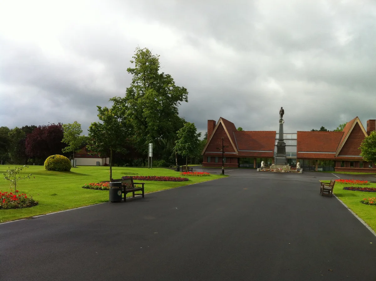
Everton Park, located in Everton, Liverpool, England, is a modern park, covering over 40 hectares (0.40 km2), created between 1984 and 1989, as part of a major house clearance programme, on Everton Hi

Ian Greig — CC BY-SA 2.0 via Wikimedia Commons licence

Plan your visit
- Typical visit
- 1 h–2 h
- Nearest railway station
- Liverpool Lime Street · 1.4 km
- Free entry
- Family-friendly
- Dog-friendly
Getting there & planning your visit
Everton Park is located in Liverpool, with the nearest railway station being Liverpool Lime Street, approximately 1.4 km away. Entry to the park is free, and it is accessible for visitors. The postcode for sat-nav is L5 3SY.
About
Everton Park, located in Everton, Liverpool, England, is a modern park, covering over 40 hectares (0.40 km2), created between 1984 and 1989, as part of a major house clearance programme, on Everton Hill between Great Homer Street and Everton Road/Heyworth Street. The park is Liverpool City Council owned. The park features the Everton Park Nature Garden, a walled community garden with three ponds, bridges, paths, overhanging trees, a wildflower field, raised flower beds with seating, and colourful wild birds. Prince Rupert's Tower (a Georgian village lock-up), and St George's Church are also located within Everton Park. The park is split into loosely defined sections (according to Ordnance Survey), such as Whitley Gardens, Brow Side Gardens, Everton Nature Garden, and the Rupert Lane Recreation Ground, the latter tracing its heritage to a former building known as Rupert House, commemorating the royal visit of Prince Rupert in 1644, during the siege of Liverpool in the English Civil War. The former building (still standing by 1830) was built upon and converted into a militia barracks, then into a recreation ground by 1930, then was integrated with the rest of what would be called Everton Park in the early 1980s.
Photo gallery
From the Wikipedia article
Everton Park, located in Everton, Liverpool, England, is a modern park, covering over 40 hectares (0.40 km2), created between 1984 and 1989, as part of a major house clearance programme, on Everton Hill between Great Homer Street and Everton Road/Heyworth Street. The park is Liverpool City Council owned. The park features the Everton Park Nature Garden, a walled community garden with three ponds, bridges, paths, overhanging trees, a wildflower field, raised flower beds with seating, and colourful wild birds. Prince Rupert's Tower (a Georgian village lock-up), and St George's Church are also located within Everton Park. The park is split into loosely defined sections (according to Ordnance Survey), such as Whitley Gardens, Brow Side Gardens, Everton Nature Garden, and the Rupert Lane Recreation Ground, the latter tracing its heritage to a former building known as Rupert House, commemorating the royal visit of Prince Rupert in 1644, during the siege of Liverpool in the English Civil War. The former building (still standing by 1830) was built upon and converted into a militia barracks, then into a recreation ground by 1930, then was integrated with the rest of what would be called Everton Park in the early 1980s.
Excerpt from Wikipedia under CC BY-SA 4.0. See the source article linked in Sources below.
Background
History
During the mid-20th century, the area became notorious for its cramped terraced slums, visible from the River Mersey and unfit for human habitation. During the 1950s and 60s, demolition planning for many of the Victorian era streets commenced. Gaps in the housing of the area appeared over the following decades as streets and buildings disappeared. Following the clearance of the slums, some of housing were replaced by high-rise flats in the 1960s, such as a group of 14-storey three tower blocks nicknamed "the Piggeries". Within 18 months, they fell into disrepair and were subsequently demolished in the 1980s. The remaining population of the area resettled in areas such as Kirkby, Cantril…
Sourced from Wikipedia under CC BY-SA 4.0.
- Coordinates
- 53.4200, -2.9720
- District
- Liverpool
- Parish
- Liverpool, unparished area
- Postcode
- L5 3SY
- Parliamentary constituency
- Liverpool Riverside
- Nearest railway station
- Liverpool Lime Street — 1.4 km
Sources
- wikipedia: Everton Park, Liverpool (CC BY-SA 4.0)
Other places nearby

Everton Brow
Mountains & hills · 0.2 km
Popular Picture House
Theatres · 0.3 km

Everton Lock-Up
Natural landmarks · 0.3 km
Prince Rupert's Tower
Historic houses · 0.3 km

Portrait Bench Liverpool
Public art & sculpture · 0.4 km
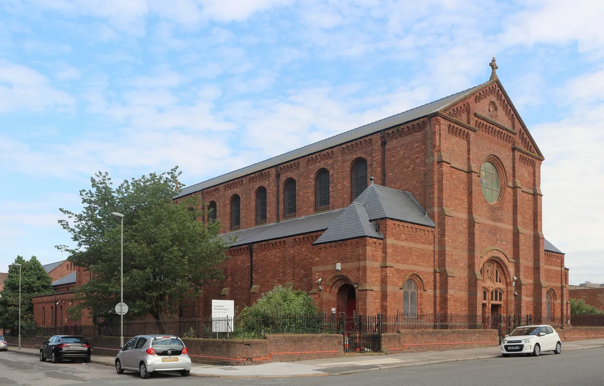
St Mary of the Angels, Liverpool, England
Historic churches · 0.5 km

Homer Cinema
Theatres · 0.5 km

Everton water tower
Memorials & monuments · 0.6 km
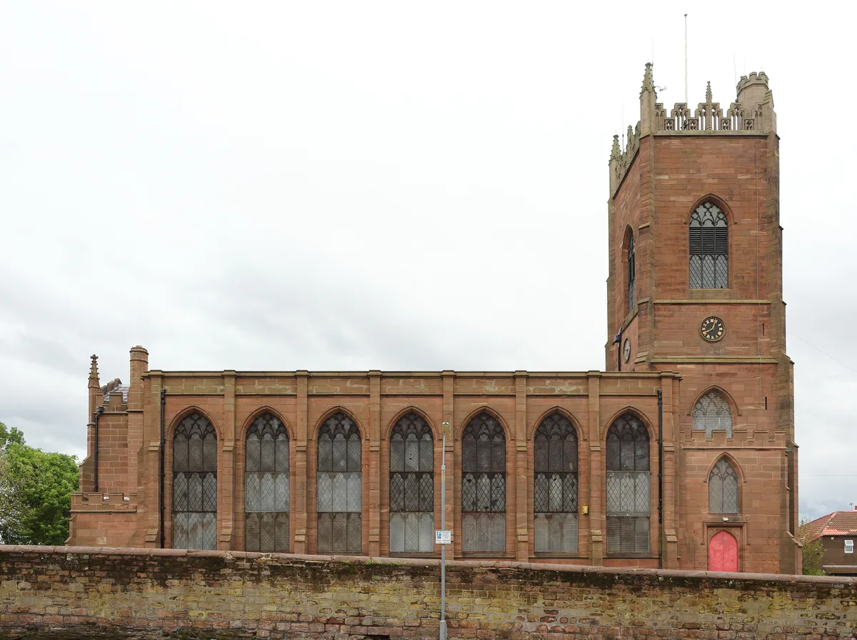
St George's Church, Everton
Historic churches · 0.6 km

War Memorial at North End of Whitley Gardens
Memorials & monuments · 0.6 km

Throstles Nest Hotel, Scotland Road
Historic pubs · 0.6 km

Everton Hostel
Hostels · 0.6 km
Nearby
📷 5Mountains & hills · North West England
Everton Brow
Everton Brow — mountain in wales north. Elevation: 70 m.
📷 3Theatres · North West England
Popular Picture House
Popular Picture House in Wales North, United Kingdom.
📷 3Natural landmarks · North West England
Everton Lock-Up
Everton Lock-Up — a other in wales-north, United Kingdom.
📷 4Historic houses · North West England
Prince Rupert's Tower
Prince Rupert's Tower — a Grade II*-listed historic house in wales-north, United Kingdom.
📷 3Public art & sculpture · North West England
Portrait Bench Liverpool
Portrait Bench Liverpool — a public art in wales-north, United Kingdom.
📷 5Historic churches · North West England
St Mary of the Angels, Liverpool, England
St Mary of the Angels, Liverpool, England — church in Liverpool, Merseyside, England, UK.
Where to eat & stay near Everton Park, Liverpool
Places to stay
📷 5 📷 5
📷 5Hostels · North West England
Monument Building Pierhead Housing
Monument Building Pierhead Housing — a hostel in wales north.
 📷 5
📷 5 📷 5
📷 5Hotels · North West England
The Shankly Hotel
The Shankly Hotel — a hotel in wales north.
 📷 5
📷 5Hotels · North West England
DoubleTree by Hilton Hotel & Spa Liverpool
DoubleTree by Hilton Hotel & Spa Liverpool — a hotel in wales north. 4-star. Brand: DoubleTree.
 📷 5
📷 5Hostels · North West England
YHA Liverpool Central
YHA Liverpool Central — a hostel in wales north. Brand: Youth Hostels Association.
Places to eat & drink
📷 5Historic pubs · North West England
Throstles Nest Hotel, Scotland Road
Throstles Nest Hotel, Scotland Road in Wales North, United Kingdom.
 📷 5
📷 5Historic pubs · North West England
Crown Hotel
Crown Hotel in Wales North, United Kingdom.
 📷 6
📷 6Historic pubs · North West England
The Vines Public House
The Vines Public House in Wales North, United Kingdom.
 ★ Iconic📷 4
Historic pubs · North West England
The Philharmonic Dining Rooms
Britain's only Grade I-listed pub interior, with the famous marble urinals.
 📷 5
📷 5Historic pubs · North West England
Rigby's Buildings
Rigby's Buildings in Wales North, United Kingdom.
📷 5Historic pubs · North West England
Flanagan's Apple
Flanagan's Apple in Wales North, United Kingdom.
More parks in this region
 📷 4
📷 4Parks · North West England
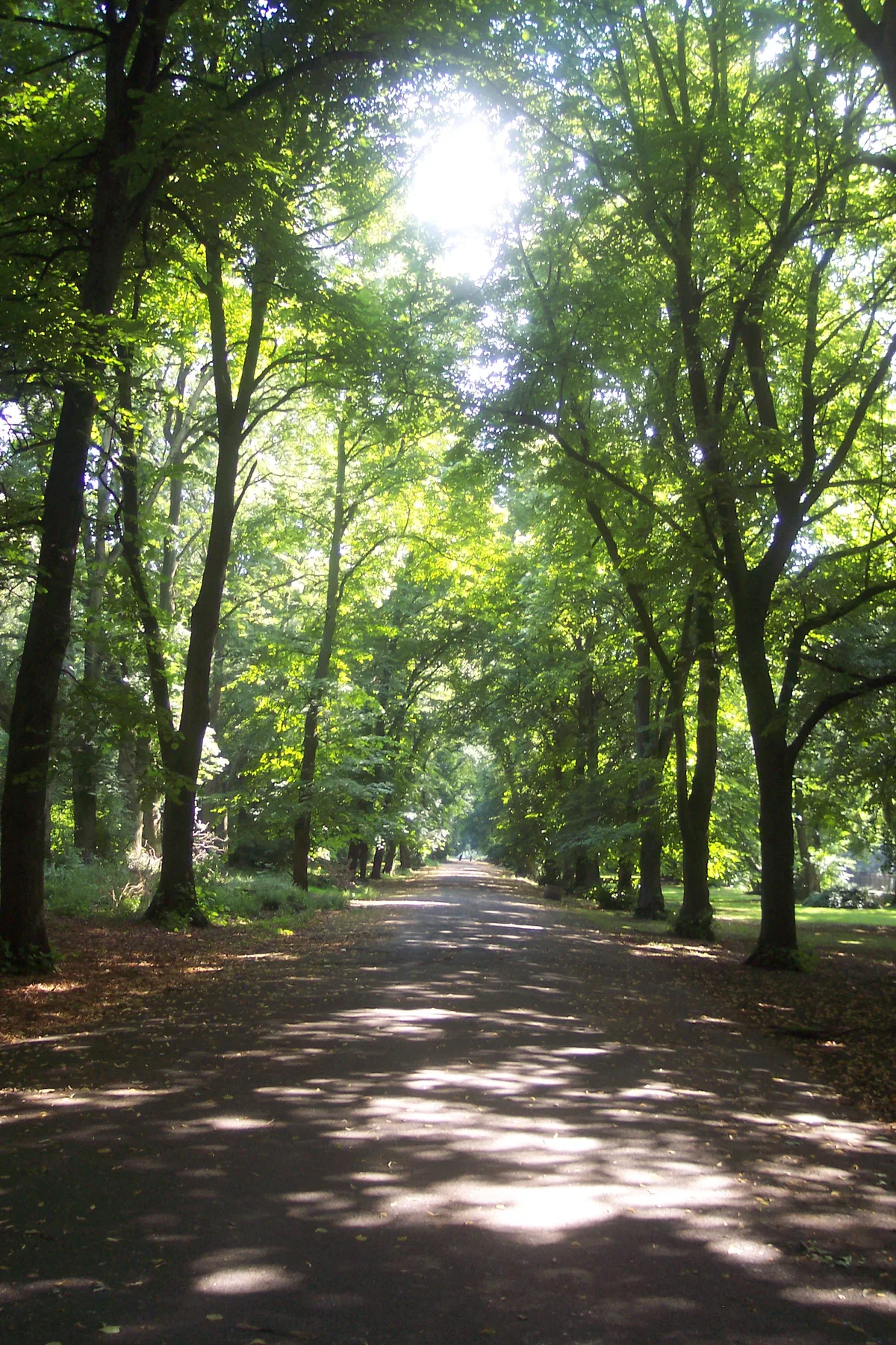
Alexandra Park, Manchester
Alexandra Park, Manchester — park in Whalley Range, United Kingdom.
 📷 5
📷 5Parks · North West England
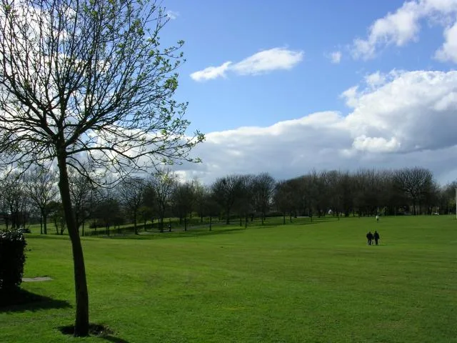
Buile Hill Park
Buile Hill Park — park in Seedley, Salford, Greater Manchester, England, UK.
 📷 4
📷 4Parks · North West England
Queen's Park, Crewe
Queen's Park, Crewe — Park in Crewe, Cheshire, England, UK.
 📷 3
📷 3Parks · North West England
Ardwick Green
Ardwick Green — public park in Ardwick, Manchester, England.
Frequently asked questions
- Where is Everton Park, Liverpool?
- Everton Park, Liverpool is in North Wales, United Kingdom (postcode L5 3SY), in the parish of Liverpool, unparished area.
- What is Everton Park, Liverpool?
- Everton Park, located in Everton, Liverpool, England, is a modern park, covering over 40 hectares (0.40 km2), created between 1984 and 1989, as part of a major house clearance programme, on Everton Hi
- How do I get to Everton Park, Liverpool?
- The nearest railway station is Liverpool Lime Street, about 1.4 km away. Drivers can use postcode L5 3SY.
- Who owns Everton Park, Liverpool?
- Everton Park, Liverpool is owned by Liverpool City Council.
- Is Everton Park, Liverpool free to visit?
- Yes, Everton Park, Liverpool is free to enter.
- How do I get to Everton Park, Liverpool?
- The nearest railway station is Liverpool Lime Street, about 1.4 km away. Drivers can navigate to postcode L5 3SY.