
Historic bridges · South Wales
Prince of Wales Bridge
Also known as: Pont Tywysog Cymru, Second Severn Crossing, Ail Groesfan Hafren
In or near Aust.
Prince of Wales Bridge is a historic bridge in the United Kingdom.

Wikimedia Commons contributors — see linked file page for photographer and licence licence

Plan your visit
- Typical visit
- 15 min–30 min
- Nearest railway station
- Severn Beach · 3.0 km
- Free entry
- Dog-friendly
- Limited wheelchair access
Getting there & planning your visit
To visit the Prince of Wales Bridge, the nearest railway station is Severn Beach, located 3 km away. Entry to the bridge is free, but wheelchair accessibility is limited. The postcode for sat-nav is NP26 5TB.
About
Prince of Wales Bridge is a named historic bridge in the United Kingdom. Records date its origin to 1996. Also known as: Pont Tywysog Cymru, Second Severn Crossing. Coordinates: 51.5758°, -2.6994°.
Photo gallery
Heritage listing
The Prince of Wales Bridge (Welsh: Pont Tywysog Cymru), previously the Second Severn Crossing (Welsh: Ail Groesfan Hafren) until July 2018, is the M4 motorway bridge over the River Severn between England and Wales, opened in 1996 to supplement the traffic capacity of the Severn Bridge built in 1966. The bridge is operated by England's National Highways. It has a total length of 5,128 metres (16,824 ft), or 3.2 miles. It is southwest of the Severn Bridge and because it is more closely in line with the rest of the M4, it reduces the length of the journey between England and Wales.
From Historic Environment Scotland under OGL v3.
Protected designations
- Site of Special Scientific Interest: Severn Estuary SSSI
- Ramsar wetland: Severn Estuary
Designations sourced from Natural England open data under OGL v3.
From the Wikipedia article
The Prince of Wales Bridge (Welsh: Pont Tywysog Cymru), previously the Second Severn Crossing (Welsh: Ail Groesfan Hafren) until July 2018, is the M4 motorway bridge over the River Severn between England and Wales, opened in 1996 to supplement the traffic capacity of the Severn Bridge built in 1966. The bridge is operated by England's National Highways. It has a total length of 5,128 metres (16,824 ft), or 3.2 miles. It is southwest of the Severn Bridge and because it is more closely in line with the rest of the M4, it reduces the length of the journey between England and Wales. The junctions at each end are designed for most traffic to use this crossing, and in order to use the old Severn Bridge, one has to leave the M4 at junction 21 and join the M48 near Aust or at junction 23 near Magor. The new crossing carries more traffic than the Severn Bridge, which is still in use. It is wider than the Severn Bridge, having three lanes and a narrow hard shoulder each way, compared to the two lanes, cycle path and narrow footpath of the original crossing. It is a cable-stayed bridge, whereas the Severn Bridge is a suspension bridge. The position of the bridge is close to that of the Severn Tunnel, which has carried the railway line beneath the river bed since 1886. Much of the estuary is mudflats at low tide, but at high tide these can be covered by as much as 14 metres (46 ft) of water. This presented the engineers with a constraint: packets of work were scheduled at low tide, and needed to be completed within the short windows allowed by the tides. The concession given to the consortium which financed, built and operate the bridge required them to take over the outstanding debt on the original Severn Bridge and to operate the two bridges as a single entity. Tolls were set annually by the government based on the previous year's change in the Retail Price Index. On the expiry of the concession in January 2018, the consortium was required to hand the bridge over to public…
Excerpt from Wikipedia under CC BY-SA 4.0. See the source article linked in Sources below.
Background
History
The Severn Estuary presented a barrier between the Bristol area and South Wales. The estuary has a maximum tidal range of 14.5 m, amongst the highest in the world, and during a rising or falling tide there are strong currents of up to 8 kn. Much of the estuary is mud flats that are exposed at low tide; these have been designated a Special Protection Area. The central part of the estuary is a navigable channel which, at the site of the bridge, is known as "The Shoots". The bridge is upstream from Avonmouth and the Port of Bristol, but downstream from the Port of Sharpness. The Gloucester Harbour Trustees have responsibility for controlling navigation in the estuary's tidal waters upstream…
Architecture
The chief architect of the bridge was Ronald Weeks of the Cardiff-based Percy Thomas Partnership, with the detailed engineering design by the Halcrow Group and the French consultancy . The bridge has portals close to Sudbrook, Monmouthshire on the Welsh side and Severn Beach in South Gloucestershire on the English side. It has three principal sections – a 25 span viaduct on the English side of length 2103 m, a 24 span viaduct of length 2077 m on the Welsh side and the bridge itself, a 948 m structure with a 37 m navigational clearance, giving a total length of 5128 m. The central section, called the Shoots Bridge, is of cable-stayed design and the central span (between the bridge pylons) is…
Sourced from Wikipedia under CC BY-SA 4.0.
- Coordinates
- 51.5758, -2.6994
- District
- Monmouthshire
- Parish
- Portskewett
- Postcode
- NP26 5TB
- Parliamentary constituency
- Monmouthshire
- Established
- 1996
- Nearest railway station
- Severn Beach — 3 km
- Opening
- {{start date and age|5 June 1996}}
Sources
- osm: w398032977 (ODbL)
- wikipedia: Prince of Wales Bridge (CC BY-SA 4.0)
- commons: New severn bridge best 750pix.jpg (CC BY-SA 4.0)
Other places nearby

Sudbrook Fort
Vineyards · 1.3 km

Sudbrook hill fort
Hill forts · 1.3 km
Sudbrook Camp
Vineyards · 1.3 km

Black Rock Picnic Site
Natural landmarks · 1.5 km

Portskewett
Villages · 2.2 km

Portskewett War Memorial
Memorials & monuments · 2.3 km
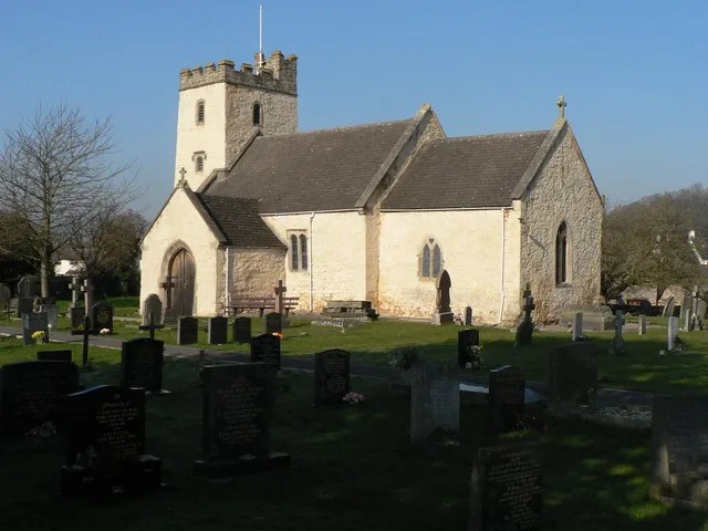
Church of St Mary, Portskewett
Historic churches · 2.3 km

Harold's House
Historic houses · 2.3 km

Harold's House
Archaeological sites · 2.3 km

Bristol & South Wales Union Railway
Memorials & monuments · 2.7 km
Crossings of John and Charles Wesley
Memorials & monuments · 2.7 km

New Passage
Villages · 2.8 km
Nearby
📷 5Vineyards · South Wales
Sudbrook Fort
Sudbrook Fort — a UK vineyard in wales south, producing English or Welsh wine from cool-climate grape varieties.
📷 3Hill forts · South Wales
Sudbrook hill fort
Sudbrook hill fort — a hill fort in wales-south, United Kingdom.
📷 5Vineyards · South Wales
Sudbrook Camp
Sudbrook Camp — a UK vineyard in wales south, producing English or Welsh wine from cool-climate grape varieties.
📷 3Natural landmarks · South Wales
Black Rock Picnic Site
Black Rock Picnic Site — a other in wales-south, United Kingdom.
📷 5📷 5Memorials & monuments · South Wales
Portskewett War Memorial
Portskewett War Memorial — Grade II listed building-listed memorial in wales-south, United Kingdom.
Where to eat & stay near Prince of Wales Bridge
Places to stay
 📷 5
📷 5Hotels · South Wales
St Pierre Country Club
St Pierre Country Club — a hotel in wales south.
 📷 5
📷 5Caravan parks · South West England
Vine Farm Caravan Park
Vine Farm Caravan Park — a caravan park in wales south.
 📷 5
📷 5 📷 5
📷 5Campsites · South West England
Brockmead Scout Camp Site
Brockmead Scout Camp Site — a campsite in wales south.
 📷 5
📷 5Campsites · South West England
The Wave Campsite
The Wave Campsite — a campsite in wales south.
 📷 5
📷 5Places to eat & drink
 📷 7
📷 7Historic pubs · South West England
The Boar's Head
The Boar's Head in Wales South, United Kingdom.
 📷 6
📷 6 📷 7
📷 7 📷 5
📷 5Restaurants · South Wales
Mint & Mustard
Mint & Mustard — a restaurant in wales south.
 📷 7
📷 7Historic pubs · South West England
Blaise Inn Public House
Blaise Inn Public House in Wales South, United Kingdom.
 📷 5
📷 5Historic pubs · South Wales
The Lamplighters Public House
The Lamplighters Public House in Wales South, United Kingdom.
Other bridges from this era
 📷 5
📷 5.jpg?width=1200) 📷 5
📷 5Historic bridges · London
Blue Bridge
Blue Bridge is a historic bridge in the United Kingdom.
 📷 5
📷 5 📷 5
📷 5Historic bridges · London
Chiswick Bridge
Chiswick Bridge is a historic bridge in the United Kingdom.
More bridges in this region
.jpg?width=1200) 📷 3
📷 3Historic bridges · South Wales
Afon Taff Viaduct
Afon Taff Viaduct is a historic bridge in the United Kingdom.
 📷 3
📷 3Historic bridges · South Wales
Avonmouth Bridge
Avonmouth Bridge is a historic bridge in the United Kingdom.
 📷 5
📷 5Historic bridges · South Wales
Biblins Bridge
Biblins Bridge is a historic bridge in the United Kingdom.
 📷 3
📷 3Historic bridges · South Wales
Blackweir Bridge
Blackweir Bridge is a historic bridge in the United Kingdom.
Frequently asked questions
- Where is Prince of Wales Bridge?
- Prince of Wales Bridge is in South Wales, United Kingdom (postcode NP26 5TB), in the parish of Portskewett.
- What is Prince of Wales Bridge?
- Prince of Wales Bridge is a historic bridge in the United Kingdom.
- How do I get to Prince of Wales Bridge?
- The nearest railway station is Severn Beach, about 3.0 km away. Drivers can use postcode NP26 5TB.
- When was Prince of Wales Bridge built?
- Built or established in 1996.
- Is Prince of Wales Bridge a listed building?
- Prince of Wales Bridge is officially recognised as category B listed building listed.
- Is Prince of Wales Bridge a protected site?
- Yes — Prince of Wales Bridge is part of the Severn Estuary SSSI Site of Special Scientific Interest and the Severn Estuary Ramsar wetland.
- Is Prince of Wales Bridge free to visit?
- Yes, Prince of Wales Bridge is free to enter.
- How do I get to Prince of Wales Bridge?
- The nearest railway station is Severn Beach, about 3.0 km away. Drivers can navigate to postcode NP26 5TB.