Natural landmarks · Northern Ireland
Portaferry
Also known as: Port an Pheire
In or near Strangford.
Portaferry in Northern Ireland, United Kingdom.

Eric Jones — CC BY-SA 2.0 via Wikimedia Commons licence
Plan your visit
- Typical visit
- 1 h–2 h
- Nearest railway station
- Delamont · 8.3 km
- Paid entry
- Dog-friendly
- Wheelchair accessible
About
Portaferry is a place of interest in Northern Ireland, United Kingdom — drawn from open-data sources for visitor reference. See the linked Wikipedia article for the full description.
Photo gallery
See it from the streetimagery from 2025
Imagery © Mapillary contributors, CC BY-SA 4.0
Official information
Exploris Aquarium and Seal Sanctuary is a marine attraction where visitors can observe a variety of aquatic life, including seals, sharks, and tropical fish. The facility also offers educational experiences and opportunities for seal adoption, making it a family-friendly destination.
From the Wikipedia article
Portaferry (from Irish Port an Pheire 'landing place of the ferry') is a village in County Down, Northern Ireland, at the southern end of the Ards Peninsula, near the Narrows at the entrance to Strangford Lough. It is home to the Exploris aquarium and is well known for the annual Gala Week Float Parade. It hosts its own small Marina, the Portaferry Marina. The Portaferry–Strangford ferry service operates daily at 30-minute intervals (7.45 am to 10.45 pm) between the villages of Portaferry and Strangford, less than 1500 metres apart, conveying about 500,000 passengers per annum. It had a population of 2,514 people in the 2011 Census. The village is located within the Barony of Ards Upper. Pot fishing, mainly for prawns and crabs and licensed shellfish farming takes place within Strangford Lough. Queen's University of Belfast have a Marine Research Laboratory on the shorefront. The village is also home to a research centre for Swedish tidal-kite developer Minesto. The lough is one of the world's most important marine sites with over 2,000 marine species. There are fine Georgian buildings in the village square, including a Market House, now used as a community centre. Portaferry Lifeboat is an essential lifeline for local fishermen and yachtsmen. The Atlantic 75 is the fastest seagoing lifeboat in the RNLI's fleet and is capable of speeds up to 34 knots.
Excerpt from Wikipedia under CC BY-SA 4.0. See the source article linked in Sources below.
Background
History
About two miles from Portaferry is Cooey's Wells which had a church thought to date to the about the 7th century. Three wells reputed to have healing properties are located at that site.
Sourced from Wikipedia under CC BY-SA 4.0.
- Coordinates
- 54.3809, -5.5486
- District
- Ards and North Down
- Postcode
- BT22 1NZ
- Parliamentary constituency
- Strangford
- Phone
- +44 28 4272 8062
- Nearest railway station
- Delamont — 8.3 km
- Official site
- www.explorisni.com
Sources
- wikidata: Q1959712 (CC0)
- wikipedia: Portaferry (CC BY-SA 4.0)
Other places nearby

Portaferry Lifeboat Station
Natural landmarks · 0.1 km

Exploris Aquarium
Zoos & aquariums · 0.1 km
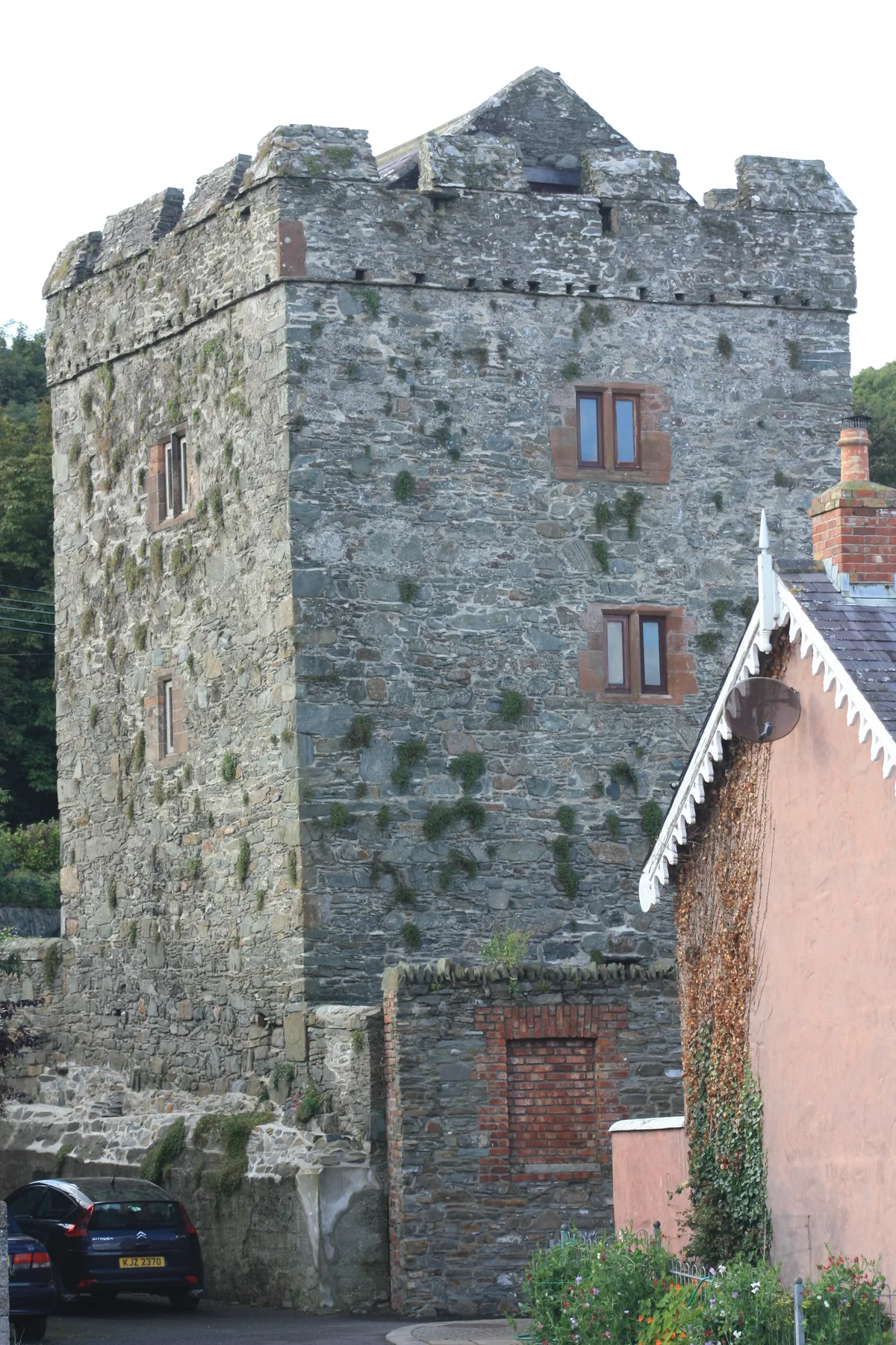
Portaferry Castle
Castles · 0.1 km
%2C_October_2009.JPG?width=1200)
Exploris
Zoos & aquariums · 0.1 km

Portaferry Marina
Natural landmarks · 0.3 km

Portaferry Marina
Marinas · 0.4 km
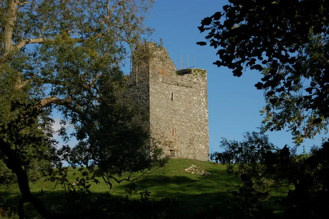
Strangford Castle
Castles · 1.1 km
.JPG?width=1200)
Strangford
Towns & cities · 1.2 km

SeaGen
Natural landmarks · 1.4 km

Evopod
Natural landmarks · 1.4 km
Audley's Castle
Castles · 1.5 km

Ballyhenry
Natural landmarks · 1.8 km
Nearby
📷 4Natural landmarks · Northern Ireland
Portaferry Lifeboat Station
Portaferry Lifeboat Station in Northern Ireland, United Kingdom.
📷 3Zoos & aquariums · Northern Ireland
Exploris Aquarium
Exploris Aquarium — a zoo aquarium in northern-ireland, United Kingdom.
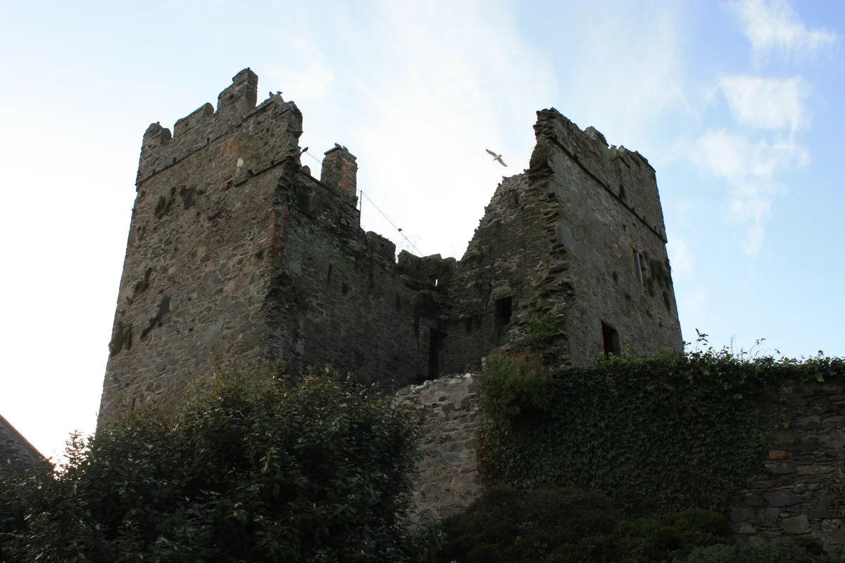
📷 5Castles · Northern Ireland
Portaferry Castle
Portaferry Castle — castle in Portaferry, County Down, Northern Ireland.
📷 3Zoos & aquariums · Northern Ireland
Exploris
Exploris — aquarium in Portaferry, Northern Ireland.
📷 5Natural landmarks · Northern Ireland
Portaferry Marina
Portaferry Marina is situated in Portaferry, on the east shore of The Narrows (separating Portaferry and Strangford villages), the gateway to Strangford Lough, County Down, Northern Ireland. It is own
📷 5Where to eat & stay near Portaferry
Places to stay
 📷 5
📷 5Campsites · Northern Ireland
Castle Ward Caravan Park
Castle Ward Caravan Park — a campsite in northern ireland.
 📷 5
📷 5Caravan parks · Northern Ireland
Strangford Holiday Park
Strangford Holiday Park — a caravan park in northern ireland.
 📷 5
📷 5Campsites · Northern Ireland
EDYC Caravan and Camping Area
EDYC Caravan and Camping Area — a campsite in northern ireland.
 📷 5
📷 5Campsites · Northern Ireland
Delamont Country Park
Delamont Country Park — a campsite in northern ireland.
 📷 4
📷 4Caravan parks · Northern Ireland
Quoile Yacht Club Caravan Park
Quoile Yacht Club Caravan Park — a caravan park in northern ireland.
 📷 3
📷 3Campsites · Northern Ireland
The Lodge at Quarterland Bay Camp Site
The Lodge at Quarterland Bay Camp Site — a campsite in northern ireland.
More natural landmarks in this region
 Flagship📷 4
Natural landmarks · Northern Ireland
Lough Erne
Lough Erne — lake in County Fermanagh, Northern Ireland, UK.
 Flagship📷 4
Natural landmarks · Northern Ireland
Lough Neagh
Lough Neagh — large lake in Northern Ireland.
 📷 3
📷 3Natural landmarks · Northern Ireland
Ballysaggart Lough
Ballysaggart Lough — lake in the United Kingdom.
 📷 5
📷 5Natural landmarks · Northern Ireland
Belmore Mountain
Belmore Mountain — mountain in the United Kingdom.
Frequently asked questions
- Where is Portaferry?
- Portaferry is in Northern Ireland, United Kingdom (postcode BT22 1NZ).
- What is Portaferry?
- Portaferry in Northern Ireland, United Kingdom.
- How do I get to Portaferry?
- The nearest railway station is Delamont, about 8.3 km away. Drivers can use postcode BT22 1NZ.
- Is Portaferry free to visit?
- Yes, Portaferry is free to enter.
- How do I get to Portaferry?
- Drivers can navigate to postcode BT22 1NZ. It sits within the Strangford parliamentary constituency.