
Archaeological sites · South Wales
Pont Rhyd-y-cyff Mining remains
In or near Treorchy.
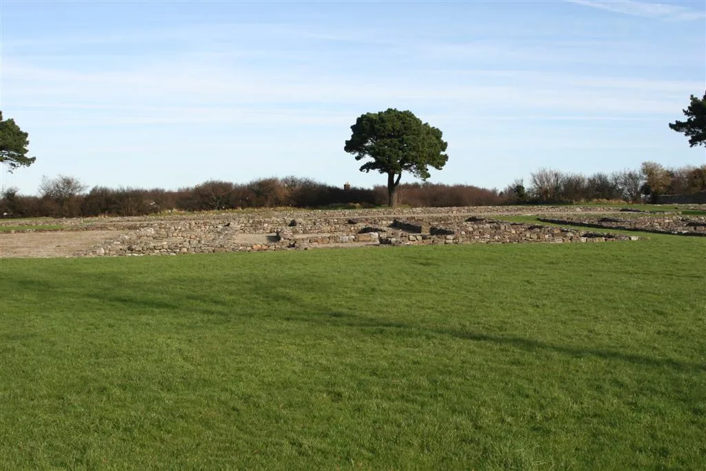
Pont Rhyd-y-cyff Mining remains — a archaeological in wales-south, United Kingdom.

John Finch — CC BY-SA 2.0 via Wikimedia Commons licence

Plan your visit
- Typical visit
- 45 min–1.5 h
- Nearest railway station
- Garth (Bridgend) · 1.5 km
- Free entry
- Dog-friendly
About
Pont Rhyd-y-cyff Mining remains is a archaeological located in wales-south, United Kingdom. Sourced from OpenStreetMap (ODbL licence); see local listings for visitor information, opening hours and admission details.
Photo gallery
Place summary
Pont Rhyd-y-cyff Mining remains are archaeological sites located in South Wales. These remains offer insights into the region's industrial heritage, particularly related to mining activities.
AI-generated from the structured facts on this page (operator, designation, listing, era). Not a substitute for visiting.
- Coordinates
- 51.5904, -3.6238
- District
- Bridgend
- Parish
- Llangynwyd Middle
- Postcode
- CF34 0EH
- Parliamentary constituency
- Aberafan Maesteg
- Nearest railway station
- Garth (Bridgend) — 1.5 km
Sources
- osm: node/3281982675 (ODbL)
Other places nearby

House Platform
Archaeological sites · 0.9 km
Garth Hill Platform House
Archaeological sites · 1.0 km
Garth Hill
Viewpoints · 1.2 km

Garth
Villages · 1.3 km

Moel Troed-Y-Rhiw
Mountains & hills · 1.7 km

Mynydd Troed-y-rhiw
Mountains & hills · 1.8 km

Llangynwyd
Villages · 1.9 km

St Cynwyd's Church
Historic churches · 1.9 km
Jenkins Monument in the churchyard, Church of St Cynwyd
Memorials & monuments · 1.9 km

The Hopcyn Cross
Memorials & monuments · 1.9 km

Llwdarth
Literary houses · 2.0 km

Craig-yr-hudol
Mountains & hills · 2.4 km
Nearby
📷 3Archaeological sites · South Wales
House Platform
House Platform — a archaeological in wales-south, United Kingdom.
📷 3Archaeological sites · South Wales
Garth Hill Platform House
Garth Hill Platform House — a archaeological in wales-south, United Kingdom.
📷 4📷 5📷 5Mountains & hills · South Wales
Moel Troed-Y-Rhiw
Moel Troed-Y-Rhiw — mountain in wales south. Elevation: 234 m.
📷 5Mountains & hills · South Wales
Mynydd Troed-y-rhiw
Mynydd Troed-y-rhiw — a hill or mountain in wales south.
Where to eat & stay near Pont Rhyd-y-cyff Mining remains
Places to stay
 📷 5
📷 5 📷 5
📷 5Campsites · South Wales
Red rock camping
Red rock camping — a campsite in wales south.
 📷 7
📷 7 📷 5
📷 5Caravan parks · South Wales
Cae Garw Caravan Site
Cae Garw Caravan Site — a caravan park in wales south.
 📷 5
📷 5 📷 5
📷 5Campsites · South Wales
Glyncorrwg Ponds Campsite
Glyncorrwg Ponds Campsite — a campsite in wales south.
Places to eat & drink
 📷 7
📷 7Historic pubs · South Wales
Tŷ Mawr Aka The Great House
Tŷ Mawr Aka The Great House in Wales South, United Kingdom.

Restaurants · South Wales
The Old Mill
The Old Mill — a restaurant in wales south. Cuisine: american. Brand: Harvester.
 📷 3
📷 3Restaurants · South Wales
The Golden Mile
The Golden Mile — a restaurant in wales south.
 📷 5
📷 5Restaurants · South Wales
Bagle Brook
Bagle Brook — a restaurant in wales south. Cuisine: burger;steak house. Brand: Beefeater.
 📷 7
📷 7
More archaeological sites in this region
 📷 3
📷 3Archaeological sites · South Wales
Coygan Cave
Coygan Cave — cave and archaeological site in the United Kingdom.
 📷 3
📷 3 📷 3
📷 3Archaeological sites · South Wales
Glasfynydd Forest
Glasfynydd Forest — forest on the boundary of Carmarthenshire and Powys, Wales, UK.
 📷 3
📷 3Archaeological sites · South Wales
Gwersyll Rhufeinig Bargoed
Gwersyll Rhufeinig Bargoed — archaeological site in Caerphilly County Borough, Wales, UK.
Frequently asked questions
- Where is Pont Rhyd-y-cyff Mining remains?
- Pont Rhyd-y-cyff Mining remains is in South Wales, United Kingdom (postcode CF34 0EH), in the parish of Llangynwyd Middle.
- What is Pont Rhyd-y-cyff Mining remains?
- Pont Rhyd-y-cyff Mining remains — a archaeological in wales-south, United Kingdom.
- How do I get to Pont Rhyd-y-cyff Mining remains?
- The nearest railway station is Garth (Bridgend), about 1.5 km away. Drivers can use postcode CF34 0EH.
- Is Pont Rhyd-y-cyff Mining remains free to visit?
- Yes, Pont Rhyd-y-cyff Mining remains is free to enter.
- How do I get to Pont Rhyd-y-cyff Mining remains?
- The nearest railway station is Garth (Bridgend), about 1.5 km away. Drivers can navigate to postcode CF34 0EH.