
Mountains & hills · North East England
Pennines
Also known as: Sléibhte Pennine
In or near Ousby.
Pennines in England North East, United Kingdom.

Ian S — CC BY-SA 2.0 via Wikimedia Commons licence

Plan your visit
- Typical visit
- 3 h–8 h
- Best time of year
- Late spring – early autumn (May–Oct)
- Free entry
- Dog-friendly
About
Pennines is a place of interest in England North East, United Kingdom — drawn from open-data sources for visitor reference. See the linked Wikipedia article for the full description.
Photo gallery
See it from the streetimagery from 2022
Imagery © Mapillary contributors, CC BY-SA 4.0
Protected designations
- Site of Special Scientific Interest: River Eden and Tributaries SSSI
- Site of Special Scientific Interest: Moorhouse and Cross Fell SSSI
- National Nature Reserve: MOOR HOUSE-UPPER TEESDALE
- Area of Outstanding Natural Beauty: North Pennines
Designations sourced from Natural England open data under OGL v3.
From the Wikipedia article
The Pennines (), also known as the Pennine Chain or Pennine Hills, are an upland range mainly located in Northern England. Sometimes described as the "backbone of England" because of its length and position, the range runs from Derbyshire and Staffordshire in the north of the Midlands to Northumberland in North East England. From the Tyne Gap in the north, the range extends south through the North Pennines, Yorkshire Dales, South Pennines, and Peak District to end near the valley of the River Trent. The Border Moors and Cheviot Hills, which lie beyond the Tyne Gap, are included in some definitions of the range. The range is divided into two by the Aire Gap, a wide pass formed by the valleys of the rivers Aire and Ribble. There are several spurs off the main Pennine range west into Greater Manchester and Lancashire, comprising the Rossendale Fells, West Pennine Moors, and Bowland Fells. The Howgill Fells and Orton Fells in Cumbria are also sometimes considered to be Pennine spurs. The Pennines are an important water catchment area, with numerous reservoirs in the head streams of the river valleys. Most of the range is protected by national parks and national landscapes (formerly Areas of Outstanding Natural Beauty). Running north to south, and including the Cheviots, the range is within Northumberland National Park, the North Pennines National Landscape, the Yorkshire Dales National Park, Nidderdale National Landscape, the Forest of Bowland National Landscape, and the Peak District National Park. The only significant unprotected area is that between Skipton and Marsden. Britain's oldest long-distance footpath, the 268-mile (429 km) Pennine Way, runs along most of the Pennines.
Excerpt from Wikipedia under CC BY-SA 4.0. See the source article linked in Sources below.
Background
History
]] The Pennines contained Bronze Age settlements, and evidence remains of Neolithic settlement including many stone circles and henges, such as Long Meg and Her Daughters. The uplands were controlled by the tribal federation of the Brigantes, made up of small tribes who inhabited the area and cooperated on defence and external affairs. They evolved an early form of kingdom. During Roman times, the Brigantes were dominated by the Romans who exploited the Pennines for their natural resources including the wild animals found there. The Pennines were an obstacle for Anglo-Saxon expansion westwards, although it appears the Anglo-Saxons travelled through the valleys. During the Dark Ages the…
Sourced from Wikipedia under CC BY-SA 4.0.
- Coordinates
- 54.7028, -2.4867
- Address
- Northumberland, Cumbria, County Durham, North Yorkshire, West Yorkshire, South Yorkshire, Lancashire, Greater Manchester, Cheshire, Derbyshire, Staffordshire
Sources
Other places nearby
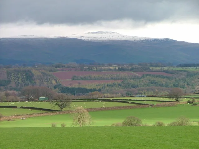
Cross Fell
Mountains & hills · 0.0 km
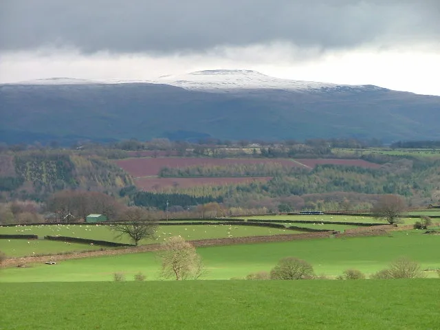
Cross Fell
Natural landmarks · 0.0 km

Tees Head
Natural landmarks · 1.3 km
River Tees
Memorials & monuments · 1.3 km

Skirwith Hill
Mountains & hills · 1.4 km

Black Dub
Mountains & hills · 1.6 km

Fallow Hill
Mountains & hills · 1.8 km
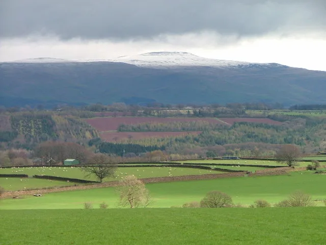
Little Dun Fell
Mountains & hills · 2.1 km

High Cap
Mountains & hills · 2.4 km

Raehow End
Mountains & hills · 2.5 km

Green Fell
Mountains & hills · 2.6 km

Moray Hill
Mountains & hills · 2.9 km
Nearby
📷 5📷 5📷 3Natural landmarks · North East England
Tees Head
Tees Head — a other in scotland-lowlands, United Kingdom.
📷 4Memorials & monuments · North East England
River Tees
River Tees in England North East, United Kingdom.
📷 5Mountains & hills · North East England
Skirwith Hill
Skirwith Hill — mountain in scotland lowlands. Elevation: 785.8 m.
📷 5Mountains & hills · North East England
Black Dub
Black Dub — mountain in scotland lowlands. Elevation: 803.8 m.
Where to eat & stay near Pennines
Places to stay
 📷 5
📷 5Caravan parks · North East England
Silverband Caravan Park
Silverband Caravan Park — a caravan park in scotland lowlands.
 📷 5
📷 5Caravan parks · North East England
Crossfell Caravan Park
Crossfell Caravan Park — a caravan park in scotland lowlands.
 📷 5
📷 5Caravan parks · North East England
Melmerby Holiday Park
Melmerby Holiday Park — a caravan park in scotland lowlands.
 📷 5
📷 5Caravan parks · North West England
Melmerby Mill Holiday Caravan Park
Melmerby Mill Holiday Caravan Park — a caravan park in scotland lowlands.
 📷 5
📷 5 📷 5
📷 5Campsites · North East England
Garrigill Village Hall Camp Site
Garrigill Village Hall Camp Site — a campsite in scotland lowlands.
Places to eat & drink
 📷 3
📷 3 📷 5
📷 5Historic pubs · North East England
1, Scattergate
1, Scattergate in England North East, United Kingdom.
 📷 7
📷 7Cafés · North West England
Narrowbar Cafe
Narrowbar Cafe — a café in scotland lowlands.
 📷 7
📷 7Historic pubs · North West England
Two Lions public house and integral stables
Two Lions public house and integral stables in Scotland Lowlands, United Kingdom.
 📷 6
📷 6Historic pubs · North West England
Gloucester Arms
Gloucester Arms in Scotland Lowlands, United Kingdom.
 📷 5
📷 5Historic pubs · North West England
Horse And Farrier Inn And Stables
Horse And Farrier Inn And Stables in Scotland Lowlands, United Kingdom.
More mountains in this region
 📷 5
📷 5Mountains & hills · North East England
Danby High Moor
Danby High Moor — a hill or mountain in england yorkshire.
 📷 5
📷 5Mountains & hills · North East England
Arndale Hill
Arndale Hill — mountain in england yorkshire. Elevation: 515.7 m.
 📷 5
📷 5Mountains & hills · North East England
Peat Hill
Peat Hill — mountain in england yorkshire. Elevation: 396 m.
 📷 5
📷 5Mountains & hills · North East England
Cocker Hill
Cocker Hill — mountain in england yorkshire. Elevation: 470 m.
Frequently asked questions
- Where is Pennines?
- Pennines is in North-East England, United Kingdom.
- What is Pennines?
- Pennines in England North East, United Kingdom.
- How do I get to Pennines?
- Its coordinates are 54.7028°, -2.4867°.
- Is Pennines a protected site?
- Yes — Pennines is part of the River Eden and Tributaries SSSI Site of Special Scientific Interest and the Moorhouse and Cross Fell SSSI Site of Special Scientific Interest.
- Is Pennines free to visit?
- Yes, Pennines is free to enter.