
Mountains & hills · South West England
Pen Hill
In or near Wells.
Pen Hill — Named summit at 305 m.

Wikimedia Commons contributors — see linked file page for photographer and licence licence

Plan your visit
- Typical visit
- 3 h–8 h
- Best time of year
- Late spring – early autumn (May–Oct)
- Nearest railway station
- Mendip Vale · 9.8 km
- Free entry
- Dog-friendly
Getting there & planning your visit
To visit Pen Hill, the nearest railway station is Mendip Vale, located 9.8 km away. The postcode for navigation is BA5 3LB, and entry is free. Accessibility details are not provided.
About
Pen Hill is a named summit in the United Kingdom. Wikidata describes it as: "Named summit at 305 m.". Coordinates: 51.2368°, -2.6252°.
Photo gallery
Protected designations
- National Nature Reserve: MENDIP
- Area of Outstanding Natural Beauty: Mendip Hills
Designations sourced from Natural England open data under OGL v3.
From the Wikipedia article
Pen Hill forms part of the Mendip Hills plateau in Somerset, England. The hill is located in St Cuthbert Out civil parish. The name Pen is believed to be Celtic for hill or tor. It gives its name to one of the four periclines which underlay the geology of the hills. The summit is 305 metres (1,001 ft) above sea level and is marked by an Ordnance Survey trig point. It is the second highest point on the Mendip Hills. Pen Hill is home to the Mendip TV Mast which is 281 metres (922 ft) high. Pen Hill provides views in all directions, particularly to the south, with views to the City of Wells and Wells Cathedral (approximately 2 miles (3.2 km) distant). On clear day it is often possible to see across Somerset to the Blackdown Hills, Quantock Hills and Brendon Hills. There are ancient remains on the hill, in the form of a Neolithic Long barrow, which has been listed as Scheduled Ancient Monument, and a post medieval pillow mound thought to have been built specifically for rabbit breeding.
Excerpt from Wikipedia under CC BY-SA 4.0. See the source article linked in Sources below.
- Coordinates
- 51.2368, -2.6252
- District
- Somerset
- Parish
- St Cuthbert Out
- Postcode
- BA5 3LB
- Parliamentary constituency
- Wells and Mendip Hills
- Nearest railway station
- Mendip Vale — 9.8 km
Sources
- osm: n341047657 (ODbL)
- wikipedia: Pen Hill (CC BY-SA 4.0)
- commons: Mendip TV Mast Large.jpg (CC BY-SA 4.0)
Other places nearby

Horrington Hill
Mountains & hills · 1.7 km

Cuckoo Cleeves (cave)
Caves · 1.8 km

Hunter's Hole
Caves · 2.0 km
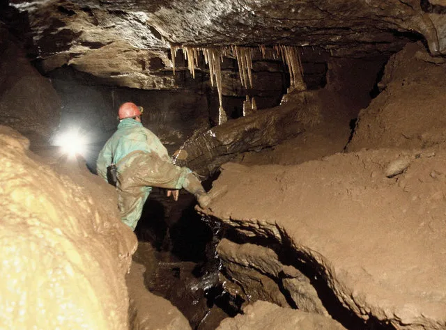
St Cuthbert's Swallet
Mountains & hills · 2.6 km

Stock Hill
Archaeological sites · 2.6 km

St. Cuthbert's Swallet
Caves · 2.7 km

Templeton
Caves · 2.8 km

Milton Lodge
Gardens · 2.8 km

Green Ore Roman metal-working site
Archaeological sites · 2.8 km

Lower Milton Caravan And Camping Site
Campsites · 2.8 km

Cedars Hall
Gardens · 2.9 km

Claver Morris House
Historic houses · 3.0 km
Nearby
📷 5Mountains & hills · South West England
Horrington Hill
Horrington Hill — mountain in england south west. Elevation: 253 m.
📷 5Caves · South West England
Cuckoo Cleeves (cave)
Cuckoo Cleeves (cave) is a cave in the United Kingdom.
📷 5📷 3Mountains & hills · South West England
St Cuthbert's Swallet
St Cuthbert's Swallet — cave in the Mendip Hills, Somerset, England.
📷 3Archaeological sites · South West England
Stock Hill
Stock Hill — Forestry Commission plantation in Chewton Mendip, Somerset, UK.
📷 3Caves · South West England
St. Cuthbert's Swallet
St. Cuthbert's Swallet is a cave in the United Kingdom.
Where to eat & stay near Pen Hill
Places to stay
📷 5Campsites · South West England
Lower Milton Caravan And Camping Site
Lower Milton Caravan And Camping Site — a campsite in england south west.
 📷 5
📷 5Hotels · South West England
Ancient Gate House Hotel
Ancient Gate House Hotel — a hotel in england south west.
 📷 5
📷 5Campsites · South West England
Ebborways Camping
Ebborways Camping — a campsite in england south west.
 📷 5
📷 5Caravan parks · South West England
Wells Holiday Park
Wells Holiday Park — a caravan park in england south west.
 📷 5
📷 5Campsites · South West England
The Lorax Patch
The Lorax Patch — a campsite in england south west.
 📷 5
📷 5Campsites · South West England
Nettwood Country Breaks
Nettwood Country Breaks — a campsite in england south west.
Places to eat & drink
 📷 5
📷 5Restaurants · South West England
Bekynton Brasserie
Bekynton Brasserie — a restaurant in england south west.
 📷 7
📷 7Historic pubs · South West England
The Bull Terrier
The Bull Terrier in England South West, United Kingdom.
 📷 5
📷 5 📷 7
📷 7 📷 7
📷 7Historic pubs · South West England
The Wine Vaults, Public House
The Wine Vaults, Public House in England South West, United Kingdom.
 📷 7
📷 7Historic pubs · South West England
Knatchbull Arms
Knatchbull Arms in England South West, United Kingdom.
More mountains in this region
 📷 5
📷 5 📷 5
📷 5 📷 5
📷 5 📷 5
📷 5Frequently asked questions
- Where is Pen Hill?
- Pen Hill is in South-West England, United Kingdom (postcode BA5 3LB), in the parish of St Cuthbert Out.
- What is Pen Hill?
- Pen Hill — Named summit at 305 m.
- How do I get to Pen Hill?
- The nearest railway station is Mendip Vale, about 9.8 km away. The nearest town is Wells. Drivers can use postcode BA5 3LB.
- Is Pen Hill a protected site?
- Yes — Pen Hill is part of the MENDIP National Nature Reserve and the Mendip Hills National Landscape (AONB).
- Is Pen Hill free to visit?
- Yes, Pen Hill is free to enter.
- How do I get to Pen Hill?
- Drivers can navigate to postcode BA5 3LB. It sits within the Wells and Mendip Hills parliamentary constituency.