
Historic bridges · South East England
Ouse Valley Viaduct
In or near Ardingly.
Ouse Valley Viaduct is a historic bridge in the United Kingdom.

Wikimedia Commons contributors — see linked file page for photographer and licence licence

Plan your visit
- Typical visit
- 15 min–30 min
- Nearest railway station
- Balcombe · 2.8 km
- Paid entry
- Family-friendly
- Dog-friendly
Getting there & planning your visit
The nearest railway station to Ouse Valley Viaduct is Balcombe, which is 2.8 km away. Entry to the viaduct is paid, and there is no specific information provided regarding accessibility. You can use the postcode RH17 6QP for sat-nav coordinates.
About
Ouse Valley Viaduct is a named historic bridge in the United Kingdom. Coordinates: 51.0349°, -0.1144°. This entry is part of The Great Britain Guide, a free, ad-free, open-data tourist directory.
Photo gallery
Protected designations
- Area of Outstanding Natural Beauty: High Weald
Designations sourced from Natural England open data under OGL v3.
From the Wikipedia article
The Ouse Valley Viaduct (or the Balcombe Viaduct) carries the Brighton Main Line over the River Ouse in Sussex, England. It is located to the north of Haywards Heath and the south of Balcombe. Known for its ornate design, the structure has been described as "probably the most elegant viaduct in Britain." Construction of the Ouse Valley Viaduct commenced by the London and Brighton Railway company the beginning of 1839. It was designed by the principal engineer for the line, John Urpeth Rastrick. The architect of the London to Brighton railway, David Mocatta is often associated with the ornate stonework but an 1843 contemporary report on the construction of the viaduct makes no mention of him and neither does a drawing of one of the pavilions in a collection of Rastrick's drawings. The viaduct is 96 feet (29 m) tall and is carried on 37 semi-circular arches, each of 30 feet (9.1 m), surmounted by balustrades, spanning a total length of 1,480 feet (450 m). Each pier contains a jack arch with a semi-circular soffit, which had the benefit of reducing the number of bricks required. On 12 July 1841, the viaduct was officially opened to train services, although the finishing details were not fully completed until the following year. Despite the structure's fine design, materials, and architectural features, the viaduct has had an expensive and problematic history. The first major restoration work occurred during the 1890s, during which sections of the original brickwork were entirely replaced in the belief that this would increase the structure's strength. However, the viaduct suffered considerable decay during the majority of the twentieth century. By May 1983, the viaduct had been recognised as a Grade II* listed structure. Between March 1996 and September 1999, the viaduct was subject to an extensive restoration by national rail infrastructure owner Railtrack; this work was part-funded by the Railway Heritage Trust, English Heritage and West Sussex County Council.
Excerpt from Wikipedia under CC BY-SA 4.0. See the source article linked in Sources below.
Background
Architecture
In July 1837, an act of Parliament, the London and Brighton Railway Act 1837 (7 Will. 4 & 1 Vict. c. cxix), was passed which gave the London and Brighton Railway company permission to construct its proposed railway line between London and the south coast. (equivalent to £}} in ). The viaduct was designed as an elegant structure, being around 500 m in length and carrying a straight line over 37 identical arches. Each of these semi-circular arches had a span of 9.1 m and was supported upon tapered red-brick piers. The foundation of each pier is provided with two courses of inclined footings, which have a total depth of just over 1 m. and RAIL 386/6). }} }} The core construction was complete…
Visiting
The Brighton Main Line was opened in two sections because completion was delayed by the need to complete major earthworks, in particular the tunnel at Haywards Heath. The viaduct was officially opened when the section between Norwood Junction and Haywards Heath was opened on 12 July 1841. By 1846 the viaduct had become part of the London, Brighton and South Coast Railway. In 1923 as a result of the Railways Act 1921, it became part of the Southern Railway network. It remained under Southern's ownership until January 1948, when the nationalisation of the Big Four railway companies formed the publicly owned railway operator British Railways.
Sourced from Wikipedia under CC BY-SA 4.0.
- Coordinates
- 51.0349, -0.1144
- County
- West Sussex
- District
- Mid Sussex
- Parish
- Balcombe
- Postcode
- RH17 6QP
- Parliamentary constituency
- East Grinstead and Uckfield
- Nearest railway station
- Balcombe — 2.8 km
- Opening
- July 1841
Sources
- osm: w123101058 (ODbL)
- wikipedia: Ouse Valley Viaduct (CC BY-SA 4.0)
- commons: Ouse Valley viaduct - 42183534692.jpg (CC BY-SA 4.0)
Other places nearby

Ouse Valley Viaduct Viewpoint
Viewpoints · 0.2 km
.jpg?width=1200)
Stone Hall
Historic houses · 1.0 km

Ardingly Reservoir & Ouse Valley
Reservoirs & lochs · 1.4 km

Borde Hill Garden
Botanic gardens · 1.4 km

Borde Hill Garden
Gardens · 1.4 km

Ardingly Reservoir
Reservoirs & lochs · 1.6 km

Borde Hill
Natural landmarks · 1.7 km

Ardingly College
Historic houses · 1.8 km

Mid Sussex District
Museums · 2.3 km
.jpg?width=1200)
Kemp's House
Historic houses · 2.3 km

South Nutfield
Villages · 2.4 km
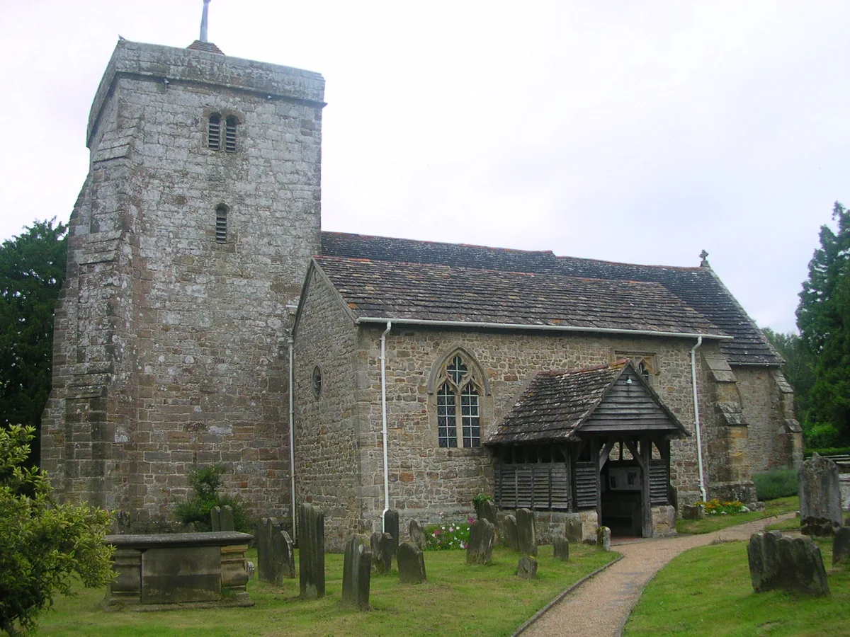
St Peter's Church, Ardingly
Historic churches · 2.6 km
Nearby
📷 5Viewpoints · South East England
Ouse Valley Viaduct Viewpoint
Ouse Valley Viaduct Viewpoint is a viewpoint in the United Kingdom.
📷 5Historic houses · South East England
Stone Hall
Stone Hall — Grade I listed building in Mid Sussex, England, UK.
📷 5Reservoirs & lochs · South East England
Ardingly Reservoir & Ouse Valley
Ardingly Reservoir & Ouse Valley — a other in england-south-east, United Kingdom.
📷 5Botanic gardens · South East England
Borde Hill Garden
Borde Hill Garden — a botanic garden in england south east.
📷 5Gardens · South East England
Borde Hill Garden
Borde Hill Garden is a garden located 1.5 miles (2.4 km) north of Haywards Heath, West Sussex in southern England. It is set in over 200 acres (80 ha) of garden, park and woodlands which has views acr
📷 5Reservoirs & lochs · South East England
Ardingly Reservoir
Ardingly Reservoir — lake in the United Kingdom.
Where to eat & stay near Ouse Valley Viaduct
Places to stay
 📷 5
📷 5Campsites · South East England
Bluebell Camp Site
Bluebell Camp Site — a campsite in england south east.
 📷 5
📷 5Caravan parks · South East England
Woodside Park
Woodside Park — a caravan park in england south east.
 📷 5
📷 5Campsites · South East England
Hook Farm Campsite
Hook Farm Campsite — a campsite in england south east.
 📷 5
📷 5Campsites · South East England
Wild Boar Wood Campsite
Wild Boar Wood Campsite — a campsite in england south east.
📷 5 📷 5
📷 5Campsites · South East England
Embers
Embers — a campsite in england south east.
Places to eat & drink
 📷 7
📷 7Historic pubs · South East England
The Sergison Arms Public House
The Sergison Arms Public House in England South East, United Kingdom.
 📷 5
📷 5Historic pubs · South East England
The Jolly Tanners Public House
The Jolly Tanners Public House in England South East, United Kingdom.
 📷 5
📷 5 📷 7
📷 7 📷 5
📷 5Historic pubs · South East England
White Hart Inn
White Hart Inn in England South East, United Kingdom.
 📷 5
📷 5Historic pubs · South East England
Old Punch Bowl
Old Punch Bowl in England South East, United Kingdom.
More bridges in this region
 📷 5
📷 5Historic bridges · South East England
Briary Hill Bridge east
Briary Hill Bridge east is a historic bridge in the United Kingdom.
 📷 5
📷 5Historic bridges · South East England
Briary Hill Bridge west
Briary Hill Bridge west is a historic bridge in the United Kingdom.
 📷 5
📷 5Historic bridges · South East England
Bridge 157 VIR (Bath Hard Road)
Bridge 157 VIR (Bath Hard Road) is a historic bridge in the United Kingdom.
 📷 5
📷 5Historic bridges · South East England
Dorking Arch Bridge
Dorking Arch Bridge is a historic bridge in the United Kingdom.
Frequently asked questions
- Where is Ouse Valley Viaduct?
- Ouse Valley Viaduct is in West Sussex, South-East England, United Kingdom (postcode RH17 6QP), in the parish of Balcombe.
- What is Ouse Valley Viaduct?
- Ouse Valley Viaduct is a historic bridge in the United Kingdom.
- How do I get to Ouse Valley Viaduct?
- The nearest railway station is Balcombe, about 2.8 km away. Drivers can use postcode RH17 6QP.
- Is Ouse Valley Viaduct a protected site?
- Yes — Ouse Valley Viaduct is part of the High Weald National Landscape (AONB).
- How do I get to Ouse Valley Viaduct?
- The nearest railway station is Balcombe, about 2.8 km away. Drivers can navigate to postcode RH17 6QP.