
Historic bridges · Yorkshire & the Humber
Ouse Bridge
In or near Laxton.
Ouse Bridge is a historic bridge in the United Kingdom.

Wikimedia Commons contributors — see linked file page for photographer and licence licence

Plan your visit
- Typical visit
- 15 min–30 min
- Nearest railway station
- Goole · 2.2 km
- Paid entry
- Dog-friendly
Getting there & planning your visit
To visit Ouse Bridge, the nearest railway station is Goole, located 2.2 km away. Entry is paid, and there is no specific information provided about accessibility. The postcode for sat-nav is DN14 7ED.
About
Ouse Bridge is a named historic bridge in the United Kingdom. Coordinates: 53.7249°, -0.8787°. This entry is part of The Great Britain Guide, a free, ad-free, open-data tourist directory.
Photo gallery
See it from the streetimagery from 2025
Imagery © Mapillary contributors, CC BY-SA 4.0
Protected designations
- Site of Special Scientific Interest: Humber Estuary - 2000480 SSSI
- Ramsar wetland: Humber Estuary
Designations sourced from Natural England open data under OGL v3.
From the Wikipedia article
The Ouse Bridge is a reinforced concrete plate girder bridge that spans River Ouse between Goole and Howden in the East Riding of Yorkshire, England. It carries the M62 and is situated between junctions 36 and 37. It was built between 1973 and 1976 by Costain and was designed by Scott Wilson Kirkpatrick & Partners. The bridge was officially opened to traffic on 24 May 1976 by nine-year-old Martin Brigham.
Excerpt from Wikipedia under CC BY-SA 4.0. See the source article linked in Sources below.
Background
History
Traffic to and from Hull to the A1 historically went over Boothferry Bridge, on the A614, which was a swing bridge. The position of the bridge and the M62 resulted from a study carried out in 1964 by Scott Wilson Kirkpatrick & Partners. They would also design the bridge. It is a haunched girder bridge.
Architecture
In the early stages an immersed tube tunnel was considered, which was thought to be too expensive. The superstructure was designed by Redpath Dorman Long and G Maunsell & Partners. 1310 m of the River Ouse had to be bridged. The area was in the Boothferry district of Humberside. The gradient of the road on the approach to the bridge is 1 in 33.
Visiting
It was opened on 24 May 1976 by nine-year-old Martin Brigham, who had been handed the scissors at the last moment by Minister of Transport John Gilbert, Baron Gilbert, who was to have opened it. It was the last section of the main part of the M62 to open, comprising 109 mi. The M62 had taken 15 years and cost £190 million. The A63 Caves Bypass and M62 Balkholme sections (built by Clugston Construction) had opened on 19 February 1976. The Balkholme to Caves section was the first use on a UK motorway of continuously reinforced concrete pavement (CRCP), which has no transverse joints.
Sourced from Wikipedia under CC BY-SA 4.0.
- Coordinates
- 53.7249, -0.8787
- District
- East Riding of Yorkshire
- Parish
- Howden
- Postcode
- DN14 7ED
- Parliamentary constituency
- Goole and Pocklington
- Nearest railway station
- Goole — 2.2 km
- Opening
- | inaugurated = 24 May 1976
Sources
- osm: w659152114 (ODbL)
- wikipedia: Ouse Bridge (M62) (CC BY-SA 4.0)
- commons: M62 Bridge - geograph.org.uk - 138956.jpg (CC BY-SA 4.0)
Other places nearby

Boothferry Bridge
Historic bridges · 0.8 km
.jpg?width=1200)
Hook Island
Forests & woodlands · 1.0 km

St Paul's Players
Theatres · 1.8 km

River Aire
Museums · 1.9 km
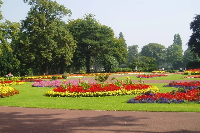
West Park
Country parks · 1.9 km

The Cenotaph
Memorials & monuments · 2.0 km

Goole Cenotaph
Memorials & monuments · 2.0 km

Windmill Tower At Number 145 (Timm And Son Ltd)
Windmills · 2.0 km

Knedlington
Villages · 2.0 km

Percy Jeeves
Memorials & monuments · 2.1 km

Howden Cemetery
Cemeteries · 2.1 km
Gate Arts Theatre
Theatres · 2.2 km
Nearby
📷 5Historic bridges · Yorkshire & the Humber
Boothferry Bridge
Boothferry Bridge is a historic bridge in the United Kingdom.
📷 3Forests & woodlands · Yorkshire & the Humber
Hook Island
Hook Island is a forest or woodland in the United Kingdom.
📷 3Theatres · Yorkshire & the Humber
St Paul's Players
St Paul's Players is a theatre in the United Kingdom.
📷 5Museums · Yorkshire & the Humber
River Aire
River Aire — a museum in england-yorkshire, United Kingdom.
📷 3Country parks · Yorkshire & the Humber
West Park
West Park — park in Goole, East Riding of Yorkshire, England, UK.
📷 5Memorials & monuments · Yorkshire & the Humber
The Cenotaph
The Cenotaph is a memorial in the United Kingdom.
Where to eat & stay near Ouse Bridge
Places to stay
 📷 5
📷 5Caravan parks · Yorkshire & the Humber
Brenda House Touring Caravan Park
Brenda House Touring Caravan Park — a caravan park in england yorkshire.
 📷 5
📷 5Campsites · Yorkshire & the Humber
Dobella Lane Farm Camping
Dobella Lane Farm Camping — a campsite in england yorkshire.
 📷 5
📷 5Campsites · Yorkshire & the Humber
Whitgift Hall Caravan Site and Fishery
Whitgift Hall Caravan Site and Fishery — a campsite in england yorkshire.
 📷 5
📷 5Caravan parks · Yorkshire & the Humber
Cliffe Meadows Holiday Park
Cliffe Meadows Holiday Park — a caravan park in england yorkshire.
 📷 5
📷 5Caravan parks · Yorkshire & the Humber
Ranch Caravan Park
Ranch Caravan Park — a caravan park in england yorkshire.
 📷 5
📷 5Caravan parks · Yorkshire & the Humber
New Holland Country Park
New Holland Country Park — a caravan park in england yorkshire.
Places to eat & drink
 📷 4
📷 4Historic pubs · Yorkshire & the Humber
The Royal
The Royal — Historic pub — listed building or notable heritage status.
 📷 7
📷 7Restaurants · Yorkshire & the Humber
The Lowther Hotel
The Lowther Hotel — a restaurant in england yorkshire.
 📷 7
📷 7Historic pubs · Yorkshire & the Humber
The Plough Inn
The Plough Inn in England Yorkshire, United Kingdom.
 📷 5
📷 5Historic pubs · Yorkshire & the Humber
The Blacksmith Arms
The Blacksmith Arms in England Yorkshire, United Kingdom.
 📷 7
📷 7Historic pubs · Yorkshire & the Humber
Fox And Coney Public House
Fox And Coney Public House in England Yorkshire, United Kingdom.
 📷 5
📷 5Historic pubs · Yorkshire & the Humber
The Buccaneer Public House
The Buccaneer Public House in England Yorkshire, United Kingdom.
More bridges in this region
 📷 5
📷 5Historic bridges · Yorkshire & the Humber
Broadbottom Viaduct
Broadbottom Viaduct is a historic bridge in the United Kingdom.
 📷 3
📷 3Historic bridges · Yorkshire & the Humber
Goyt Cliff Viaduct
Goyt Cliff Viaduct is a historic bridge in the United Kingdom.
 📷 3
📷 3Historic bridges · Yorkshire & the Humber
Iron Bridge
Iron Bridge is a historic bridge in the United Kingdom.
.jpg?width=1200) 📷 5
📷 5Historic bridges · Yorkshire & the Humber
Marple Aqueduct
Marple Aqueduct is a historic bridge in the United Kingdom.
Frequently asked questions
- Where is Ouse Bridge?
- Ouse Bridge is in Yorkshire, United Kingdom (postcode DN14 7ED), in the parish of Howden.
- What is Ouse Bridge?
- Ouse Bridge is a historic bridge in the United Kingdom.
- How do I get to Ouse Bridge?
- The nearest railway station is Goole, about 2.2 km away. The nearest town is Laxton. Drivers can use postcode DN14 7ED.
- Who owns Ouse Bridge?
- Ouse Bridge is owned by | maint = National Highways.
- Is Ouse Bridge a protected site?
- Yes — Ouse Bridge is part of the Humber Estuary - 2000480 SSSI Site of Special Scientific Interest and the Humber Estuary Ramsar wetland.
- How do I get to Ouse Bridge?
- The nearest railway station is Goole, about 2.2 km away. Drivers can navigate to postcode DN14 7ED.