
Historic houses · North West England
Old Well Hall
In or near Chatburn.
Old Well Hall — Grade II* listed house in Downham, Lancashire, England, UK.

Wikimedia Commons contributors — see linked file page for photographer and licence licence

Plan your visit
- Typical visit
- 1 h–2 h
- Nearest railway station
- Clitheroe · 4.9 km
- Family-friendly
- Limited wheelchair access
About
Old Well Hall is a historic house in Lancashire, North-West England. Built or established in 1700, it dates from the Tudor or Stuart period. Officially recognised as Grade II* listed building. The site is within the Forest Of Bowland National Landscape (AONB), and is a designated Site of Special Scientific Interest. It sits within the Pendle and Clitheroe parliamentary constituency. The nearest railway station is Clitheroe, about 4.9 km away. Postcode area BB7.
Photo gallery
Protected designations
- Site of Special Scientific Interest: Clitheroe Knoll Reefs SSSI
- Area of Outstanding Natural Beauty: Forest Of Bowland
Designations sourced from Natural England open data under OGL v3.
Place summary
Old Well Hall is a Grade II* listed Tudor-Stuart historic house located in Downham, Lancashire, North-West England. Established in 1700, it is situated within the designated areas of the Clitheroe Knoll Reefs SSSI and the Forest of Bowland AONB.
AI-generated from the structured facts on this page (operator, designation, listing, era). Not a substitute for visiting.
- Coordinates
- 53.8932, -2.3275
- County
- Lancashire
- District
- Ribble Valley
- Parish
- Downham
- Postcode
- BB7 4BW
- Parliamentary constituency
- Pendle and Clitheroe
- Established
- 1700
- Nearest railway station
- Clitheroe — 4.9 km
Sources
- wikidata: Q17532554 (CC0)
- commons: Old Well Hall, Downham - geograph.org.uk - 908325.jpg (CC BY-SA 4.0)
Other places nearby

Bridge approximately 15 metres south west of Fir Tree House
Historic bridges · 0.0 km
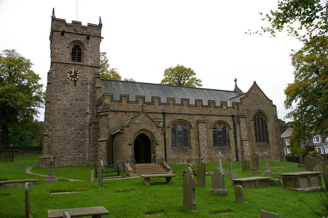
St Leonard's Church, Downham
Abbeys & priories · 0.2 km

St Leonard's Church, Downham
Cathedrals · 0.2 km

Downham Mill
Mills · 1.0 km

Worsaw Hill
Mountains & hills · 1.1 km
.jpg?width=1200)
Swanside Bridge
Historic bridges · 1.2 km
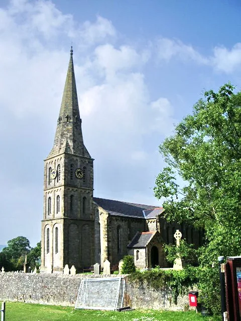
Christ Church, Chatburn
Historic churches · 1.6 km

Sawley
Villages · 1.7 km

The Ridge
Mountains & hills · 2.0 km

Chatburn
Towns & cities · 2.1 km
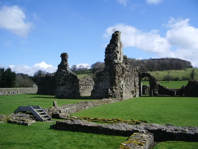
Sawley Abbey
Abbeys & priories · 2.4 km

Sawley Abbey
Cathedrals · 2.4 km
Nearby
📷 3Historic bridges · North West England
Bridge approximately 15 metres south west of Fir Tree House
Bridge approximately 15 metres south west of Fir Tree House — Grade II listed building-listed bridge in england-north-west, United Kingdom.
📷 3Abbeys & priories · North West England
St Leonard's Church, Downham
St Leonard's Church, Downham — Grade II* listed church in Downham, Lancashire, England, UK.
Flagship📷 4Cathedrals · North West England
St Leonard's Church, Downham
St Leonard's Church, Downham is a cathedral in the United Kingdom.
📷 3Mills · North West England
Downham Mill
Downham Mill — Grade II listed former watermill in the parish of Downham, Ribble Valley, Lancashire, BB7.
📷 5Mountains & hills · North West England
Worsaw Hill
Worsaw Hill — a hill or mountain in england north west.
📷 3Historic bridges · North West England
Swanside Bridge
Swanside Bridge is a historic bridge in the United Kingdom.
Where to eat & stay near Old Well Hall
Places to stay
 📷 5
📷 5Caravan parks · North West England
Holgates Ribble Valley
Holgates Ribble Valley — a caravan park in england north west.
 📷 5
📷 5Campsites · North West England
Calder Farm Campsite
Calder Farm Campsite — a campsite in england north west.
 📷 5
📷 5Caravan parks · North West England
Clitheroe Camping and Caravanning Club Site
Clitheroe Camping and Caravanning Club Site — a caravan park in england north west.
📷 5Campsites · North West England
Clitheroe Camping & Caravanning Club
Clitheroe Camping & Caravanning Club — a campsite in england north west.
 📷 5
📷 5Campsites · North West England
Edisford Bridge Farm Camping & Caravan Site
Edisford Bridge Farm Camping & Caravan Site — a campsite in england north west.
 📷 5
📷 5Caravan parks · North West England
Stubbins Vale Caravan Park
Stubbins Vale Caravan Park — a caravan park in england north west.
Places to eat & drink
 📷 5
📷 5Restaurants · North West England
The Spread Eagle
The Spread Eagle — a restaurant in england north west.
 📷 5
📷 5Historic pubs · North West England
Swan with Two Necks
Swan with Two Necks in England North West, United Kingdom.
 📷 5
📷 5 📷 5
📷 5Restaurants · North West England
Fence Gate Inn
Fence Gate Inn — a restaurant in england north west.
📷 5 📷 5
📷 5Historic pubs · North West England
Cross Gaits Inn
Cross Gaits Inn in England North West, United Kingdom.
Other historic houses from this era
.jpg?width=1200) 📷 5
📷 5Historic houses · London
Aubrey House
Aubrey House — large 18th-century house in Holland Park in west London.
.jpg?width=1200) 📷 5
📷 5Historic houses · London
Cloth Hill
Cloth Hill — 17th-century house in Hampstead, London NW3.
 📷 5
📷 5Historic houses · London
Cromwell House
Cromwell House — Grade I listed building in the London Borough of Haringey, England,UK.
 📷 5
📷 5More historic houses in this region
 📷 3
📷 3Historic houses · North West England
116 Hospital Street, Nantwich
116 Hospital Street, Nantwich — substantial townhouse in Nantwich, Cheshire, England, UK.
 📷 3
📷 3Historic houses · North West England
140–142 Hospital Street, Nantwich
140–142 Hospital Street, Nantwich — grade II listed building in Nantwich, Cheshire East, Cheshire, England, UK.
 📷 3
📷 3Historic houses · North West England
46 High Street, Nantwich
46 High Street, Nantwich — house in Nantwich, Cheshire, England, UK.
 📷 3
📷 3Historic houses · North West England
64, St Ann's Road
64, St Ann's Road — Grade II* listed house in Middlewich, Cheshire East, England, UK.
Frequently asked questions
- Where is Old Well Hall?
- Old Well Hall is in Lancashire, North-West England, United Kingdom (postcode BB7 4BW), in the parish of Downham.
- What is Old Well Hall?
- Old Well Hall — Grade II* listed house in Downham, Lancashire, England, UK.
- How do I get to Old Well Hall?
- The nearest railway station is Clitheroe, about 4.9 km away. Drivers can use postcode BB7 4BW.
- When was Old Well Hall built?
- Built or established in 1700.
- Is Old Well Hall a listed building?
- Old Well Hall is officially recognised as Grade II* listed building listed.
- Is Old Well Hall a protected site?
- Yes — Old Well Hall is part of the Clitheroe Knoll Reefs SSSI Site of Special Scientific Interest and the Forest Of Bowland National Landscape (AONB).
- How do I get to Old Well Hall?
- The nearest railway station is Clitheroe, about 4.9 km away. Drivers can navigate to postcode BB7 4BW.