
Castles · Yorkshire & the Humber
Neville Castle, 430m north west of the parish church
In or near Fadmoor.
Neville Castle, 430m north west of the parish church — scheduled monument-listed castle in england-yorkshire, United Kingdom.

Gordon Hatton — CC BY-SA 2.0 via Wikimedia Commons licence

Plan your visit
- Typical visit
- 1.5 h–3 h
- Family-friendly
- Limited wheelchair access
About
Neville Castle, 430m north west of the parish church is a scheduled monument-listed castle in england-yorkshire, United Kingdom, registered on the National Heritage List for England (NHLE entry 1017993). Listed status protects buildings and structures of special architectural or historic interest. See the linked Wikipedia article for further details.
Photo gallery
Heritage listing
Details The monument includes the buried and standing remains of a late medieval hunting lodge known as Neville Castle, located on the north side of Kirkbymoorside. Neville Castle is believed to have replaced the moated manor house on Vivier's Hill, 500m to the south east, as the main seat of the manor of Kirkbymoorside which was held by the Neville family from the beginning of the 15th century until 1569, when it was forfeited to the Crown following the rebellion of Charles Neville, Earl of Westmoreland. The Nevilles were an important and influential family throughout this period. Their numbers included Richard Neville, Earl of Warwick, known as the Kingmaker for his role in the Wars of the Roses, and Charles Neville, who rebelled in support of Mary, Queen of Scots. In 1570 Neville Castle was described as a 16th century hunting lodge set in a park with a boundary circuit 2.5 miles (3.75 km) in length. Two small areas of the monument were excavated in advance of building work over several seasons in the early 1960s and in 1974. These excavations uncovered a complex sequence of buildings and modifications to buildings on the site, starting with a timber cruck framed hall which was occupied until about the end of the 15th century, when it was replaced by a larger, more grandiose set of stone buildings arranged around a courtyard. Most of the remains of Neville Castle survive as buried deposits, but there are at least four sections of exposed masonry. The largest is the wall fragment standing to the west of the path that leads from the end of Castlegate lane along the side of Manor Vale. This is of rough rubble stonework standing some 6m high, 1m thick and 4m long. It retains part of a buttress at the north end of its west face along with a number of putlog holes (sockets
From the Historic England List Entry under OGL v3.
Place summary
Neville Castle is a scheduled monument located 430 metres north-west of the parish church in Kirkbymoorside, Yorkshire. This historic site reflects the region's medieval heritage. Its designation highlights its importance as an archaeological and architectural relic.
AI-generated from the structured facts on this page (operator, designation, listing, era). Not a substitute for visiting.
- Coordinates
- 54.2736, -0.9347
- District
- North Yorkshire
- Parish
- Kirkbymoorside
- Postcode
- YO62 6BW
- Parliamentary constituency
- Thirsk and Malton
Sources
- wikidata: Q17663455 (CC0)
Other places nearby
Neville Castle
Castles · 0.0 km

Kirkbymoorside
Museums · 0.5 km

Vivers Hill Castle
Literary houses · 0.5 km
Kirkbymoorside
Castles · 0.6 km

Windmill At Rear Of No 17
Windmills · 0.6 km

Keldholme Bridge
Historic bridges · 1.5 km

Hutton le Hole
Villages · 1.6 km

Excalibur Pot
Caves · 1.8 km

Howkeld Mill
Mills · 1.9 km
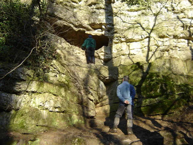
Kirkdale Cave
Mountains & hills · 2.1 km

Kirkdale Cave
Caves · 2.1 km
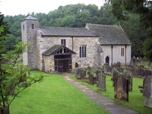
St Gregory's Minster
Historic churches · 2.2 km
Nearby
📷 3Castles · Yorkshire & the Humber
Neville Castle
Neville Castle — a castle in england-yorkshire, United Kingdom.
📷 5Museums · Yorkshire & the Humber
Kirkbymoorside
Kirkbymoorside — a museum in england-yorkshire, United Kingdom.
📷 5Literary houses · Yorkshire & the Humber
Vivers Hill Castle
Vivers Hill Castle — a literary house museum in england yorkshire.
📷 5📷 5Windmills · Yorkshire & the Humber
Windmill At Rear Of No 17
Windmill At Rear Of No 17 — Grade II listed building-listed windmill in england-yorkshire, United Kingdom.
📷 3Historic bridges · Yorkshire & the Humber
Keldholme Bridge
Keldholme Bridge — Grade II listed building-listed bridge in england-yorkshire, United Kingdom.
Where to eat & stay near Neville Castle, 430m north west of the parish church
Places to stay
 📷 5
📷 5Caravan parks · Yorkshire & the Humber
Hutton-le-Hole Caravan Park
Hutton-le-Hole Caravan Park — a caravan park in england yorkshire.
 📷 5
📷 5Caravan parks · Yorkshire & the Humber
Hutton-le-Hole Caravan Site
Hutton-le-Hole Caravan Site — a caravan park in england yorkshire.
 📷 5
📷 5Campsites · Yorkshire & the Humber
Wombleton Caravan Park
Wombleton Caravan Park — a campsite in england yorkshire.
 📷 5
📷 5Caravan parks · Yorkshire & the Humber
Wrens of Ryedale Touring Park
Wrens of Ryedale Touring Park — a caravan park in england yorkshire.
📷 5 📷 5
📷 5Hotels · Yorkshire & the Humber
Lastingham Grange
Lastingham Grange — a hotel in england yorkshire.
Places to eat & drink
 📷 5
📷 5Restaurants · Yorkshire & the Humber
The Star Inn
The Star Inn — a restaurant in england yorkshire.
 📷 5
📷 5Historic pubs · Yorkshire & the Humber
The Blacksmith's Arms Restaurant
The Blacksmith's Arms Restaurant in England Yorkshire, United Kingdom.
 📷 7
📷 7Historic pubs · Yorkshire & the Humber
The Black Swan And Railings To Front
The Black Swan And Railings To Front in England Yorkshire, United Kingdom.
 📷 7
📷 7Historic pubs · Yorkshire & the Humber
The Rose Inn
The Rose Inn in England Yorkshire, United Kingdom.
 📷 7
📷 7Restaurants · Yorkshire & the Humber
Capplemans
Capplemans — a restaurant in england yorkshire.
 📷 7
📷 7More castles in this region
 📷 5
📷 5Castles · Yorkshire & the Humber
Ashton-under-Lyne
Ashton-under-Lyne, also known simply as Ashton, is a market town in Tameside, Greater Manchester, United Kingdom. The population was 48,604 at the 2021 census. Historically a part of Lancashire, it is
 📷 5
📷 5Castles · Yorkshire & the Humber
Audenshaw
Audenshaw is a town in Tameside, Greater Manchester, England, 4.9 miles (7.9 km) east of Manchester. Historically part of Lancashire, in 2011 it had a population of 11,419. The name derives from Aldwi
 📷 5
📷 5Castles · Yorkshire & the Humber
Bramhall
Bramhall is a large village in the Metropolitan Borough of Stockport, Greater Manchester, England. It was formerly a civil parish in Cheshire. At the 2021 census, the built-up area, as defined by the
 📷 5
📷 5Castles · Yorkshire & the Humber
Bredbury
Bredbury is a town in the Metropolitan Borough of Stockport, Greater Manchester, England; it lies 8 miles (12.9 km) south-east of Manchester, 2 miles (3.2 km) east of Stockport and 3 miles (4.8 km) so
Frequently asked questions
- Where is Neville Castle, 430m north west of the parish church?
- Neville Castle, 430m north west of the parish church is in Yorkshire, United Kingdom (postcode YO62 6BW), in the parish of Kirkbymoorside.
- What is Neville Castle, 430m north west of the parish church?
- Neville Castle, 430m north west of the parish church — scheduled monument-listed castle in england-yorkshire, United Kingdom.
- How do I get to Neville Castle, 430m north west of the parish church?
- Drivers can use postcode YO62 6BW.
- Is Neville Castle, 430m north west of the parish church a listed building?
- Neville Castle, 430m north west of the parish church is officially recognised as scheduled monument listed.
- Does Neville Castle, 430m north west of the parish church charge admission?
- Neville Castle, 430m north west of the parish church typically charges admission. Check the official site for current ticket prices and opening hours.
- How do I get to Neville Castle, 430m north west of the parish church?
- Drivers can navigate to postcode YO62 6BW. It sits within the Thirsk and Malton parliamentary constituency.