Natural landmarks · North East England
Nesbit
In or near Milfield.
Nesbit in England North East, United Kingdom.

Richard Webb — CC BY-SA 2.0 via Wikimedia Commons licence
Plan your visit
- Typical visit
- 1 h–2 h
- Nearest railway station
- Heatherslaw · 6.9 km
- Free entry
- Dog-friendly
Getting there & planning your visit
To visit Nesbit, the nearest railway station is Heatherslaw, which is 6.9 km away. The postcode for navigation is NE71 6JN, and entry is free.
About
Nesbit is a place of interest in England North East, United Kingdom — drawn from open-data sources for visitor reference. See the linked Wikipedia article for the full description.
Photo gallery
Protected designations
- Site of Special Scientific Interest: Till Riverbanks SSSI
- Site of Special Scientific Interest: Tweed Catchment Rivers - England: Till Catchment SSSI
- Site of Special Scientific Interest: Northumberland Shore SSSI
Designations sourced from Natural England open data under OGL v3.
From the Wikipedia article
Nesbit is a hamlet and former civil parish, now in the parish of Doddington, Northumberland, England. It was once the site of a medieval village. In maps published during the 17th to 19th centuries, the name of the settlement was variously spelled Nesbet, Nesbitt or Nesbit. In 1951 the parish had a population of 143. Nesbit is near the confluence of the Glen and Till rivers and the hypothesized location of one of King Arthur's battles against invading Anglo-Saxons. Latin documentation dating to 1242 lists "Dodington cum Nesebit membro suo" (Doddington with its member Nesbit) as among the holdings of Baron William de Vesci. In 1346, Edward III granted land at Nesbit to Thomas Grey (or Gray) of Heaton after the rebellion of the previous holder, John de Trollope. Documents note the existence in 1415 of a defensive tower at Nesbit belonging to his grandson, Thomas Grey. However, in a 1541 survey it was observed that: At Nesebytte (Nesebitt) there was a towre of thinheritaunce of Sir Roger Gray but yt is longe synce for laske of reparacons decayed & fallen and no fortresse there now remayneth. During the 19th century, the township was productive farmland supporting a small community of workers. An 1855 survey of Northumberland reports as follows. Nesbit township is situated four miles north by west of Wooler. It contains 776 acres, and the landowners are the Messrs. Clarke of Newcastle. The number of inhabitants in 1801, was 63; in 1811, 65; in 1821, 52; in 1831, 47; in 1841, 59 and in 1851, 63 souls. Nesbit was formerly a township in Doddington parish, from 1866 Nesbit was a civil parish in its own right until it was abolished on 1 April 1955 and merged with Doddington. Today, Nesbit is the site of a sheep farm with no visible trace of the medieval tower or village.
Excerpt from Wikipedia under CC BY-SA 4.0. See the source article linked in Sources below.
- Coordinates
- 55.5951, -2.0285
- District
- Northumberland
- Parish
- Doddington
- Postcode
- NE71 6JN
- Parliamentary constituency
- North Northumberland
- Nearest railway station
- Heatherslaw — 6.9 km
Sources
- wikidata: Q6997168 (CC0)
- wikipedia: Nesbit, Northumberland (CC BY-SA 4.0)
Other places nearby

Fentonhill
Villages · 0.6 km

Chesters Strip Plantation earthwork near Fenton House, Nesbit
Vineyards · 1.1 km

Fenton Centre - Farm Visitor Centre and Trail
Natural landmarks · 1.4 km

S of Fenton Hill Camp
Vineyards · 1.6 km

Doddington
Historic churches · 1.8 km
Church of St Mary and St Michael, Doddington
Historic churches · 1.8 km

Near Doddington
Vineyards · 1.8 km
Multivallate hillfort, at Fenton Hill
Vineyards · 1.9 km

Dodd Well Cross
Memorials & monuments · 2.0 km

Doddington Northmoor
Mountains & hills · 2.4 km

Bridge Over River Till
Historic bridges · 2.5 km

White Hill
Mountains & hills · 2.5 km
Nearby
📷 5📷 5Vineyards · North East England
Chesters Strip Plantation earthwork near Fenton House, Nesbit
Chesters Strip Plantation earthwork near Fenton House, Nesbit — a UK vineyard in scotland central, producing English or Welsh wine from cool-climate grape varieties.
📷 3Natural landmarks · North East England
Fenton Centre - Farm Visitor Centre and Trail
Fenton Centre - Farm Visitor Centre and Trail — a natural landmark in scotland-central, United Kingdom.
📷 5Vineyards · North East England
S of Fenton Hill Camp
S of Fenton Hill Camp — a UK vineyard in scotland central, producing English or Welsh wine from cool-climate grape varieties.
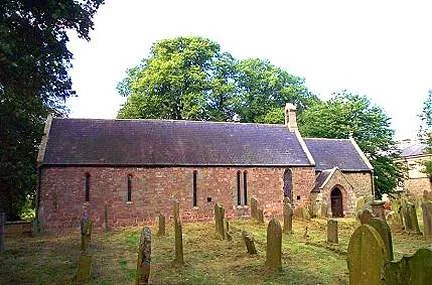
📷 5Historic churches · North East England
Doddington
Doddington in England North East, United Kingdom.
📷 3Historic churches · North East England
Church of St Mary and St Michael, Doddington
Church of St Mary and St Michael, Doddington — Grade I listed church in Northumberland, England, UK.
Where to eat & stay near Nesbit
Places to stay
 📷 7
📷 7Hotels · North East England
Tankerville Arms Hotel
Tankerville Arms Hotel — a hotel in scotland central.
 📷 5
📷 5Caravan parks · North East England
Highburn House Country Holiday Park
Highburn House Country Holiday Park — a caravan park in scotland central.
 📷 7
📷 7Hotels · North East England
The Black Bull
The Black Bull — a hotel in scotland central.
 📷 5
📷 5Hotels · North East England
No 1 Hotel
No 1 Hotel — a hotel in scotland central.
 📷 5
📷 5Hostels · North East England
Wooler Hostel
Wooler Hostel — a hostel in scotland central.
 📷 5
📷 5Caravan parks · North East England
Bridgend Park
Bridgend Park — a caravan park in scotland central.
Places to eat & drink
 📷 7
📷 7 📷 4
📷 4Historic pubs · Scottish Lowlands
Newcastle Arms
Newcastle Arms — Historic pub — listed building or notable heritage status.
 📷 5
📷 5Historic pubs · Scottish Lowlands
The Masons Arms
The Masons Arms in Scotland Lowlands, United Kingdom.
 📷 7
📷 7Historic pubs · Scottish Lowlands
The Victoria Hotel
The Victoria Hotel in Scotland Lowlands, United Kingdom.
 📷 7
📷 7Historic pubs · North East England
Plough Inn With Outbuilding To North
Plough Inn With Outbuilding To North in Scotland Lowlands, United Kingdom.
 📷 7
📷 7Historic pubs · North East England
59 And 61, Bridge Street
59 And 61, Bridge Street in Scotland Lowlands, United Kingdom.
More natural landmarks in this region
 📷 4
📷 4Natural landmarks · North East England
Cleveland Way
109-mile horseshoe trail around the North York Moors and its sea cliffs.
 📷 3
📷 3Natural landmarks · North East England
The Hand Stone
The Hand Stone — a other in england-yorkshire, United Kingdom.
 📷 3
📷 3Natural landmarks · North East England
The Face Stone
The Face Stone — a other in england-yorkshire, United Kingdom.
 📷 3
📷 3Frequently asked questions
- Where is Nesbit?
- Nesbit is in North-East England, United Kingdom (postcode NE71 6JN), in the parish of Doddington.
- What is Nesbit?
- Nesbit in England North East, United Kingdom.
- How do I get to Nesbit?
- The nearest railway station is Heatherslaw, about 6.9 km away. Drivers can use postcode NE71 6JN.
- Is Nesbit a protected site?
- Yes — Nesbit is part of the Till Riverbanks SSSI Site of Special Scientific Interest and the Tweed Catchment Rivers - England: Till Catchment SSSI Site of Special Scientific Interest.
- Is Nesbit free to visit?
- Yes, Nesbit is free to enter.
- How do I get to Nesbit?
- The nearest railway station is Heatherslaw, about 6.9 km away. Drivers can navigate to postcode NE71 6JN.