
Towns & cities · North East England
Milfield
Milfield — village and civil parish in Northumberland, UK.

Wikimedia Commons contributors — see linked file page for photographer and licence licence

Plan your visit
- Typical visit
- 3 h–6 h
- Nearest railway station
- Heatherslaw · 4.9 km
- Free entry
- Family-friendly
- Dog-friendly
About
Milfield is a town, city, village or settlement in the United Kingdom. Recent population estimates put it at around 265 people. Wikidata describes it as: "village and civil parish in Northumberland, UK". Coordinates: 55.5950°, -2.1047°.
Photo gallery
Protected designations
- Site of Special Scientific Interest: Tweed Catchment Rivers - England: Till Catchment SSSI
Designations sourced from Natural England open data under OGL v3.
From the Wikipedia article
Milfield is a village in Northumberland, England about 3 miles (5 km) northwest of Wooler. The A697 road passes through the village.
Excerpt from Wikipedia under CC BY-SA 4.0. See the source article linked in Sources below.
Background
History
Milfield is the likely location of the Northumbrian royal settlement of Maelmin. According to Bede, a residence was built at Maelmin to supersede Edwin of Northumbria's residence of Ad-Gefrin at Yeavering. Evidence of a high-status Anglo-Saxon settlement at Milfield strongly suggests that this is the location of Maelmin, because of its proximity to Yeavering. Maelmin has been identified as a Brittonic place name with a probable meaning of 'decayed edge', though other Brittonic etymologies are also possible. One of the many battles between the Scots and the English was fought on Milfield Plain, which is part of the bed of the prehistoric Lake of Glendale. In the month before the Battle of…
Sourced from Wikipedia under CC BY-SA 4.0.
- Coordinates
- 55.5950, -2.1047
- District
- Northumberland
- Parish
- Milfield
- Postcode
- NE71 6HU
- Parliamentary constituency
- North Northumberland
- Population
- 265
- Nearest railway station
- Heatherslaw — 4.9 km
- Official site
- www.neighbourhood.statistics.gov.uk
Sources
- wikidata: Q1814437 (CC0)
- wikipedia: Milfield (CC BY-SA 4.0)
- commons: The Red Lion Inn at Milfield in Northumberland - geograph.org.uk - 1402680.jpg (CC BY-SA 4.0)
Other places nearby

Glendale
Natural landmarks · 0.0 km

Maelmin Henge
Archaeological sites · 0.5 km

Maelmin Henge
Archaeological sites · 0.5 km

Maelmin Henge and Heritage Trail
Archaeological sites · 0.5 km

Coupland Henge
Archaeological sites · 0.7 km

Coupland Henge
Archaeological sites · 0.7 km

RAF Milfield
Other places · 1.1 km

Defended settlement, 380m south west of Sandy House
Vineyards · 1.4 km

Marley Knowe round cairn
Burial mounds & barrows · 1.4 km

Marley Knowe round cairn
Archaeological sites · 1.4 km

East of Flodden Camp
Vineyards · 1.8 km

Flodden Camp
Vineyards · 2.0 km
Milfield is a small village located in central Scotland with a population of 265. Our guide lists N attractions within reach.
At a glance
- Population
- 265
- Constituency
- North Northumberland
Things to see in Milfield
68 attractions within 12 km — showing the 24 most editorially-significant. Full guide: things to do in Milfield →
 📷 4
📷 4Abbeys & priories · North East England
St Cuthbert's Way
St Cuthbert's Way in England North East, United Kingdom.
 📷 5
📷 5 📷 4
📷 4Castles · North East England
Ford Castle
Ford Castle in England North East, United Kingdom.
 📷 4
📷 4 📷 5
📷 5Natural landmarks · North East England
Bowmont Water
Bowmont Water in England North East, United Kingdom.
📷 3 📷 4📷 3
 📷 5
📷 5Historic houses · North East England
Lady Waterford Hall
Lady Waterford Hall in England North East, United Kingdom.
 📷 4
📷 4Heritage railway stations · North East England
Kirknewton railway station
Kirknewton railway station in England North East, United Kingdom.
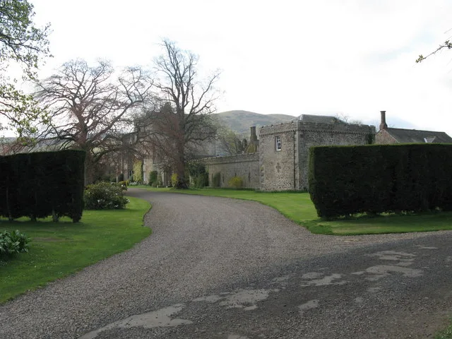 📷 3
📷 3Castles · North East England
Coupland Castle
Coupland Castle — Grade I listed castle in Ewart, Northumberland, England, UK.
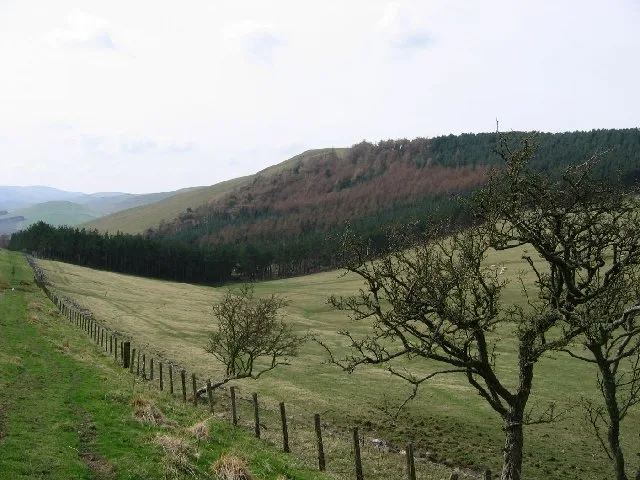 📷 3
📷 3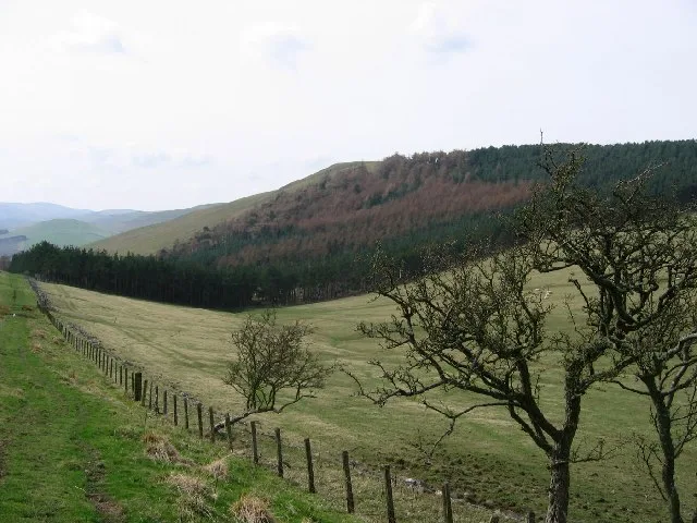 📷 3
📷 3 📷 3
📷 3Viewpoints · North East England
Viewpoint - near Ford Moss
Viewpoint - near Ford Moss is a viewpoint in the United Kingdom.
 📷 3
📷 3Viewpoints · North East England
viewpoint – just north of Hay Farm
viewpoint – just north of Hay Farm is a viewpoint in the United Kingdom.
 📷 5
📷 5Memorials & monuments · North East England
War memorial
War memorial is a memorial in the United Kingdom.
 📷 3
📷 3Natural landmarks · North East England
Fenton Centre - Farm Visitor Centre and Trail
Fenton Centre - Farm Visitor Centre and Trail — a natural landmark in scotland-central, United Kingdom.
 📷 3
📷 3Wildlife reserves · North East England
Ford Moss Nature Reserve
Ford Moss Nature Reserve — a wildlife reserve in scotland-central, United Kingdom.
 📷 3
📷 3Natural landmarks · North East England
Kimmerston Equestrian Centre
Kimmerston Equestrian Centre — a other in scotland-central, United Kingdom.
📷 3Burial mounds & barrows · North East England
Marley Knowe round cairn
Marley Knowe round cairn — a burial mound in scotland-central, United Kingdom.
📷 3Archaeological sites · North East England
Coupland Henge
Coupland Henge — a archaeological in scotland-central, United Kingdom.
 📷 3
📷 3Archaeological sites · North East England
Green Humbleton
Green Humbleton — a archaeological in scotland-central, United Kingdom.
 📷 3
📷 3Archaeological sites · North East England
Ring Chesters
Ring Chesters — a archaeological in scotland-central, United Kingdom.
 📷 3
📷 3Archaeological sites · North East England
Lynchets (cultivation terraces)
Lynchets (cultivation terraces) — a archaeological in scotland-central, United Kingdom.
Nearby
📷 3📷 3Archaeological sites · North East England
Maelmin Henge
Maelmin Henge — a archaeological in scotland-central, United Kingdom.
📷 5Archaeological sites · North East England
Maelmin Henge
Maelmin Henge — archaeological in scotland central.
📷 3Archaeological sites · North East England
Maelmin Henge and Heritage Trail
Maelmin Henge and Heritage Trail — a archaeological in scotland-central, United Kingdom.
📷 3Archaeological sites · North East England
Coupland Henge
Coupland Henge — a archaeological in scotland-central, United Kingdom.
📷 5Archaeological sites · North East England
Coupland Henge
Coupland Henge — archaeological in scotland central.
Where to eat & stay near Milfield
Places to stay
 📷 5
📷 5Caravan parks · North East England
Highburn House Country Holiday Park
Highburn House Country Holiday Park — a caravan park in scotland central.
 📷 7
📷 7Hotels · North East England
Tankerville Arms Hotel
Tankerville Arms Hotel — a hotel in scotland central.
 📷 7
📷 7Hotels · North East England
The Black Bull
The Black Bull — a hotel in scotland central.
 📷 5
📷 5Hotels · North East England
No 1 Hotel
No 1 Hotel — a hotel in scotland central.
 📷 5
📷 5Hostels · North East England
Wooler Hostel
Wooler Hostel — a hostel in scotland central.
 📷 5
📷 5Caravan parks · North East England
Bridgend Park
Bridgend Park — a caravan park in scotland central.
Places to eat & drink
 📷 7
📷 7 📷 4
📷 4Historic pubs · Scottish Lowlands
Newcastle Arms
Newcastle Arms — Historic pub — listed building or notable heritage status.
 📷 5
📷 5Historic pubs · Scottish Lowlands
The Masons Arms
The Masons Arms in Scotland Lowlands, United Kingdom.
 📷 7
📷 7Historic pubs · Scottish Lowlands
The Victoria Hotel
The Victoria Hotel in Scotland Lowlands, United Kingdom.
 📷 7
📷 7Historic pubs · North East England
59 And 61, Bridge Street
59 And 61, Bridge Street in Scotland Lowlands, United Kingdom.
 📷 5
📷 5Historic pubs · North East England
The Berwick Arms
The Berwick Arms in Scotland Lowlands, United Kingdom.
More towns in this region
 Flagship📷 3
Towns & cities · North East England
Newby
Newby — village and civil parish in Hambleton, North Yorkshire, England, UK.
 📷 5
📷 5Towns & cities · North East England
Archdeacon Newton
Archdeacon Newton — village and civil parish in County Durham, England, UK.
 📷 3
📷 3Towns & cities · North East England
Boosbeck
Boosbeck — village in North Yorkshire, England, UK.
 📷 3
📷 3Frequently asked questions
- Where is Milfield?
- Milfield is in central Scotland, United Kingdom (postcode NE71 6HU), in the parish of Milfield.
- What is Milfield?
- Milfield — village and civil parish in Northumberland, UK.
- How do I get to Milfield?
- The nearest railway station is Heatherslaw, about 4.9 km away. Drivers can use postcode NE71 6HU.
- Is Milfield a protected site?
- Yes — Milfield is part of the Tweed Catchment Rivers - England: Till Catchment SSSI Site of Special Scientific Interest.
- Is Milfield free to visit?
- Yes, Milfield is free to enter.
- How do I get to Milfield?
- The nearest railway station is Heatherslaw, about 4.9 km away. Drivers can navigate to postcode NE71 6HU.