Mountains & hills · South Wales
Mynydd Llysiau
In or near Longtown.
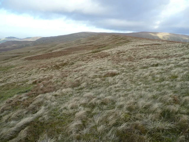
Mynydd Llysiau — Named summit at 663 m.

Wikimedia Commons contributors — see linked file page for photographer and licence licence
Plan your visit
- Typical visit
- 3 h–8 h
- Best time of year
- Late spring – early autumn (May–Oct)
- Free entry
- Dog-friendly
About
Mynydd Llysiau is a named summit in the United Kingdom. Wikidata describes it as: "Named summit at 663 m.". Coordinates: 51.9444°, -3.1550°.
Photo gallery
From the Wikipedia article
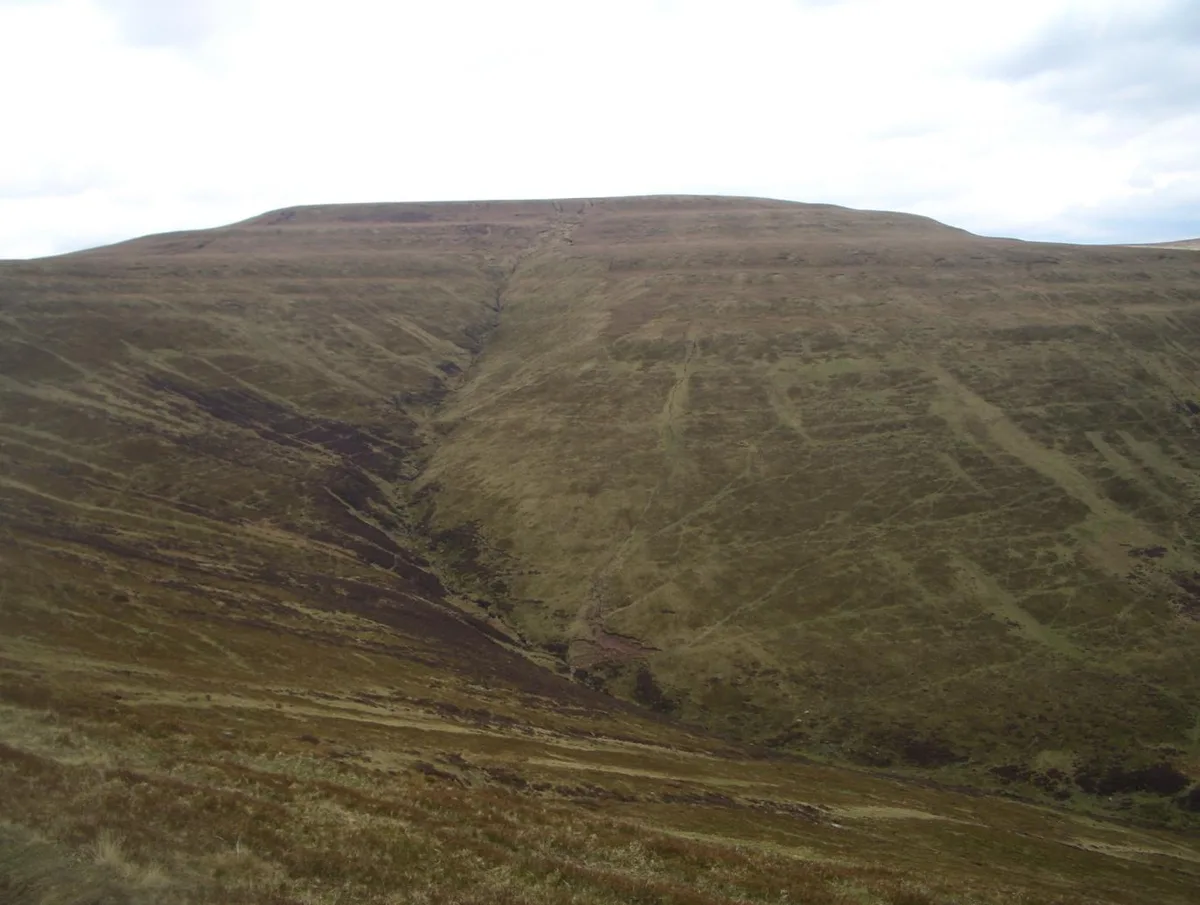
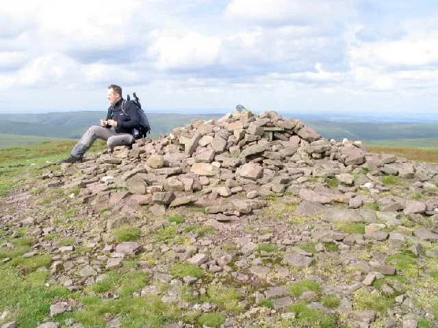
Mynydd Llysiau is a subsidiary summit of Waun Fach in the Black Mountains in south-eastern Wales. It lies halfway between Waun Fach and Pen Allt-mawr. It is a distinguished summit with a steep eastern face. The summit, marked by a pile of stones, is long grassy ridge. To the south is Pen Twyn Glas, before which are two boundary stones that resemble grave stones.
Excerpt from Wikipedia under CC BY-SA 4.0. See the source article linked in Sources below.
- Coordinates
- 51.9444, -3.1550
- District
- Powys
- Parish
- Talgarth
- Postcode
- LD3 0ES
- Parliamentary constituency
- Brecon, Radnor and Cwm Tawe
Sources
- osm: n9764881655 (ODbL)
- wikipedia: Mynydd Llysiau (CC BY-SA 4.0)
- commons: Mynydd Llysiau.jpg (CC BY-SA 4.0)
Other places nearby
Mynydd Llysiau
Natural landmarks · 0.0 km

Black Mountains
National parks · 1.4 km

Pen Trumau
Mountains & hills · 1.4 km

Twyn Du
Mountains & hills · 2.2 km
Waun Fach
Mountains & hills · 2.2 km

Pen Twyn Glas
Mountains & hills · 2.3 km

Pen Twyn Glas
Mountains & hills · 2.3 km

Pen y Gader Fawr
Vineyards · 2.3 km

Pen y Gadair Fawr
Natural landmarks · 2.4 km
Pen Y Gadair Fawr
Mountains & hills · 2.4 km

Pen y Gader-fawr
Mountains & hills · 2.7 km

Mynydd Troed Copa Deheuol
Mountains & hills · 2.9 km
Nearby
📷 3📷 4📷 5📷 5📷 3📷 5Mountains & hills · South Wales
Pen Twyn Glas
Pen Twyn Glas — mountain in wales south. Elevation: 646 m.
Where to eat & stay near Mynydd Llysiau
Places to stay
 📷 5
📷 5Campsites · South Wales
Cwmdu Campsite
Cwmdu Campsite — a campsite in wales south.
 📷 5
📷 5Campsites · Mid Wales
Grange Pony Trekking
Grange Pony Trekking — a campsite in wales south.
 📷 5
📷 5 📷 5
📷 5Caravan parks · South Wales
Llynfi Holiday Park
Llynfi Holiday Park — a caravan park in wales south.
 📷 5
📷 5Campsites · South Wales
Lakeside Caravan Park
Lakeside Caravan Park — a campsite in wales south.
 📷 5
📷 5Places to eat & drink
 📷 4
📷 4 📷 7
📷 7 📷 5
📷 5Historic pubs · South Wales
White Hart
White Hart — Historic pub — listed building or notable heritage status.
 📷 5
📷 5Historic pubs · South Wales
Cornewall Arms
Cornewall Arms in Wales South, United Kingdom.
 📷 5
📷 5Historic pubs · South Wales
Skirrid Mountain Inn
Skirrid Mountain Inn — Historic pub — listed building or notable heritage status.
 📷 7
📷 7More mountains in this region
 Flagship📷 3
Mountains & hills · South Wales
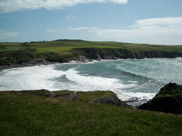
Milford Haven Waterway
Milford Haven Waterway — ria, or flooded valley, in Pembrokeshire, south-west Wales, UK.
 📷 5
📷 5Mountains & hills · South Wales
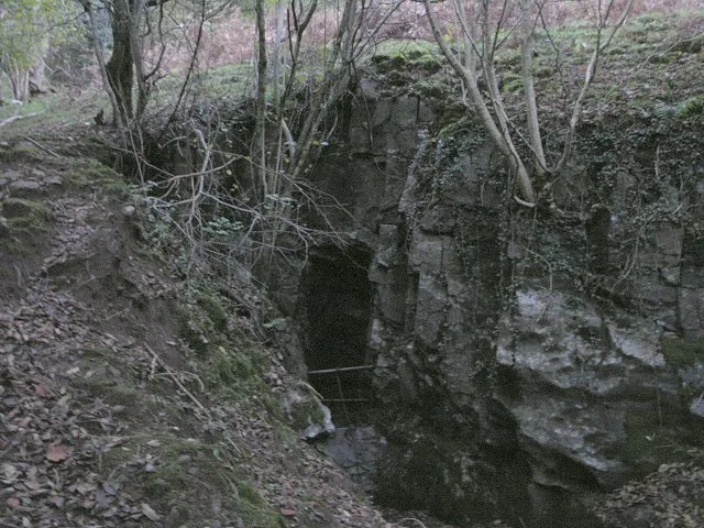
Ogof Ffynnon Ddu
Ogof Ffynnon Ddu — cave in the Upper Swansea Valley in South Wales.
 📷 3
📷 3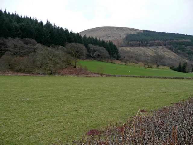 📷 3
📷 3Frequently asked questions
- Where is Mynydd Llysiau?
- Mynydd Llysiau is in South Wales, United Kingdom (postcode LD3 0ES), in the parish of Talgarth.
- What is Mynydd Llysiau?
- Mynydd Llysiau — Named summit at 663 m.
- How do I get to Mynydd Llysiau?
- Drivers can use postcode LD3 0ES.
- Is Mynydd Llysiau free to visit?
- Yes, Mynydd Llysiau is free to enter.
- How do I get to Mynydd Llysiau?
- Drivers can navigate to postcode LD3 0ES. It sits within the Brecon, Radnor and Cwm Tawe parliamentary constituency.