
Canals · South Wales
Monmouthshire and Brecon Canal
Also known as: Camlas Sir Fynwy a Brycheiniog, Dowrgleudh Konteth Vonnow hag Aberhondhu
Monmouthshire and Brecon Canal — network of canals in South Wales.
.jpg?width=1200)
Wikimedia Commons contributors — see linked file page for photographer and licence licence
.jpg)
Plan your visit
- Typical visit
- 1 h–2 h
- Nearest railway station
- Whistle Inn halt · 4.7 km
- Free entry
- Dog-friendly
Getting there & planning your visit
To visit the Monmouthshire and Brecon Canal, the nearest railway station is Whistle Inn halt, which is 4.7 km away. Entry is free, and the postcode for sat-nav is NP7 0DY.
About
Monmouthshire and Brecon Canal is a canal in the United Kingdom. Heritage designation: National Monuments of Wales. Wikidata describes it as: "network of canals in South Wales". Coordinates: 51.8241°, -3.0986°.
Photo gallery
See it from the streetimagery from 2024
Imagery © Mapillary contributors, CC BY-SA 4.0
Protected designations
- Site of Special Scientific Interest: River Wye SSSI
Designations sourced from Natural England open data under OGL v3.
From the Wikipedia article
The Monmouthshire and Brecon Canal (Welsh: Camlas Sir Fynwy a Brycheiniog) is a small network of canals in South Wales. For most of its currently (2018) navigable 35-mile (56 km) length it runs through the Brecon Beacons National Park, and its present rural character and tranquillity belies its original purpose as an industrial corridor for coal and iron, which were brought to the canal by a network of tramways and/or railroads, many of which were built and owned by the canal company. The "Mon and Brec" was originally two independent canals – the Monmouthshire Canal from Newport to Pontymoile Basin (including the Crumlin Arm) and the Brecknock and Abergavenny Canal running from Pontymoile to Brecon. Both canals were abandoned in 1962, but the Brecknock and Abergavenny route and a small section of the Monmouthshire route have been reopened since 1970. Much of the rest of the original Monmouthshire Canal is the subject of a restoration plan, which includes the construction of a new marina at the Newport end of the canal.
Excerpt from Wikipedia under CC BY-SA 4.0. See the source article linked in Sources below.
Background
Description
| repeal_date = | amendments = | repealing_legislation = | related_legislation = | status = Amended | original_text = https://books.google.co.uk/books?id=1ITe3ogChoIC&pg=PA680 | collapsed = yes }} This canal was authorised by an act of Parliament, the (32 Geo. 3. c. 102), passed on 11 June 1792, which created the Company of Proprietors of the Monmouthshire Canal Navigation and empowered it to raise £120,000 by the issuing of shares, and a further £60,000 if required. The act stated that the canal would run from Pontnewynydd to the River Usk near Newport, and would include a branch from Crindau to Crumlin Bridge. The company also had powers to construct railways from the canal to any coal…
Visiting
Much of the canal towpath is easily walkable along the entire route. The towpath from Brecon to Pontymoile is passable by cyclists over its whole length. The Taff Trail cycle route follows the canal for a few miles from Brecon, but the path after that is not suitable for cyclists with road bikes. National Cycle Network Routes 47 and 49 follow the canals between Cross Keys and Pontypool.
Sourced from Wikipedia under CC BY-SA 4.0.
- Coordinates
- 51.8241, -3.0986
- District
- Monmouthshire
- Parish
- Llanelly
- Postcode
- NP7 0DY
- Parliamentary constituency
- Monmouthshire
- Nearest railway station
- Whistle Inn halt — 4.7 km
Sources
- wikidata: Q6901171 (CC0)
- wikipedia: Monmouthshire and Brecon Canal (CC BY-SA 4.0)
- commons: Monmouthshire and Brecon Canal in Pontypool (9201).jpg (CC BY-SA 4.0)
Featured in this guide
Other places nearby

Bridge at Dan-y-bont Mill
Historic bridges · 0.2 km

Gilwern War Memorial
Memorials & monuments · 0.4 km

Gilwern
Villages · 0.4 km

Crawshay Memorial
Memorials & monuments · 0.4 km

Bridge 105 over the Brecknock & Abergavenny Canal including Iron Sign
Historic bridges · 0.5 km

Bridge 106 over the Brecknock & Abergavenny Canal including Iron Sign
Historic bridges · 1.0 km

Bridge 102 over the Brecknock & Abergavenny Canal
Historic bridges · 1.0 km

Battle Tump
Literary houses · 1.1 km
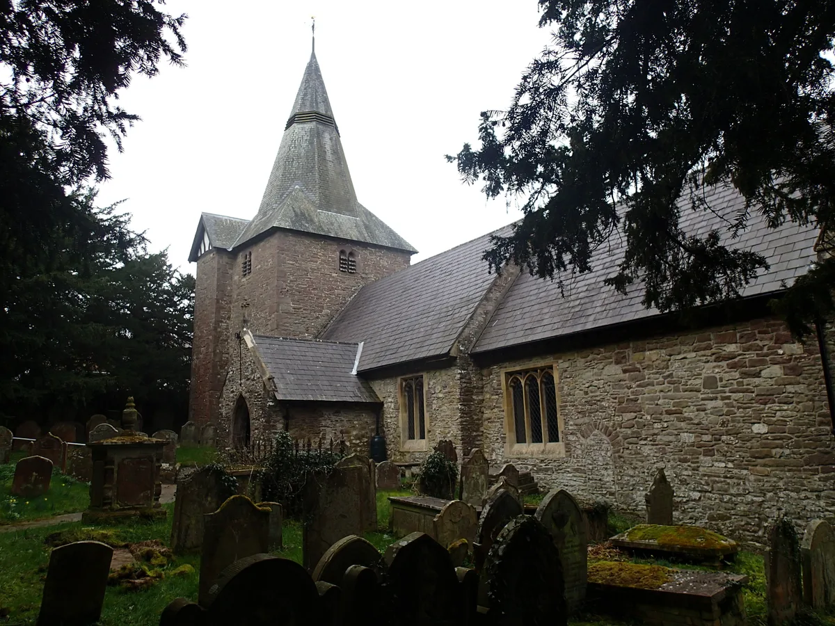
Parish Church of St Elli
Abbeys & priories · 1.2 km

Clydach House
Historic houses · 1.2 km

Bridge 101 over the Brecknock & Abergavenny Canal
Historic bridges · 1.3 km

Bridge 107 over the Brecknock & Abergavenny Canal including Iron Sign
Historic bridges · 1.5 km
Nearby
📷 5Historic bridges · South Wales
Bridge at Dan-y-bont Mill
Bridge at Dan-y-bont Mill — Grade II listed building-listed bridge in wales-south, United Kingdom.
📷 3Memorials & monuments · South Wales
Gilwern War Memorial
Gilwern War Memorial — a memorial in South Wales, United Kingdom.
📷 5📷 3Memorials & monuments · South Wales
Crawshay Memorial
Crawshay Memorial — a memorial in South Wales, United Kingdom.
📷 5Historic bridges · South Wales
Bridge 105 over the Brecknock & Abergavenny Canal including Iron Sign
Bridge 105 over the Brecknock & Abergavenny Canal including Iron Sign — Grade II listed building-listed bridge in wales-south, United Kingdom.
📷 5Historic bridges · South Wales
Bridge 106 over the Brecknock & Abergavenny Canal including Iron Sign
Bridge 106 over the Brecknock & Abergavenny Canal including Iron Sign — Grade II listed building-listed bridge in wales-south, United Kingdom.
Where to eat & stay near Monmouthshire and Brecon Canal
Places to stay
 📷 5
📷 5Campsites · South Wales
Pyscodlyn Camping and Caravan Site
Pyscodlyn Camping and Caravan Site — a campsite in wales south.
📷 5Caravan parks · South Wales
Pyscodlyn Camping and Caravan Site
Pyscodlyn Camping and Caravan Site — a caravan park in wales south.
 📷 5
📷 5 📷 5
📷 5 📷 5
📷 5 📷 5
📷 5Campsites · South Wales
Tudor Cule Scout Campsite
Tudor Cule Scout Campsite — a campsite in wales south.
Places to eat & drink
 📷 7
📷 7 📷 5
📷 5Restaurants · South Wales
The Walnut Tree
The Walnut Tree — a restaurant in wales south.
 📷 5
📷 5Historic pubs · South Wales
Skirrid Mountain Inn
Skirrid Mountain Inn — Historic pub — listed building or notable heritage status.
 📷 7
📷 7 📷 5
📷 5Restaurants · South Wales
Little Crown
Little Crown — a restaurant in wales south.
 📷 5
📷 5Restaurants · South Wales
Sultan of Wales
Sultan of Wales — a restaurant in wales south.
More places in this region
 📷 5
📷 5Canals · South Wales
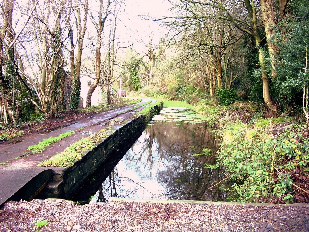
Glamorganshire Canal
Glamorganshire Canal — Site of Special Scientific Interest in Wales.
 📷 3
📷 3 📷 3
📷 3 📷 3
📷 3Frequently asked questions
- Where is Monmouthshire and Brecon Canal?
- Monmouthshire and Brecon Canal is in South Wales, United Kingdom (postcode NP7 0DY), in the parish of Llanelly.
- What is Monmouthshire and Brecon Canal?
- Monmouthshire and Brecon Canal — network of canals in South Wales.
- How do I get to Monmouthshire and Brecon Canal?
- The nearest railway station is Whistle Inn halt, about 4.7 km away. Drivers can use postcode NP7 0DY.
- Is Monmouthshire and Brecon Canal a listed building?
- Monmouthshire and Brecon Canal is officially recognised as National Monuments of Wales listed.
- Is Monmouthshire and Brecon Canal a protected site?
- Yes — Monmouthshire and Brecon Canal is part of the River Wye SSSI Site of Special Scientific Interest.
- Is Monmouthshire and Brecon Canal free to visit?
- Yes, Monmouthshire and Brecon Canal is free to enter.
- How do I get to Monmouthshire and Brecon Canal?
- The nearest railway station is Whistle Inn halt, about 4.7 km away. Drivers can navigate to postcode NP7 0DY.