
Historic bridges · West Midlands
Mill Bridge 200 Metres South-West Of The Abbey
In or near Ashow.
Mill Bridge 200 Metres South-West Of The Abbey — Grade II listed building-listed bridge in england-west-midlands, United Kingdom.

Philip Halling — CC BY-SA 2.0 via Wikimedia Commons licence

Plan your visit
- Typical visit
- 15 min–30 min
- Nearest railway station
- Kenilworth · 2.5 km
- Free entry
- Dog-friendly
Getting there & planning your visit
To visit Mill Bridge 200 Metres South-West Of The Abbey, the nearest railway station is Kenilworth, located 2.5 km away. Entry is free. The postcode for sat-nav is CV8 2LF.
About
Mill Bridge 200 Metres South-West Of The Abbey is a Grade II listed building-listed bridge in england-west-midlands, United Kingdom, registered on the National Heritage List for England (NHLE entry 1096010). Listed status protects buildings and structures of special architectural or historic interest. See the linked Wikipedia article for further details.
Photo gallery
Heritage listing
Details STONELEIGH 1827/0/10028 Mill Bridge c200 metres south-west of 26-NOV-02 the Abbey II Bridge and sluices. Bridge dated 1704, with C19 sluices and alterations. Ashlar and wood, with iron fittings. 2 round arches with cascades, divided by a central stepped buttress on the downstream side. Splayed balustrade walls with rounded coping. On the upstream side, 4 sluices, the gates now missing. Legacy The contents of this record have been generated from a legacy data system. Legacy System number: 489900 Legacy System: LBS
From the Historic England List Entry under OGL v3.
Place summary
Mill Bridge, located 200 metres south-west of the Abbey in Stoneleigh, Warwickshire, is a Grade II listed bridge. It is situated in the West Midlands region and is notable for its historical significance.
AI-generated from the structured facts on this page (operator, designation, listing, era). Not a substitute for visiting.
- Coordinates
- 52.3373, -1.5364
- County
- Warwickshire
- District
- Warwick
- Parish
- Stoneleigh
- Postcode
- CV8 2LF
- Parliamentary constituency
- Kenilworth and Southam
- Nearest railway station
- Kenilworth — 2.5 km
Sources
- wikidata: Q26388307 (CC0)
Other places nearby
C19 Iron Bridge And Cascade 320 Metres South-West Of Abbey
Waterfalls · 0.2 km
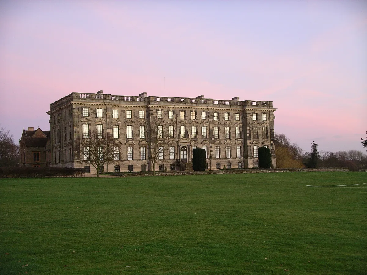
Stoneleigh Abbey
Abbeys & priories · 0.2 km

Stoneleigh Abbey
Cathedrals · 0.2 km

Stoneleigh Abbey Gatehouse
Abbeys & priories · 0.2 km

Stoneleigh Park
Parks · 0.9 km

Church of the Assumption of Our Lady
Historic churches · 1.0 km

Bridge Over Rocky Lane
Historic bridges · 1.1 km

Glasshouse Spinney
Forests & woodlands · 1.2 km

Stare Bridge
Historic bridges · 1.3 km

River Sowe
Museums · 1.5 km

Stoneleigh Motslow Hill
Castles · 1.7 km

Gurdwara Babake
Historic churches · 1.7 km
Nearby
Waterfalls · South East England
C19 Iron Bridge And Cascade 320 Metres South-West Of Abbey
C19 Iron Bridge And Cascade 320 Metres South-West Of Abbey in England West Midlands, United Kingdom.
📷 3Abbeys & priories · West Midlands
Stoneleigh Abbey
Stoneleigh Abbey — country house in Stoneleigh, Warwickshire, England, UK.
Flagship📷 4Cathedrals · West Midlands
Stoneleigh Abbey
Stoneleigh Abbey is a cathedral in the United Kingdom.
📷 4Abbeys & priories · West Midlands
Stoneleigh Abbey Gatehouse
Stoneleigh Abbey Gatehouse — a Grade I-listed abbey in england-west-midlands, United Kingdom.
📷 5Parks · West Midlands
Stoneleigh Park
Stoneleigh Park, known between 1963 and 2013 as the National Agricultural Centre, is a business park located south-west of the village of Stoneleigh, Warwickshire, England. It is home to the NAEC Ston
📷 3Historic churches · West Midlands
Church of the Assumption of Our Lady
Church of the Assumption of Our Lady — Grade I listed building-listed church in england-west-midlands, United Kingdom.
Where to eat & stay near Mill Bridge 200 Metres South-West Of The Abbey
Places to stay
 📷 5
📷 5 📷 7
📷 7Hotels · West Midlands
The Angel Hotel
The Angel Hotel — a hotel in england west midlands.
 📷 6
📷 6Hotels · West Midlands
The Regent Hotel
The Regent Hotel — a hotel in england west midlands.
 📷 5
📷 5Hotels · West Midlands
Warwick Arms Hotel
Warwick Arms Hotel — a hotel in england west midlands.
 📷 7
📷 7Hotels · West Midlands
Ramada Hotel & Suites Coventry
Ramada Hotel & Suites Coventry — a hotel in england west midlands. 4-star. Brand: Ramada.
 📷 5
📷 5Caravan parks · West Midlands
Warwick Racecourse Caravan Club Site
Warwick Racecourse Caravan Club Site — a caravan park in england west midlands.
Places to eat & drink
 📷 5
📷 5Historic pubs · West Midlands
The Coventry Cross Inn (The North East Section)
The Coventry Cross Inn (The North East Section) in England West Midlands, United Kingdom.
 📷 5
📷 5Historic pubs · West Midlands
The Famous Virgins and Castle
The Famous Virgins and Castle — Historic pub — listed building or notable heritage status.
 📷 7📷 6
Restaurants · West Midlands
Harringtons on the Hill
Harringtons on the Hill — a restaurant in england west midlands.
 📷 5
📷 5Historic pubs · West Midlands
Queen & Castle
Queen & Castle — Historic pub — listed building or notable heritage status.
 📷 5
📷 5Historic pubs · West Midlands
The Malt Shovel
The Malt Shovel — Historic pub — listed building or notable heritage status.
More bridges in this region
 📷 3
📷 3Historic bridges · West Midlands
Wolseley Bridge
Wolseley Bridge is a historic bridge in the United Kingdom.
 📷 3
📷 3Historic bridges · West Midlands
Bridge, Gatepiers, Walls And Ha Ha South Of Blithfield Hall
Bridge, Gatepiers, Walls And Ha Ha South Of Blithfield Hall — Grade II listed building-listed bridge in england-east-midlands, United Kingdom.
 📷 3
📷 3Historic bridges · West Midlands
Bridge Over River Swarbourn At West End Of Town Hill
Bridge Over River Swarbourn At West End Of Town Hill — Grade II listed building-listed bridge in england-east-midlands, United Kingdom.
 📷 3
📷 3Historic bridges · West Midlands
Viaduct over Trent and Mersey Canal at SK 0485 1780
Viaduct over Trent and Mersey Canal at SK 0485 1780 — Grade II listed building-listed bridge in england-east-midlands, United Kingdom.
Frequently asked questions
- Where is Mill Bridge 200 Metres South-West Of The Abbey?
- Mill Bridge 200 Metres South-West Of The Abbey is in Warwickshire, the West Midlands, United Kingdom (postcode CV8 2LF), in the parish of Stoneleigh.
- What is Mill Bridge 200 Metres South-West Of The Abbey?
- Mill Bridge 200 Metres South-West Of The Abbey — Grade II listed building-listed bridge in england-west-midlands, United Kingdom.
- How do I get to Mill Bridge 200 Metres South-West Of The Abbey?
- The nearest railway station is Kenilworth, about 2.5 km away. Drivers can use postcode CV8 2LF.
- Is Mill Bridge 200 Metres South-West Of The Abbey a listed building?
- Mill Bridge 200 Metres South-West Of The Abbey is officially recognised as Grade II listed building listed.
- Is Mill Bridge 200 Metres South-West Of The Abbey free to visit?
- Yes, Mill Bridge 200 Metres South-West Of The Abbey is free to enter.
- How do I get to Mill Bridge 200 Metres South-West Of The Abbey?
- The nearest railway station is Kenilworth, about 2.5 km away. Drivers can navigate to postcode CV8 2LF.