
Historic bridges · West Midlands
Milford Bridge, No.105, North Of Home Farm, Milford
In or near Berkswich.
Milford Bridge, No.105, North Of Home Farm, Milford — Grade II listed building-listed bridge in england-west-midlands, United Kingdom.

Roger D Kidd — CC BY-SA 2.0 via Wikimedia Commons licence

Plan your visit
- Typical visit
- 15 min–30 min
- Nearest railway station
- Stafford · 5.2 km
- Free entry
- Dog-friendly
Getting there & planning your visit
Milford Bridge is located in Stafford, Staffordshire, with the postcode ST17 0UL. The nearest railway station is Stafford, which is 5.2 km away. Entry to the bridge is free.
About
Milford Bridge, No.105, North Of Home Farm, Milford is a Grade II listed building-listed bridge in england-west-midlands, United Kingdom, registered on the National Heritage List for England (NHLE entry 1393482). Listed status protects buildings and structures of special architectural or historic interest. See the linked Wikipedia article for further details.
Photo gallery
See it from the streetimagery from 2023
Imagery © Mapillary contributors, CC BY-SA 4.0
Heritage listing
Details BERKSWICH 603/19/10022 STAFFORDSHIRE AND WORCESTERSHIRE CANAL 15-OCT-09 MILFORD Milford Bridge, No.105, North of Home Farm, Milford II Canal accommodation bridge, No. 105. Late-C18 by canal engineer James Brindley for the Staffordshire and Worcestershire Canal. MATERIAL: Random bond brick with sandstone coping, though replaced in part with engineering brick. DESCRIPTION: The bridge is ramped down to the towpath approach on the west side, and terminates in corner piers on the east side. It has a semi-elliptical arch, sandstone string course and plain parapets. The west and east faces each carry a cast-iron plaque bearing the name and number of the bridge. There appears to have been some minor repairs to the structure. HISTORY: The Staffordshire and Worcestershire Canal was one of the earliest canals, constructed under an Act of 1766 and opened fully for traffic in 1772. Devised by James Brindley, the canal runs for 46½ miles between Great Haywood, where it joins the Trent & Mersey Canal (completed 1777) to Stourport where it connects with the River Severn. The canal forms one of the arms of Brindley's `Grand Cross', a scheme to link the Rivers Trent, Mersey, Thames and Severn, and was the first of the arms to be completed. SOURCES: Victoria County History, A History of the County of Stafford: Volume 5: East Cuttlestone Hundred (1959) 1-11 J. Ian Langford, Towpath Guide for the Staffordshire and Worcestershire Canal (1974), 37-8 REASONS FOR DESIGNATION: Milford Bridge (No.105) on the Staffordshire and Worcestershire Canal is designated at Grade II for the following principal reasons: * Despite some minor repairs, it is good example of a substantially intact canal structure of c.1770 * It is considered to be one of the earliest examples of a turnover bridge in the
From the Historic England List Entry under OGL v3.
Protected designations
- Area of Outstanding Natural Beauty: Cannock Chase
Designations sourced from Natural England open data under OGL v3.
Place summary
Milford Bridge is a Grade II listed bridge located north of Home Farm in Milford, Staffordshire, within the West Midlands region. It is situated in the parish of Berkswich. The bridge is notable for its historical significance and architectural merit.
AI-generated from the structured facts on this page (operator, designation, listing, era). Not a substitute for visiting.
- Coordinates
- 52.7896, -2.0495
- County
- Staffordshire
- District
- Stafford
- Parish
- Berkswich
- Postcode
- ST17 0UL
- Parliamentary constituency
- Stone, Great Wyrley and Penkridge
- Nearest railway station
- Stafford — 5.2 km
Sources
- wikidata: Q26672640 (CC0)
Other places nearby

Milford, Staffordshire
Museums · 0.6 km

Walton Bridge No 104
Historic bridges · 0.6 km

Milford
Villages · 0.7 km

Holdiford Bridge (Over River Sow)
Historic bridges · 0.8 km
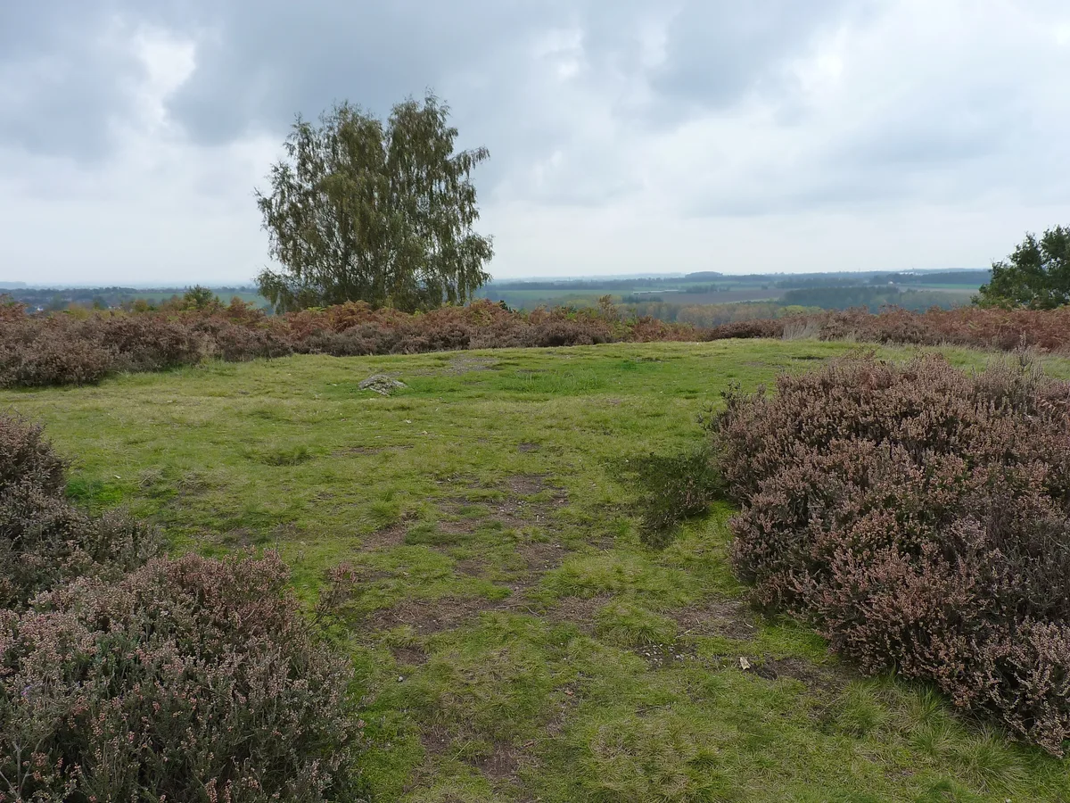
Saucer barrow on Spring Hill
Archaeological sites · 1.0 km

Saucer barrow
Burial mounds & barrows · 1.1 km

Satnall Hill
Mountains & hills · 1.3 km

Oat Hill
Mountains & hills · 1.4 km

Berkswich
Towns & cities · 1.4 km

Brocton Hall
Manor houses · 1.6 km

Tixall
Towns & cities · 1.8 km

Dark Lantern
Memorials & monuments · 1.8 km
Nearby
📷 5Museums · West Midlands
Milford, Staffordshire
Milford is a village in the county of Staffordshire, England. It lies at the edge of Cannock Chase, on the A513 road between Stafford and Rugeley. Just to the north of the village is the River Sow.
📷 3Historic bridges · West Midlands
Walton Bridge No 104
Walton Bridge No 104 — Grade II listed building-listed bridge in england-west-midlands, United Kingdom.
📷 5📷 3Historic bridges · West Midlands
Holdiford Bridge (Over River Sow)
Holdiford Bridge (Over River Sow) — Grade II listed building-listed bridge in england-west-midlands, United Kingdom.
📷 3Archaeological sites · West Midlands
Saucer barrow on Spring Hill
Saucer barrow on Spring Hill — archaeological site in Berkswich, Stafford, England, UK.
📷 3Burial mounds & barrows · West Midlands
Saucer barrow
Saucer barrow — a burial mound in england-west-midlands, United Kingdom.
Where to eat & stay near Milford Bridge, No.105, North Of Home Farm, Milford
Places to stay
 📷 5
📷 5Campsites · West Midlands
Spring Slade Lodge
Spring Slade Lodge — a campsite in england west midlands.
 📷 5
📷 5Caravan parks · West Midlands
Tackeroo Caravan Site
Tackeroo Caravan Site — a caravan park in england west midlands.
 📷 5
📷 5Caravan parks · West Midlands
Green Man Caravan Site
Green Man Caravan Site — a caravan park in england east midlands.
 📷 5
📷 5Caravan parks · West Midlands
Silvertrees Caravan Park
Silvertrees Caravan Park — a caravan park in england east midlands.
 📷 5
📷 5Caravan parks · West Midlands
Cannock Chase Camping and Caravanning Club
Cannock Chase Camping and Caravanning Club — a caravan park in england east midlands.
 📷 5
📷 5Caravan parks · West Midlands
Red Lion Farm Caravan Park
Red Lion Farm Caravan Park — a caravan park in england west midlands.
Places to eat & drink
 📷 5
📷 5Historic pubs · West Midlands
Shrewsbury Arms
Shrewsbury Arms in England West Midlands, United Kingdom.
 📷 5
📷 5 📷 5
📷 5Historic pubs · West Midlands
The Chains Public House
The Chains Public House in England West Midlands, United Kingdom.
 📷 5
📷 5Historic pubs · West Midlands
Eagle Inn Public House
Eagle Inn Public House in England West Midlands, United Kingdom.
 📷 7
📷 7Historic pubs · West Midlands
The Littleton Arms
The Littleton Arms in England West Midlands, United Kingdom.
 📷 7
📷 7More bridges in this region
 📷 3
📷 3Historic bridges · West Midlands
Wolseley Bridge
Wolseley Bridge is a historic bridge in the United Kingdom.
 📷 3
📷 3Historic bridges · West Midlands
Bridge, Gatepiers, Walls And Ha Ha South Of Blithfield Hall
Bridge, Gatepiers, Walls And Ha Ha South Of Blithfield Hall — Grade II listed building-listed bridge in england-east-midlands, United Kingdom.
 📷 3
📷 3Historic bridges · West Midlands
Bridge Over River Swarbourn At West End Of Town Hill
Bridge Over River Swarbourn At West End Of Town Hill — Grade II listed building-listed bridge in england-east-midlands, United Kingdom.
 📷 3
📷 3Historic bridges · West Midlands
Viaduct over Trent and Mersey Canal at SK 0485 1780
Viaduct over Trent and Mersey Canal at SK 0485 1780 — Grade II listed building-listed bridge in england-east-midlands, United Kingdom.
Frequently asked questions
- Where is Milford Bridge, No.105, North Of Home Farm, Milford?
- Milford Bridge, No.105, North Of Home Farm, Milford is in Staffordshire, the West Midlands, United Kingdom (postcode ST17 0UL), in the parish of Berkswich.
- What is Milford Bridge, No.105, North Of Home Farm, Milford?
- Milford Bridge, No.105, North Of Home Farm, Milford — Grade II listed building-listed bridge in england-west-midlands, United Kingdom.
- How do I get to Milford Bridge, No.105, North Of Home Farm, Milford?
- The nearest railway station is Stafford, about 5.2 km away. Drivers can use postcode ST17 0UL.
- Is Milford Bridge, No.105, North Of Home Farm, Milford a listed building?
- Milford Bridge, No.105, North Of Home Farm, Milford is officially recognised as Grade II listed building listed.
- Is Milford Bridge, No.105, North Of Home Farm, Milford a protected site?
- Yes — Milford Bridge, No.105, North Of Home Farm, Milford is part of the Cannock Chase National Landscape (AONB).
- Is Milford Bridge, No.105, North Of Home Farm, Milford free to visit?
- Yes, Milford Bridge, No.105, North Of Home Farm, Milford is free to enter.
- How do I get to Milford Bridge, No.105, North Of Home Farm, Milford?
- The nearest railway station is Stafford, about 5.2 km away. Drivers can navigate to postcode ST17 0UL.