
Historic houses · North West England
Mewith Head Hall, wall to garden and gatepiers
In or near Clapham.
Mewith Head Hall, wall to garden and gatepiers — Grade II* listed house in Bentham, Craven, England, UK.

Wikimedia Commons contributors — see linked file page for photographer and licence licence

Plan your visit
- Typical visit
- 1 h–2 h
- Nearest railway station
- Clapham · 3.5 km
- Family-friendly
- Limited wheelchair access
Getting there & planning your visit
To visit Mewith Head Hall, wall to garden and gatepiers, the nearest railway station is Clapham, located 3.5 km away. The postcode for sat-nav is LA2 7AP. Accessibility is limited for wheelchair users.
About
Mewith Head Hall, wall to garden and gatepiers is a historic house in the United Kingdom — typically a country seat, manor, or town house with notable architecture or history. Heritage designation: Grade II* listed building. Wikidata describes it as: "Grade II* listed house in Bentham, Craven, England, UK". Coordinates: 54.0971°, -2.4627°.
Photo gallery
Protected designations
- Area of Outstanding Natural Beauty: Forest Of Bowland
Designations sourced from Natural England open data under OGL v3.
From the Wikipedia article
Mewith Head Hall is a historic building in Bentham, North Yorkshire, a town in England. The house was built in the early 18th century for Ralph Baynes, father of John Baynes Garforth. The date "1708" is inscribed above the barn door, and it may well also be the date that the house was completed. The house was altered in the 19th century, and was grade II* listed in 1958. The three-storey house is built of stone, with a stone slate roof. The central section is two bays wide, and the right and left wings are two bays wide and two storeys high. It has a central staircase plan, and a central doorway with a Doric surround, pilasters, a round-headed fanlight with a moulded surround, a frieze with metopes, triglyphs and guttae, and an open segmental pediment. The windows are cross windows with moulded surrounds, mullions and transoms, some with hood moulds. Above the entrance is a slate sundial with an iron gnomon in a moulded architrave. At the rear are four bays, the middle two bays gabled. The garden walls are in stone, the entrances with moulded surrounds. The gate piers have rusticated shafts, and moulded caps, each with a cornice and a ball finial. Inside the house, the dining room and principal bedroom have 18th century panelling and fireplaces, and there are also early fireplaces in the kitchen and in a second bedroom. There is a king post roof.
Excerpt from Wikipedia under CC BY-SA 4.0. See the source article linked in Sources below.
- Coordinates
- 54.0971, -2.4627
- District
- North Yorkshire
- Parish
- Bentham
- Postcode
- LA2 7AP
- Parliamentary constituency
- Skipton and Ripon
- Nearest railway station
- Clapham — 3.5 km
- Official site
- thegreatbritainguide.com
Sources
- wikidata: Q17534906 (CC0)
- wikipedia: Mewith Head Hall (CC BY-SA 4.0)
- commons: Mewith Head Hall - geograph.org.uk - 4261049.jpg (CC BY-SA 4.0)
Other places nearby

Greystonegill Bridge
Historic bridges · 1.5 km

Standard on Burn Moor
Memorials & monuments · 2.3 km

Lowther Hill Caravan & Camp Site
Caravan parks · 2.6 km

Great Stone of Fourstones
Natural landmarks · 2.9 km

Wenning Bridge
Historic bridges · 3.5 km
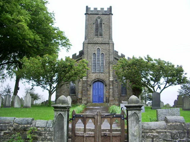
St Margaret's Church, High Bentham
Historic churches · 3.6 km

Abbey Farm
Campsites · 3.6 km

Bentham, North Yorkshire
Museums · 3.9 km

High Bentham
Villages · 4.0 km

Horse And Farrier Inn
Historic pubs · 4.1 km

Riverside Caravan Park
Caravan parks · 4.2 km

Newby
Villages · 4.3 km
Nearby
📷 3Historic bridges · North West England
Greystonegill Bridge
Greystonegill Bridge is a historic bridge in the United Kingdom.
📷 3Memorials & monuments · North West England
Standard on Burn Moor
Standard on Burn Moor — a memorial in england-north-west, United Kingdom.
📷 5Caravan parks · North West England
Lowther Hill Caravan & Camp Site
Lowther Hill Caravan & Camp Site — a caravan park in england north west.
📷 4Natural landmarks · North West England
Great Stone of Fourstones
The Great Stone of Fourstones, or the Big Stone as it is known locally, is a glacial deposit on the moorlands of Tatham Fells, England, straddling the county border between North Yorkshire and Lancash
📷 3Historic bridges · North West England
Wenning Bridge
Wenning Bridge — Grade II listed building-listed bridge in england-north-west, United Kingdom.
📷 3Historic churches · North West England
St Margaret's Church, High Bentham
St Margaret's Church, High Bentham — grade II listed church in Bentham, Craven, North Yorkshire, England, UK.
Where to eat & stay near Mewith Head Hall, wall to garden and gatepiers
Places to stay
📷 5Caravan parks · North West England
Lowther Hill Caravan & Camp Site
Lowther Hill Caravan & Camp Site — a caravan park in england north west.
📷 5📷 5Caravan parks · North West England
Riverside Caravan Park
Riverside Caravan Park — a caravan park in england north west.
 📷 5
📷 5Campsites · North West England
Moorgarth Farm Campsite
Moorgarth Farm Campsite — a campsite in england north west.
 📷 5
📷 5 📷 5
📷 5Caravan parks · North West England
Stackstead Farm Caravan Park
Stackstead Farm Caravan Park — a caravan park in england north west.
Places to eat & drink
📷 5Historic pubs · North West England
Horse And Farrier Inn
Horse And Farrier Inn in England North West, United Kingdom.
 📷 5
📷 5Cafés · North West England
Lakehouse Food & Drink
Lakehouse Food & Drink — a café in england north west.
 📷 5
📷 5 📷 5
📷 5Historic pubs · North West England
Punch Bowl Hotel
Punch Bowl Hotel in England North West, United Kingdom.
 📷 5
📷 5Restaurants · North West England
The Game Cock Inn
The Game Cock Inn — a restaurant in england north west. Cuisine: french;english.
 📷 6
📷 6Historic pubs · North West England
Falcon Manor Hotel
Falcon Manor Hotel in England North West, United Kingdom.
More historic houses in this region
 📷 3
📷 3Historic houses · North West England
116 Hospital Street, Nantwich
116 Hospital Street, Nantwich — substantial townhouse in Nantwich, Cheshire, England, UK.
 📷 3
📷 3Historic houses · North West England
140–142 Hospital Street, Nantwich
140–142 Hospital Street, Nantwich — grade II listed building in Nantwich, Cheshire East, Cheshire, England, UK.
 📷 3
📷 3Historic houses · North West England
46 High Street, Nantwich
46 High Street, Nantwich — house in Nantwich, Cheshire, England, UK.
 📷 3
📷 3Historic houses · North West England
64, St Ann's Road
64, St Ann's Road — Grade II* listed house in Middlewich, Cheshire East, England, UK.
Frequently asked questions
- Where is Mewith Head Hall, wall to garden and gatepiers?
- Mewith Head Hall, wall to garden and gatepiers is in North-West England, United Kingdom (postcode LA2 7AP), in the parish of Bentham.
- What is Mewith Head Hall, wall to garden and gatepiers?
- Mewith Head Hall, wall to garden and gatepiers — Grade II* listed house in Bentham, Craven, England, UK.
- How do I get to Mewith Head Hall, wall to garden and gatepiers?
- The nearest railway station is Clapham, about 3.5 km away. Drivers can use postcode LA2 7AP.
- Is Mewith Head Hall, wall to garden and gatepiers a listed building?
- Mewith Head Hall, wall to garden and gatepiers is officially recognised as Grade II* listed building listed.
- Is Mewith Head Hall, wall to garden and gatepiers a protected site?
- Yes — Mewith Head Hall, wall to garden and gatepiers is part of the Forest Of Bowland National Landscape (AONB).
- How do I get to Mewith Head Hall, wall to garden and gatepiers?
- The nearest railway station is Clapham, about 3.5 km away. Drivers can navigate to postcode LA2 7AP.