Museums · North West England
Bentham, North Yorkshire
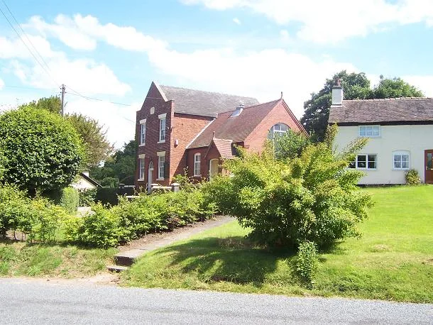
In or near Burton in Lonsdale.
Bentham is a civil parish in North Yorkshire, England, with a population of 3,027 at the 2011 Census. The parish includes the town High Bentham, occasionally known as Higher Bentham or just Bentham,

John S Turner — CC BY-SA 2.0 via Wikimedia Commons licence
Plan your visit
- Typical visit
- 1.5 h–3 h
- Best time of year
- Year-round
- Nearest railway station
- Bentham · 0.3 km
- Family-friendly
- Limited wheelchair access
Getting there & planning your visit
To visit Bentham in North Yorkshire, the nearest railway station is Bentham, located 0.3 km away. The postcode for sat-nav is LA2 7LG. Accessibility is limited for wheelchair users.
About
Bentham is a civil parish in North Yorkshire, England, with a population of 3,027 at the 2011 Census. The parish includes the town High Bentham, occasionally known as Higher Bentham or just Bentham, and the older adjacent village Low Bentham. The town lies on the River Wenning, just west of the Yorkshire Dales National Park and on the northern edge of the Forest of Bowland. The original centre of the town lay in Low Bentham, but a market was granted to High Bentham in the 14th century, and it became a centre for weaving from the 18th century, particularly after weavers in the town discovered how to weave hosepipes from flax. It was historically part of the West Riding of Yorkshire until 1974. From 1974 to 2023 it was part of the Craven District; it is now administered by the unitary North Yorkshire Council. The name Bentham derives from the Old English beonethām meaning 'bentgrass village'.
Photo gallery
Protected designations
- Area of Outstanding Natural Beauty: Forest Of Bowland
Designations sourced from Natural England open data under OGL v3.
From the Wikipedia article
Bentham is a civil parish in North Yorkshire, England, with a population of 3,027 at the 2011 Census. The parish includes the town High Bentham, occasionally known as Higher Bentham or just Bentham, and the older adjacent village Low Bentham. The town lies on the River Wenning, just west of the Yorkshire Dales National Park and on the northern edge of the Forest of Bowland. The original centre of the town lay in Low Bentham, but a market was granted to High Bentham in the 14th century, and it became a centre for weaving from the 18th century, particularly after weavers in the town discovered how to weave hosepipes from flax. It was historically part of the West Riding of Yorkshire until 1974. From 1974 to 2023 it was part of the Craven District; it is now administered by the unitary North Yorkshire Council. The name Bentham derives from the Old English beonethām meaning 'bentgrass village'.
Excerpt from Wikipedia under CC BY-SA 4.0. See the source article linked in Sources below.
- Coordinates
- 54.1180, -2.5100
- District
- North Yorkshire
- Parish
- Bentham
- Postcode
- LA2 7LG
- Parliamentary constituency
- Skipton and Ripon
- Nearest railway station
- Bentham — 0.3 km
Sources
- wikipedia: Bentham, North Yorkshire (CC BY-SA 4.0)
Other places nearby

High Bentham
Villages · 0.1 km

Horse And Farrier Inn
Historic pubs · 0.3 km
St Margaret's Church, High Bentham
Historic churches · 0.4 km

Riverside Caravan Park
Caravan parks · 0.8 km

Lower Bentham
Villages · 1.7 km

Sun Dial Inn
Historic pubs · 1.8 km

Low Bentham Bridge
Historic bridges · 1.9 km

Church Bridge
Historic bridges · 2.2 km

Bentham Moor Motte
Literary houses · 2.3 km

Fackon House
Castles · 2.3 km

Greystonegill Bridge
Historic bridges · 2.7 km

Rivers Edge
Caravan parks · 2.8 km
Nearby
📷 5📷 5Historic pubs · North West England
Horse And Farrier Inn
Horse And Farrier Inn in England North West, United Kingdom.
📷 3Historic churches · North West England
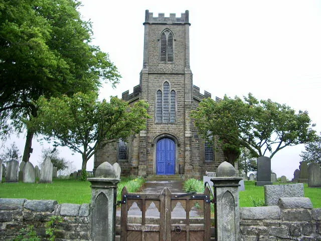
St Margaret's Church, High Bentham
St Margaret's Church, High Bentham — grade II listed church in Bentham, Craven, North Yorkshire, England, UK.
📷 5Caravan parks · North West England
Riverside Caravan Park
Riverside Caravan Park — a caravan park in england north west.
📷 5📷 5Where to eat & stay near Bentham, North Yorkshire
Places to stay
📷 5Caravan parks · North West England
Riverside Caravan Park
Riverside Caravan Park — a caravan park in england north west.
📷 5 📷 5
📷 5Caravan parks · North West England
Lowther Hill Caravan & Camp Site
Lowther Hill Caravan & Camp Site — a caravan park in england north west.
 📷 5
📷 5Caravan parks · North West England
Stackstead Farm Caravan Park
Stackstead Farm Caravan Park — a caravan park in england north west.
 📷 5
📷 5Campsites · North West England
Moorgarth Farm Campsite
Moorgarth Farm Campsite — a campsite in england north west.
 📷 5
📷 5Campsites · North West England
Box Tree Farm Glamping
Box Tree Farm Glamping — a campsite in england north west.
Places to eat & drink
📷 5Historic pubs · North West England
Horse And Farrier Inn
Horse And Farrier Inn in England North West, United Kingdom.
📷 5 📷 5
📷 5Historic pubs · North West England
Punch Bowl Hotel
Punch Bowl Hotel in England North West, United Kingdom.
 📷 5
📷 5Cafés · North West England
Lakehouse Food & Drink
Lakehouse Food & Drink — a café in england north west.
 📷 5
📷 5Restaurants · North West England
The Game Cock Inn
The Game Cock Inn — a restaurant in england north west. Cuisine: french;english.
 📷 3
📷 3Historic pubs · North West England
The Eagles Head
The Eagles Head — Historic pub — listed building or notable heritage status.
More museums in this region
 📷 3
📷 3Museums · North West England
Cube Gallery
Cube Gallery — former architecture museum in Manchester, England.
 📷 3
📷 3Museums · North West England
Cuckooland Museum
Cuckooland Museum — horological museum in England, UK.
 📷 4
📷 4Museums · North West England
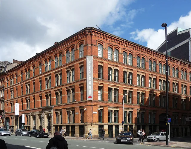
Elizabeth Gaskell's House
Elizabeth Gaskell's House — museum in Manchester.
 📷 3
📷 3Museums · North West England
Englesea Brook Chapel and Museum of Primitive Methodism
Englesea Brook Chapel and Museum of Primitive Methodism — Primitive Methodist chapel and museum, United Kingdom.
Frequently asked questions
- Where is Bentham, North Yorkshire?
- Bentham, North Yorkshire is in North-West England, United Kingdom (postcode LA2 7LG), in the parish of Bentham.
- What is Bentham, North Yorkshire?
- Bentham is a civil parish in North Yorkshire, England, with a population of 3,027 at the 2011 Census. The parish includes the town High Bentham, occasionally known as Higher Bentham or just Bentham,
- How do I get to Bentham, North Yorkshire?
- The nearest railway station is Bentham, about 0.3 km away. Drivers can use postcode LA2 7LG.
- Is Bentham, North Yorkshire a protected site?
- Yes — Bentham, North Yorkshire is part of the Forest Of Bowland National Landscape (AONB).
- How do I get to Bentham, North Yorkshire?
- The nearest railway station is Bentham, about 0.3 km away. Drivers can navigate to postcode LA2 7LG.