
Forests & woodlands · South West England
Meerend Thicket and Ashleworth Ham
In or near Sandhurst.
Meerend Thicket and Ashleworth Ham is a forest or woodland in the United Kingdom.

Wikimedia Commons contributors — see linked file page for photographer and licence licence

Plan your visit
- Typical visit
- 1 h–3 h
- Nearest railway station
- Gloucester · 7.9 km
- Free entry
- Family-friendly
- Dog-friendly
Getting there & planning your visit
To visit Meerend Thicket and Ashleworth Ham, the nearest railway station is Gloucester, located 7.9 km away. The postcode for sat-nav is GL19 4LD. Entry to the site is free.
About
Meerend Thicket and Ashleworth Ham is a named forest, woodland or nature reserve in the United Kingdom. Coordinates: 51.9360°, -2.2479°.
Photo gallery
Official information
Ashleworth Ham is a nature reserve that serves as an important habitat for various bird species, particularly during the winter months. While public access is restricted to protect breeding birds, visitors can enjoy views from designated viewing screens and a hide along the roadside.
Protected designations
- Site of Special Scientific Interest: Ashleworth Ham SSSI
- Area of Outstanding Natural Beauty: Cotswolds
Designations sourced from Natural England open data under OGL v3.
From the Wikipedia article
Ashleworth Ham (grid reference SO833263) is a 104.73-hectare (258.8-acre) biological Site of Special Scientific Interest. It is a large area of grassland on the Severn floodplain, north of Ashleworth in Gloucestershire, England. It is registered as a Site of Special Scientific Interest and was notified in 1974 and renotified in 1985. Ashleworth Ham received this designation because it is one of three sites in the Severn Vale where migratory waterfowl winter. The site has three units of assessment and is part managed as a nature reserve by the Gloucestershire Wildlife Trust. The nature reserve is unit 1 (grid reference SO830265) and is a 45-hectare (110-acre) area. Unit 2 (grid reference SO833261) is a 55-hectare (140-acre) site and unit 3 (grid reference SO829258) is a 4-hectare (9.9-acre) site, and are areas to the east of the nature reserve. The site is fen, marsh, swamp lowland, open water ditches, neutral grassland and hedges divide many of the fields. Access to the reserve is prohibited in winter, but the birds may be viewed from hides in Meerend Thicket. The Thicket is a steep wooded bank and indicates the former much higher boundary of the Severn. In addition, some parts of the Ham are of special botanical interest. Meerend Thicket is listed in the ‘Tewkesbury Borough Local Plan to 2011’, adopted March 2006, Appendix 3 'Nature Conservation',' as a Key Wildlife Site (KWS). This part of the Vale, which is alluvium over Lower Lias clay, has been greatly affected by drainage and other agricultural improvements. A public enquiry resulted in the exclusion of the reserve from the Internal Drainage Board scheme.
Excerpt from Wikipedia under CC BY-SA 4.0. See the source article linked in Sources below.
- Coordinates
- 51.9360, -2.2479
- County
- Gloucestershire
- District
- Tewkesbury
- Parish
- Ashleworth
- Postcode
- GL19 4LD
- Parliamentary constituency
- Forest of Dean
- Phone
- 01452 383333
- Nearest railway station
- Gloucester — 7.9 km
- Official site
- www.gloucestershirewildlifetrust.co.uk
Sources
- osm: r2144628 (ODbL)
- wikipedia: Ashleworth Ham (CC BY-SA 4.0)
- commons: Power Lines over Ashleworth Ham - geograph.org.uk - 86416.jpg (CC BY-SA 4.0)
Other places nearby

Hasfield
Villages · 1.0 km
Barrow Hill
Mountains & hills · 1.0 km
.jpg?width=1200)
Wall And Main Entrance Gates, Hasfield Court
Holy wells · 1.2 km

Hasfield Court
Gardens · 1.2 km

Church of St Mary
Historic churches · 1.2 km

Monument To William Lane In The Churchyard Of The Church Of St Mary, Circa 9 Metres South West Of Tower
Memorials & monuments · 1.2 km

Monument To Reverend Ralph Bourne Baker In The Churchyard Of The Church Of St Mary, Circa 6 Metres North Of North Aisle
Memorials & monuments · 1.2 km
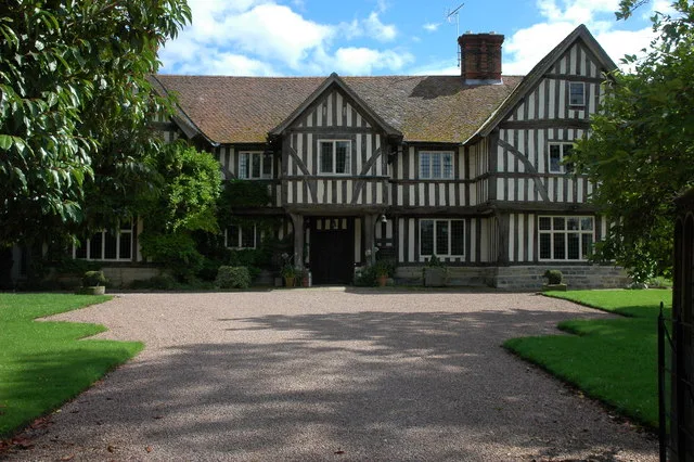
Ashleworth Manor
Stately homes · 1.3 km

The Great House
Historic houses · 1.4 km

Sandhurst Hill
Mountains & hills · 1.6 km
Norton Hill
Mountains & hills · 1.6 km

Wainlode Cliff
Natural landmarks · 1.7 km
Nearby
📷 5📷 5Mountains & hills · South West England
Barrow Hill
Barrow Hill — mountain in england west midlands. Elevation: 75 m.
📷 3Holy wells · South West England
Wall And Main Entrance Gates, Hasfield Court
Wall And Main Entrance Gates, Hasfield Court — wall in Hasfield, Tewkesbury, Gloucestershire, England, UK.
📷 4Gardens · South West England
Hasfield Court
Hasfield Court — a garden in england-west-midlands, United Kingdom.
📷 3Historic churches · South West England
Church of St Mary
Church of St Mary — church in Hasfield, Gloucestershire, England, UK.
📷 3Memorials & monuments · South West England
Monument To William Lane In The Churchyard Of The Church Of St Mary, Circa 9 Metres South West Of Tower
Monument To William Lane In The Churchyard Of The Church Of St Mary, Circa 9 Metres South West Of Tower — Grade II listed building-listed memorial in england-west-midlands, United Kingdom.
Where to eat & stay near Meerend Thicket and Ashleworth Ham
Places to stay
 📷 5
📷 5Campsites · South West England
The Red Lion Caravan and Camping Park
The Red Lion Caravan and Camping Park — a campsite in england west midlands.
 📷 5
📷 5Caravan parks · South West England
Fieldview Caravan Park
Fieldview Caravan Park — a caravan park in england west midlands.
 📷 5
📷 5Campsites · South West England
Court Farm Camping
Court Farm Camping — a campsite in england west midlands.
 📷 5
📷 5Hotels · South West England
Hatherley Manor Hotel
Hatherley Manor Hotel — a hotel in england west midlands.
 📷 5
📷 5Caravan parks · South West England
The Willows
The Willows — a caravan park in england west midlands.
 📷 5
📷 5Caravan parks · South West England
Mill Avon Holiday Park
Mill Avon Holiday Park — a caravan park in england west midlands.
Places to eat & drink
 📷 7
📷 7Restaurants · South West England
The Dark Barn
The Dark Barn — a restaurant in england west midlands. Cuisine: gastropub. 4-star.
📷 5Historic pubs · South West England
Lower Lode Hotel
Lower Lode Hotel in England South East, United Kingdom.
 📷 5
📷 5Historic pubs · South West England
Coach And Horses Inn
Coach And Horses Inn in England South East, United Kingdom.
 📷 6
📷 6Historic pubs · South West England
The Pelican Inn
The Pelican Inn in England South East, United Kingdom.
 📷 7
📷 7Historic pubs · South West England
Dick Whittington Tavern
Dick Whittington Tavern in England South East, United Kingdom.
 📷 5
📷 5More forests in this region
 📷 5
📷 5Forests & woodlands · South West England
Avebury Stone Circle
Avebury Stone Circle is a forest or woodland in the United Kingdom.
 📷 5
📷 5Forests & woodlands · South West England
Bowerchalke Downs SSSI
Bowerchalke Downs SSSI is a forest or woodland in the United Kingdom.
 📷 5
📷 5Forests & woodlands · South West England
Broadcroft Quarry Butterfly Reserve
Broadcroft Quarry Butterfly Reserve is a forest or woodland in the United Kingdom.
 📷 5
📷 5Forests & woodlands · South West England
Chickengrove Bottom SSSI
Chickengrove Bottom SSSI is a forest or woodland in the United Kingdom.
Frequently asked questions
- Where is Meerend Thicket and Ashleworth Ham?
- Meerend Thicket and Ashleworth Ham is in Gloucestershire, South-West England, United Kingdom (postcode GL19 4LD), in the parish of Ashleworth.
- What is Meerend Thicket and Ashleworth Ham?
- Meerend Thicket and Ashleworth Ham is a forest or woodland in the United Kingdom.
- How do I get to Meerend Thicket and Ashleworth Ham?
- The nearest railway station is Gloucester, about 7.9 km away. The nearest town is Sandhurst. Drivers can use postcode GL19 4LD.
- Is Meerend Thicket and Ashleworth Ham a protected site?
- Yes — Meerend Thicket and Ashleworth Ham is part of the Ashleworth Ham SSSI Site of Special Scientific Interest and the Cotswolds National Landscape (AONB).
- Is Meerend Thicket and Ashleworth Ham free to visit?
- Yes, Meerend Thicket and Ashleworth Ham is free to enter.
- How do I get to Meerend Thicket and Ashleworth Ham?
- The nearest railway station is Gloucester, about 7.9 km away. Drivers can navigate to postcode GL19 4LD.