
Vineyards · East Midlands
Medieval settlement on the north western slopes of Cales Dale, 490m north west of Cales Farm
In or near Youlgrave.
Medieval settlement on the north western slopes of Cales Dale, 490m north west of Cales Farm — a UK vineyard in england east midlands, producing English or Welsh wine from cool-climate grape varieties.

Philip Halling — CC BY-SA 2.0 via Wikimedia Commons licence

Plan your visit
- Typical visit
- 1 h–2 h
- Best time of year
- Late summer & autumn (Aug–Oct)
- Nearest railway station
- Rowsley South · 9.6 km
About
Medieval settlement on the north western slopes of Cales Dale, 490m north west of Cales Farm is one of Britain's growing number of vineyards, located in england east midlands. UK viticulture has expanded significantly since the 1980s, with English sparkling wines now winning international awards. Most British vineyards offer tours and tastings of their estate-grown wines. human settlement in Monyash, Derbyshire Dales, Derbyshire, England, UK
Photo gallery
Protected designations
- Site of Special Scientific Interest: Lathkill Dale SSSI
- National Nature Reserve: DERBYSHIRE DALES
Designations sourced from Natural England open data under OGL v3.
Place summary
A vineyard located on the north western slopes of Cales Dale, 490 metres north west of Cales Farm in the East Midlands. This site is characterised by its historical significance as a medieval settlement. Visitors can expect a rural setting with opportunities for wine tasting and vineyard tours, reflecting the region's agricultural heritage.
AI-generated from the structured facts on this page (operator, designation, listing, era). Not a substitute for visiting.
- Coordinates
- 53.1801, -1.7536
- County
- Derbyshire
- District
- Derbyshire Dales
- Parish
- Monyash
- Postcode
- DE45 1JS
- Parliamentary constituency
- Derbyshire Dales
- Nearest railway station
- Rowsley South — 9.6 km
Sources
- wikidata: Q17678374 (CC0)
Other places nearby

Water Icicle Close Cavern
Caves · 0.5 km

Cales Dale Cave (lower)
Caves · 1.0 km

Limey Way
Military museums · 1.0 km

Lathkill, Garden Path Entrance
Caves · 1.2 km

Lathkill, Top Entrance
Caves · 1.2 km

Lathkill Head Cave
Caves · 1.2 km
Lathkill Head Cave
Caves · 1.2 km
Critchlow Cave
Caves · 1.2 km
Ricklow Cave
Caves · 1.2 km
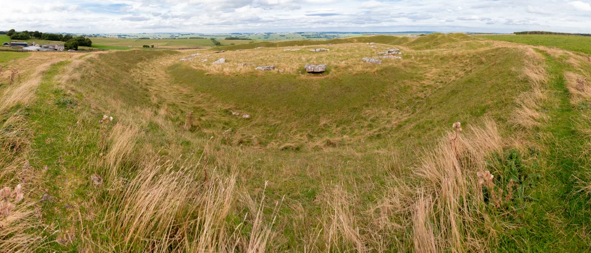
Arbor Low
Hill forts · 1.5 km

Haddon Grove Farm caravan and campsite
Campsites · 1.5 km
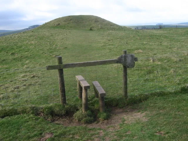
Gib Hill
Hill forts · 1.6 km
Nearby
📷 5Caves · East Midlands
Water Icicle Close Cavern
Water Icicle Close Cavern — a cave broad in england-east-midlands, United Kingdom.
📷 5Caves · East Midlands
Cales Dale Cave (lower)
Cales Dale Cave (lower) — a cave broad in england-east-midlands, United Kingdom.
📷 5📷 5Caves · East Midlands
Lathkill, Garden Path Entrance
Lathkill, Garden Path Entrance — a cave broad in england-east-midlands, United Kingdom.
📷 5Caves · East Midlands
Lathkill, Top Entrance
Lathkill, Top Entrance — a cave broad in england-east-midlands, United Kingdom.
📷 5Caves · East Midlands
Lathkill Head Cave
Lathkill Head Cave — a cave broad in england-east-midlands, United Kingdom.
Where to eat & stay near Medieval settlement on the north western slopes of Cales Dale, 490m north west of Cales Farm
Places to stay
📷 5Campsites · East Midlands
Haddon Grove Farm caravan and campsite
Haddon Grove Farm caravan and campsite — a campsite in england east midlands.
 📷 5
📷 5Campsites · East Midlands
Lathkill Dale Campsite
Lathkill Dale Campsite — a campsite in england east midlands.
 📷 5
📷 5Caravan parks · East Midlands
Newhaven Lodge Farm Caravan Site
Newhaven Lodge Farm Caravan Site — a caravan park in england east midlands.
 📷 5
📷 5Caravan parks · East Midlands
Peak View Caravan Site
Peak View Caravan Site — a caravan park in england east midlands.
 📷 5
📷 5B&Bs · East Midlands
Cotesfield Farm
Cotesfield Farm — a bed-and-breakfast in england east midlands.
 📷 5
📷 5Caravan parks · East Midlands
Brundcliffe Farm
Brundcliffe Farm — a caravan park in england east midlands.
Places to eat & drink
 📷 5
📷 5Historic pubs · East Midlands
The Square House
The Square House in England West Midlands, United Kingdom.
 📷 3
📷 3Historic pubs · East Midlands
Bull's Head Inn
Bull's Head Inn — Historic pub — listed building or notable heritage status.
 📷 5
📷 5 📷 5
📷 5 📷 5
📷 5Historic pubs · East Midlands
Duke of York Inn
Duke of York Inn in England East Midlands, United Kingdom.
 📷 7
📷 7Historic pubs · East Midlands
The Peacock Hotel
The Peacock Hotel in England East Midlands, United Kingdom.
More places in this region
 📷 5
📷 5Vineyards · East Midlands
Settlement site E of Uffington and Barnack Station
Settlement site E of Uffington and Barnack Station — a UK vineyard in england london, producing English or Welsh wine from cool-climate grape varieties.
 📷 5
📷 5Vineyards · East Midlands
Settlement site E of Greatford village
Settlement site E of Greatford village — a UK vineyard in england london, producing English or Welsh wine from cool-climate grape varieties.
 📷 4
📷 4Vineyards · East Midlands
Fleet settlement site near Lambert Drain
Fleet settlement site near Lambert Drain — a UK vineyard in england london, producing English or Welsh wine from cool-climate grape varieties.
 📷 5
📷 5Vineyards · East Midlands
Settlement site at Greatford
Settlement site at Greatford — a UK vineyard in england london, producing English or Welsh wine from cool-climate grape varieties.
Frequently asked questions
- Where is Medieval settlement on the north western slopes of Cales Dale, 490m north west of Cales Farm?
- Medieval settlement on the north western slopes of Cales Dale, 490m north west of Cales Farm is in Derbyshire, the East Midlands, United Kingdom (postcode DE45 1JS), in the parish of Monyash.
- What is Medieval settlement on the north western slopes of Cales Dale, 490m north west of Cales Farm?
- Medieval settlement on the north western slopes of Cales Dale, 490m north west of Cales Farm — a UK vineyard in england east midlands, producing English or Welsh wine from cool-climate grape varieties.
- How do I get to Medieval settlement on the north western slopes of Cales Dale, 490m north west of Cales Farm?
- The nearest railway station is Rowsley South, about 9.6 km away. Drivers can use postcode DE45 1JS.
- Is Medieval settlement on the north western slopes of Cales Dale, 490m north west of Cales Farm a protected site?
- Yes — Medieval settlement on the north western slopes of Cales Dale, 490m north west of Cales Farm is part of the Lathkill Dale SSSI Site of Special Scientific Interest and the DERBYSHIRE DALES National Nature Reserve.
- How do I get to Medieval settlement on the north western slopes of Cales Dale, 490m north west of Cales Farm?
- Drivers can navigate to postcode DE45 1JS. It sits within the Derbyshire Dales parliamentary constituency.