
Archaeological sites · West Midlands
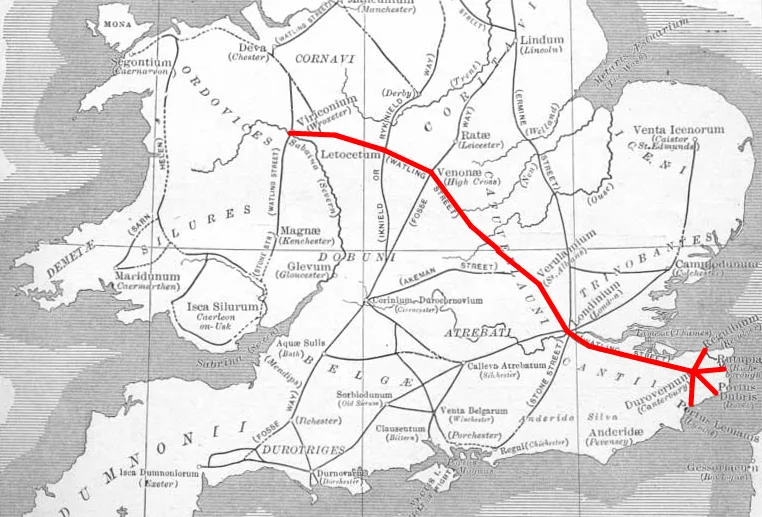
Manduvessedum Roman Station
In or near Merevale.
Manduvessedum Roman Station — an archaeological site in West Midlands, United Kingdom.

Mat Fascione — CC BY-SA 2.0 via Wikimedia Commons licence

Plan your visit
- Typical visit
- 45 min–1.5 h
- Nearest railway station
- Atherstone · 2.8 km
- Free entry
- Dog-friendly
About
Manduvessedum Roman Station is an archaeological site located in West Midlands, United Kingdom. Sourced from OpenStreetMap (ODbL licence); see local listings for visitor information, opening hours and admission details.
Photo gallery
Place summary
Manduvessedum Roman Station is an archaeological site located in the West Midlands. This site represents the remnants of a Roman fort and settlement, significant for its historical context within Roman Britain.
AI-generated from the structured facts on this page (operator, designation, listing, era). Not a substitute for visiting.
- Coordinates
- 52.5688, -1.5145
- County
- Warwickshire
- District
- North Warwickshire
- Parish
- Mancetter
- Postcode
- CV9 1RE
- Parliamentary constituency
- North Warwickshire and Bedworth
- Nearest railway station
- Atherstone — 2.8 km
Sources
- osm: node/4729253315 (ODbL)
Other places nearby

The Old House
B&Bs · 0.3 km

Witherley Village Sign
Public art & sculpture · 0.6 km

Church of St Peter
Historic churches · 0.7 km
Blue Lion
Historic pubs · 0.7 km

Witherley
Villages · 0.9 km

Mancetter
Villages · 0.9 km
Manduessedum
Hill forts · 1.0 km

Mancetter Roman Fort
Archaeological sites · 1.0 km

Bridge 33 At Sp 3257 9529 Coventry Canal
Historic bridges · 1.7 km

Bridge 37 Rawnhill Bridge At Sp 3120 9692 Coventry Canal
Historic bridges · 1.8 km

George Fox Monument
Memorials & monuments · 2.0 km

Bridge 30 Grange Road Bridge At Sp 3317 9489 Coventry Canal
Historic bridges · 2.0 km
Nearby
📷 7📷 3Public art & sculpture · East Midlands
Witherley Village Sign
Witherley Village Sign — a public art in East Midlands, United Kingdom.
📷 3Historic churches · East Midlands
Church of St Peter
Church of St Peter — church in Witherley, Leicestershire, England, UK.
📷 3Historic pubs · East Midlands
Blue Lion
Blue Lion — Historic pub — listed building or notable heritage status.
📷 5📷 5Where to eat & stay near Manduvessedum Roman Station
Places to stay
📷 7 📷 5
Caravan parks · East Midlands
Atherstone Stables
Atherstone Stables — a caravan park in england west midlands.
 📷 5
Campsites · East Midlands
Etties Field
Etties Field — a campsite in england west midlands.
 📷 5
Caravan parks · East Midlands
Upton Barn Caravan and Camping site
Upton Barn Caravan and Camping site — a caravan park in england west midlands.
 📷 5
Hostels · West Midlands
Manor Court Care Home
Manor Court Care Home — a hostel in england west midlands.
 📷 5
Caravan parks · West Midlands
Griff Caravan Site
Griff Caravan Site — a caravan park in england west midlands.
Places to eat & drink
📷 3Historic pubs · East Midlands
Blue Lion
Blue Lion — Historic pub — listed building or notable heritage status.
 📷 3
Historic pubs · West Midlands
The Old Swan
The Old Swan — Historic pub — listed building or notable heritage status.
 📷 3
Historic pubs · West Midlands
Market Tavern
Market Tavern — Historic pub — listed building or notable heritage status.
 📷 3
Historic pubs · West Midlands
New Swan Inn
New Swan Inn — Historic pub — listed building or notable heritage status.
 📷 3
Historic pubs · West Midlands
The Bull
The Bull — Historic pub — listed building or notable heritage status.
 📷 3
Historic pubs · West Midlands
Bird in Hand
Bird in Hand — Historic pub — listed building or notable heritage status.
More archaeological sites in this region
 📷 3
Archaeological sites · West Midlands
Queen Stone
Queen Stone — an archaeological site in West Midlands, United Kingdom.
 📷 3
Archaeological sites · West Midlands
Wetton Hill (West)
Wetton Hill (West) — an archaeological site in West Midlands, United Kingdom.
 📷 3
Archaeological sites · West Midlands
Oakedge Hall
Oakedge Hall — an archaeological site in West Midlands, United Kingdom.
 📷 3
Archaeological sites · West Midlands
Hales Roman Villa
Hales Roman Villa — archaeological site in Loggerheads, Newcastle-under-Lyme, England, UK.
Frequently asked questions
- Where is Manduvessedum Roman Station?
- Manduvessedum Roman Station is in Warwickshire, the West Midlands, United Kingdom (postcode CV9 1RE), in the parish of Mancetter.
- What is Manduvessedum Roman Station?
- Manduvessedum Roman Station — an archaeological site in West Midlands, United Kingdom.
- How do I get to Manduvessedum Roman Station?
- The nearest railway station is Atherstone, about 2.8 km away. The nearest town is Merevale. Drivers can use postcode CV9 1RE.
- Is Manduvessedum Roman Station free to visit?
- Yes, Manduvessedum Roman Station is free to enter.
- How do I get to Manduvessedum Roman Station?
- The nearest railway station is Atherstone, about 2.8 km away. Drivers can navigate to postcode CV9 1RE.