
Towns & cities · East of England
Lyng
Lyng — village and civil parish in the English county of Norfolk.

Wikimedia Commons contributors — see linked file page for photographer and licence licence

Plan your visit
- Typical visit
- 3 h–6 h
- Nearest railway station
- Dereham · 8.8 km
- Free entry
- Family-friendly
- Dog-friendly
Getting there & planning your visit
To visit Lyng, the nearest railway station is Dereham, located 8.8 km away. Entry to the town is free.
About
Lyng is a town, city, village or settlement in the United Kingdom. It covers approximately 8 km². Recent population estimates put it at around 806 people. Address: NR9. Wikidata describes it as: "village and civil parish in the English county of Norfolk". Coordinates: 52.7192°, 1.0600°.
Photo gallery
Protected designations
- Site of Special Scientific Interest: River Wensum SSSI
- Area of Outstanding Natural Beauty: Norfolk Coast
Designations sourced from Natural England open data under OGL v3.
From the Wikipedia article
Lyng is a village and civil parish in the English county of Norfolk. It is situated on the River Wensum, some 10 km (6.2 mi) north-east of the town of East Dereham and 20 km (12 mi) north-west of the city of Norwich. The civil parish has an area of 7.99 km2 (3.08 sq mi) and in the 2021 census had a population of 860 people in 360 separate households (in the 2011 census had a population of 807 in 356 households). For the purposes of local government, the parish falls within the Elmham and Mattishall division of Norfolk County Council and the Upper Wensum ward of Breckland District Council.
Excerpt from Wikipedia under CC BY-SA 4.0. See the source article linked in Sources below.
Background
History
The village's name is likely derived from the Old English word 'hlinc', meaning 'bank', 'ledge', or 'terrace', possibly deriving from a river terrace. Human activity in the Lyng area dates back to the Paleolithic period, with two flint handaxes from the period found in a gravel pit there in the 1960s. In 1916, archaeologists observed a probable Mesolithic flint working site. Evidence of activity in the Early Bronze Age has been found, but there is currently no sign of Iron Age activity in the area. There is significant evidence of a Roman presence in the area, including a pottery kiln in the east of the parish as well as coins, pottery fragments, brooches, and a copper alloy votive hammer.…
Sourced from Wikipedia under CC BY-SA 4.0.
- Coordinates
- 52.7192, 1.0600
- County
- Norfolk
- District
- Breckland
- Parish
- Lyng
- Postcode
- NR9
- Parliamentary constituency
- Mid Norfolk
- Population
- 806
- Nearest railway station
- Dereham — 8.8 km
Sources
- wikidata: Q1886041 (CC0)
- wikipedia: Lyng, Norfolk (CC BY-SA 4.0)
- commons: Lyng pub.JPG (CC BY-SA 4.0)
Other places nearby

Lyng Village Sign
Public art & sculpture · 0.3 km

Utopia Paradise
Campsites · 0.3 km

Weir Bridge
Historic bridges · 0.4 km

Lyng
Villages · 0.5 km

Sparham Pools Nature Reserve
Forests & woodlands · 0.7 km

St Edmund's Chapel
Chapels · 1.3 km
Saint Edmund's Chapel
Historic houses · 1.3 km

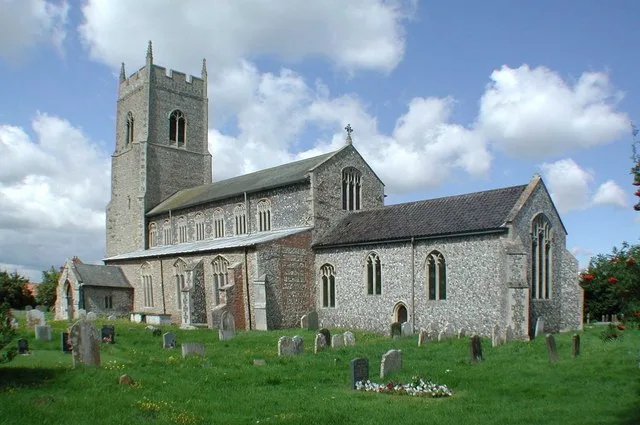
Elsing
Villages · 1.7 km
Sparham
Towns & cities · 1.8 km

Elsing War Memorial
Memorials & monuments · 2.1 km
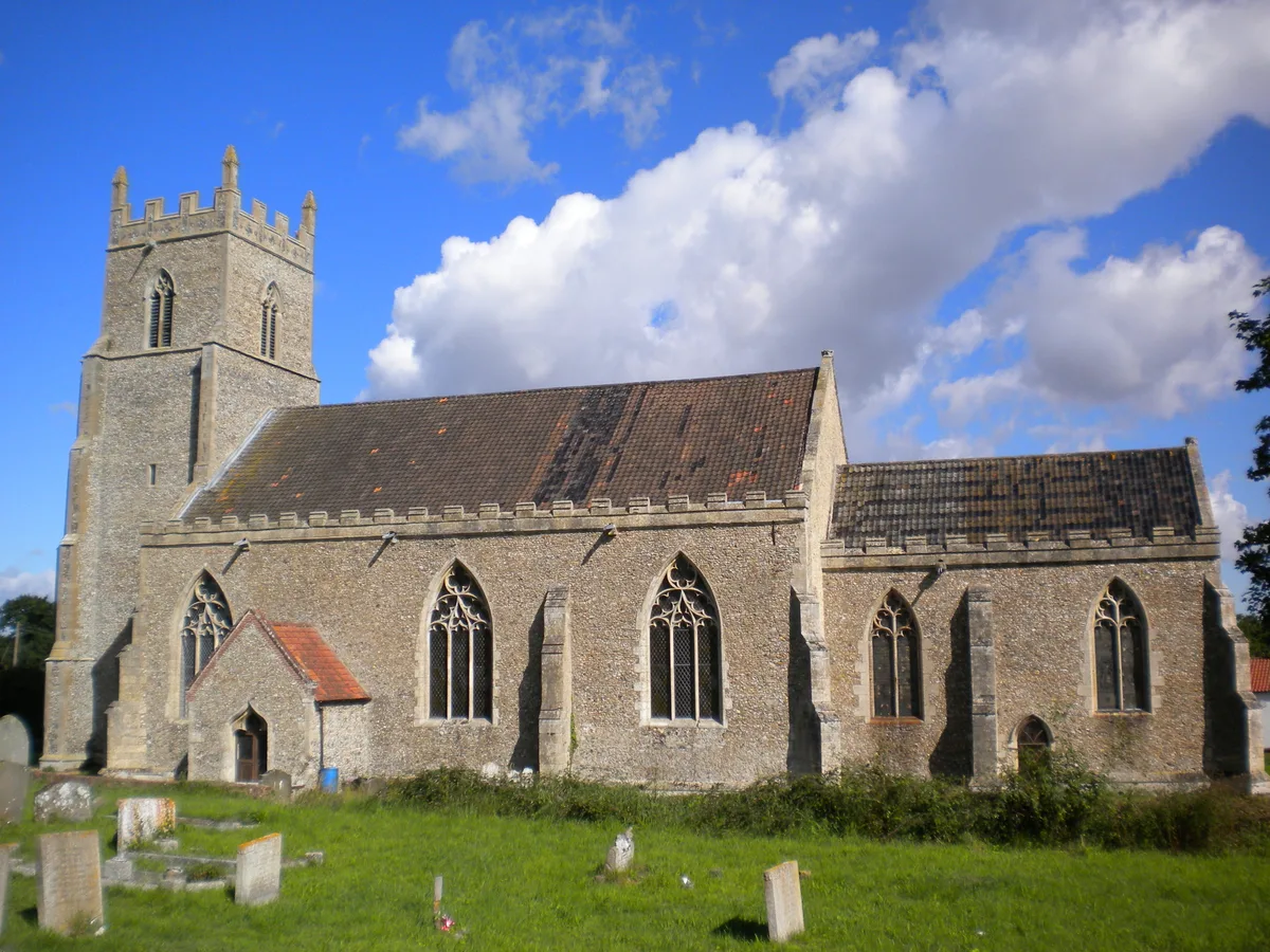
St Mary's Church, Elsing
Historic churches · 2.1 km

Elsing Village Sign
Public art & sculpture · 2.1 km
Lyng is a village in Norfolk, located in the East Midlands, with a population of 806. Our guide lists nearby attractions within reach.
At a glance
- Population
- 806
- Administrative county
- Norfolk
- Constituency
- Mid Norfolk
- Top categories near here
Things to see in Lyng
12 attractions within 12 km. Full guide: things to do in Lyng →
📷 3Forests & woodlands · East of England
Sparham Pools Nature Reserve
Sparham Pools Nature Reserve is a forest or woodland in the United Kingdom.
📷 2Chapels · East of England
St Edmund's Chapel
St Edmund's Chapel — ruinous chapel in Lyng, Breckland, Norfolk, England, UK.
📷 5Historic churches · East of England
St Mary's Church, Elsing
St Mary's Church, Elsing — Grade I listed church in Elsing, Breckland, Norfolk, England, UK.
📷 2Historic houses · East of England
Saint Edmund's Chapel
Saint Edmund's Chapel — a historic house in england-east-midlands, United Kingdom.
📷 3Historic bridges · East of England
Weir Bridge
Weir Bridge — Grade II listed building-listed bridge in england-east-midlands, United Kingdom.
📷 3Memorials & monuments · East of England
Elsing War Memorial
Elsing War Memorial — Grade II listed building-listed memorial in england-east-midlands, United Kingdom.
📷 3Public art & sculpture · East of England
Elsing Village Sign
Elsing Village Sign — a public art in england-east-midlands, United Kingdom.
📷 3Public art & sculpture · East of England
Lyng Village Sign
Lyng Village Sign — a public art in england-east-midlands, United Kingdom.
📷 5 📷 5
📷 5Campsites · East of England
Get Away Hide Away
Get Away Hide Away — a campsite in england east midlands.
📷 5📷 5Nearby
📷 3Public art & sculpture · East of England
Lyng Village Sign
Lyng Village Sign — a public art in england-east-midlands, United Kingdom.
📷 5📷 3Historic bridges · East of England
Weir Bridge
Weir Bridge — Grade II listed building-listed bridge in england-east-midlands, United Kingdom.
📷 5📷 3Forests & woodlands · East of England
Sparham Pools Nature Reserve
Sparham Pools Nature Reserve is a forest or woodland in the United Kingdom.
📷 2Chapels · East of England
St Edmund's Chapel
St Edmund's Chapel — ruinous chapel in Lyng, Breckland, Norfolk, England, UK.
Where to eat & stay near Lyng
Places to stay
📷 5📷 5Campsites · East of England
Get Away Hide Away
Get Away Hide Away — a campsite in england east midlands.
 📷 3
📷 3Campsites · East of England
Park Farm Camping
Park Farm Camping — a campsite in england east midlands.
 📷 5
📷 5Campsites · East of England
Whitwell and Reepham Railway Camping
Whitwell and Reepham Railway Camping — a campsite in england east midlands.
 📷 5
📷 5 📷 5
📷 5Places to eat & drink
 📷 5
📷 5 📷 5
📷 5Historic pubs · East of England
The Marlpit Public House
The Marlpit Public House in England East, United Kingdom.
 📷 5
📷 5Historic pubs · East of England
Buckinghamshire Arms Public House
Buckinghamshire Arms Public House in England East, United Kingdom.
 📷 5
📷 5Historic pubs · East of England
Green Dragon Public House
Green Dragon Public House in England East, United Kingdom.
 📷 5
📷 5 📷 5
📷 5Historic pubs · East of England
Gibraltar Gardens
Gibraltar Gardens in England East, United Kingdom.
More towns in this region
 Flagship📷 10
 Flagship📷 10
Towns & cities · East of England
Cambridge
Cambridge — city in Cambridgeshire, England.
 Flagship📷 10
Towns & cities · East of England
Chelmsford
Chelmsford — city in Essex, United Kingdom.
 Flagship📷 10
Towns & cities · East of England
Colney Heath
Colney Heath — village and civil parish in St Albans, Hertfordshire, England, UK.
Frequently asked questions
- Where is Lyng?
- Lyng is in Norfolk, the East Midlands, United Kingdom (postcode NR9), in the parish of Lyng.
- What is Lyng?
- Lyng — village and civil parish in the English county of Norfolk.
- How do I get to Lyng?
- The nearest railway station is Dereham, about 8.8 km away. Drivers can use postcode NR9.
- Is Lyng a protected site?
- Yes — Lyng is part of the River Wensum SSSI Site of Special Scientific Interest and the Norfolk Coast National Landscape (AONB).
- Is Lyng free to visit?
- Yes, Lyng is free to enter.
- How do I get to Lyng?
- Drivers can navigate to postcode NR9. It sits within the Mid Norfolk parliamentary constituency.