
Natural landmarks · Scottish Lowlands
Loch o' th' Lowes
In or near Auchinleck.
Loch o' th' Lowes — lake in New Cumnock, East Ayrshire, Scotland, UK, outflows south via a watercourse to River Nith.

Wikimedia Commons contributors — see linked file page for photographer and licence licence

Plan your visit
- Typical visit
- 1 h–2 h
- Nearest railway station
- New Cumnock · 1.7 km
- Free entry
- Dog-friendly
About
Loch o' th' Lowes is a named natural landmark in the United Kingdom. Wikidata describes it as: "lake in New Cumnock, East Ayrshire, Scotland, UK, outflows south via a watercourse to River Nith". Coordinates: 55.4048°, -4.2097°.
Photo gallery
From the Wikipedia article
The Loch o' th' Lowes, also called Lochside Loch or Meikle Creoch Loch, is a small freshwater loch near New Cumnock in East Ayrshire, Scotland. It is one of three linked lochs, the others being Creoch Loch and Black Loch. The name means "loch of the lochs", lowes being an obsolete plural of the word loch.
Excerpt from Wikipedia under CC BY-SA 4.0. See the source article linked in Sources below.
Background
Description
McMichael records that in wet weather the three lochs combined as one, and suggests that until the trap dyke on the River Nith below Corsancone Hill wore down, the loch covered the whole area as far as the watershed at Sannock Hill and had a shape and surface area similar to Loch Doon. The name Lochside is derived from the shooting lodge, now a hotel (2011), built by the Marquis of Bute. The "Runner" is a deep and broad ditch that was dug many years back to link the three lochs of Lowes, Black, and Creoch. The 19th century OS maps indicated two islets, one small and close to the southern lochshore and the other larger and near the western lochshore.
Sourced from Wikipedia under CC BY-SA 4.0.
- Coordinates
- 55.4048, -4.2097
- District
- East Ayrshire
- Postcode
- KA18 4QE
- Parliamentary constituency
- Ayr, Carrick and Cumnock
- Nearest railway station
- New Cumnock — 1.7 km
Sources
- wikidata: Q6665026 (CC0)
- wikipedia: Loch o' th' Lowes (New Cumnock) (CC BY-SA 4.0)
- commons: Loch o' th' Lowes - geograph.org.uk - 1227886.jpg (CC BY-SA 4.0)
Other places nearby
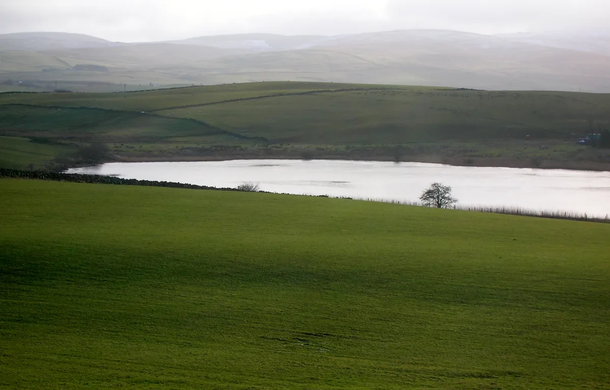
Creoch Loch
Natural landmarks · 0.7 km

Cumnock Castle
Literary houses · 1.7 km

New Cumnock Old Church
Historic churches · 1.7 km

Nith Bridge
Historic bridges · 1.7 km

Lanemark Collieries Boigside No2
Archaeological sites · 1.8 km

New Cumnock Mine Workers Memorial
Memorials & monuments · 1.8 km
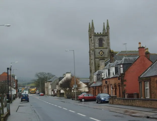
Martyrs Parish Church
Historic churches · 1.9 km

New Cumnock
Villages · 1.9 km

Black Loch
Natural landmarks · 2.0 km

Colliery
Archaeological sites · 2.2 km

Old Colliery
Archaeological sites · 2.5 km

Knockshinnoch Mining Disaster Memorial
Memorials & monuments · 2.5 km
Nearby
📷 5Natural landmarks · Scottish Lowlands
Creoch Loch
Creoch Loch — lake in East Ayrshire, Scotland, UK, outflows south via a watercourse to Loch o' th' Lowes.
📷 5Literary houses · Scottish Lowlands
Cumnock Castle
Cumnock Castle — a literary house museum in scotland lowlands.
📷 5Historic churches · Scottish Lowlands
New Cumnock Old Church
New Cumnock Old Church — category B listed building-listed church in scotland-lowlands, United Kingdom.
📷 5Historic bridges · Scottish Lowlands
Nith Bridge
Nith Bridge — category B listed building-listed bridge in scotland-lowlands, United Kingdom.
📷 5Archaeological sites · Scottish Lowlands
Lanemark Collieries Boigside No2
Lanemark Collieries Boigside No2 — an archaeological site in Scottish Lowlands, United Kingdom.
📷 3Memorials & monuments · Scottish Lowlands
New Cumnock Mine Workers Memorial
New Cumnock Mine Workers Memorial — a memorial in Scottish Lowlands, United Kingdom.
Where to eat & stay near Loch o' th' Lowes
Places to stay
 📷 5
📷 5Campsites · Scottish Lowlands
Catrine House Caravan and Camping
Catrine House Caravan and Camping — a campsite in scotland lowlands.
 📷 5
📷 5Caravan parks · Scottish Lowlands
Loch Doon Caravan Park
Loch Doon Caravan Park — a caravan park in scotland lowlands.
 📷 5
📷 5Caravan parks · Scottish Lowlands
Sundrum Castle Holiday Park
Sundrum Castle Holiday Park — a caravan park in scotland lowlands. Brand: Parkdean Resorts.
 📷 5
📷 5Caravan parks · Scottish Lowlands
Crofthead Holiday Park
Crofthead Holiday Park — a caravan park in scotland lowlands.
 📷 5
📷 5Campsites · Scottish Lowlands
Informal campsite- no facilities
Informal campsite- no facilities — a campsite in scotland lowlands.
Places to eat & drink
 📷 5
📷 5Historic pubs · Scottish Lowlands
The Sun Inn, 23 The Square, Cumnock
The Sun Inn, 23 The Square, Cumnock in Scotland Lowlands, United Kingdom.
 📷 7
📷 7Historic pubs · Scottish Lowlands
Commercial Inn, 1-3 Mill Street, Ochiltree
Commercial Inn, 1-3 Mill Street, Ochiltree in Scotland Lowlands, United Kingdom.
 📷 7
📷 7Historic pubs · Scottish Lowlands
Queensberry Arms Hotel
Queensberry Arms Hotel in Scotland Lowlands, United Kingdom.
 📷 5
📷 5Historic pubs · Scottish Lowlands
Doon Tavern, High Street, Dalmellington
Doon Tavern, High Street, Dalmellington in Scotland Lowlands, United Kingdom.
 📷 5
📷 5Historic pubs · Scottish Lowlands
Loudoun Arms, 69 Main Street, Newmilns
Loudoun Arms, 69 Main Street, Newmilns in Scotland Central, United Kingdom.
More natural landmarks in this region
 📷 5
📷 5Natural landmarks · Scottish Lowlands
Birkenside
Birkenside in England North East, United Kingdom.
 📷 4
📷 4Natural landmarks · Scottish Lowlands
River Teviot
River Teviot in England North East, United Kingdom.
 📷 5
📷 5Natural landmarks · Scottish Lowlands
River Leader
River Leader in England North East, United Kingdom.
 📷 4
📷 4Natural landmarks · Scottish Lowlands
Makerstoun
Makerstoun in England North East, United Kingdom.
Frequently asked questions
- Where is Loch o' th' Lowes?
- Loch o' th' Lowes is in the Scottish Lowlands, United Kingdom (postcode KA18 4QE).
- What is Loch o' th' Lowes?
- Loch o' th' Lowes — lake in New Cumnock, East Ayrshire, Scotland, UK, outflows south via a watercourse to River Nith.
- How do I get to Loch o' th' Lowes?
- The nearest railway station is New Cumnock, about 1.7 km away. The nearest town is Auchinleck. Drivers can use postcode KA18 4QE.
- Is Loch o' th' Lowes free to visit?
- Yes, Loch o' th' Lowes is free to enter.
- How do I get to Loch o' th' Lowes?
- The nearest railway station is New Cumnock, about 1.7 km away. Drivers can navigate to postcode KA18 4QE.