
Natural landmarks · Scottish Lowlands
Black Loch
In or near Auchinleck.
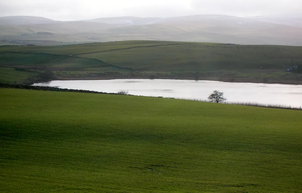
Black Loch — lake in New Cumnock, East Ayrshire, Scotland, UK, outflows south va a watercourse to Loch Creoch.

Wikimedia Commons licence
Plan your visit
- Typical visit
- 1 h–2 h
- Nearest railway station
- New Cumnock · 3.4 km
- Free entry
- Dog-friendly
Getting there & planning your visit
To visit Black Loch, the nearest railway station is New Cumnock, located 3.4 km away. The postcode for navigation is KA18 4PL, and entry to the site is free.
About
Black Loch is a named natural landmark in the United Kingdom. Wikidata describes it as: "lake in New Cumnock, East Ayrshire, Scotland, UK, outflows south va a watercourse to Loch Creoch". Coordinates: 55.4196°, -4.2282°.
Photo gallery
From the Wikipedia article
Black Loch (NS 59057 161720) is a freshwater loch, named from its dark waters, situated in the East Ayrshire Council Area of Scotland, between Cumnock and New Cumnock, lying in a glacial Kettle Hole mainly within the Parish of New Cumnock, with a small portion protruding into Old Cumnock Parish. It is said to be one of only two lochs or lakes in the world that have outflows running to two separate destinations. The 'Runner' is a deep and broad ditch that was dug many years ago to link the three lochs of Lowes, Black, and Creoch.
Excerpt from Wikipedia under CC BY-SA 4.0. See the source article linked in Sources below.
Background
Description
The Black Loch, just over 400 metres long, is the deepest of three linked lochs within the Parish of New Cumnock. It is unusual in that its northerly outflow is into the Glaisnock Water, flowing into the Lugar Water and the River Ayr, finally emptying into the Firth of Clyde, while the southerly outflow runs into the River Nith and thence into the Solway Firth.
Sourced from Wikipedia under CC BY-SA 4.0.
- Coordinates
- 55.4196, -4.2282
- District
- East Ayrshire
- Postcode
- KA18 4PL
- Parliamentary constituency
- Ayr, Carrick and Cumnock
- Nearest railway station
- New Cumnock — 3.4 km
Sources
- wikidata: Q4921202 (CC0)
- wikipedia: Black Loch (New Cumnock) (CC BY-SA 4.0)
Other places nearby

Borland Castle
Literary houses · 1.3 km
Creoch Loch
Natural landmarks · 1.3 km
Loch o' th' Lowes
Natural landmarks · 2.0 km

Coalburn Colliery
Archaeological sites · 2.4 km

Avisyard Hill
Mountains & hills · 2.6 km
Crosshill Coal Pit
Archaeological sites · 2.9 km

Lanemark Collieries Boigside No2
Archaeological sites · 3.2 km

Stonepark Monument
Memorials & monuments · 3.2 km

Nith Bridge
Historic bridges · 3.5 km

Cumnock Castle
Literary houses · 3.6 km

New Cumnock Old Church
Historic churches · 3.6 km

New Cumnock Mine Workers Memorial
Memorials & monuments · 3.7 km
Nearby
📷 5Literary houses · Scottish Lowlands
Borland Castle
Borland Castle — a literary house museum in scotland lowlands.
📷 5Natural landmarks · Scottish Lowlands
Creoch Loch
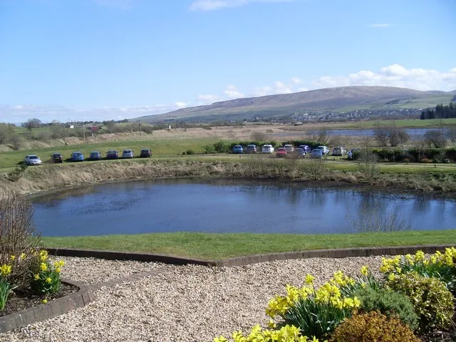
Creoch Loch — lake in East Ayrshire, Scotland, UK, outflows south via a watercourse to Loch o' th' Lowes.
📷 3Natural landmarks · Scottish Lowlands
Loch o' th' Lowes
Loch o' th' Lowes — lake in New Cumnock, East Ayrshire, Scotland, UK, outflows south via a watercourse to River Nith.
📷 3Archaeological sites · Scottish Lowlands
Coalburn Colliery
Coalburn Colliery — an archaeological site in Scottish Lowlands, United Kingdom.
📷 5Mountains & hills · Scottish Lowlands
Avisyard Hill
Avisyard Hill — a hill or mountain in scotland lowlands.
📷 5Archaeological sites · Scottish Lowlands
Crosshill Coal Pit
Crosshill Coal Pit — an archaeological site in Scottish Lowlands, United Kingdom.
Where to eat & stay near Black Loch
Places to stay
 📷 5
📷 5Campsites · Scottish Lowlands
Catrine House Caravan and Camping
Catrine House Caravan and Camping — a campsite in scotland lowlands.
 📷 5
📷 5Caravan parks · Scottish Lowlands
Sundrum Castle Holiday Park
Sundrum Castle Holiday Park — a caravan park in scotland lowlands. Brand: Parkdean Resorts.
 📷 5
📷 5Caravan parks · Scottish Lowlands
Loch Doon Caravan Park
Loch Doon Caravan Park — a caravan park in scotland lowlands.
 📷 5
📷 5Caravan parks · Scottish Lowlands
Crofthead Holiday Park
Crofthead Holiday Park — a caravan park in scotland lowlands.
 📷 5
📷 5Caravan parks · Scottish Lowlands
Ayr Cragie Gardens Caravan Club
Ayr Cragie Gardens Caravan Club — a caravan park in scotland lowlands.
Places to eat & drink
 📷 5
📷 5Historic pubs · Scottish Lowlands
The Sun Inn, 23 The Square, Cumnock
The Sun Inn, 23 The Square, Cumnock in Scotland Lowlands, United Kingdom.
 📷 7
📷 7Historic pubs · Scottish Lowlands
Commercial Inn, 1-3 Mill Street, Ochiltree
Commercial Inn, 1-3 Mill Street, Ochiltree in Scotland Lowlands, United Kingdom.
 📷 7
📷 7Historic pubs · Scottish Lowlands
Queensberry Arms Hotel
Queensberry Arms Hotel in Scotland Lowlands, United Kingdom.
 📷 5
📷 5Historic pubs · Scottish Lowlands
Doon Tavern, High Street, Dalmellington
Doon Tavern, High Street, Dalmellington in Scotland Lowlands, United Kingdom.
 📷 5
📷 5Historic pubs · Scottish Lowlands
Loudoun Arms, 69 Main Street, Newmilns
Loudoun Arms, 69 Main Street, Newmilns in Scotland Central, United Kingdom.
More natural landmarks in this region
 📷 5
📷 5Natural landmarks · Scottish Lowlands
Birkenside
Birkenside in England North East, United Kingdom.
 📷 4
📷 4Natural landmarks · Scottish Lowlands
River Teviot
River Teviot in England North East, United Kingdom.
 📷 5
📷 5Natural landmarks · Scottish Lowlands
River Leader
River Leader in England North East, United Kingdom.
 📷 4
📷 4Natural landmarks · Scottish Lowlands
Makerstoun
Makerstoun in England North East, United Kingdom.
Frequently asked questions
- Where is Black Loch?
- Black Loch is in the Scottish Lowlands, United Kingdom (postcode KA18 4PL).
- What is Black Loch?
- Black Loch — lake in New Cumnock, East Ayrshire, Scotland, UK, outflows south va a watercourse to Loch Creoch.
- How do I get to Black Loch?
- The nearest railway station is New Cumnock, about 3.4 km away. The nearest town is Auchinleck. Drivers can use postcode KA18 4PL.
- Is Black Loch free to visit?
- Yes, Black Loch is free to enter.
- How do I get to Black Loch?
- The nearest railway station is New Cumnock, about 3.4 km away. Drivers can navigate to postcode KA18 4PL.