Natural landmarks · North Wales
Llwytmor
In or near Beaumaris.
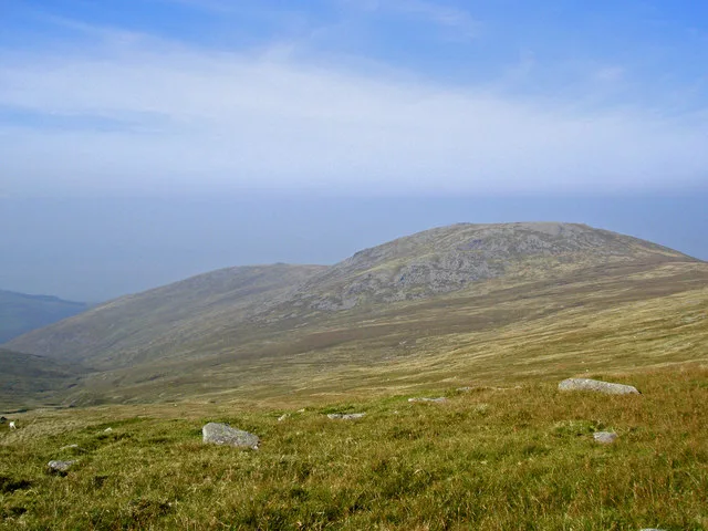
Llwytmor — mountain (849m) in Gwynedd.

Wikimedia Commons contributors — see linked file page for photographer and licence licence
Plan your visit
- Typical visit
- 1 h–2 h
- Nearest railway station
- Llanfairfechan · 5.9 km
- Free entry
- Dog-friendly
Getting there & planning your visit
To visit Llwytmor in North Wales, the nearest railway station is Llanfairfechan, located 5.9 km away. Entry to the site is free.
About
Llwytmor is a named natural landmark in the United Kingdom. Wikidata describes it as: "mountain (849m) in Gwynedd". Coordinates: 53.2046°, -3.9650°.
Photo gallery
From the Wikipedia article
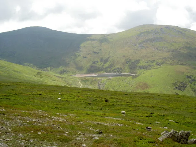
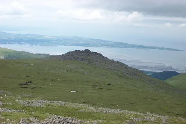
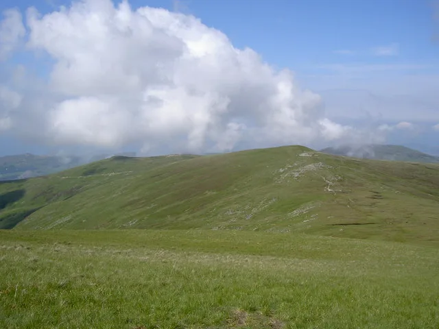
Llwytmor is a satellite peak of Foel-fras, and forms a part of the Carneddau range. The summit is 849 metres (2,785 ft) above sea level and it contains a series of boulderfields, a shelter and several cairns. It is the 27th highest peak in Wales. In editions of OS Maps published into the 1960’s it was called Llwydmor (Llwyd is the Welsh word for grey) and it is likely that the later substitution of ‘t’ for ‘d’ is a typographical error. On a fine day to the north, the summit offers extensive views towards the Menai Strait, Anglesey and on exceptionally clear days the Isle of Man across the Irish Sea can be seen. The Lake District in England and the Wicklow Mountains in Ireland are also visible on clear days. Carneddau mountain ponies graze on the mountain throughout the year. Its full name Llwytmor Uchaf means "upper big (derived from the Welsh word “mawr”) (&) grey". It has a subsidiary summit, Llwytmor Bach (690 metres, 2264 feet), to the North West of Llwytmor summit itself, offers sweeping views into the Cwm Coch, Aber Falls and Afon Anafon valleys below. The summit of Llwytmor Bach also contains a small enclosed refuge shelter, which provides much more protection from poor weather than a standard summit shelter.
Excerpt from Wikipedia under CC BY-SA 4.0. See the source article linked in Sources below.
- Coordinates
- 53.2046, -3.9650
- Address
- Snowdonia, Wales
- Nearest railway station
- Llanfairfechan — 5.9 km
Sources
- wikidata: Q6662922 (CC0)
- wikipedia: Llwytmor (CC BY-SA 4.0)
- commons: Llwytmor and Llwytmor Bach - geograph.org.uk - 981209.jpg (CC BY-SA 4.0)
Other places nearby
Llwytmor
Mountains & hills · 0.1 km

Llwytmor Bach (Llwydmor Bach)
Mountains & hills · 1.1 km
Foel Fras
Mountains & hills · 1.4 km

Foel-fras
Mountains & hills · 1.4 km
Bera Mawr
Mountains & hills · 1.7 km

Drum
Natural landmarks · 2.0 km
Drum
Mountains & hills · 2.0 km

Yr Aryg
Mountains & hills · 2.1 km

Pen Bryn-du
Mountains & hills · 2.1 km

Aber Falls
Historic bridges · 2.1 km

Y Rhaeadr Fawr
Natural landmarks · 2.1 km

Y Rhaeadr Fawr
Waterfalls · 2.1 km
Nearby
📷 3📷 5Mountains & hills · North Wales
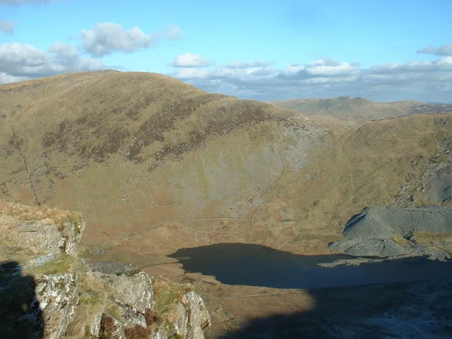
Llwytmor Bach (Llwydmor Bach)
Llwytmor Bach (Llwydmor Bach) — mountain in wales north. Elevation: 690 m.
📷 3📷 5📷 3📷 3Where to eat & stay near Llwytmor
Places to stay
 📷 5
📷 5 📷 5
📷 5 📷 5
📷 5 📷 5
📷 5 📷 5
📷 5Campsites · North Wales
Ogwen Bank Holiday Park & Country Club
Ogwen Bank Holiday Park & Country Club — a campsite in wales north.
 📷 5
📷 5Places to eat & drink
 📷 7
📷 7Restaurants · North Wales
Tafarn Tryfan
Tafarn Tryfan — a restaurant in wales north.
 📷 7
📷 7 📷 7
📷 7 📷 5
📷 5Historic pubs · North Wales
The George and Dragon
The George and Dragon — Historic pub — listed building or notable heritage status.
 📷 7📷 7
More natural landmarks in this region
 Flagship📷 5
Natural landmarks · North Wales
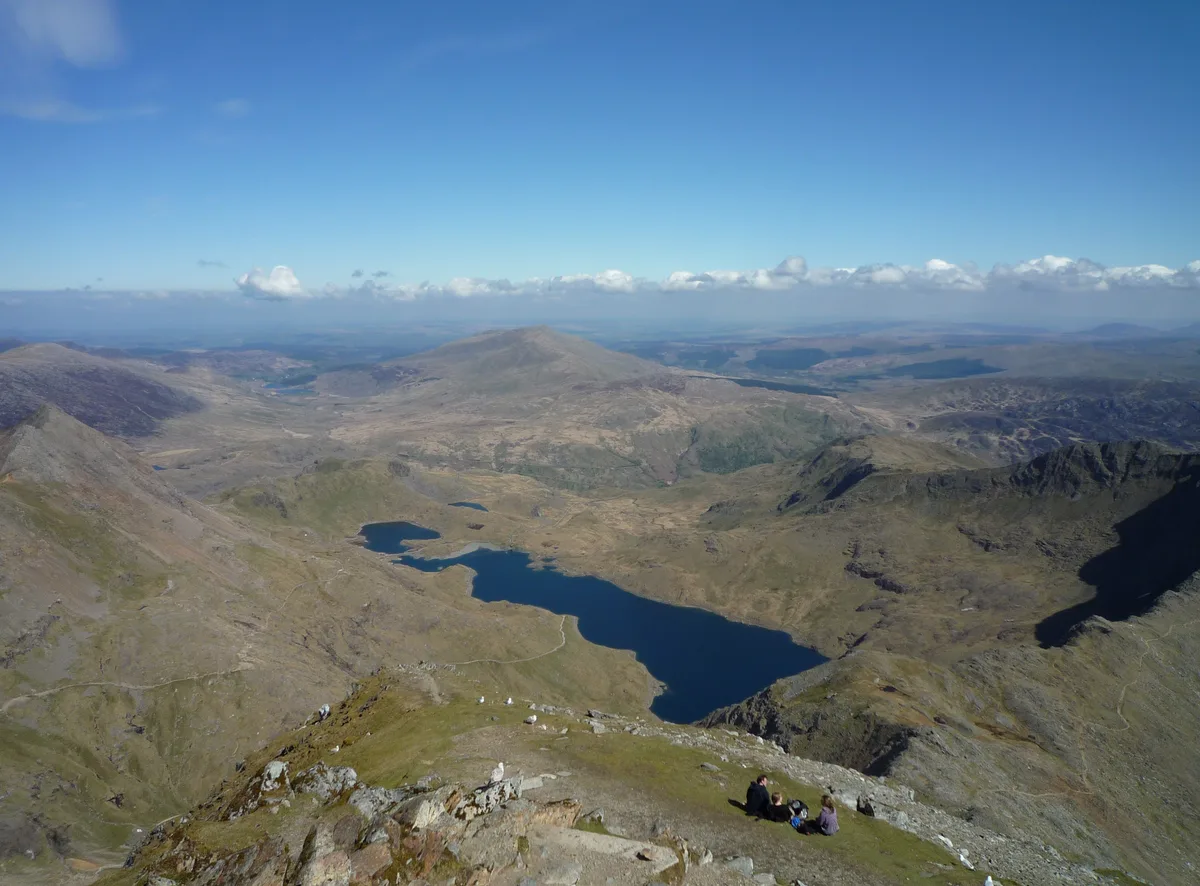
Llyn Llydaw
Llyn Llydaw is a natural landmark in the United Kingdom.
 📷 5
📷 5Natural landmarks · North Wales
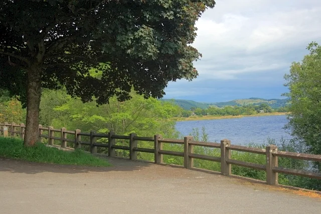
Llyn Tegid
Llyn Tegid is a natural landmark in the United Kingdom.
 📷 3
📷 3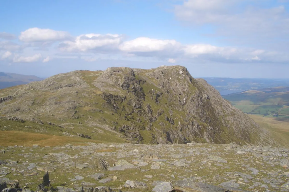 📷 3
📷 3Natural landmarks · North Wales
Aran Benllyn
Aran Benllyn — mountain (885m) in Gwynedd.
Frequently asked questions
- Where is Llwytmor?
- Llwytmor is in North Wales, United Kingdom.
- What is Llwytmor?
- Llwytmor — mountain (849m) in Gwynedd.
- How do I get to Llwytmor?
- The nearest railway station is Llanfairfechan, about 5.9 km away. Its coordinates are 53.2046°, -3.9650°.
- Is Llwytmor free to visit?
- Yes, Llwytmor is free to enter.
- How do I get to Llwytmor?
- The nearest railway station is Llanfairfechan, about 5.9 km away.