
Historic bridges · North Wales
Aber Falls
Also known as: Rhaeadr Fawr
In or near Beaumaris.
Aber Falls (Welsh: Rhaeadr Fawr, lit. 'big waterfall') is a waterfall located about two miles (3 km) south of the village of Abergwyngregyn, Gwynedd, Wales. The waterfall is formed as the Afon Goch pl

Llywelyn2000 — CC BY-SA 4.0 via Wikimedia Commons licence
_nr_Penmaenmawr%2C_Gwynedd%2C_Wales_-_Coedydd_Aber_National_Nature_Reserve_10.jpg)
Plan your visit
- Typical visit
- 15 min–30 min
- Nearest railway station
- Llanfairfechan · 5.2 km
- Free entry
- Family-friendly
- Dog-friendly
Getting there & planning your visit
To visit Aber Falls, the nearest railway station is Llanfairfechan, located 5.2 km away. Entry is free.
About
Aber Falls (Welsh: Rhaeadr Fawr, lit. 'big waterfall') is a waterfall located about two miles (3 km) south of the village of Abergwyngregyn, Gwynedd, Wales. The waterfall is formed as the Afon Goch plunges about 120 feet (37 m) over a sill of igneous rock in the foothills of the Carneddau range. Two tributaries merge; the enlarged stream is known as Afon Rhaeadr Fawr; from the road bridge, Bont Newydd ("New Bridge"), the name becomes Afon Aber. There is a second waterfall a short distance west named Rhaeadr-bach or Rhaeadr Fach.
Photo gallery
From the Wikipedia article
Aber Falls (Welsh: Rhaeadr Fawr, lit. 'big waterfall') is a waterfall located about two miles (3 km) south of the village of Abergwyngregyn, Gwynedd, Wales. The waterfall is formed as the Afon Goch plunges about 120 feet (37 m) over a sill of igneous rock in the foothills of the Carneddau range. Two tributaries merge; the enlarged stream is known as Afon Rhaeadr Fawr; from the road bridge, Bont Newydd ("New Bridge"), the name becomes Afon Aber. There is a second waterfall a short distance west named Rhaeadr-bach or Rhaeadr Fach.
Excerpt from Wikipedia under CC BY-SA 4.0. See the source article linked in Sources below.
Background
History
Visitors walking along the main footpath towards the falls may spot several small Bronze Age settlements including an excavated roundhouse and smithy fenced off with an information plaque adorning it, several standing stones and cairns are also present, most of these sites can be found on the right side of the pathway. There is also a piece of recording equipment that is recording the weather. It is located to the north west of Snowdonia National Park in Wales. The waterfall and nearby area has been a popular tourist destination since the Romantic Period, with visitors including author Julius Rodenberg exploring the area.
Sourced from Wikipedia under CC BY-SA 4.0.
- Coordinates
- 53.2105, -3.9950
- Address
- About two miles (3 km) south of the village of {{lang|cy|Abergwyngregyn|italic=no}}
- Nearest railway station
- Llanfairfechan — 5.2 km
Sources
- wikipedia: Aber Falls (CC BY-SA 4.0)
Other places nearby

Y Rhaeadr Fawr
Natural landmarks · 0.0 km

Y Rhaeadr Fawr
Waterfalls · 0.0 km

Aber Valley Hut Circle
Archaeological sites · 0.4 km

Rhaeadr-bach
Waterfalls · 0.6 km

Llwytmor Bach (Llwydmor Bach)
Mountains & hills · 1.1 km

Gwarchodfa Natur Genedlaethol Coedydd Aber
Forests & woodlands · 1.2 km
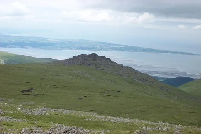
Bera Mawr
Mountains & hills · 1.8 km

Moel Wnion
Mountains & hills · 1.9 km

Moel Wnion
Mountains & hills · 1.9 km

Foel Dduarth
Mountains & hills · 2.0 km

Ffridd Ddu
Mountains & hills · 2.0 km

Y Drosgl
Mountains & hills · 2.1 km
Nearby
📷 3Natural landmarks · North Wales
Y Rhaeadr Fawr
Y Rhaeadr Fawr — a other in wales-north, United Kingdom.
📷 5📷 3Archaeological sites · North Wales
Aber Valley Hut Circle
Aber Valley Hut Circle — a archaeological in wales-north, United Kingdom.
📷 5📷 5Mountains & hills · North Wales
Llwytmor Bach (Llwydmor Bach)
Llwytmor Bach (Llwydmor Bach) — mountain in wales north. Elevation: 690 m.
📷 3Forests & woodlands · North Wales
Gwarchodfa Natur Genedlaethol Coedydd Aber
Gwarchodfa Natur Genedlaethol Coedydd Aber is a forest or woodland in the United Kingdom.
Where to eat & stay near Aber Falls
Places to stay
 📷 5
📷 5 📷 5
📷 5 📷 5
📷 5Campsites · North Wales
Ogwen Bank Holiday Park & Country Club
Ogwen Bank Holiday Park & Country Club — a campsite in wales north.
 📷 5
📷 5 📷 5
📷 5Caravan parks · North Wales
Bryn Llys Caravan Site
Bryn Llys Caravan Site — a caravan park in wales north.
 📷 5
📷 5Places to eat & drink
 📷 7
📷 7Restaurants · North Wales
Tafarn Tryfan
Tafarn Tryfan — a restaurant in wales north.
 📷 7
📷 7 📷 7
📷 7 📷 5
📷 5Historic pubs · North Wales
The George and Dragon
The George and Dragon — Historic pub — listed building or notable heritage status.
 📷 5
📷 5 📷 7
📷 7More bridges in this region
%3B_June_2023.jpg?width=1200) 📷 5
📷 5Historic bridges · North Wales
Britannia Bridge
Britannia Bridge is a historic bridge in the United Kingdom.
 📷 3
📷 3Historic bridges · North Wales
Cegin Viaduct
Cegin Viaduct is a historic bridge in the United Kingdom.
 📷 3
📷 3Historic bridges · North Wales
Chirk Aqueduct
Chirk Aqueduct is a historic bridge in the United Kingdom.
.jpg?width=1200) 📷 3
📷 3Historic bridges · North Wales
Chirk Viaduct
Chirk Viaduct is a historic bridge in the United Kingdom.
Frequently asked questions
- Where is Aber Falls?
- Aber Falls is in North Wales, United Kingdom.
- What is Aber Falls?
- Aber Falls (Welsh: Rhaeadr Fawr, lit. 'big waterfall') is a waterfall located about two miles (3 km) south of the village of Abergwyngregyn, Gwynedd, Wales. The waterfall is formed as the Afon Goch pl
- How do I get to Aber Falls?
- The nearest railway station is Llanfairfechan, about 5.2 km away. Its coordinates are 53.2105°, -3.9950°.
- Is Aber Falls free to visit?
- Yes, Aber Falls is free to enter.
- How do I get to Aber Falls?
- The nearest railway station is Llanfairfechan, about 5.2 km away.