
Historic bridges · North West England
Leeds and Liverpool Canal Salterforth Bridge Number 151
In or near Foulridge.
Leeds and Liverpool Canal Salterforth Bridge Number 151 — Grade II listed building-listed bridge in england-north-west, United Kingdom.

Gordon Hatton — CC BY-SA 2.0 via Wikimedia Commons licence

Plan your visit
- Typical visit
- 15 min–30 min
- Nearest railway station
- Colne · 5.5 km
- Free entry
- Dog-friendly
Getting there & planning your visit
To visit Leeds and Liverpool Canal Salterforth Bridge Number 151, the nearest railway station is Colne, located 5.5 km away. Entry to the bridge is free. The postcode for sat-nav is BB18 5TT.
About
Leeds and Liverpool Canal Salterforth Bridge Number 151 is a Grade II listed building-listed bridge in england-north-west, United Kingdom, registered on the National Heritage List for England (NHLE entry 1272781). Listed status protects buildings and structures of special architectural or historic interest. See the linked Wikipedia article for further details.
Photo gallery
Heritage listing
Details SD 84 NE SALTERFORTH LEEDS AND LIVERPOOL CANAL 3/287 Salterforth Bridge No 151 - GV II Public road bridge, 1794. Robert Whitworth, engineer. Dressed stone. Single elliptical arch with rock faced voussoirs. Punched band and solid, coped parapet. Curved abutment end in piers. Listing NGR: SD8876245297 Legacy The contents of this record have been generated from a legacy data system. Legacy System number: 186384 Legacy System: LBS
From the Historic England List Entry under OGL v3.
Place summary
Leeds and Liverpool Canal Salterforth Bridge Number 151 is a Grade II listed bridge located in Salterforth, Lancashire, North-West England. This structure is part of the historic Leeds and Liverpool Canal, which played a significant role in the region's industrial heritage.
AI-generated from the structured facts on this page (operator, designation, listing, era). Not a substitute for visiting.
- Coordinates
- 53.9037, -2.1725
- County
- Lancashire
- District
- Pendle
- Parish
- Salterforth
- Postcode
- BB18 5TT
- Parliamentary constituency
- Pendle and Clitheroe
- Nearest railway station
- Colne — 5.5 km
Sources
- wikidata: Q26562593 (CC0)
Other places nearby

Salterforth
Villages · 0.1 km

Lower Greenhill Holiday Park
Campsites · 0.6 km

Barlick Castle
Castles · 0.8 km

Leeds And Liverpool Canal Cockshott Bridge
Historic bridges · 0.9 km

Cockshott Bridge
Historic bridges · 0.9 km

Frog Carving
Public art & sculpture · 1.0 km

Leeds and Liverpool Canal Halters Bridge Number 150
Historic bridges · 1.0 km
Man in the ground
Public art & sculpture · 1.1 km

Wooden Ram
Public art & sculpture · 1.2 km
Stacked Stone Totem
Public art & sculpture · 1.3 km
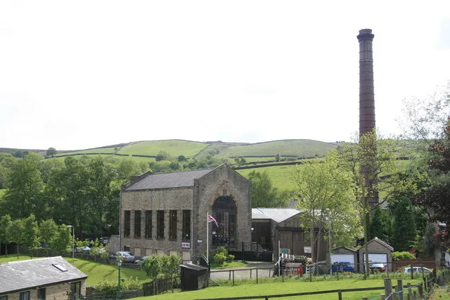
Bancroft Shed
Museums · 1.5 km

Bancroft Mill
Museums · 1.5 km
Nearby
📷 5📷 5Campsites · North West England
Lower Greenhill Holiday Park
Lower Greenhill Holiday Park — a campsite in england north west.
📷 3Castles · North West England
Barlick Castle
Barlick Castle — a castle in england-north-west, United Kingdom.
📷 3Historic bridges · North West England
Leeds And Liverpool Canal Cockshott Bridge
Leeds And Liverpool Canal Cockshott Bridge — Grade II listed building-listed bridge in england-north-west, United Kingdom.
📷 3Historic bridges · North West England
Cockshott Bridge
Cockshott Bridge is a historic bridge in the United Kingdom.
📷 3Public art & sculpture · North West England
Frog Carving
Frog Carving — a public art in england-north-west, United Kingdom.
Where to eat & stay near Leeds and Liverpool Canal Salterforth Bridge Number 151
Places to stay
📷 5Campsites · North West England
Lower Greenhill Holiday Park
Lower Greenhill Holiday Park — a campsite in england north west.
 📷 5
📷 5Campsites · North West England
Bridge Holme Caravan Site
Bridge Holme Caravan Site — a campsite in england north west.
 📷 5
📷 5Hostels · North West England
Earby Holiday Hostel
Earby Holiday Hostel — a hostel in england north west.
📷 5Hostels · North West England
Earby Friends of Nature House
Earby Friends of Nature House — a hostel in england north west.
 📷 5
📷 5Caravan parks · North West England
Holgates Ribble Valley
Holgates Ribble Valley — a caravan park in england north west.
 📷 5
📷 5Campsites · Yorkshire & the Humber
Winter House Farm Campsite
Winter House Farm Campsite — a campsite in england north west.
Places to eat & drink
 📷 5
📷 5Historic pubs · North West England
Cross Gaits Inn
Cross Gaits Inn in England North West, United Kingdom.
 📷 5
📷 5 📷 7
📷 7Cafés · Yorkshire & the Humber
The Dalesman Cafe, Tea Room and Sweet Emporium
The Dalesman Cafe, Tea Room and Sweet Emporium — a café in england north west.
 📷 5
📷 5Restaurants · North West England
Fence Gate Inn
Fence Gate Inn — a restaurant in england north west.
📷 5 📷 5
📷 5Restaurants · North West England
The Spread Eagle
The Spread Eagle — a restaurant in england north west.
More bridges in this region
 📷 3
📷 3Historic bridges · North West England
Albert Bridge
Albert Bridge is a historic bridge in the United Kingdom.
 📷 3
📷 3Historic bridges · North West England
Arpley New Bridge
Arpley New Bridge is a historic bridge in the United Kingdom.
 📷 3
📷 3Historic bridges · North West England
Arpley Railway Bridge
Arpley Railway Bridge is a historic bridge in the United Kingdom.
 📷 5
📷 5Historic bridges · North West England
Barton Road Bridge
Barton Road Bridge is a historic bridge in the United Kingdom.
Frequently asked questions
- Where is Leeds and Liverpool Canal Salterforth Bridge Number 151?
- Leeds and Liverpool Canal Salterforth Bridge Number 151 is in Lancashire, North-West England, United Kingdom (postcode BB18 5TT), in the parish of Salterforth.
- What is Leeds and Liverpool Canal Salterforth Bridge Number 151?
- Leeds and Liverpool Canal Salterforth Bridge Number 151 — Grade II listed building-listed bridge in england-north-west, United Kingdom.
- How do I get to Leeds and Liverpool Canal Salterforth Bridge Number 151?
- The nearest railway station is Colne, about 5.5 km away. Drivers can use postcode BB18 5TT.
- Is Leeds and Liverpool Canal Salterforth Bridge Number 151 a listed building?
- Leeds and Liverpool Canal Salterforth Bridge Number 151 is officially recognised as Grade II listed building listed.
- Is Leeds and Liverpool Canal Salterforth Bridge Number 151 free to visit?
- Yes, Leeds and Liverpool Canal Salterforth Bridge Number 151 is free to enter.
- How do I get to Leeds and Liverpool Canal Salterforth Bridge Number 151?
- The nearest railway station is Colne, about 5.5 km away. Drivers can navigate to postcode BB18 5TT.