National parks · North East England
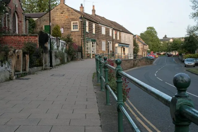
Langbaurgh Ridge
In or near Great Ayton.
Langbaurgh Ridge in England North East, United Kingdom.

Stephen McCulloch — CC BY-SA 2.0 via Wikimedia Commons licence
Plan your visit
- Typical visit
- 4 h–8 h
- Best time of year
- Spring – autumn (Apr–Oct)
- Nearest railway station
- Great Ayton · 1.8 km
- Dog-friendly
Getting there & planning your visit
To visit Langbaurgh Ridge, the nearest railway station is Great Ayton, located 1.8 km away. The postcode for sat-nav is TS9 6QW. Entry is free, and accessibility details are not specified.
About
Langbaurgh Ridge is a place of interest in England North East, United Kingdom — drawn from open-data sources for visitor reference. See the linked Wikipedia article for the full description.
Photo gallery
Protected designations
- Site of Special Scientific Interest: Langbaurgh Ridge SSSI
- Site of Special Scientific Interest: North York Moors SSSI
Designations sourced from Natural England open data under OGL v3.
From the Wikipedia article
Langbaurgh Ridge (grid reference NZ560121) is an 8.0 hectare geological Site of Special Scientific Interest near the hamlet of Langbaurgh in North Yorkshire, England, notified in 1986. The site crosses the boundary of the Redcar and Cleveland district and the area covered by the North Yorkshire unitary authority. The site is identified as being of national importance in the Geological Conservation Review for its exposure of the Cleveland Dyke, a Palaeogene intrusion associated with the Mull central volcanic complex.
Excerpt from Wikipedia under CC BY-SA 4.0. See the source article linked in Sources below.
- Coordinates
- 54.5014, -1.1344
- District
- Redcar and Cleveland
- Parish
- Guisborough
- Postcode
- TS9 6QW
- Parliamentary constituency
- Middlesbrough South and East Cleveland
- Established
- 1986
- Nearest railway station
- Great Ayton — 1.8 km
- Official site
- www.natureonthemap.org.uk
Sources
- wikidata: Q6485746 (CC0)
- wikipedia: Langbaurgh Ridge (CC BY-SA 4.0)
Other places nearby

Langbaurgh
Historic houses · 0.7 km
Great Ayton
Towns & cities · 0.7 km

Great Ayton
Villages · 1.1 km

Newton under Roseberry
National parks · 1.3 km

Captain Cook Schoolroom Museum
Museums · 1.4 km
Captain Cook's Schoolroom
Museums · 1.4 km

Ayton Hall
Historic houses · 1.4 km

The Royal Oak Hotel
Historic pubs · 1.4 km

James Cook statue
Memorials & monuments · 1.5 km

Great Ayton Friends' School
Other places · 1.5 km
Friends' School East Building
Cemeteries · 1.5 km

Captain Cook Memorial
Memorials & monuments · 1.6 km
Nearby
📷 3Flagship📷 5Towns & cities · Yorkshire & the Humber
Great Ayton
Great Ayton — village in North Yorkshire, England, UK.
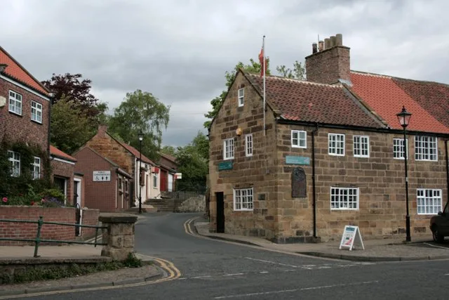
📷 5📷 4National parks · North East England
Newton under Roseberry
Newton under Roseberry in England North East, United Kingdom.
📷 3Museums · Yorkshire & the Humber
Captain Cook Schoolroom Museum
Captain Cook Schoolroom Museum — a museum in england-yorkshire, United Kingdom.
📷 4Museums · Yorkshire & the Humber
Captain Cook's Schoolroom
Captain Cook's Schoolroom — architectural structure in Great Ayton, Hambleton, North Yorkshire, England, UK.
Where to eat & stay near Langbaurgh Ridge
Places to stay
 📷 5
📷 5Caravan parks · Yorkshire & the Humber
Angrove Country Park
Angrove Country Park — a caravan park in england yorkshire.
 📷 5
📷 5 📷 5
📷 5Campsites · Yorkshire & the Humber
Kildale Camping & Barn
Kildale Camping & Barn — a campsite in england yorkshire.
 📷 5
📷 5Campsites · Yorkshire & the Humber
Southview Farm Campsite
Southview Farm Campsite — a campsite in england yorkshire.
 📷 5
📷 5 📷 5
📷 5Places to eat & drink
📷 5Historic pubs · North East England
The Royal Oak Hotel
The Royal Oak Hotel in England North East, United Kingdom.
 📷 7
📷 7Historic pubs · North East England
The Queen's Head Public House
The Queen's Head Public House in England North East, United Kingdom.
 📷 4
📷 4Historic pubs · North East England
The Dudley Arms Public House
The Dudley Arms Public House in England North East, United Kingdom.
 📷 4
📷 4 📷 5
📷 5Historic pubs · North East England
The Stainton Public House
The Stainton Public House in England North East, United Kingdom.
 📷 4
📷 4Historic pubs · North East England
The Bay Horse Inn
The Bay Horse Inn in England North East, United Kingdom.
More national parks in this region
 📷 4
📷 4 📷 4
📷 4National parks · North East England
Mallerstang
Mallerstang in England North East, United Kingdom.
 📷 4
📷 4National parks · North East England
Kisdon Force
Kisdon Force in England North East, United Kingdom.
 📷 4
📷 4Frequently asked questions
- Where is Langbaurgh Ridge?
- Langbaurgh Ridge is in North-East England, United Kingdom (postcode TS9 6QW), in the parish of Guisborough.
- What is Langbaurgh Ridge?
- Langbaurgh Ridge in England North East, United Kingdom.
- How do I get to Langbaurgh Ridge?
- The nearest railway station is Great Ayton, about 1.8 km away. Drivers can use postcode TS9 6QW.
- When was Langbaurgh Ridge built?
- Built or established in 1986.
- Is Langbaurgh Ridge a protected site?
- Yes — Langbaurgh Ridge is part of the Langbaurgh Ridge SSSI Site of Special Scientific Interest and the North York Moors SSSI Site of Special Scientific Interest.
- How do I get to Langbaurgh Ridge?
- The nearest railway station is Great Ayton, about 1.8 km away. Drivers can navigate to postcode TS9 6QW.