
Historic churches · Scottish Lowlands
Kirkoswald Parish Church
In or near Dailly.
Kirkoswald Parish Church — church in South Ayrshire, Scotland, UK.

Wikimedia Commons contributors — see linked file page for photographer and licence licence

Plan your visit
- Typical visit
- 30 min–1 h
- Nearest railway station
- Maybole · 6.4 km
- Free entry
Getting there & planning your visit
Kirkoswald Parish Church is located in the Scottish Lowlands, with the nearest railway station being Maybole, which is 6.4 km away. The postcode for the church is KA19 8HZ, and entry is free.
About
Kirkoswald Parish Church is a historic church in the United Kingdom. Heritage designation: category A listed building. Wikidata describes it as: "church in South Ayrshire, Scotland, UK". Coordinates: 55.3288°, -4.7765°.
Photo gallery
Heritage listing
Kirkoswald Parish Church is located in the small village of Kirkoswald (on the A77 road), South Ayrshire, Scotland. It is a parish church in the Church of Scotland. The church is unusual in that its design was, at the very least, strongly influenced by Robert Adam, one of Scotland's outstanding architects. He was working at the time on his masterpiece, Culzean Castle, and there are many Adam features about the church. It was built in 1777 and is essentially unchanged since. A fire in 1997 was confined within the ducted central heating system, and when that was being removed, wet rot, dry rot and plaster fungus were discovered. The building underwent a substantial renovation at that time, but the interior of the church was restored with only minor changes.
From Historic Environment Scotland under OGL v3.
From the Wikipedia article
Kirkoswald Parish Church is located in the small village of Kirkoswald (on the A77 road), South Ayrshire, Scotland. It is a parish church in the Church of Scotland. The church is unusual in that its design was, at the very least, strongly influenced by Robert Adam, one of Scotland's outstanding architects. He was working at the time on his masterpiece, Culzean Castle, and there are many Adam features about the church. It was built in 1777 and is essentially unchanged since. A fire in 1997 was confined within the ducted central heating system, and when that was being removed, wet rot, dry rot and plaster fungus were discovered. The building underwent a substantial renovation at that time, but the interior of the church was restored with only minor changes. The church was fortunate in being able to call on the architectural historians working at Culzean, and the colour scheme is now as close to the original as could be achieved. This church was built as a replacement for an older church—built around 1220—the ruins of which are still visible in the village, in the middle of the old graveyard (55.3300°N 4.7779°W / 55.3300; -4.7779 (Remains of Kirk Oswald)). The graveyard has a number of interesting graves, mainly because of the strong links with Robert Burns, whose mother (Agnes Broun) came from this village. The poet also spent around 9 months in the village in 1776, when he was 17, and most of the characters in his poem "Tam o' Shanter" are based on local people whose graves are in the old kirkyard and are suitably marked. One noteworthy grave not linked to Burns work is that of Scipio Kennedy, a black African slave who was brought to Scotland in 1702 and lived on the Culzean estate, and given his freedom in 1725. The church, which is linked with Fisherton Parish Church, is without a minister since the retiral of Arrick Wilkinson at the beginning of February 2013.
Excerpt from Wikipedia under CC BY-SA 4.0. See the source article linked in Sources below.
- Coordinates
- 55.3288, -4.7765
- District
- South Ayrshire
- Postcode
- KA19 8HZ
- Parliamentary constituency
- Ayr, Carrick and Cumnock
- Nearest railway station
- Maybole — 6.4 km
- Official site
- kirkoswaldchurch.wordpress.com
Sources
- wikidata: Q6415801 (CC0)
- wikipedia: Kirkoswald Parish Church (CC BY-SA 4.0)
- commons: Kirkoswald Old Church - geograph.org.uk - 826979.jpg (CC BY-SA 4.0)
Other places nearby

Old Parish Church and Graveyard, Kirkoswald
Historic churches · 0.2 km

Hollowshean Camp
Archaeological sites · 1.3 km

Hallowshean
Vineyards · 1.3 km

Kirkoswald
Villages · 1.5 km
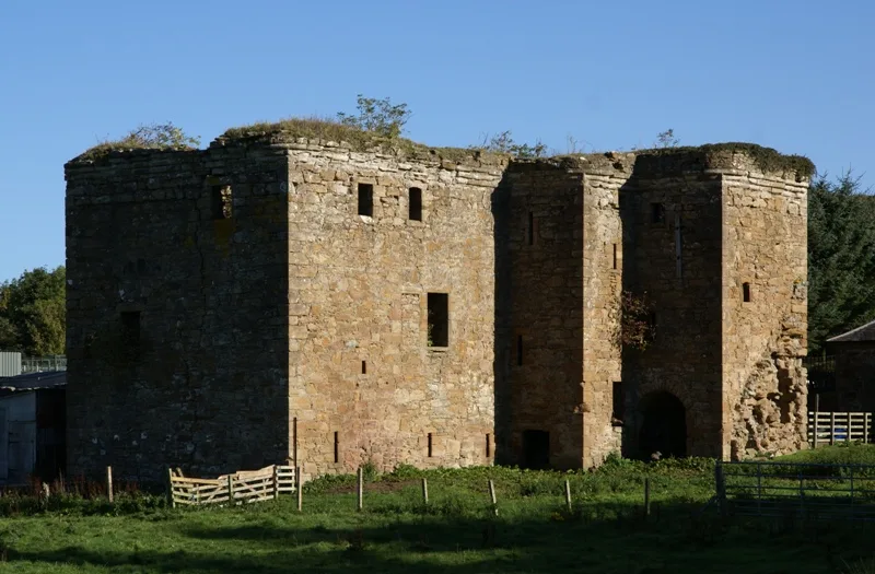
Thomaston Castle
Castles · 2.2 km

Redgates Holiday Park
Caravan parks · 2.3 km

Old Mill Caravan Park
Caravan parks · 2.4 km
Sandy Beach Caravan Park
Caravan parks · 2.5 km

Maidens
Villages · 2.6 km

Culzean Bay
Natural landmarks · 2.8 km

Maidenhead Bay
Natural landmarks · 2.8 km

Ruined Arch and Viaduct, Culzean Castle Estate
Historic bridges · 2.9 km
Nearby
📷 5Historic churches · Scottish Lowlands
Old Parish Church and Graveyard, Kirkoswald
Old Parish Church and Graveyard, Kirkoswald — category B listed building-listed church in scotland-lowlands, United Kingdom.
📷 3Archaeological sites · Scottish Lowlands
Hollowshean Camp
Hollowshean Camp — an archaeological site in Scottish Lowlands, United Kingdom.
📷 5Vineyards · Scottish Lowlands
Hallowshean
Hallowshean — a UK vineyard in scotland lowlands, producing English or Welsh wine from cool-climate grape varieties.
📷 5📷 3Castles · Scottish Lowlands
Thomaston Castle
Thomaston Castle — castle in South Ayrshire, Scotland, UK.
📷 5Caravan parks · Scottish Lowlands
Redgates Holiday Park
Redgates Holiday Park — a caravan park in scotland lowlands.
Where to eat & stay near Kirkoswald Parish Church
Places to stay
📷 5Caravan parks · Scottish Lowlands
Redgates Holiday Park
Redgates Holiday Park — a caravan park in scotland lowlands.
📷 5Caravan parks · Scottish Lowlands
Old Mill Caravan Park
Old Mill Caravan Park — a caravan park in scotland lowlands.
📷 5Caravan parks · Scottish Lowlands
Sandy Beach Caravan Park
Sandy Beach Caravan Park — a caravan park in scotland lowlands.
 📷 5
📷 5Campsites · Scottish Lowlands
Culzean Castle Camping and Caravanning Club Site
Culzean Castle Camping and Caravanning Club Site — a campsite in scotland lowlands.
 📷 5
📷 5Caravan parks · Scottish Lowlands
Turnberry Holiday Park
Turnberry Holiday Park — a caravan park in scotland lowlands.
 📷 5
📷 5Places to eat & drink
 📷 5
📷 5Historic pubs · Scottish Lowlands
The White House and Adjoining Joiner's Shop, Kirkmichael Arms, Straiton Road, Kirkmichael
The White House and Adjoining Joiner's Shop, Kirkmichael Arms, Straiton Road, Kirkmichael in Scotland Lowlands, United Kingdom.
 📷 5
📷 5Historic pubs · Scottish Lowlands
Railway Tavern, 18 Smith Street, Ayr
Railway Tavern, 18 Smith Street, Ayr in Scotland Lowlands, United Kingdom.
 📷 5
📷 5Historic pubs · Scottish Lowlands
Doon Tavern, High Street, Dalmellington
Doon Tavern, High Street, Dalmellington in Scotland Lowlands, United Kingdom.
More places in this region
 📷 4
📷 4Historic churches · Scottish Lowlands
Bassendean
Bassendean in England North East, United Kingdom.
 📷 4
📷 4Historic churches · Scottish Lowlands
St Andrew's College, Drygrange
St Andrew's College, Drygrange in England North East, United Kingdom.
 📷 4
📷 4Historic churches · Scottish Lowlands
St John The Evangelist's Episcopal Church
St John The Evangelist's Episcopal Church in England North East, United Kingdom.
 📷 5
📷 5Frequently asked questions
- Where is Kirkoswald Parish Church?
- Kirkoswald Parish Church is in the Scottish Lowlands, United Kingdom (postcode KA19 8HZ).
- What is Kirkoswald Parish Church?
- Kirkoswald Parish Church — church in South Ayrshire, Scotland, UK.
- How do I get to Kirkoswald Parish Church?
- The nearest railway station is Maybole, about 6.4 km away. The nearest town is Dailly. Drivers can use postcode KA19 8HZ.
- Is Kirkoswald Parish Church a listed building?
- Kirkoswald Parish Church is officially recognised as category A listed building listed.
- Is Kirkoswald Parish Church free to visit?
- Yes, Kirkoswald Parish Church is free to enter.
- How do I get to Kirkoswald Parish Church?
- The nearest railway station is Maybole, about 6.4 km away. Drivers can navigate to postcode KA19 8HZ.