Historic churches · Scottish Lowlands
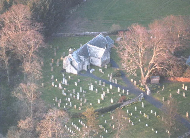
Fogo
In or near Duns.
Fogo in England North East, United Kingdom.

James T M Towill — CC BY-SA 2.0 via Wikimedia Commons licence
Plan your visit
- Typical visit
- 30 min–1 h
- Free entry
About
Fogo is a place of interest in England North East, United Kingdom — drawn from open-data sources for visitor reference. See the linked Wikipedia article for the full description.
Photo gallery
See it from the streetimagery from 2019
Imagery © Mapillary contributors, CC BY-SA 4.0
From the Wikipedia article
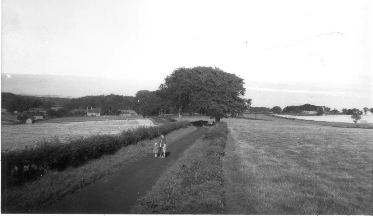
Fogo is a village in the county of Berwickshire, in the Borders of Scotland, 3 miles south of Duns, on the Blackadder Water. The settlement of Fogo lies within the northern boundary of the historical region the Merse, an undulating agrarian landscape that provides rich ploughland and pastures of excellent quality. It has always been the centre of the parish of Fogo, harbouring both the parish kirk and the (now closed) parish school. Fogo is first mentioned in a c. 1152 deed as Ecclesiam de foghou (Latin for Fogo church), whereby Gospatric III de Hirsel, Earl of Lothian and, later, of Dunbar makes a grant to the Tironensian monks of Kelso Abbey. Due to the importance of its kirk, possibly even having hosted a priory for some time, Fogo, for a hamlet of its size, is disproportionately often mentioned in medieval texts. A selection of the earliest manuscripts is listed in early history. In the following century, c. 1250, the whole estate of Fogo was valued at 40 merks. The settlement of Fogo and its upstream mill are depicted on Joan Blaeu's map of the Merse, the first printed map of southeastern Scotland, published in 1654.
Excerpt from Wikipedia under CC BY-SA 4.0. See the source article linked in Sources below.
Background
History
The early history of the hamlet Fogo is recorded on a number of deeds, all related to the most important institution in those days: Fogo Kirk and its belongings in the surrounding Fogo parish. These deeds, documenting donations or dedications by the ruling lord, were handwritten in Latin on parchments that were kept at the site of the ecclesiastical owner, in this case, Kelso Abbey. A book published in 1846 reproduces the text of the whole collection of manuscripts from Kelso Abbey, ranging from 1113 to 1567, and may be accessed online here (Vol 1 and 2). Within those documents that refer to Fogo, apart from the omnipresent "Kirk" the text mentions "ploughlands", "meadows", "a manse" or…
Sourced from Wikipedia under CC BY-SA 4.0.
- Coordinates
- 55.7347, -2.3636
- District
- Scottish Borders
- Postcode
- TD11 3RA
- Parliamentary constituency
- Berwickshire, Roxburgh and Selkirk
Sources
- wikidata: Q5464124 (CC0)
- wikipedia: Fogo, Scottish Borders (CC BY-SA 4.0)
Other places nearby

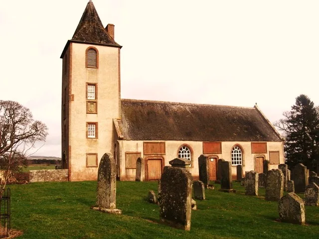
Fogo Parish Church
Historic churches · 0.1 km
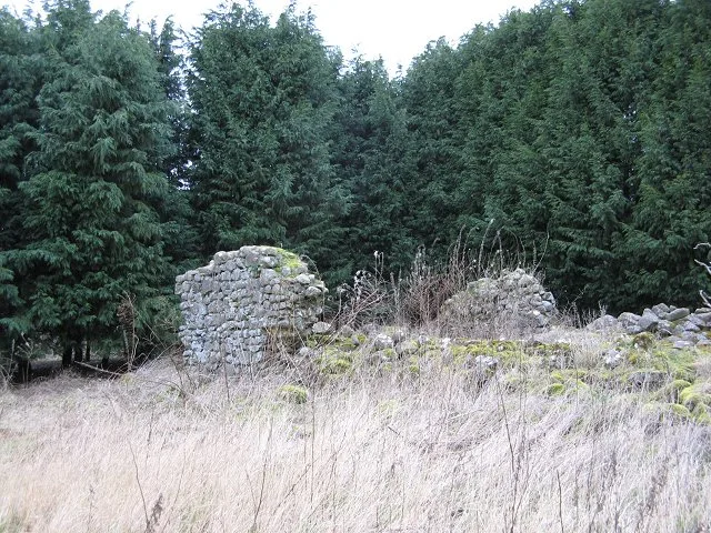
Fogo Priory
Abbeys & priories · 0.1 km

Fogo Bridge
Historic bridges · 0.3 km

Green Rig
Mountains & hills · 0.6 km
Cairn's Mill, Fogo
Museums · 1.6 km

Marchmont railway station
Heritage railway stations · 2.0 km
Polwarth Church
Historic churches · 2.3 km

Polwarth Castle
Castles · 2.5 km

Bridge, Manse, Polwarth Church
Historic bridges · 2.5 km
Bite-about Pele
Castles · 2.6 km

Redbraes Castle
Castles · 2.7 km

Tower, Stables Court, Marchmont House
Memorials & monuments · 2.7 km
Nearby
📷 5Historic churches · Scottish Lowlands
Fogo Parish Church
Fogo Parish Church — category A listed building-listed church in scotland-central, United Kingdom.
📷 3Abbeys & priories · Scottish Lowlands
Fogo Priory
Fogo Priory — monastery in Scottish Borders, Scotland, UK.
📷 5Historic bridges · Scottish Lowlands
Fogo Bridge
Fogo Bridge — category A listed building-listed bridge in scotland-central, United Kingdom.
📷 5Mountains & hills · Scottish Lowlands
Green Rig
Green Rig — mountain in scotland central. Elevation: 125 m.
📷 5Museums · Scottish Lowlands
Cairn's Mill, Fogo
Cairn's Mill, Fogo — architectural structure in Scottish Borders, Scotland, UK.
📷 3Heritage railway stations · Scottish Lowlands
Marchmont railway station
Marchmont railway station in England North East, United Kingdom.
Where to eat & stay near Fogo
Places to stay
 📷 5
📷 5Caravan parks · Scottish Lowlands
Blackadder Caravan Park
Blackadder Caravan Park — a caravan park in scotland central.
 📷 5
📷 5 📷 5
📷 5Campsites · Scottish Lowlands
Coldstream Holiday Park
Coldstream Holiday Park — a campsite in scotland central.
 📷 5
📷 5Hotels · North East England
Tillmouth Park Country House Hotel
Tillmouth Park Country House Hotel — a hotel in scotland central.
 📷 7
📷 7Hotels · North East England
Collingwood Arms
Collingwood Arms — a hotel in scotland central.
 📷 5
📷 5Caravan parks · North East England
Salutation Caravan Park
Salutation Caravan Park — a caravan park in scotland central.
Places to eat & drink
 📷 7
📷 7Historic pubs · Central Scotland
The Royal Bar, 15 Market Square, Duns
The Royal Bar, 15 Market Square, Duns in Scotland Central, United Kingdom.
 📷 4
📷 4Historic pubs · Scottish Lowlands
Newcastle Arms
Newcastle Arms — Historic pub — listed building or notable heritage status.
 📷 5
📷 5Historic pubs · Scottish Lowlands
The Masons Arms
The Masons Arms in Scotland Lowlands, United Kingdom.
 📷 7
📷 7Historic pubs · Scottish Lowlands
The Victoria Hotel
The Victoria Hotel in Scotland Lowlands, United Kingdom.
 📷 7
📷 7Historic pubs · North East England
Red Lion Public House
Red Lion Public House in Scotland Lowlands, United Kingdom.
 📷 7
📷 7Historic pubs · North East England
59 And 61, Bridge Street
59 And 61, Bridge Street in Scotland Lowlands, United Kingdom.
More places in this region
 📷 4
📷 4Historic churches · Scottish Lowlands
Bassendean
Bassendean in England North East, United Kingdom.
 📷 4
📷 4Historic churches · Scottish Lowlands
St Andrew's College, Drygrange
St Andrew's College, Drygrange in England North East, United Kingdom.
 📷 4
📷 4Historic churches · Scottish Lowlands
St John The Evangelist's Episcopal Church
St John The Evangelist's Episcopal Church in England North East, United Kingdom.
 📷 4
📷 4Historic churches · Scottish Lowlands
St. Boswells railway station
St. Boswells railway station in England North East, United Kingdom.
Frequently asked questions
- Where is Fogo?
- Fogo is in North-East England, United Kingdom (postcode TD11 3RA).
- What is Fogo?
- Fogo in England North East, United Kingdom.
- How do I get to Fogo?
- Drivers can use postcode TD11 3RA.
- Is Fogo free to visit?
- Yes, Fogo is free to enter.
- How do I get to Fogo?
- Drivers can navigate to postcode TD11 3RA. It sits within the Berwickshire, Roxburgh and Selkirk parliamentary constituency.